Pete's Walks - Chiltern Heritage Trail
If you are considering walking this route yourself, please see my disclaimer. You may also like to see these notes about the maps and GPX files.
Day 1 07/09/06 Chesham to Chenies (6 miles each way, approximately)
Parked in car park near Chesham railway station.
This was a thoroughly enjoyable walk, one of the best and most interesting that I have done so far. Although it was slightly shorter than most of my walks, it took me about the same length of time as usual, because there were so many interesting things to stop and see on the way. The weather was great all day, bright and sunny but not too warm. The walking was a good mixture of woodlands and fields. Despite the route basically following the valley of the river Chess, there was a nice amount of ‘up and down’ as the route switched from the top of the hillside on one side of the valley to the other, and then back again.
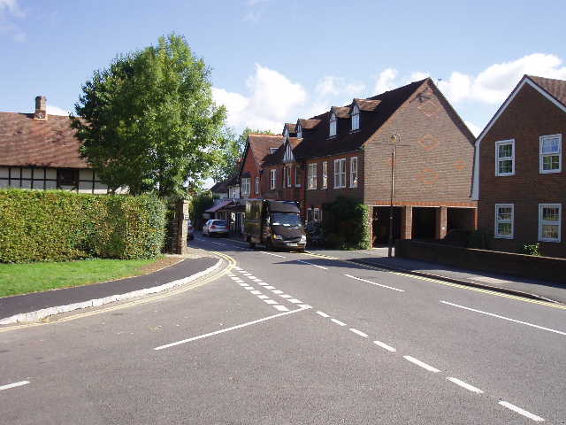
The Chiltern Heritage Trail starts at the foot of Station Road in Chesham, where the High Street becomes The Broadway. Setting off about 9.55am, I walked down the pedestrianised High Street [1], to reach the old market square with its relatively modern clock tower [2] – I remembered walking this stretch when I did the Chiltern Link last year (see my separate journal for that one-day walk). I used the pedestrian crossing to get over the busy main road, and then went down Germain Street for about a hundred yards before turning into Duck Alley. This is a footpath running beside the infant river Chess – there seemed to be no water in this part of the river today, the whole river bed being full of vegetation in places [3]. After about a quarter of a mile, the path emerged on a road by a roundabout. Here there was a mosaic built into a wall, celebrating Chesham’s twin town of Friedrichsdorf – this was the first of several artworks that have been created along the route of the Chiltern Heritage Trail [4].
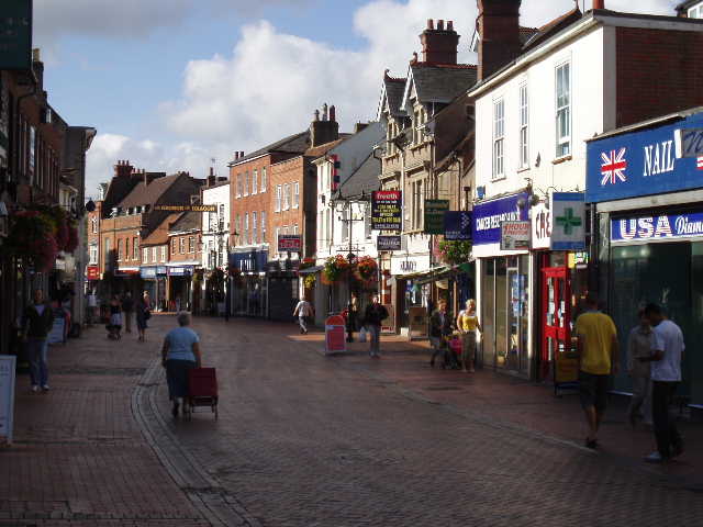
[1] Chesham High Street
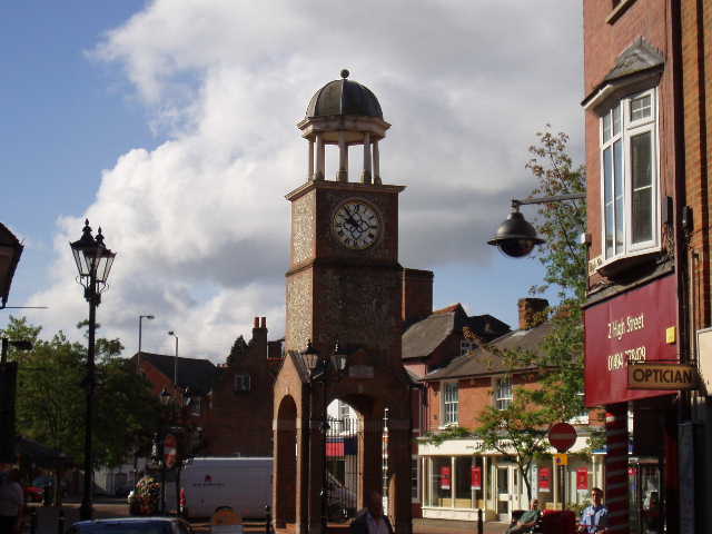
[2] Market square and clock tower, Chesham
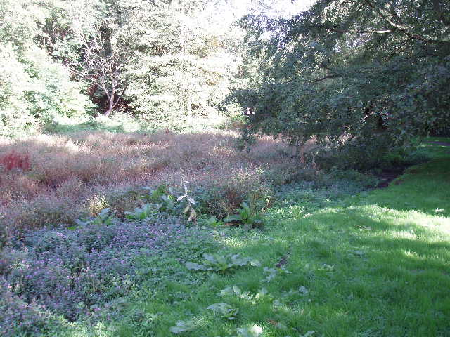
[3] Dry course of the River Chess, Chesham
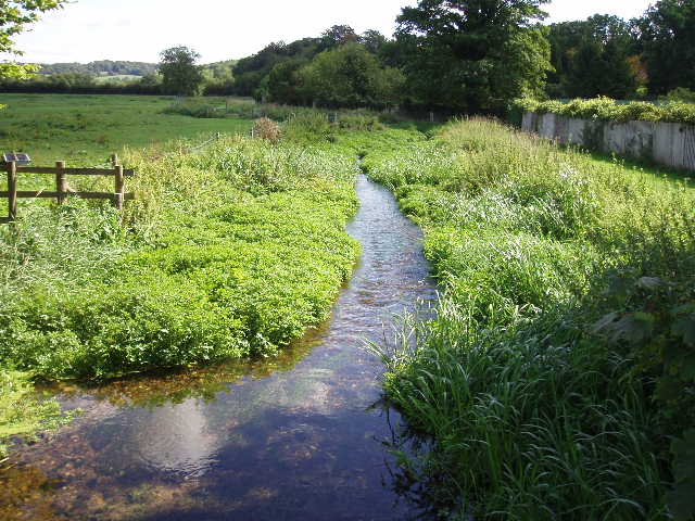
Across the roundabout, I followed Moor Road to go under a railway bridge, then took a footpath on the left, now with the river on my right. The path soon returned to Moor Road, which I crossed and then followed to the left, passing Chesham Swimming Pool. At the next road junction I continued ahead, entering a large open area of grass known as Chesham Moor. The Chiltern Heritage Trail went slightly left again to follow a millstream – the guide books says that mills have played an important role in Chesham’s history, with corn mills in the middle ages, cloth making in the 16th and 17th centuries and paper working more recently all being powered by the river Chess. There was now a steady flow of water in the millstream, which was appreciably wider than the river which soon came in from the right. I noticed a wild rose amongst the bushes the path passed through here. Where the millstream went over a weir [5], the Chiltern Heritage Trail turned right and followed a good path that passed between small lakes on either side to reach some houses. Across a road, an alleyway between houses led to another road, which I followed a short distance to the right, before crossing over and taking a good track that immediately went under a railway bridge.
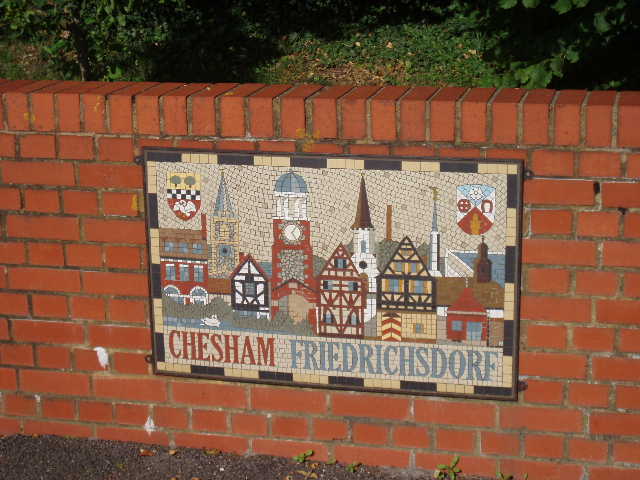
[4] Mural by roadside in Chesham (the first of the Millennium Artworks along the route
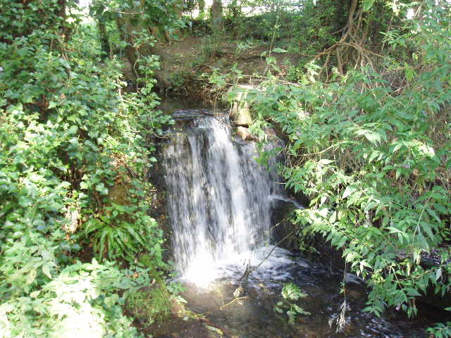
[5] Weir, Chesham
[6] Track leading through wood towards Chesham Bois
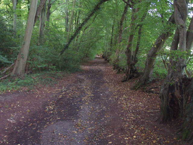
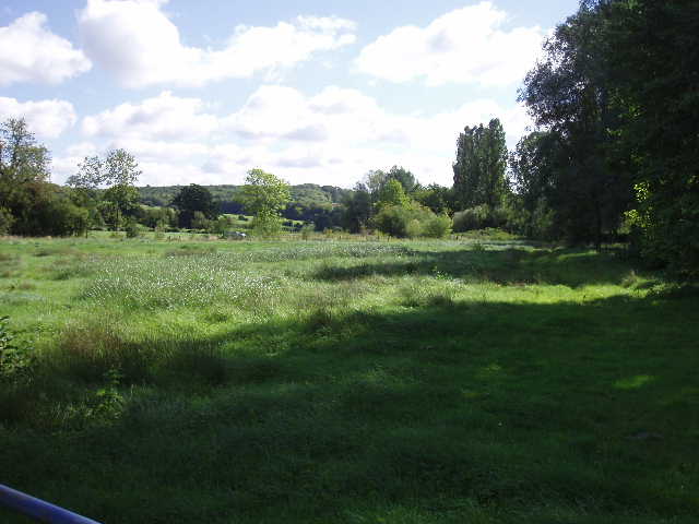
This good track had obviously been a surfaced lane some years ago, as there was a lot of broken asphalt and stones throughout its course [6]. It started with an avenue of trees either side, with woodland to the left and some open rough grassland to the left, before this latter was replaced by more woodland. The track rose steadily at an almost constant gradient, in an almost straight line, gradually ascending the hillside to the west of the Chess valley. After about half a mile, it passed a few houses and then, about one hundred yards short of a main road, the Chiltern Heritage Trail bore left on a bridleway through more woods to reach North Road on the edge of Chesham Bois (pronounced Boys). I turned left along the road, soon reaching Chesham Bois Common and Bricky Pond [7]. An information board told me that the pond had been restored in 1996-97, but had been there since at least 1735 – it was thought to have been formed by the flooding of a clay pit used for brickmaking. There were also some carved wooden seats [8] and some other wooden sculptures by the pond.
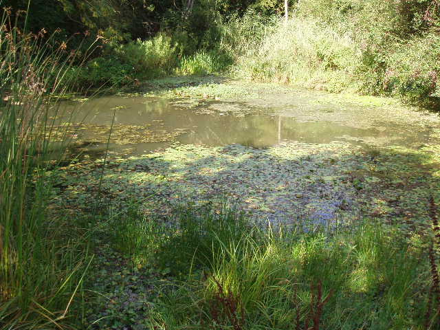
[7] Bricky Pond, Chesham Bois
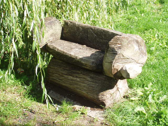
[8]Carved seat at Bricky Pond, Chesham Bois
[9] Chesham Bois
I continued along the road to the war memorial in the centre of Chesham Bois [9], where I turned left down Bois Lane (the name comes from the Du Bois or Boyes family who were once lords of the manor). After a few hundred yards I turned right into Hollow Way Lane and then right again into St Leonards Road. At the next junction, I took a footpath on the left. Leaving the houses of Chesham Bois behind, this path entered a wood (a mixture of several deciduous trees, including ash, rather than a beech wood) and descended downhill back into the Chess Valley. After going under the railway (for a third time!) the path left the woods and crossed a couple of meadows. It passed a farm, where two noisy collies barked loudly as I crossed a stile by the farm drive, and came out on a road. The Chiltern Heritage Trail then went up a lane opposite, with nice views south along the valley [10], passing another farm and a few houses. At a left hand bend, I took a footpath past another farm, and then alongside a hedge through three green pastures. There were cows in the third of these, but a long way off at the top of the hill. The path then entered another wood, and started to rise up the hillside at a fairly gentle gradient, keeping to the very edge of the wood with a large ploughed field on my right. I noticed the lovely pink flowers of some Musk Mallow beside this path. Near the top of the slope, a gate gave access to a permissive path on my right.
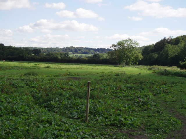
The next section of the walk was quite delightful. Just before reaching the gate, I’d seen a lady sitting by the side of the ploughed field painting. I could now see why she’d chosen that spot because the views over the Chess valley were very charming indeed. The path continued along the edge of the ploughed field, with the wood on my left. The field sloped down to the river on my right [11]. On the other side of the river was a flat meadow, then a line of trees marking the route of the road, then another ploughed field rising up the opposite slope, with more woods all along the top of the hillside. Slightly ahead of me I could see where the river widened [12], and there were several swans on the river. Nothing dramatic or spectacular, but a very charming scene, especially on this beautiful warm and sunny day.
[10] Chess valley, from the lane
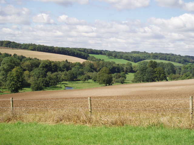
[11] Looking back along the Chess Valley, near Latimer House
[12] Looking across the Chess Valley, near Latimer House
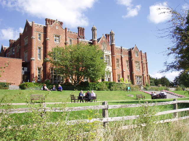
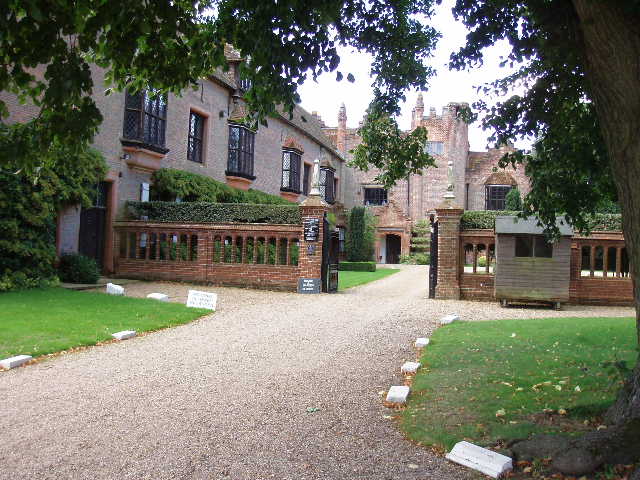
I followed this path for about half a mile. I met an old gentleman coming the other way, and we stopped and chatted for a few minutes, agreeing how splendid the Chess valley was. He lived in Chenies, and was checking out a family walk for his church that was to take place a week on Sunday. A little later on, I passed in front of Latimer House [13] – an information board by the side of the path gave some of its history, and other details of local history. The house was owned by the Cavendish family for 350 years, one of them eventually being created Lord Chesham in 1853. The house is now a conference centre, and when I passed by there were several small groups of people engaged in discussions in the grounds. At the end of the path I turned left on to a drive for a few yards, then right along a lane that took me downhill into the village of Latimer.
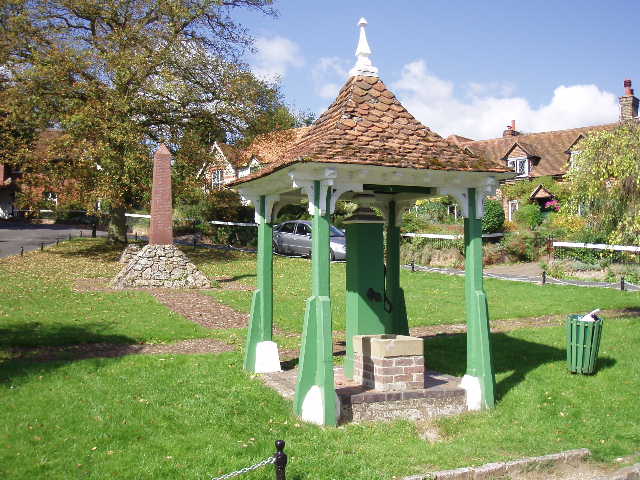
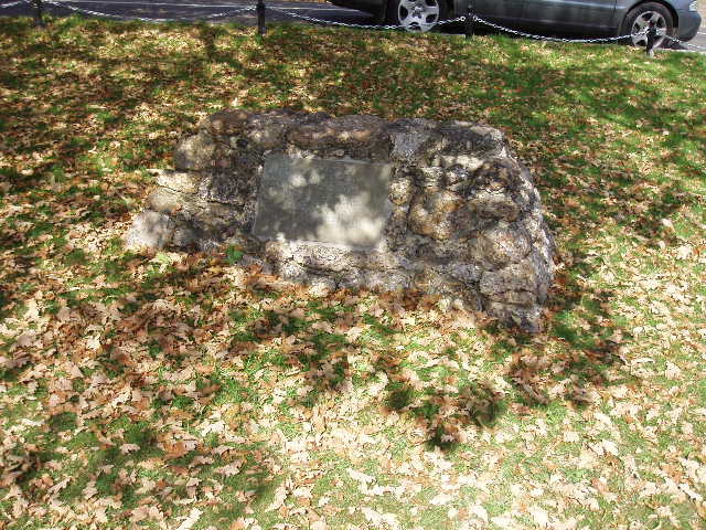
There is a very attractive triangular green in the centre of Latimer. On the green is a pump, a memorial to the local men who died in the Boer war [14], and another tomb-shaped stone memorial marking the burial place of the heart of a horse that was wounded when a General Villebois was killed (also in the Boer War) [15]. I was surprised at the large numbers of names on the war memorial, considering the small size of Latimer, but reading the inscription made it clear that it commemorated the men lost from Amersham, Chesham and several surrounding villages.
[13] Latimer House
[14] War memorial and village pump, Latimer
[15] Gravestone of Horse's heart, Latimer
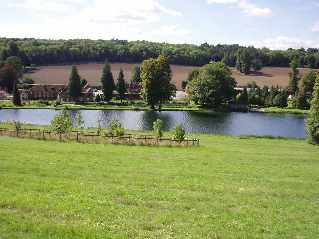
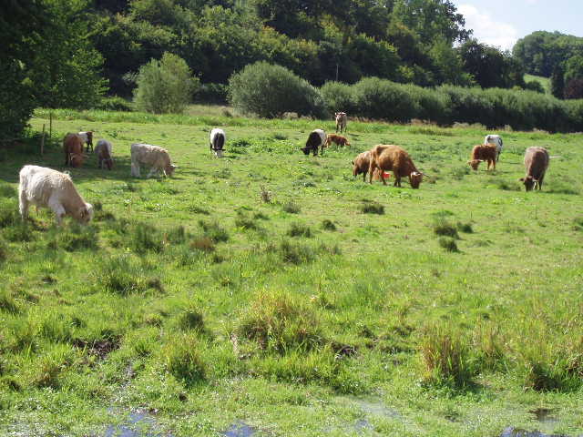
From Latimer, I took a path along the valley across a very large meadow, and then alongside a left-hand hedge in a smaller meadow. Curiously, part way along this hedge there was the tomb of two members of the Liberty family (the founder of the Liberty’s store in London’s West End had been born in a house that I’d passed on the High Street in Chesham). Beyond this meadow, the path continued between a hedge on the left and a fence on the right. In a field to the left there were some Llamas, while a variety of cattle (including highland cattle) grazed the water meadow on my right [16].
The path went through a farm yard to reach a lane [17]. Again there were good views ahead along the valley. I followed the lane to the right, crossing over the river [18] to reach a road junction. Here I took a path opposite through a wood rising up the hillside. There was a very steep but fairly short climb here – curiously, I somehow didn’t seem to notice this, because when I came back this way 20 minutes later, I didn’t remember there being such a steep slope and I wondered if I’d gone the wrong way! The path led out of the wood at the top of the slope, and went down an alleyway between Chenies church on the left and Chenies manor on the right (I saw a Comma butterfly here on my way back, the first one I’ve seen on any of my walks). Chenies Manor dates from about 1460, and belonged to the Cheynes family before passing by marriage to the Dukes of Bedford.
[16] Cattle in water meadow in the Chess Valley
[17] Chess Valley from near the farm
[18]River Chess near Chenies
I followed the drive from Chenies Manor [19] to the green in the centre of Chenies. As in Latimer, this also had a village pump [20]. An elderly couple were sat painting on the green, and another gentleman was leaning on the roof of his car sketching. Having seen an artist earlier, I wondered if there was some sort of competition going on – I do see people out painting and drawing very occasionally, but never as many as this. I walked a few yards to the entrance of the village school – the notice board there was elaborately carved by Dennis Heath in 2000, using designs suggested by the children, another of the artworks created for the Chiltern Heritage Trail Community Artworks Project. Before turning round and heading back to Chesham, I spent about 15 minutes looking round inside St Michael’s church [21]. I paid 20p for a leaflet about the church’s history, and made a small donation to the tower restoration fund. There is a large side chapel containing very impressive memorials to the Russell family, the Dukes of Bedford – the Bedford Chapel was closed, as it usually is apparently, but I could see some of the tombs through a window.
[19] Chenies Manor
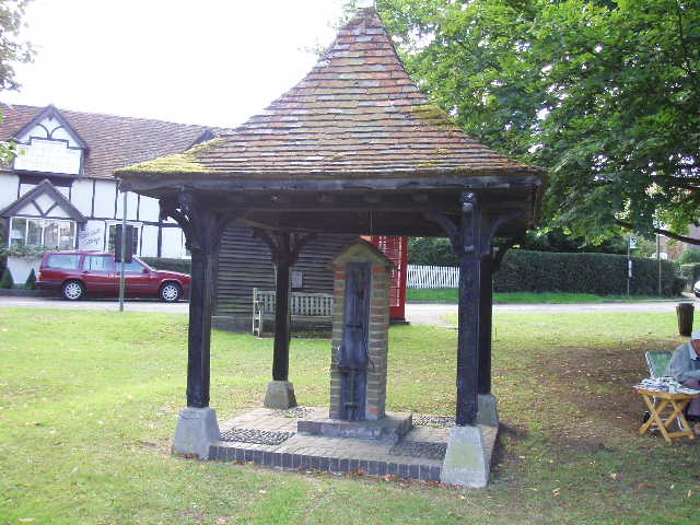
[20] Village pump, Chenies
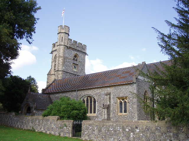
[21] Chenies church
I really enjoyed the walk back to Chesham, it was such a lovely route and the weather was glorious. Near the entrance to Latimer House, I met the old gentleman I’d talked to earlier and we had another short but pleasant conversation. There wasn’t really anywhere convenient to stop, so I had a late lunch about 1.45pm at Bricky Pond in Chesham Bois, watching dragonflies flying over the lily pads and over vegetation. I got back to my car just before 3pm.
This was a really lovely walk, in charming scenery and with plenty of historic interest along the way. I’d love to do it again someday. Much of the route was shared with the Chess Valley Walk – this 10-mile route between Chesham and Rickmansworth was already on the list of walks that I intend to do but, having seen the sort of countryside it goes through, it’s now much nearer the top of the list!