Pete's Walks - Chiltern Heritage Trail
If you are considering walking this route yourself, please see my disclaimer. You may also like to see these notes about the maps and GPX files.
Day 2 09/09/06 Chenies to Chalfont St Peter (7 miles each way, approximately)
Parked in Chenies, near the school.
Unusually for me, I did this walk on a Saturday – I had intended to walk the day before, but had a very bad night’s sleep which left me feeling very tired, and so I decided to put it off a day. It was another glorious day for walking, with clear blue skies all day and a slight breeze keeping the temperature at a very pleasant level. The walk seemed to go by remarkably quickly. I managed the 14 miles in fractionally less than four hours, a walking speed of 3.5mph which is faster than I normally manage on these walks. The reason for this was that I didn’t have to spend much time navigating, only looking at the guide book once to check where I was going. I’d read the guide book the night before, as I usually do, and knew that over 90% of the route was along paths I’d walked before. The five miles from Chenies to Chalfont St Giles was almost entirely along the route of the Chiltern Way, and the remaining two miles to Chalfont St Peter was along the route of the South Bucks Way.
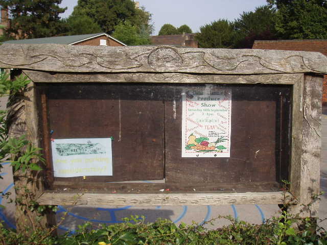
[1] Notice board outside Chenies School, carved by Dennis Heath in 2000, using designs suggested by the children, one of several artworks created for the Chiltern Heritage Trail Community Artworks Project
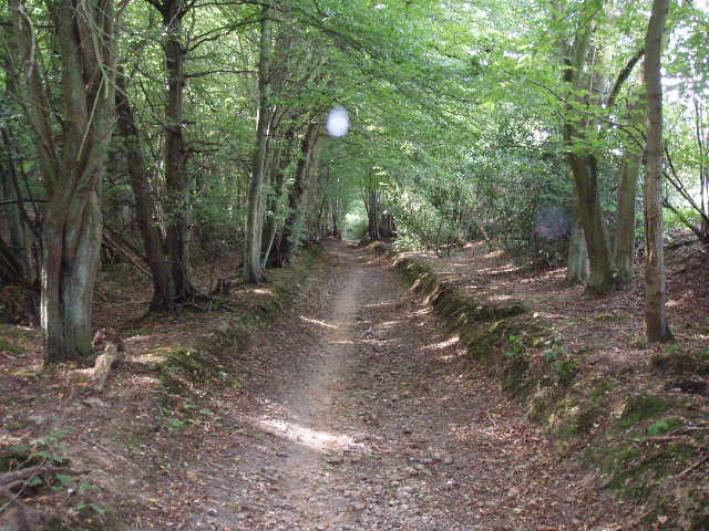
[2] Bridleway from Chenies to Chorleywood West
I set off from Chenies about 10am, following the lane that goes past the village school [1]. About 50 yards before this ended at a junction with the busy A404, a sign on my left indicated where the Chiltern Way joined the lane – I would now be following the route of that long-distance path almost all the way to Chalfont St Giles. It took me a minute or two before a gap in the traffic allowed me to cross the main road. Once safely across, I joined a very good bridleway, running between hedges and gradually going down hill [2]. It had obviously been surfaced with stones to prevent horse from churning it up into a mud bath. After about a third of a mile, it passed under a railway bridge (the Metropolitan Line, built in 1899 and now used jointly by Chiltern Railways – according to the Chiltern Way guide book). Beyond this the bridleway passed through a very pleasant wood, predominantly beech but with other trees as well. I remembered this as being one of the first beech woods I’d come to on my Chiltern Way walk. On the far side of the wood the bridleway ran along a good track, at first with paddocks on the left and further woodland on the right, then with paddocks on either side.
The path ended on Farm Road in Chorleywood West, where I turned left. There were houses now on my left, with more paddocks on my right. At a crossroads, I went straight ahead along Chalfont Lane, with more plush houses on either side. Where this road ended after about a quarter of a mile, I turned right into Shire Lane. After only about a hundred yards, where the road turned sharp left, I continued ahead into Old Shire Lane. This was once the boundary between Buckinghamshire and Hertfordshire – I’m not sure if it is connected to the lane of that name that I crossed near Hastoe on both the Ridgeway and the Chiltern Way, but it is certainly connected to the Shire Lane I came across on Day 3 of my South Bucks Way walk. At first the lane was a surfaced road, with houses on the left and yet more paddocks on the right before, leaving the houses of Chorleywood West behind, it became a wide and stony track, between a hedge on the left and extensive woods on the right [3]. At least part of the woodland here was owned by the Woodland Trust – there were signs welcoming people to walk the paths through their wood. The track continued some distance, very gradually descending. Where it turned sharp left, I took a path through the woods going right. After a short distance this started curving round to the left and going slightly uphill. The path ended at a stile on the edge of the wood, which gave access to a large and empty meadow.
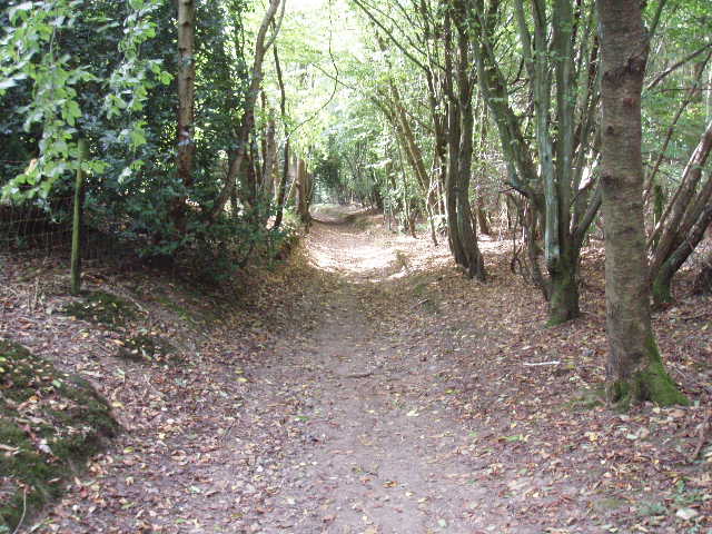
[3] Old Shire Lane, by Philipshill Wood
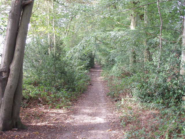
[4] Path along the old drive to Newland Park, near Chalfont St Gilesm
I followed a clear path through the grass along the right-hand edge of this field – I heard a Green Woodpecker’s distinctive call here, both now and on my way back. Beyond the left-hand hedge I could see the roofs of some of the buildings in the Chiltern Open Air Museum – according to the Chiltern Heritage Trail guide book, as well as a collection of historic buildings the museum houses an Iron Age house, a working Victorian farm, a sculpture trail and a nature walk. It is on the ever increasing list of places I want to visit some time! The path took me to a stile, near the start of the drive to both the museum and the Chalfont Campus of Buckinghamshire Chilterns University College. The latter is partly housed in Newland Park, originally built in the 1770’s and later owned by Abraham Newland, Chief Cashier of the Bank of England, whose signature was on five pound notes.
I walked a few yards to the end of the drive, by a Lodge House, and crossed the road there. I continued down a pleasant path through a long thin belt of trees [4] – this was once a continuation of the drive from Newland Park. After about a quarter of a mile this came to another minor road. Across this I followed a path between a garden hedge on my left and a fence on my right, beyond which was another paddock. Beyond this, the Chiltern Way went through a kissing gate and across a field ahead, but my route, the Chiltern Heritage Trail, turned right to continue along a clear and well-used path between fences and hedges. This junction was the only point all day where I checked my route on the guide book, although I was fairly sure where I had to go [UPDATE 25/09/17 The Chiltern Heritage Trail now follows the Chiltern Way route at this point, until it reaches a footbridge near Chiltern St Giles church - see here] The path soon led between houses to a road, then steeply downhill between more houses beyond – I noticed some Herb Robert growing here. Across another residential road, I followed a shared drive and then another fenced path to emerge near a roundabout on the main road near the centre of Chalfont St Giles. I used the zebra crossing to get over this, and continued ahead into the centre of the village. I took a quick photo of the village [5] and another of the village pond [6] before continuing on my way.

[5] Chalfont St Giles
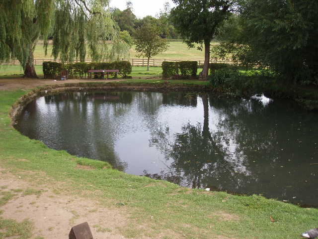
[6] Village pond, Chalfont St Gilesm
Having been here before on both the Chiltern Way and the South Bucks Way I knew where I had to go. An archway on the left of the main street gave access to a footpath around the side of the churchyard [7]. Just before a footbridge I turned right to cross a lawn behind a small block of flats – this junction had quite confused me when I walked the South Bucks Way last year, as there was no sign and the lawn obviously looked like private property. A stile then led on to a path between hedges. When, after a few hundred yards, I emerged from this into a field, I startled a young horse – it literally ‘jumped’ when it saw me! Beyond this field, I entered another very large pasture. I was now in the valley of the river Misbourne, following a left-hand hedge row for most of the remaining two miles to Chalfont St Peter. I remember being confused again on the South Bucks Way, as the OS map, the leaflet I was following as a guide and the paths on the ground all seemed to be slightly different from one another. The Chiltern Heritage Trail guide made it clear though, saying that I simply followed the left hand-hedge (there was certainly a path for some part of the way on the other side of the hedge, as I saw someone walking there on my way back).
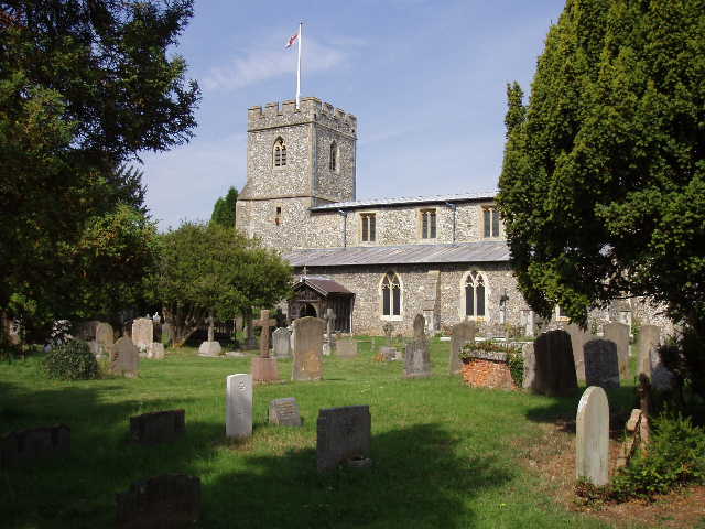
[7] Chalfont St Giles church - see Day 12 of my second Chiltern Way journal for photos taken inside the church
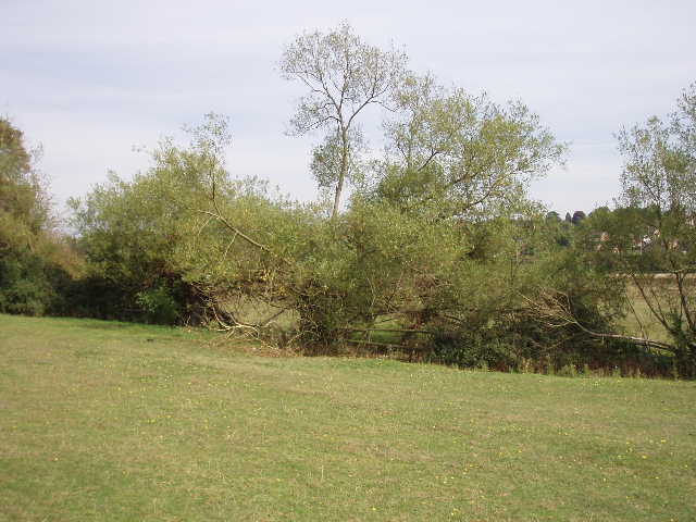
[8] Willow tree beside the path between Chalfont St Giles and Chalfont St Peter
The gates between this large pasture (which rose up the hillside on my right) and the very flat meadow to my left had been left opened, as had the ones connecting this field to the next one I came to, so the animals had a very large area in which to roam and feed. The cows were all in the meadow to my left (except for one ‘loner’ near a hedge at the top of the field), while the sheep seemed to prefer this field. The hedge on my left gave way to a fence in places, in others I noticed willow trees in the hedge [8]. This was a very pleasant and straightforward walk, following the hedge line along the valley bottom through a succession of fields [9]. There was occasionally some noise from the nearby road through the valley, but it was never very distracting. At one point I passed four elderly ladies out walking, and a bit later passed two other women, who judging by the shopping bag they were carrying were walking back from shopping in Chalfont St Giles. They kindly stopped to let me go over a stile before them.
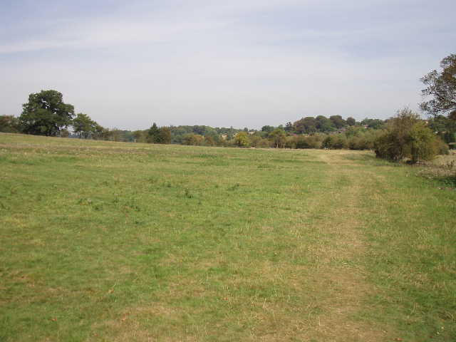
[9] Looking back along the path between Chalfont St Giles and Chalfont St Peter
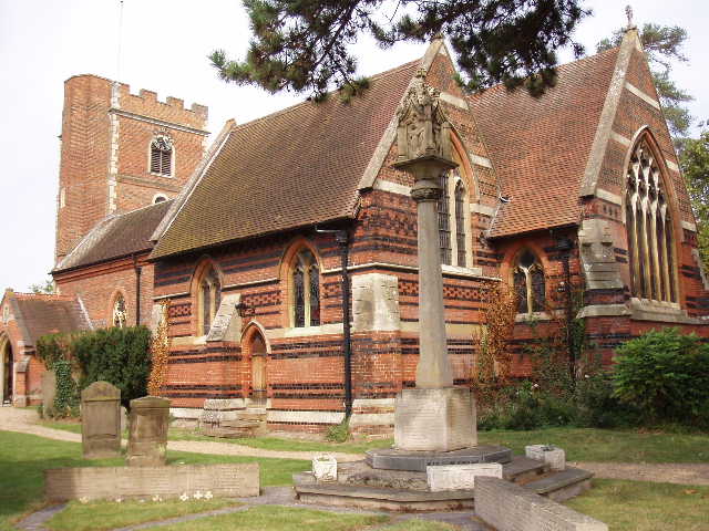
[10]Chalfont St Peter church
When I reached the end of the last field, on the outskirts of Chalfont St Peter, I took a right fork in the path, passing by some tennis courts and then crossing a sports field where a football pitch had been recently marked out. The path continued through some allotments, and then a few yards down a street brought me to the car park in the village centre (I’d always thought of both Chalfont St Giles and, especially, Chalfont St Peter as towns, but the guide book makes it clear that they are villages). I crossed the car park diagonally to come out on the high street by the church [10] [UPDATE 25/09/17 the route no longer goes through the car park, it just goes straight on ahead along Church Lane, turning right at the end].
It was just before noon when I turned round and started my return journey back to Chenies. I had my lunch sat on the stile on the edge of the wood near the Chiltern Open Air Museum – just as I was finishing and packing my things away in my rucksack, a friendly Dalmatian (or Damnation as I usually call them) ran up to me to say ‘Hello’. We had one in our family when we were children and they’re still probably my favourite breed of dog. A bit later I passed three walkers coming the other way through the wood – despite this being a Saturday, I really didn’t see too many other walkers about. I got back to my car in Chenies about 2.10pm
I enjoyed this walk, despite having walked almost all the route before. It would be hard not to enjoy a walk on such a glorious, day though! There was nothing of too much of historical or other interest on the route, and I didn’t see too many wildflowers. I did see a few Speckled Wood butterflies though. It was just a pleasant, straightforward walk on a delightful September day.
Total Distance: 13 miles each way