Pete's Walks - Chiltern Heritage Trail
If you are considering walking this route yourself, please see my disclaimer. You may also like to see these notes about the maps and GPX files.
Day 3 11/09/06 Chalfont St Peter to Amersham (8 miles each way, approximately)
Parked in car park in centre of Chalfont St Peter
It was a very hot day today. The forecast on the BBC weather web site said it would be 26C – when I looked again in the evening after the walk it said it had actually been 30C. Fortunately much of the walk was in the shade of trees, and when I walked the long shadeless section along the Misbourne valley there was quite a stiff breeze to keep the temperature down. So although it was plenty warm enough, it never became unbearably hot. I applied plenty of sun cream and drank lots of water (but not as much as on some other hot days, I still had most of my 3rd litre of water left when I got back to my car). Normally I feel rather drained at the end of a walk on such a hot day, but at the end of today’s 16 miles I actually felt pretty good and could easily have walked a few more miles. Funny how some days I feel much fitter than others.
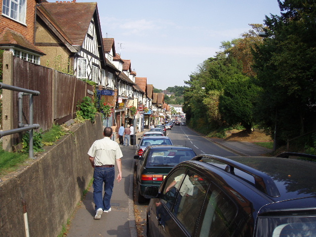
[1] Looking back towards the centre of Chalfont St Peter
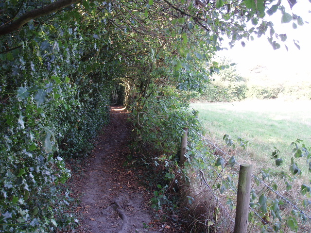
[2] Path just outside Chalfont St Peter
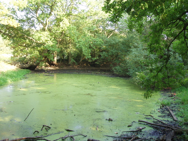
[3] Pond near Chalfont St Peter
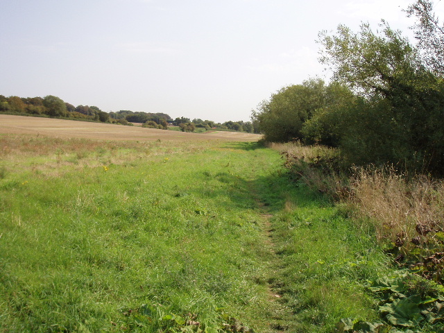
From the centre of Chalfont St Peter, I followed Market Place uphill, passing its row of shops on my right [1], then forked right and continued uphill along Nicol Road. This was actually quite a long stretch of uphill, a bit of a tough start to the day but it meant a nice easy finish to the walk. The uphill walking wasn’t a problem anyway, but my shins felt quite sore – this happens sometimes when I start a walk with a long section on pavements. I passed the entrance to a leisure centre near the end of Nicol Road, and then at the end of that road crossed over Grove Lane and took a footpath almost opposite, still heading roughly westward. This path started with garden fences on its left, but soon ran just inside an area of woodland, with rough grass fields to my left [2]. A Green Woodpecker flew up from a slimy green pond as I passed it [3]. After a few hundred yards along this path, I came to a junction where I turned half right to cross a meadow of rough grass diagonally. At the far corner I joined a path that passed through a small area of trees and then continued between fences with more grass fields to my right. This path ended at Welders Lane, by Welders House, where I turned left and followed the lane downhill to the village of Jordans.
I had really been looking forward to visiting Jordans. Firstly, because it has a youth hostel – although I’d never stayed at it in my hostelling years almost thirty years ago, I somehow remembered there was a hostel there. I don’t know if it is because it has some fame in hostelling circles, or perhaps it was just one of the nearest hostels to my home, but for some reason I still associate the name Jordans with youth hostelling. Perhaps I just remember it because the name Jordans is an unusual name for a village. Anyway I was curious to see the hostel. Unfortunately, when I got there it was obviously down a very long drive and not visible from the lane. No longer being a member of the YHA I didn’t feel like trespassing and wandering along the drive, so I had to be content with a photo of the YHA sign instead. I smiled at the thought of how utterly relieved my friends and I were to see that familiar green triangular sign at the end of a long day’s walk on numerous occasions in my youth! My friend Nigel always referred to it as the ‘Yeee-ha!’ sign.
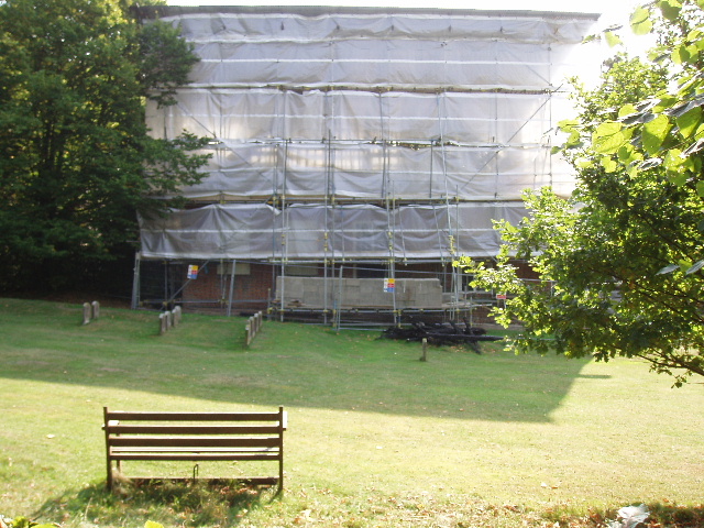
[4] Quaker Meeting House, Jordans (or is it a piece of modern art by Christo!)
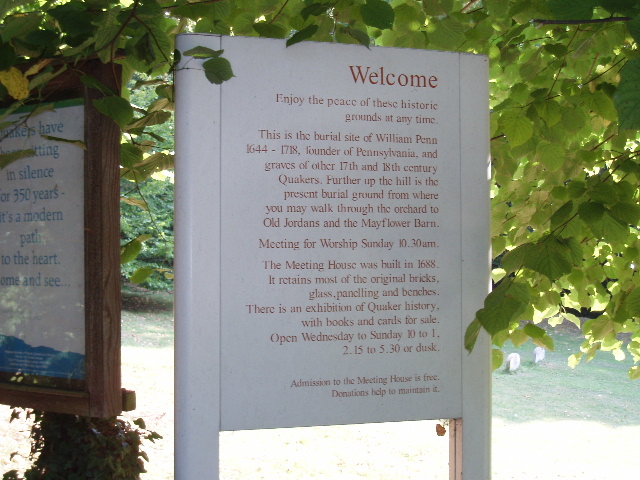
[5] Welcoming information board outside the Quaker Meeting House, Jordans
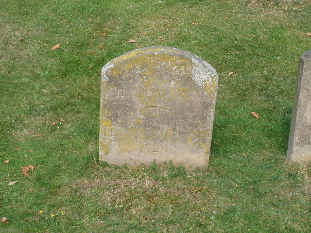
[6] William Penn's gravestone
The second thing I wanted to see in Jordans was the Quaker Meeting House [4,5], which dates from 1688 and is one of the oldest in the country. Again I was to be disappointed – it was obviously undergoing some major repair works, and was almost entirely hidden behind masses of plastic sheeting and scaffolding. Still, at least I was able to see the gravestones of William Penn [6] and his family – he was the founder of the state of Pennsylvania. Just beyond the Quaker burial ground I came to the third thing I wanted to see in Jordans, the Mayflower Barn [7]. This is reputed to have been built from the timbers of the ship that took the Pilgrim Fathers to America. I didn’t go inside [UPDATE It is now privately owned and no longer open to the public] , but took a quick photo and continued on my way.
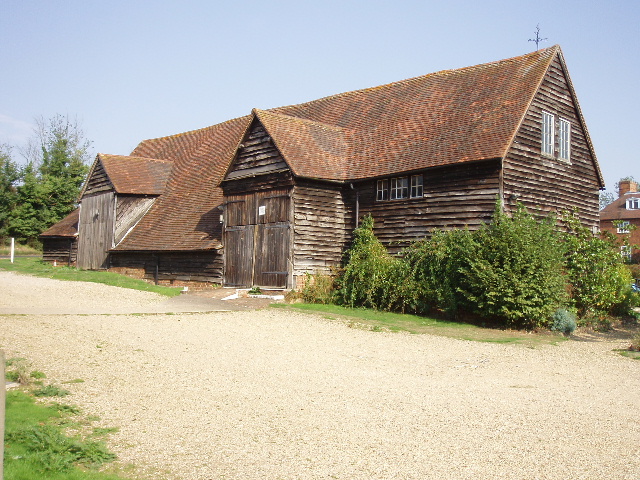
[7] Mayflower Barn, Jordans
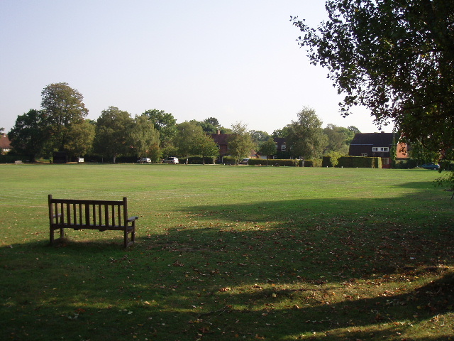
[8] Village green, Jordans
From the Mayflower Barn, I turned right along the lane, then left towards the village centre. I passed the large village green [8], and continued ahead as the road started to descend. When it ended at a T-junction I continued ahead on a footpath, soon crossing the bridleway of Wilton Lane and leaving the houses behind. The path continued between fences and then widened into a broader track with large horse paddocks on the right. It was only a few hundred yards before I reached the next village, Seer Green, emerging on a road opposite the Parish Church Hall [9]. I followed the road to the right, passing a pub, then turned left behind the church [10] (rather plain, with no tower) to reach a road junction by a second pub. Here there was supposed to be another of the artworks dotted along the route, a seat of forged and welded steel by Gillian Brent, but I couldn’t find it – perhaps it’s been stolen.
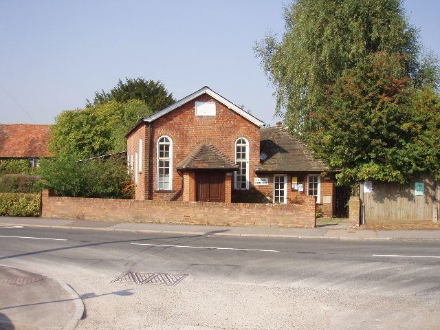
[9]Parish Church Hall, Seer Green
[10] Church, Seer Green
The Chiltern Heritage Trail followed the road to the right, but after a short distance turned right down an alleyway between houses. This path continued, crossing two residential roads, to reach a large paddock containing about 8 horses. The path crossed this paddock diagonally, half-left, to reach a stile giving access to a fenced path, where I turned right, now heading in a northerly direction. The path continued with paddocks on either side to a stile into a further paddock with a few more horses. I followed the right-hand hedge through this and the subsequent (empty) paddock, before another fenced path led to a lane, with farm buildings just to my left. I followed the lane to the right for a few hundred yards. Where the lane turned sharply right, a stile ahead gave access through a hedge to a path that followed the lane, then turned left round another side of yet another paddock. Another stile then gave access to a track leading into a wood.
Hodgemoor Wood is a Site of Special Scientific Interest (SSI), and is “one of the largest tracts of semi-natural broadleaved woodland in the Buckinghamshire Chilterns”. It was certainly very pleasant following the path through it, the shade from the trees making it cooler than when I’d been walking through the fields and paddocks. The path stayed close to the edge of the wood, and ran on for about half a mile [11] [UPDATE 25/09/17 the route now runs just inside the edge of the wood for about 500m then goes right at a junction for a few yards before turning left and following a bridleway along the edge of the wood. After about 200m the bridleway re-enters the wood and rejoins the original route (waymarks generally show the way)]. At the far end of the wood, I crossed a lane and took a footpath across a short section of ploughed field, before turning right on to a track. I was now on the route of the Chiltern Way again, though walking it in the opposite direction to that described in my journal. After a few yards the track came to a sharp bend in a lane, where I took a footpath on the left. This went between a left-hand hedge and an electrified fence on the right with a grassy field sloping away on the other side– the fence looked new, and I’m pretty sure it wasn’t here last year. Beyond this field, I continued on a track beside some cottages and across a staggered junction of tracks to pass a farmhouse and another cottage. The farmhouse was covered in scaffolding and was obviously being renovated - I remembered this being the case when I went past 15 months ago, so it’s been a long job.
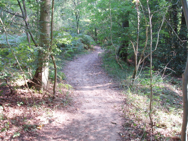
[11] Path through Hodgemoor Wood
The track became a path, with a hedge on the right and a fence on the left. There were cows in the left-hand field, and a ploughed field beyond the hedge. The path headed downhill at a steady gradient for a few hundred yards to reach a stile. Beyond this, the path continued downhill through a grassy field to reach another stile on the edge of a belt of trees running along the bottom of the valley. This was the Misbourne valley again, just north of Chalfont St Giles – I had walked along this valley from there to Chalfont St Peter on my previous walk. In fact, having walked over 5 miles this morning I was now only about 2.5 miles from my starting point! I turned left along a path running through the belt of trees, leaving the Chiltern Way but rejoining the route of the South Bucks Way (but again walking in the opposite direction to that described in my journal). The trees soon came to an end, and I crossed a stile into a grassy field and continued in a north-westerly direction along the floor of the valley. I remembered meeting two ladies here last year, who were part of a group celebrating 80 years of the Women’s Institute in Buckinghamshire by walking across the county from north to south. As I crossed the field, I saw a Red Kite rise up from the ground near the stile I was walking towards – it circled a few times, getting slightly closer to me, then rose and disappeared from view somewhere to my left. It was the first one I’d seen so far on the Chiltern Heritage Trail.
The next field contained two horses, both standing by the right-hand hedge that the path followed. I saw a yellow butterfly in this field – it seemed far too dark a yellow to be a Brimstone, but I can’t think what else it could be, so I guess it was just the effect of my sunglasses. Beyond this field I crossed a lane and then followed the path through a further sequence of empty grass fields. From my walk on the South Bucks Way I remembered the path following a rather curious wavy line through one particular field. I hadn’t liked this walk too much when I did it last year, mainly because the whole walk that day was along the bottom of the Misbourne valley and so wasn’t very varied. Walking this small section today was perfectly pleasant though. Even though it was a hot day and there was now no shade, a fairly stiff breeze kept the temperature reasonable. The noise from the road running through the valley wasn’t as intrusive as it seemed last year either.
[12] Looking back along the path just before reaching Old Amersham
[13] Dry course of the River Misbourne, Old Amersham
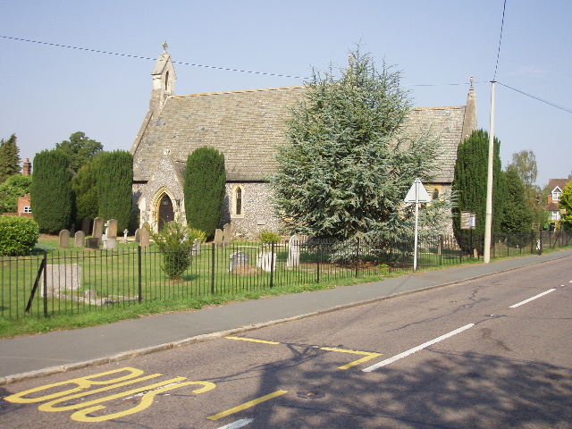
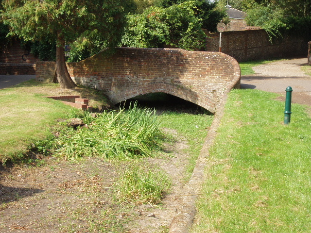
Beyond the fifth field from the lane (I counted in the guide book, so I’d know when to look for the junction) I turned off the South Bucks Way and followed tractor tracks marking a path across the ploughed field on my right. These led to a footbridge over the river Misbourne (or, at least, over its course – it was completely dry here). I turned left along the river bank, and continued on a path [12] that took me under a road bridge and on to a main road on the southern edge of Old Amersham (the road I’d driven down the valley this morning to get to Chalfont St Peter). I went left, and then turned right at a roundabout, before taking a footpath on the left [UPDATE 25/09/17 the route now goes right before reaching the roundabout, in front of The Chequers Pub and through the car park of Ambers to a pedestrian crossing, continuing along the path opposite]. This went past a smallholding on the left, then followed the river bank, with a very large stubble field on my right. It then went to the left of a graveyard, before I crossed a brick bridge (there was no water in the river here either) [13] and followed a tarmac path through the churchyard [14] into the centre of Old Amersham (as opposed to the newer town of Amersham-on-the-hill).
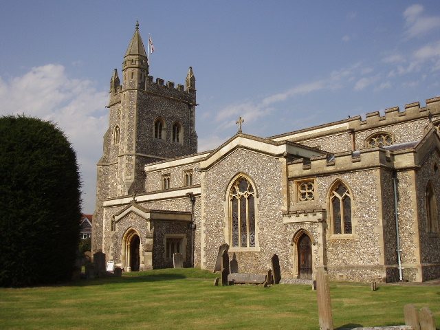
[14] Church, Old Amersham
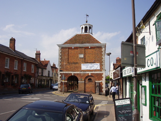
[15]Market Hall, Old Amersham
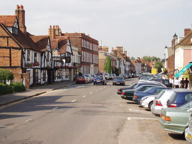
[16] Part of High Street, Old Amersham
According to the Chiltern Heritage Trail guide book, the High Street in Old Amersham has been described as the finest in England (it doesn’t say who said that – the cynic in me suspects it was the local tourist board!). It certainly is a very impressive street, with mainly Georgian buildings (or Georgian facades on older buildings), a few old coaching inns, and a market hall [54] surmounted by a small clock tower. Sadly the large number of cars parked along it rather spoil the effect. I remember being very impressed by it when I came through here on the South Bucks Way last year.
After taking one or two photos [16], I turned round and headed back the way I’d come. It was now about 12.20pm, having taken me about 2.5 hours to walk the 8 miles so far. I managed to make a reasonable start on my return journey before stopping for lunch. Originally I’d planned to have lunch on the stile at the end of the belt of trees just before I reached the Chiltern Way, but this proved to be uncomfortably close to some nettles and, in any case, this would have meant a long uphill section immediately after lunch. So I carried on as far as Hodgemoor Wood, where the remains of an old stile near the side of the path made a comfortable seat for my lunch break. This was about 1.30pm – I seem to be getting used to having my lunch a bit later than usual.
Often I feel a bit stiff and sluggish when I start walking again after lunch, but as I mentioned before, today was a day when I felt really good all day, and I had no problem getting going again. I seemed to walk at a good pace all afternoon, not tiring and slowing down as I do on some walks, especially on hot days like this. Most unusually, I was still feeling really strong when I got back to my car about 3.10pm.
This was another thoroughly enjoyable walk. I’ve been very impressed with the Chiltern Heritage Trail so far, and only hope that the rest of the route is as good. Today’s route was a little convoluted, presumably because one of the aims of the Chiltern Heritage Trail was to visit each of the 14 parishes within Chiltern District, but it was a far more interesting walk than the straightforward route followed by the South Bucks Way straight along the Misbourne Valley. It was a shame about the Quaker Meeting House being closed and hidden from view at Jordans, maybe I’ll go back there another time – I certainly wouldn’t rule out the possibility of walking the Chiltern Heritage Trail again some day.
Total Distance: 21 miles each way