Pete's Walks - Chiltern Heritage Trail
If you are considering walking this route yourself, please see my disclaimer. You may also like to see these notes about the maps and GPX files.
Day 4 13/09/06 Amersham to Little Missenden (7 miles each way, approximately)
Parked in car park in Old Amersham.
Pride comes before a fall! After bragging about how fit I felt on the last walk, it was odds-on that I would really struggle today! Actually, I didn’t feel too bad, just a bit sluggish and a bit footsore after lunch, but I certainly wasn’t as full of energy as I was two days ago. Funny how it goes.
This morning was grey and a bit misty. The forecast had said the temperature could reach 25C, but when I set off from the car park I was glad I was wearing long trousers and a long-sleeved shirt rather than the shorts and t-shirt I’d worn on my previous walk. It wasn’t cold, but it certainly wasn’t anywhere near 25C. I crossed the High Street on a pedestrian crossing near the church and headed down Whielden Street – this is another attractive road of mainly Georgian buildings, not as broad or impressive as the High Street, but still very pleasant and scenic. After about 100 yards I turned left into Whielden Green, then turned right at a stile after another 50 yards or so.
I have to confess that I accidentally took a bit of a short cut here. The guide book said to take a path going left, and so I took the clear path going half-left up the hillside through a field of rough grass – it went to a corner of the hedge where the field widened out considerably. In fact, as I realised when I came back, there should have been a path further left that went up to the hedge and then turned right between the hedge and some garden fences, to come to the corner I’ve just mentioned [UPDATE 26/11/17 The modified route now goes the way that I went] When I looked at this path on the way back, it was partly blocked by a fallen tree and garden refuse, and didn’t look at all inviting. Nor was there any evidence of a path from this one to the stile where I entered the field (where I should have turned further left). It looks very much as if the path I took has replaced the original path in the guide book, so I’m not bothered about walking a slightly different route. I turned left at the corner of the hedge. A tarmac path soon appeared on the other side of the hedge, and a right fork led in a few yards to a footbridge over the Amersham by-pass.
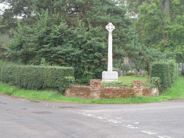
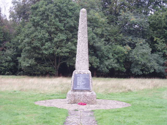
[1] War Memorial, Coleshill
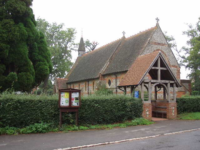
[2] Coleshill church
Almost immediately after crossing the bridge, I took a footpath on the right. This ran along the backs of some gardens initially, along the left edge of a huge field, currently stubble. Beyond the houses, the path continued alongside a ditch, gradually rising as it wound upwards into the hills west of Amersham. On my way back in the afternoon, I noticed some of the small red flowers of Scarlet Pimpernel here. After about a third of a mile, at a waymark near a solitary tree, I had to turn sharply right and cross the field for a couple of hundred yards to another waymark, where I turned sharp left to walk below a small bank (there seemed to be a better path above the bank, but the guide book and map both indicated that the path went below the bank). At the end of the field, close to the top of the hill, I went through a gap in a hedge to enter a large grassy field (looking back there were good views over Old Amersham and the Misbourne Valley). I followed the left-hand hedge for a few hundred yards, until a path forked left near a pylon. This crossed a stile and followed another left-hand hedge through a paddock, then ran between a wall and a fence to a farm drive, which led to a road on the edge of Coleshill.
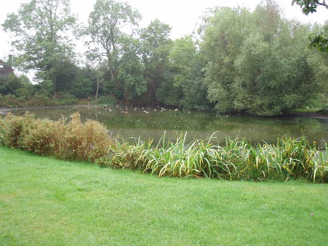
[3] Duck pond, Coleshill
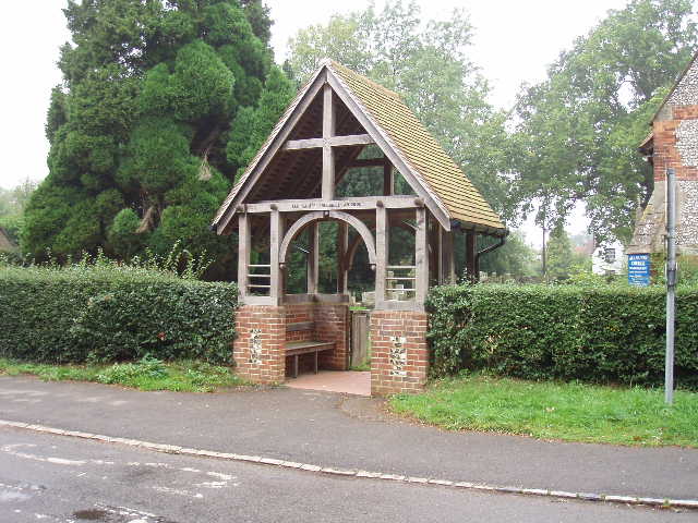
[4] Lych Gate, Coleshill - another of the artworks along the Chiltern Heritage Trail
I walked for almost half a mile along the road towards the village centre. Edmund Waller, the Civil War poet, lived in Coleshill and apparently used to write under an oak tree here that has been dated back to the Norman Conquest. Part of the manor house in which he lived has been incorporated into a more modern building. At a fork in the road by a war memorial [1], I kept left to reach the Red Lion pub - here the Chiltern Way came in from my left, and I would now be following its route as far as the next village, Winchmore Hill. After taking photos of the church [2] and the nearby pond [3], I took an alley beside the church on my right – there was a new Lych Gate [4] at the church, wooden on a brick base, another of the Millennium artworks dotted along the route of the Chiltern Heritage Trail. The alley soon came to another road, across which I walked down a driveway. After passing a few houses, the path continued ahead between a hedge on the left and a fence on the right, continuing ahead when another path forked to the right. Beyond a stile, the path next crossed a large grassy field – there were good views of typical Chiltern woods and hills from here (at least when the weather was brighter in the afternoon) [5]. The next section through a small wood was very muddy, the worst bit of the whole day’s walk – it had rained the night before, and quite heavily the night before that, so the paths were wet throughout this walk. I then followed the path alongside a left-hand hedge for about another third of a mile, to reach a road opposite the Methodist Church in Winchmore Hill (curiously, there is another Winchmore Hill in North London, only about ten miles from here – my friends Terry and Sue live there).
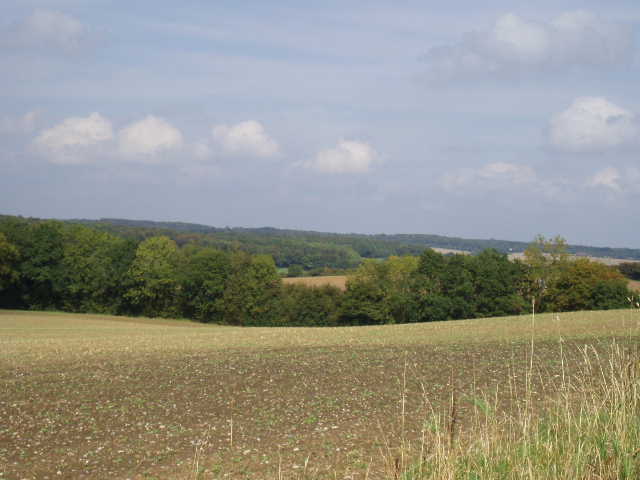
[5]Typical Chiltern scenery, between Coleshill and Winchmore Hill (photo taken in afternoon)
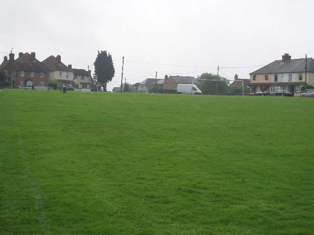
[6]Winchmore Hill
I turned left up the road, and then right to reach the green – the village has a very large green, more than big enough for a football pitch, with houses and two pubs around its edge [6]. I turned right again, parting company with the Chiltern Way, and followed the right hand edge of the green. I crossed another road and took a fenced path that soon led to a kissing gate. Unusually, this was immediately followed by a stile (in an electrified fence). This gave access to a green pasture, with cows some way over to my left, which I crossed to another kissing gate. This led into a wood, mainly coniferous but with some beech and other deciduous trees. Beyond this, I crossed a very large and empty grass field half-right, to reach a stile. A path through bushes soon led to a driveway which brought me out onto a road in the village of Penn Street [7] (I remembered driving through here on my way to Penn Bottom on my Chiltern Way walk).
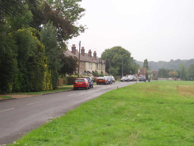
[7] Penn Street
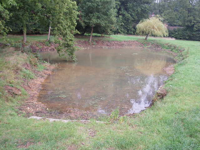
[8] Pond at Penn Street
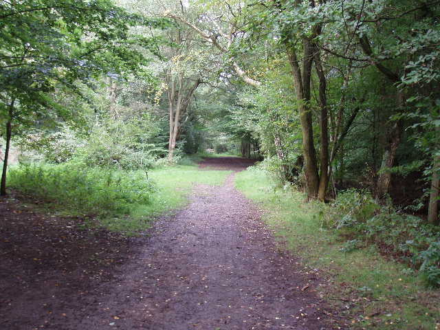
There was another pond here [8] – it was shown on the map, but it almost looked as if it had been newly created, as there was almost no vegetation round it. There was also another war memorial [9], both pond and memorial being on another large village green, this one with a cricket pitch on it rather than a football pitch. I followed the edge of the green to the left, with a row of houses and a pub across the road on my left. At a road junction, I turned right and soon reached an entrance to Penn Wood [10]. The guide book says this is the largest area of Beechwood left in the Chilterns, although the information board provided by the Woodland Trust show it has had a somewhat chequered history. At one point it was forcibly enclosed by the owners, to the anger of local residents who had grazing rights there. Much of the beech wood was felled and replaced by conifers. Fairly recently there were plans to create a golf course here, but the local residents raised the money to fight this all way through the courts to the Secretary of State, who ruled in their favour. The wood is now owned and managed by the Woodland Trust. It was a very pleasant walk along the main path through the wood, although a bit muddy in places after the recent rain.
[9] War Memorial, Penn Street
[10] Penn Wood
It had been grey and overcast all morning, but the sun briefly broke through just as I’d been leaving Winchmore Hill. Now, although there was a small patch of blue in the sky, ahead of me the clouds were dark grey and looked ominous. Beyond Penn Wood, I crossed the busy A404 and went down the surprisingly busy Sheepcote Dell Road, very shortly forking right into Beaumond End Lane. After about 50 yards I turned right down a drive for several houses, and at the end of the drive continued on a fenced path between a paddock on my left and a garden on my right. Through a kissing gate, I crossed another pasture, taking care not to come between any cows and their calves. Another gate gave access to Toby’s Lane, where I turned left to follow this bridleway about a mile and a quarter to Little Missenden.
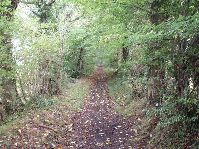
[11] Toby's Lane (afternoon)
[12] Toby's Lane, approaching Little Missenden
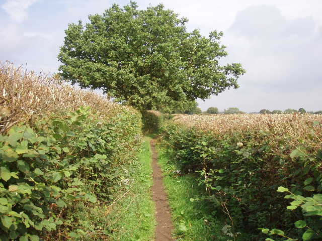
The guide book said that Toby’s Lane could be very muddy after wet weather, and suggested following Beaumond End Lane as an alternative. It was fine today however, despite the recent rain, only one muddy section of a few yards causing to me to worry about where to put my feet. It was very nice following the bridleway between hedges [11], with no worries about navigation. I didn’t see too much in the way of wildflowers today, but noticed some Rosebay Willowherb and Herb Robert along this section of the walk. A little way along the bridleway, the hedges had been recently trimmed on both sides. Beyond the hedges were mainly ploughed fields, although there was a small wood on my right for a while. At the end of the wood, where the path was starting to descend back into the Misbourne Valley [12], there was a gap in the hedge where people had obviously gone to admire the view. A hundred yards or so farther on, there was another gap in the hedge where a path forked left. I recognised the view from here as being on the photo on the cover of the Chiltern Heritage Trail guide book [13] – the path wound down hill through the field, passing a solitary tree, with the village of Little Missenden and the upper Misbourne Valley beyond.
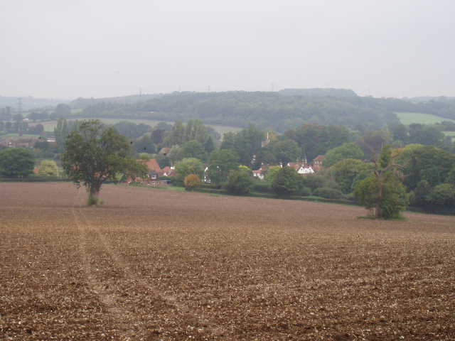
[13] View from Toby's Lane looking towards Little Missende
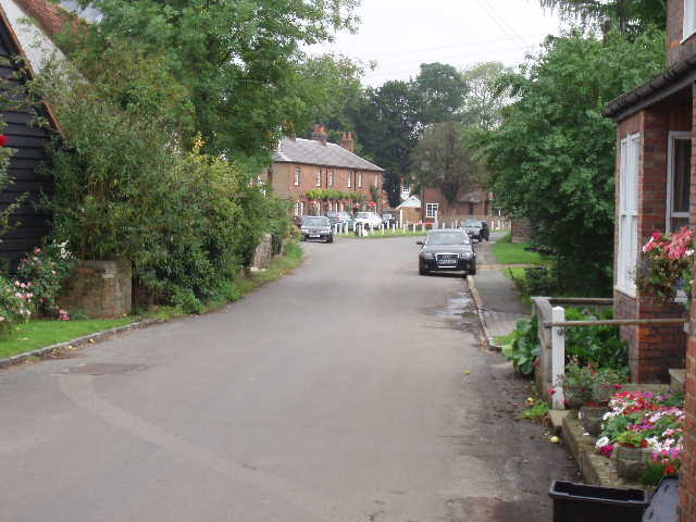
[14] Little Missenden
I continued downhill along Toby’s Lane, passing Toby’s Lane Farm and emerging on a road almost opposite The Crown public house in Little Missenden. I turned left and followed the road towards the centre of the village [14]. I was here briefly on the route of the South Bucks Way, before it forked left on a path across a field – I remember being disappointed when I did that walk that it didn’t go past the church in Little Missenden which has some impressive wall paintings. Having walked through the village today, I’m even more mystified as to why the South Bucks Way almost totally misses out on passing through this interesting and attractive village. The section of the guide book I was following today ended at the Red Lion pub (closed and completely covered in scaffolding and plastic sheeting today), but I decided to walk on as far as the church. I wanted to see the wall paintings, but didn’t want to go in with my muddy boots and trousers. So I’ll park outside the church on my next walk, and pay it a visit before I put my boots on.
As well as the church [15], I was impressed with Little Missenden generally. There were several attractive old cottages, and a couple of much grander residences. I got the impression there was probably a good community feel to the village. There was an obviously well-used village hall, a board with a map of the village showing all the footpaths, and a playing field for children – a notice said a resident had paid for the land, while the fencing was paid for by public subscription. There was also an interesting carved finger post in the village, topped by a ‘Green Man’ figure [16] (I assumed this was another of the artworks set up along the Chiltern Heritage Trail, but having checked the guide book I’ve found this is not the case). If anybody reading this ever decides to walk the South Bucks Way, I’d definitely recommend a diversion to visit the centre of Little Missenden.
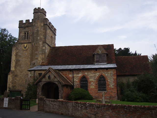
[15] Little Missenden church
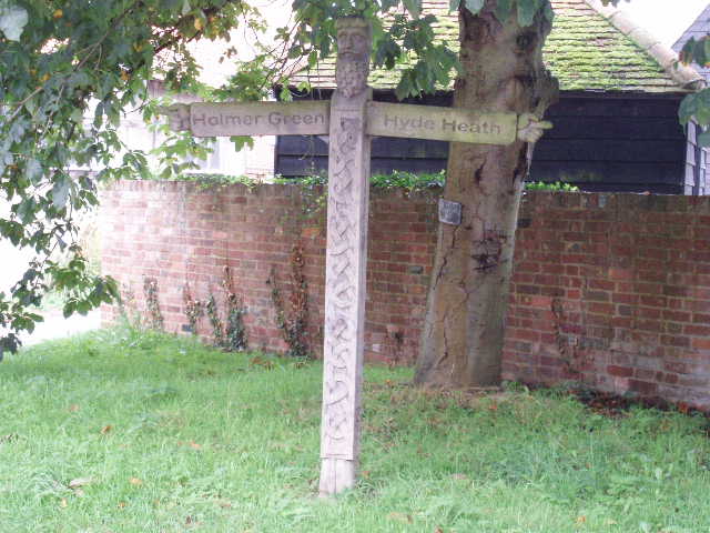
[16] Carved 'Green Man' finger post in Little Missenden
It had taken me about 2 hours and 10 minutes to walk the seven miles so far. I turned round and headed back, starting with the long and gradual ascent back up Toby’s Lane. I reflected on the fact that today’s walk was similar to the previous walk, in that both started in the Misbourne Valley, travelled westwards into the hills and villages before turning back and returning to the valley not too far from where the walk had started – Little Missenden is only a couple of miles from Old Amersham, where I started my walk this morning. In fact, the last two days on the Chiltern Heritage Trail have taken me from Chalfont St Peter to Little Missenden, a journey I did in one day on the South Bucks Way, which simply followed the Misbourne Valley.
The grey clouds that had threatened rain had gone by now, and the sky was gradually clearing, so that the return walk was much sunnier and brighter. I had my lunch on a bench in the middle of Penn Wood (I was spoilt for choice today as there were benches in Penn Street and Winchmore Hill, too). I had distant views of two Red Kites as I walked back along the road in Coleshill. It was about 2.30pm when I got back to my car in old Amersham.
This was another very enjoyable walk – allowing for the murky and muddy conditions, it was just as good as the other walks I’ve done on the Chiltern Heritage Trail so far. It was a nice mix of woodlands and fields, and passed through some pretty and interesting villages. Little Missenden in particular was worth visiting, but Penn Street and Winchmore Hill with their large greens were also attractive spots.
Total Distance: 28 miles each way