Pete's Walks - Chiltern Heritage Trail
If you are considering walking this route yourself, please see my disclaimer. You may also like to see these notes about the maps and GPX files.
Day 5 18/09/06 Little Missenden to The Lee (8 miles each way, approximately)
Parked on road by school in Little Missenden.
It was quite grey and overcast as I set off from home this morning, but in the 30 or 35 minutes it took to drive to Little Missenden the sun had broken through the clouds and most of the sky was blue. It remained a pleasantly warm and generally sunny day throughout the walk, although there were some grey clouds in the afternoon which hid the sun occasionally.
Before starting my walk I had a quick look round the church in Little Missenden [1]. This is a fascinating building, well worth a visit. The oldest parts of the building date to 950-1050AD, with the Saxon builders including Roman bricks and tiles in the construction. The Normans added aisles either side of the Saxon nave, and further modifications continued until the 15th century. There are wonderful mediaeval wall paintings on the walls of the nave, including one of St Christopher carrying the infant Christ across a river.
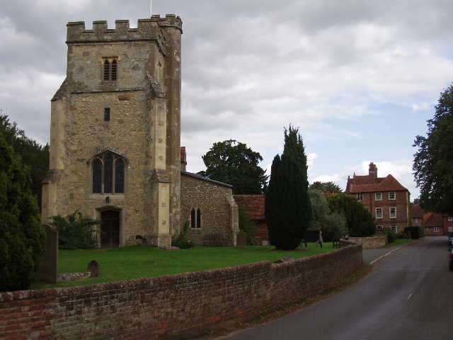
[1] Little Missenden church
I continued westward along the road past the church, crossing a stile on the left just past the last house. I went diagonally across a large paddock, where five horses were gathered near a drinking trough in the far corner. I crossed another stile, which took me into a hedged path, with another stile immediately ahead of me. Here I discovered I’d made a small mistake when I walked the South Bucks Way last year – coming from the other direction, I should have crossed the stile and turned right, instead of continuing on the clear track on the far side of the hedge. Never mind! I made up for it now, by walking the 100 yards or so down the hedged path to where it came out on the path I’d walked, before turning round and coming back to the two stiles facing each other. I crossed the second stile and continued ahead, now on the route of the South Bucks Way. I was now in a ploughed field, following the right hand hedge (where a Red Admiral butterfly flew up from my feet) before crossing a section of the field to another hedge. Beyond this I entered a much larger ploughed field, the path marked out by tractor tracks. The path was rising steadily up a broad ridge, with the Misbourne valley to my right and another smaller valley to my left. As the path rose, I occasionally turned to admire the view back over Little Missenden. I was much taken by this view when I walked the South Bucks Way (it is recommended on information boards in both Little Missenden and Little Kingshill), but my photos have failed to do it justice [2]. At the end of the large ploughed field, a short path between trees took me to a road in Little Kingshill.
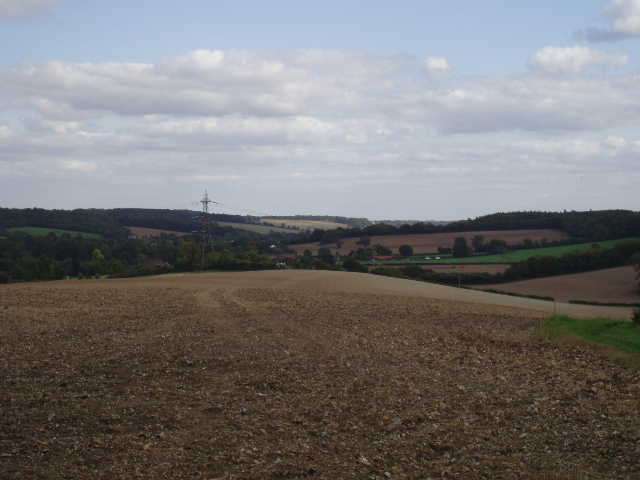
[2] View back towards Little Missenden and the Misbourne Valley from near Little Kingshill
I followed the road to my left for about half a mile, passing a nursery and an infants school. I then turned right to walk along the far edge of a playing field (I’d had my lunch here when I walked the South Bucks Way), then a short alley brought me to another road. Here the Chiltern Heritage Trail parted company from the South Bucks Way (which followed the road to the right, taking a shorter route to Great Missenden). I took a path that went straight in front of a pub and then ran between fences or hedges for some distance, with mainly paddocks on my left and cows in the pastures beyond the hedge on my right. The path then ran through a small area of scrubland to reach a stile. Beyond this, I crossed a very large grass meadow diagonally to the left, and followed the path past farm buildings to a lane.
I turned right for a couple of hundred yards, before taking a tarmac farm drive on the left that ran between very neat hedges on either side. Where this turned right after a few hundred yards, I continued ahead on a bridleway running between hedges. This soon reached a wood, where I went through a kissing gate in a fence to take a path on the right. The Chiltern Heritage Trail then almost immediately forked right. The path here in the wood was not too clear, the path being almost indiscernible amongst the leaf litter on the ground. Occasional white arrows on trees indicated the route, however, and I managed to find my way to the correct exit on the far side of the wood – I took careful notice of a couple of junctions where the route wasn’t clear, so that I wouldn’t get lost on the way back (What? Me get lost? Never!). I then followed the right-hand hedge of a field, which turned to the right and then to the left, to reach a metal gate. Beyond this, the path ran between a garden hedge and an orchard to reach the drive of a farm, which I followed a short distance to the left to reach another road.
Here the Chiltern Heritage Trail went to the right. The road was on the very edge of Prestwood, originally a hamlet within the parish of Great Missenden but now a much bigger settlement than its parent village. After 100 yards, I turned right down a footpath which soon entered a large grass field and headed downhill gently to reach Angling Spring wood. The path continued to descend slowly through the wood, where I saw a Comma butterfly on my way back. On the other side of the wood, the path continued through another grass field. Just before a metal gate, the path forked left to a stile, where an alley between two houses brought me to a private drive. I followed this to the left to reach a road, where I turned right to walk past the railway station and reach the centre of Great Missenden [3].
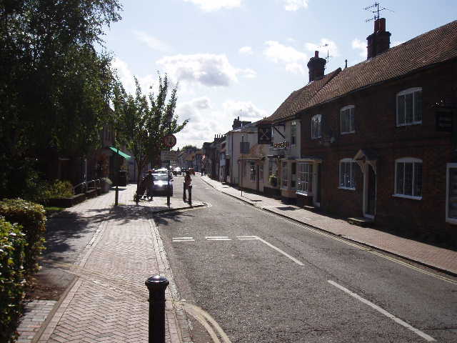
[3] Great Missenden
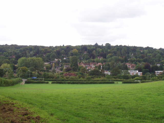
[4] View back to Great Missenden
Great Missenden is a much bigger village than Little Missenden (it’s not always the case that Great X is bigger than Little X, as populations change over centuries), with a railway station, a supermarket and plenty of attractive shops along its High Street – it’s almost a small town. It’s a long, thin settlement though, spread along the bottom of the Misbourne valley (the river rises just west of here), so it didn’t take me long to cross through it. Beyond the A413 main road, a hedge-side path led me uphill in a northerly direction, as I left the Misbourne valley for the last time on the Chiltern Heritage Trail [4]. Across a stile, the path continued between fences with a wood to my left and an empty grass field to my right, then continued uphill across another grass field to reach a stile. Here I followed the fence on my right along the edge of a field planted with some green vegetable, the path soon levelling out as it reached the top of the hill. At the corner of the field, I entered a small wood – the path here ran between thick hedges of holly, obscuring the trees beyond [5].
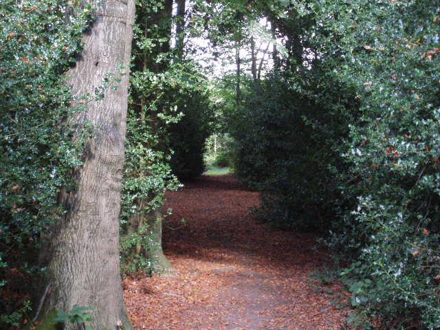
[5] Holly-lined path through wood between Great Missenden and Ballenger Common
I next crossed another grassy field, on a clear path, to each a lane where three workmen were busy repairing the surface with tarmac. A path continued across the lane, running diagonally left through another larger field, then following the far side of a hedge round a much bigger ploughed field. I didn’t see many wildflowers on this walk, but along this field edge path I saw both Scarlet Pimpernels and Field Pansies. Over a stile in the field corner, I turned left on another path with a hedge now on my left and a paddock beyond a fence on my right. Shortly before the next field corner, I went over a stile on my left, and then followed a right-hand hedge alongside another ploughed field. Just past the next field corner I turned right over a stile, and followed another right-hand hedge through a rather overgrown grassy field. A short sequence of stiles close to some farm buildings then lead to a path, with a lot of nettles, running beside a playing field, to reach a road in the small village of Ballenger Common.
I turned left along the road and then left again by the village pub, thus walking round three sides of the playing field – it would have been quicker using the footpath along the fourth side of the playing field! I can only think that the Chiltern Heritage Trail takes the long way round so that the route passes the village pub. I passed the tiny village church [6] on my right – instead of being set apart in a graveyard, it was very close to some houses, so close in fact that it seemed as if it was in their garden! On a notice board outside it announced that the church was now licenced for marriages, and there was a cutting of a local paper with details of the first wedding celebrated there (if ‘celebrated’ is the right word for some poor man losing his freedom!). J
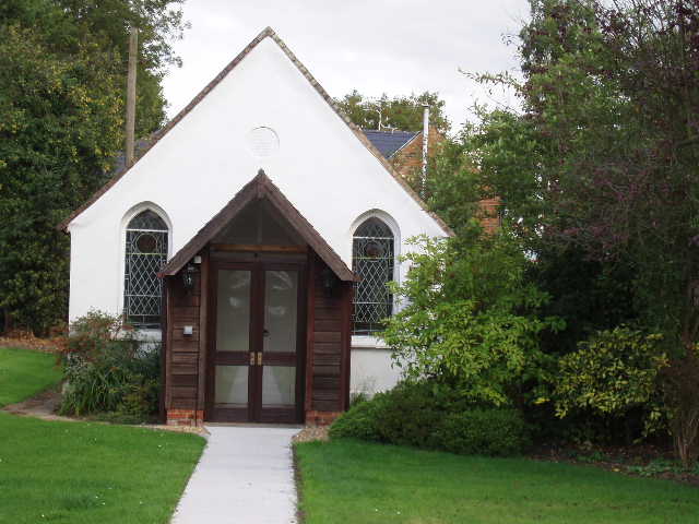
[6] Tiny church at Ballenger Common
At the end of the lane, a bridleway continued ahead [7]. This ran between fences or hedges besides two or three fields, to reach a point where a seat had been placed in memory of some local people. It was in a nice spot, with good views of the surrounding fields and woods. At this point, the bridleway became a broad track, soon passing some isolated cottages where three mountain bikers whizzed past me – they stopped to check their directions where this track crossed another bridleway in a small dip, but didn’t seem inclined to say ‘hello’ as I went by. They soon passed me again as I continued along the track, with fields over the hedge on my left and a wood on my right. I soon passed the point where the Chiltern Link took a path on my right – the Chiltern Heritage Trail sharing the route of the Chiltern Link for the rest of the short distance along the track to the village of The Lee [8].
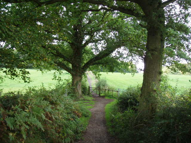
[7] Path between Ballenger Common and The Lee
[8] The Lee
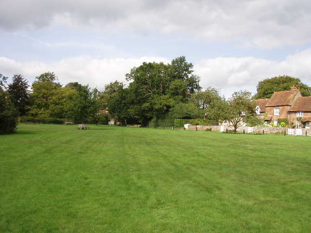
The Lee is an attractive village, with a large green surrounded by a pub and brick-built cottages and houses. There is a war memorial on the green, and also a large lump of pudding-stone [9]. I took a diversion here, going three hundred yards down a road to see a very impressive ship’s figurehead [10] set up at the entrance to a large private residence. The figurehead was of Admiral Lord Howe and came from HMS Howe (later renamed HMS Impregnable), the last wooden warship ever built for the Royal Navy. When it was broken up, many of its timbers were used in the rebuilding of the Liberty’s store in London – the founder of the store was the Lord of the Manor here, so presumably that’s how the figurehead came to be set up here (there are more connections with Liberty’s mentioned in Day 1 of this journal). As usual, this information comes from the Chiltern Heritage Trail guide book.
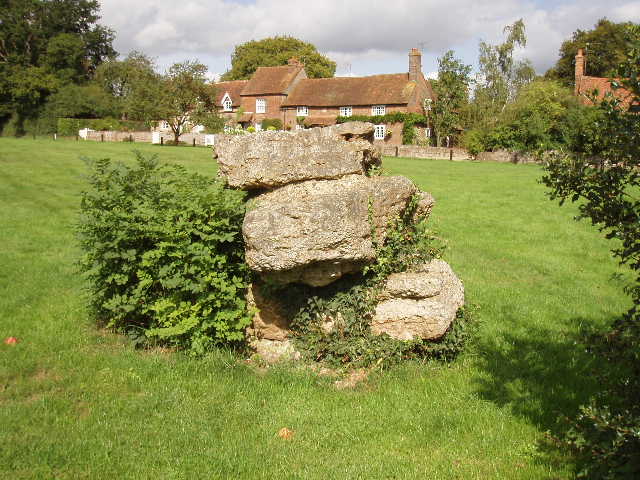
[9] The Lee
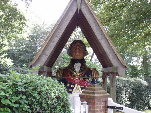
[10] Ship's figurehead
I had left Little Missenden about 10am and reached The Lee about 12.20pm, not bad for an 8 mile walk. My return journey was very pleasant but uneventful – an advantage of doing walks ‘both ways’ is that on the way back I don’t have to worry about navigating, and so have more time to enjoy looking at the countryside I’m passing through. I had lunch on a stile on the hillside overlooking Great Missenden, and got back to Little Missenden just before three (just as parents were beginning to arrive to collect their offspring from the school). This was another very pleasant walk – I’ve really enjoyed all the walks I’ve done so far on the Chiltern Heritage Trail. There was a pleasant mixture of fields and woods, and some ups and downs to make it more interesting. The villages at the start and finish were very nice, and my visit to Little Missenden church certainly added to the day.
Total Distance: 36 miles each way