Pete's Walks - Chiltern Heritage Trail
If you are considering walking this route yourself, please see my disclaimer. You may also like to see these notes about the maps and GPX files.
Day 6 20/09/06 The Lee to White Hawridge Bottom (8 miles each way, approximately)
Parked by green at The Lee.
I can’t be too precise about the furthest point I reached on this walk – White Hawridge Bottom is a long valley rather than a village or town (I’m not sure if the name applies to the whole valley or just a part of it – Bottom is a commonly used name for valleys here in the Chilterns and elsewhere). So far on this walk, I have managed to divide the route into 6-8 mile chunks by combining 2 or 3 of the 16 sections in the guide book. The last two sections of this walk are 4.5 and 6 miles though, so I’ve done 2.5 miles of the penultimate section (along with the 5.5 miles of the previous two sections) on this walk, leaving me another 8 miles (each way) to complete the Chiltern Heritage Trail on my next walk.
It looked like it was going to be a gloriously sunny morning as I sat eating my breakfast in Kensworth, but by the time I reached The Lee the sky was almost overcast with low grey clouds, which threatened showers at the very least. This was disappointing, as the forecast was for a warm dry day with sunny spells (I spent a long time yesterday reading the biographies of the BBC weather forecasters on their web page, you’d think the least they could do in return was get today’s forecast right!). In the event, it stayed dry except for a couple of spots of rain about 11am, and in the afternoon it was bright and breezy – in fact it was very warm, but with a stiff breeze.
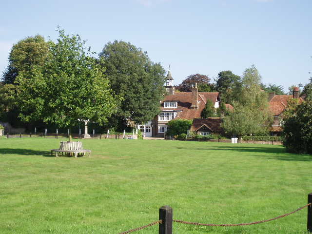
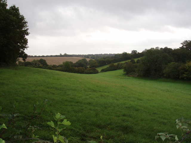
[1] The Lee (photo taken in the afternoon)
From The Lee [1] I followed a road signposted to Lee Common, passing a cricket ground on my right, and turning right into Oxford Street (!) after about a third of a mile [UPDATE 26/11/17 The modified route now turns right shortly before Oxford street (just before the Scout Hut on the left), follows the top of some park land for about 150 yards, then turns left through a kissing gate to reach Oxford Street by the school in Lee Common, where you rejoin the old route by turning right]. I followed this road through the settlement of Lee Common [2], passing an infants school, to a junction after another third of a mile. Here I turned left for a few yards, before taking a footpath on the right. This ran alongside a right-hand fence through a couple of pastures, with an avenue of trees on my left. Beyond the second field, which had a number of cows grazing on the other side of the row of trees, I crossed another empty pasture, now following a left-hand hedge. The path then entered a wood, and started going downhill. After a short distance it turned sharply to the right and then after about a hundred yards turned sharply left. The path became muddier as it reached the bottom of the valley, where it crossed another path and then climbed up the opposite slope. While still within the wood, the path reached a fence which it followed to the left to reach a stile at the edge of the wood. Beyond this, with the land now levelling out, I followed a right-hand edge through another empty grassy field for about a hundred yards, before crossing two successive stiles in the hedge. Across a smaller grass field I reached a track called Capps Lane, by a cottage.
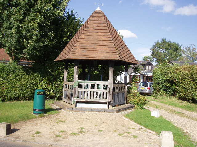
[2] Jubilee Well, in Lee Common (afternoon)
On the other side of the lane I crossed another stile – a notice warned that the cattle in the field might be naturally protective of their young, but the field was empty. The path went slightly left across the field to reach the far corner. I followed the left-hand hedge in the next field (stubble), and then followed a clear path across the next field (also stubble) to reach a playing field on the edge of Chartridge. I walked across in front of the pavilion, noticing the cricket square roped off in the centre of the playing field. I turned left down a residential street, turning right at the end when I reached the main road through the village.
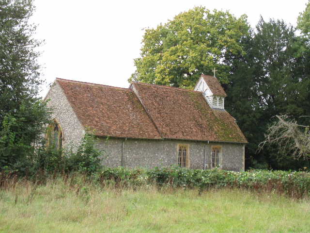
I have come to the conclusion that the Chiltern Heritage Trail is in fact an unusually lengthy pub crawl! Almost every one of the 16 sections in the guide book ends at or near a pub, and the route seems to go past the pub in every village it goes to. The guide book even points out that the pub shown in the map at Lee Common is now closed. The two complete sections in this walk both end at a pub (here in Chartridge and then at Cholesbury). Rather annoyingly for me, in each case the following sections start by doubling back a hundred yards or so, meaning I have to walk to the pub and then come back a hundred yards (and repeat the process on my way back in the afternoon!). So I followed the road through Chartridge [3] to the pub, then turned back as far as the little Mission Church [4] to take a footpath that was now on my right [UPDATE 26/11/17 The modified route now omits this unnecessary trip to the pub and back].
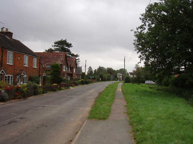
[3] Chartridge
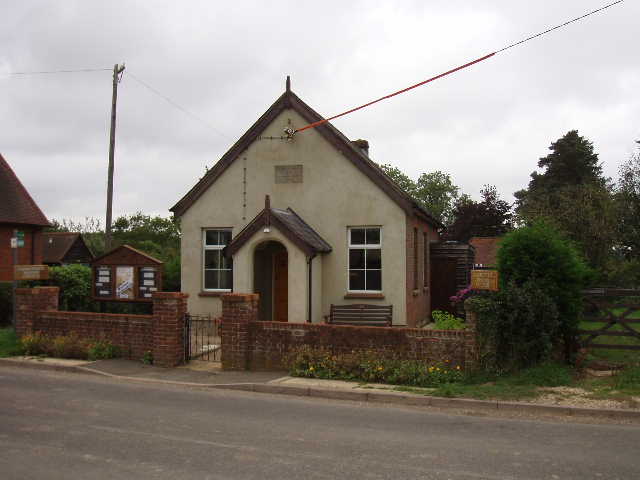
[4] Mission church, Chartridge
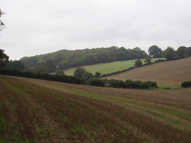
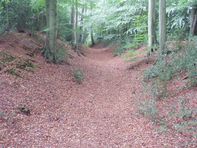
The footpath led past the church and a few gardens, before running between hedges and fences as it descended and re-ascended a shallow valley [5], before turning right. It continued between hedges for a few hundred yards, before emerging at a grassy field. On the far side of this, the Chiltern Heritage Trail descended what the guide book calls a ‘typical Chiltern dry valley’ [6], the route being a clear path through the stubble in this enormous field on both sides of the valley. Crossing the previous field I’d noticed a woman dog-walker ahead of me. As I now stopped to take photos of the attractive Chiltern scenery here, I heard her calling me from near the valley bottom. She was asking me if one of the two dogs I could see by her was mine – apparently she was walking her own dog but another dog had appeared and was following them. She didn’t want to go any further, in case the other dog ran on to the toad at the end of the footpath. The stray dog had a collar and a tag with a phone number. The lady didn’t have a mobile phone with her, so I used mine to phone the owner – the dog had been given to a professional dog-walker, but had obviously run off, apparently not for the first time. I arranged for the owner to meet the lady with his dog back at the Mission church in Chartridge (I later realised it would have been much easier for both to have met at the other end of the footpath in Asheridge – I felt a bit guilty about this, but I’m pretty sure I asked the lady where she wanted to meet the owner).
[5] Typical Chiltern scenery, between Chartridge and Asheridge
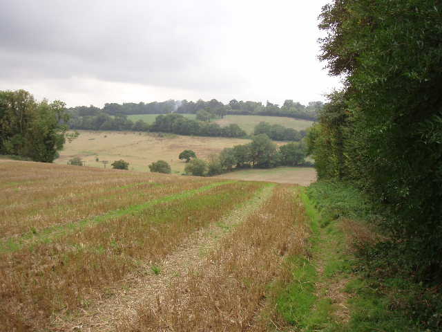
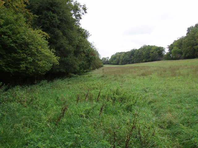
It was while I was on the phone that I felt a few spots of rain – the lady with the dogs commented that was not exactly what had been forecast. I carried on along the path through the stubble field. I didn’t realise how steep the climb up the far side of the valley was until I came back in the afternoon - the descent was really painful on my knees. I paused to take some photos of the valley near a field corner, where I noticed some Musk Mallow growing, and then continued alongside a hedge [7] to reach a minor road in the village of Asheridge (not to be confused with Ashridge, the National Trust estate where I do a lot of my local walks). Here I turned left and followed the road for about half a mile –already there’d been quite a bit of road walking on this walk, and there was more to come.
[6] Typical Chiltern scenery, between Chartridge and Asheridge/p>
[7] Looking back, from just before Asheridge
Where the road turned left, I continued ahead on a footpath, initially beside a cottage and its long back garden. There was a small fenced enclosure on the lawn in this garden, with a wooden frame for climbing and a small shed – I thought at first that this was a large playpen for children, but then noticed a warning saying the fence was electrified. Personally I’ve nothing against putting children behind electric fences, in fact I think it’s a jolly good idea, but apparently the powers that be frown on such things! In fact it turned out that the enclosure contained two goats, which were on top of the climbing frame when I passed by on my return trip in the afternoon. The path continued onwards following a left-hand hedge through a succession of grass or stubble fields, crossing a farm drive at one point. Where the hedge turned left as a large stubble field opened out, the path continued in the same direction before, crossing the stubble to reach a wood. Here the path turned half-left as it passed through the wood, mainly a plantation of young oak trees. Curiously the path through the wood ran alongside an obviously fairly new barbed-wire fence.
On the far side of the wood, the path turned right to go along the edge of yet another stubble field, with the wood now on my right. At the end of the field, I crossed a minor road to continue on another footpath through stubble. This started off parallel to a road on my left, but gradually angled over to that edge off the field, reaching the field corner near the end of a long line of fir trees. A footpath between garden fences then led to a road in Buckland Common (I passed through another bit of this village on the Chiltern Way) [UPDATE 26/11/17 The modified route now turns right in the field corner, continuing along the bottom of a valley through two or three fields, then turns left at a path junction in a field corner, following the path uphill beside a fence on the right to reach the road in Cholesbury, where you turn right]. I turned right and commenced another lengthy stretch of road walking. The road went down and up a dip, turning first left then right, before reaching the adjacent village of Cholesbury.
[8] Inside Cholesbury Camp
[9] Banks and ditch surrounding Cholesbury Camp
[10] St Lawrence's church, within the banks of Cholesbury Camp
By the village hall on the left, I took a diversion recommended in the guide book. A short footpath led past the hall and a farm and into the centre of Cholesbury Camp, an Iron Age hill-fort. This is a roughly oval shape compound [8], covering about 10 acres. Part of it has been lost due to house building in Cholesbury over the years, but an impressive ditch between two high banks [9] still runs a good way round the perimeter. The parish church of St Lawrence is built within the camp [10], the rest of the area taken up mainly by paddocks – the earthworks being marked by a curving line of trees. The hill-fort was in use between about the sixth century BC and the coming of the Romans in the middle of the first century AD. From the evidence of excavations, it is thought that the hill-fort was not a permanent settlement, but only used in times of danger. I certainly thought it was well worth the little extra effort involved in visiting the hill-fort.
I continued along the road through Cholesbury [11], passing the cricket pitch on the common on the left (my third cricket pitch of the walk, a personal record I think!). As in Chartridge, I had to walk to the pub then turn back a hundred yards [UPDATE 26/11/17 The modified route now omits this unnecessary trip to the pub and back] to go down Ray’s Hill (strictly speaking, the pub seems to be across the parish boundary in Hawridge - as well as the usual road sign, the boundary was also marked by a small column erected to celebrate Queen Victoria’s Diamond Jubilee [12]). I followed the lane down to the bottom of the hill, admiring the impressive windmill with working sails on my left as I passed it. Cholesbury Windmill [13], originally built as a smock mill in 1863 but rebuilt as a tower mill twenty years later, is a private residence with an interesting history. It was associated with the Bloomsbury Group around the time of the First World War and a number of well-known artists of the period frequented it. According to the internet web site Wikipedia, "Gilbert Cannan who rented the mill for a time and whose wife Mary was previously married to J.M Barrie, the author of Peter Pan, invited his friends including D.H.Lawrence, Katherine Mansfield and John Middleton Murry to stay there. The artist Mark Gertler, also lived there for a time and painted a famous picture of the mill now on show in the Ashmolean Museum in Oxford with Cannan and his dogs in the foreground. One of the dogs is understood to have been the model for the original illustrations of Nana the dog in the first edition of Peter Pan."
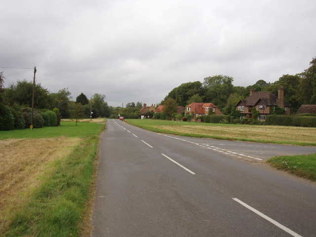
[11] Cholesbury
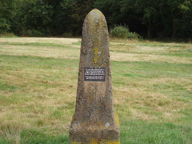
[12] Parish boundary marker between Cholesbury and Hawridge
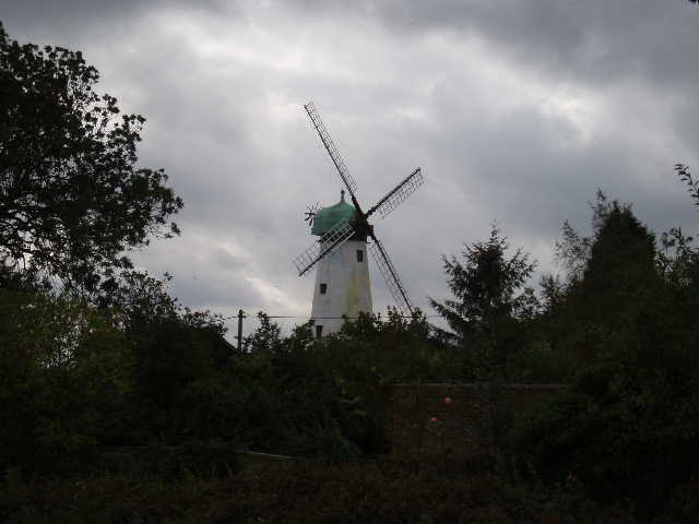
[13] Cholesbury Windmill
Where the lane turned sharply at the bottom of the slope, the Chiltern Heritage Trail took a track on the left which quickly led to a cottage. The track became a path, running alongside a smallholding behind the cottage and into a small grassy field. The path then continued for about two miles running along the bottom of a typical Chiltern valley, for most of the way following a right-hand hedge through a succession of grassy fields – in many fields the grass was overgrown with thistles and other weeds, as if the fields had been left untended this year. Early on, the path ran beside a small wood and then passed through the wood for a few hundred yards. I came across three 4x4 pickups just outside the wood, and a hundred yards or so later found a number of workmen cutting back trees and shrubs (they were from a power company, there was a small power line running parallel to the path at this point). As I passed, three of them got up and went down the path in front of me, one of them explaining that they needed to clear the path ahead of me as they’d blocked the path with some of the bushes they’d cut down. It only took them a minute to clear a way through for me, and I thanked them for doing it.
Further on, beyond the wood, I passed two cows with a bullock and a calf in a field. I tried to keep close to the hedge, so as not to come between the calf and its mother (I’d normally do this anyway, but I was mindful of the warning sign I’d seen earlier). I went a bit too close to the hedge, and snagged the right shoulder of my shirt on a bramble. As I brushed this off, I saw a wasp on my shoulder and felt it sting me – the first wasp sting I’ve had for years, certainly the first since starting these journals. Fortunately it didn’t feel painful at all during the walk, although it itched earlier when I first started writing up this journal (as usual I’m writing a day after the event). Shortly after the field with the cows, the path crossed Hawridge Lane, which was just a muddy track. In the next field, the path was on the right of the hedge, before switching back to the left again. In one of the fields along here [14], I saw a large bird fly up from a fallen tree – I didn’t have my binoculars with me, bit I’m pretty sure from its silhouette that it was a Buzzard rather than a Red Kite.
Towards the end of this same long grassy field, the path went right, entering a wood, but almost immediately joining a bridleway where it turned left, to continue following the bottom of the valley. After a short while, the bridleway turned right then left again, going round the edge of a fenced enclosure on the left, with the wood now on the right. There were more enclosures along the bridleway, and some more further to the left – these contained Ostriches [15]! The guide book had said this would be the case, otherwise I think I would have been pretty shocked at the sight of these large birds in the middle of the Chilterns. Having seen Llamas, Alpacas, Wild Boar and now Ostriches, I’m thinking of setting up a company to run Chiltern Safaris!
[14] Looking back along the path to White Hawridge Bottom
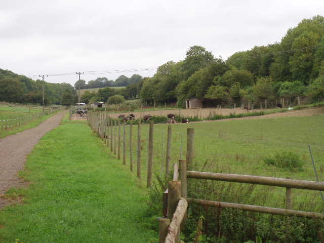
[15] Ostrich pens in White Hawridge Bottom
I finished my walk just past the last Ostrich enclosure, having followed the path along the valley for over two miles. The part of the valley where the Ostriches were is labelled White Hawridge Bottom on the map, I’m not sure if that’s the name of the whole valley. I turned and walked the two miles back up the valley. I had my lunch on a bench in front of the cricket pavilion at Cholesbury. A sign advertised that Cholesbury and Hawridge Cricket Club were looking for new players – I decided that my dodgy knees meant that my cricket playing days were over. In any case, even in what passed for my prime 20-30 years ago, I’m not sure they’d have been keen on an opening batsman with a career best score of 37! (And that score came against the second worst team in the league on a day when their best two bowlers were on holiday!). Annoyingly, as I ate my sandwiches I realised that when I’d reached the end of Ray’s Hill I’d forgotten to walk the 100 yards to the pub and back again, so after lunch I had to walk the few hundred yards to the pub and turn round again (yes, I know, I’m a very sad person indeed!).
The weather certainly brightened up in the afternoon, the dull grey clouds being replaced by bright sunshine and a stiff breeze. The lovely hills, valleys and woods of the Chilterns certainly looked better in the bright sunlight rather than in the gloomy overcast conditions of the morning [16].
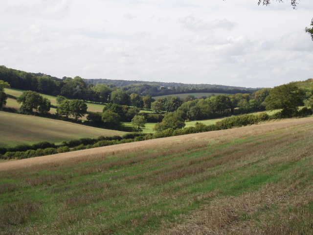
[16] Typical Chiltern scenery, between Asheridge and Chartridge (afternoon)
All the distances I’ve given for this journal are from the Chiltern Heritage Trail guide book – as they are all to the nearest mile, or occasionally half-mile, I don’t think they are too accurate, and this 8 mile walk took longer and felt further than other 8 mile walks on this trip. The delay due to the stray dog, and the diversion to Cholesbury Camp, obviously added to the time. Perhaps I walked more than 2.5 of the 4.5 miles I wanted to walk on the section between Cholesbury and Ashley Green, which means my final walk will be a bit shorter. Anyway, I felt pretty tired by the time I got back to the Lee, and it was about 3.30pm when I got there, a later finish than I’ve had for some time. Just as I reached the green in the centre of The Lee, I saw a wreath lying in the middle of the road, obviously blown there from the war memorial a few yards away. I picked it up and replaced it, also turning over another one that had been blown upside down.
This was another very good walk, but probably the least enjoyable one so far on the Chiltern Heritage Trail because of the amount of road walking. Other than that, though, it was a fine walk, with some lovely Chiltern scenery. The valley between Chartridge and Asheridge was lovely, and possibly the steepest-sided valley I’ve walked up on any of the walks I’ve written journals for. I was very glad that I did the walk, as I’d never been to Cholesbury before and thought it a very attractive village. Cholesbury Camp was definitely worth visiting.
Total Distance: 44 miles each way