Pete's Walks - Chiltern Heritage Trail
If you are considering walking this route yourself, please see my disclaimer. You may also like to see these notes about the maps and GPX files.
Day 7 23/09/06 White Hawridge Bottom to Chesham (8 miles each way, approximately)
Parked by Memorial hall at Ashley Green.
It was very misty, almost foggy, as I drove to Ashley Green. The mist was starting to lift as I began walking about 9.40am, and had soon cleared completely. The rest of the day was fine and bright, and very warm at times – I was worried that I’d only brought 2 litres of water with me, but this proved to be just enough as I finished the last few mouthfuls when I got back to the car. The forecast had been for sunny intervals and showers, so either I was lucky or the forecasters got it wrong again – there was certainly never even a threat of any showers.
My previous walk had finished in the middle of the countryside near the end of the valley of White Hawridge Bottom. Obviously I couldn’t park there, so I parked in Ashley Green and began the day by walking back the two miles to where I’d left off. This was a straightforward walk, with no difficulty navigating in the opposite direction to the guide book. As I walked along the green in Ashley Green, I saw a Green Woodpecker on the grass just a few yards from me – surprisingly it didn’t seem bothered by my presence, and stayed there as I went by.
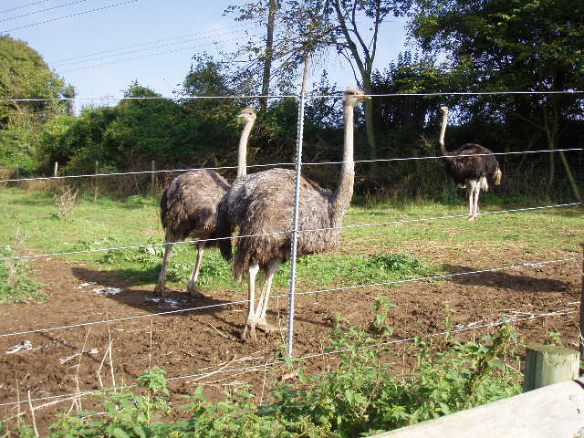
[1] Ostriches at White Hawridge Bottom
When I got back to where I’d finished the last walk, I crossed and then re-crossed the stile there, to make sure I didn’t miss out a single yard of the walk – even though I knew I’d crossed and re-crossed the stile last time! The path went up hill through a paddock in which two horses were grazing, following the left-hand fence beyond which were some of the Ostrich enclosures I’d seen before [1]. At the top of the paddock, I crossed a stile (there was some Herb Robert growing here) and turned right to follow the hedge. Beyond another stile at the next field corner, I followed a very wide grass track past a farm. Over another stile, a fenced path led on to a minor road. I’d thought about parking here, but from what I could see on the map I’d guessed it would be a narrow road where there were unlikely to be parking spaces, and so it proved to be. I turned left, and after about 150 yards turned right on a bridleway opposite a pub.
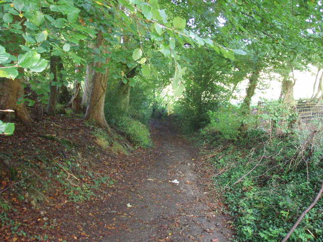
[2] Looking back along the bridleway leading to Ashley Green
The bridleway ran past a couple of buildings and went uphill at an easy gradient, then turning sharply to the right, steepening slightly. It was generally well-surfaced although a bit muddy in places (it rained the last two nights and for much of yesterday, which was why I was walking today, Saturday, instead of yesterday – again the forecasters got it wrong with yesterday’s weather, though I have to say they are usually quite reliable with their one or two day forecasts). It was already pretty warm, and I rolled my sleeves up. The bridleway continued on between hedges, turning sharply to the left as the ground levelled out [2], then turning right again to reach a farm. Here an old barn was obviously being converted, with just the bare wooden beams of the walls standing under the tiled roof and a new floor having just been put in. As I followed the bridleway to the left, a couple of men seemed to be rounding up four horses – I didn’t cotton at first what was going on, as I assumed the horses were in a paddock, but then realised there was no fence between the bridleway and the horses, who were wandering across a small field of cabbages or such like. I heard one of the men tell his mother to phone their neighbour – obviously the horses weren’t theirs but had got out from somewhere. A bit further on, there were some children learning to ride in a paddock on my right, and I wondered if the horses belonged to the riding school. The bridleway ended at a lane in Ashley Green, where I saw another walker lacing up his boots.
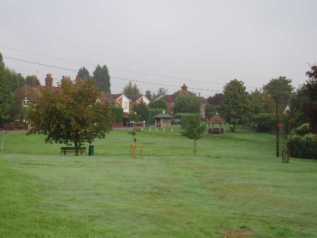
[3]Ashley Green
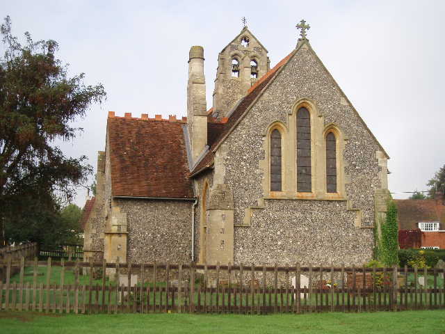
[4]Ashley Green church
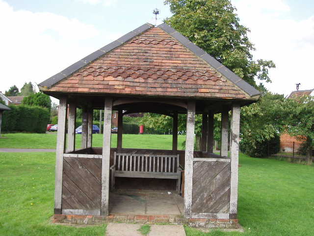
[5] Shelter, Ashley Green
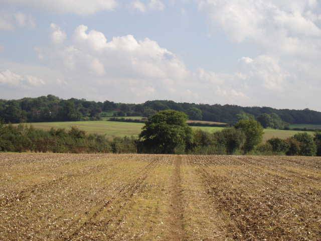
I followed the lane a short distance to the right to reach the centre of the village [3,4]. Having crossed the main road, I walked a short distance across the green, passing a wooden shelter on my left [5]. A short track between houses led on to a fenced path beside a grassy field, descending slightly as a valley started to develop ahead. I followed a farm track along the left-hand-hedge in the next field (cabbages or something similar), with nice views opening up ahead. I almost went wrong at the next field corner, as the track continued ahead invitingly, but the Chiltern Heritage Trail turned right here, rising slightly between a fence and the remnant of a hedge. It soon reached a large ploughed field, where tractor ruts marked the path as it first rose and then descended, to reach a fairly new wooden gate near a pylon at the valley bottom. Here I entered a very large grassy field, rising up the opposite slope of the valley, with four horses away to my left. The path went half-left, rising across the slope, to reach the end of a redundant hedge that stuck out into the field from its left side – as I approached the end of this hedge, I first saw and then heard a Red Kite, which rose from the grass up the slope to my right and flew off towards some trees. There were some lovely views of the fields and woods either side of a valley [6] as the path continued in roughly the same direction to reach another new gate on the edge of a wood.
A bridleway continued ahead, soon leaving the wood and running between hedges [7] and then across the back garden of an isolated farm. The Chiltern Heritage Trail then crossed a very large field of stubble, the path just about detectable. Through a gap in the far hedge, it continued between fences, with small paddocks either side. At the next hedgerow, it became a tarmac path, crossing three streets as it passed through a caravan site (permanent homes, rather than holiday caravans) to reach the corner of a road in Whelpley Hill. There was a small pond on the other side of the road [8], and a Methodist chapel a short distance to my left.
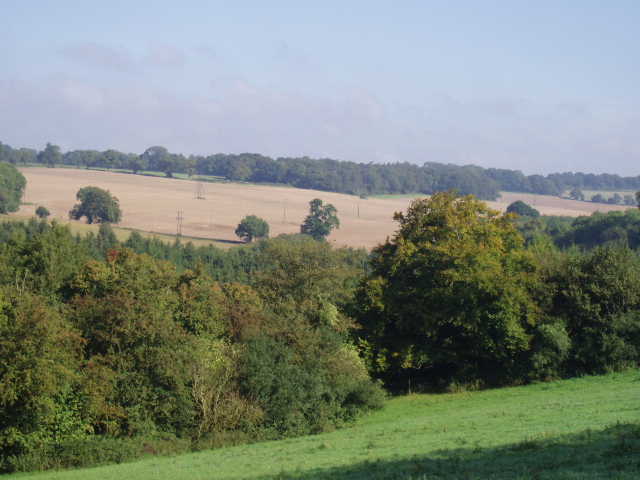
[6] Typical Chiltern scenery between Ashley Green and Whelpley Hill
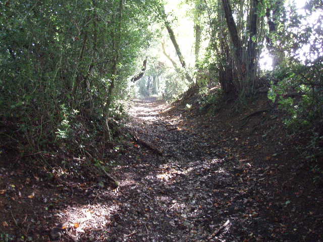
[7] Bridleway, between Ashley Green and Whelpley Hill
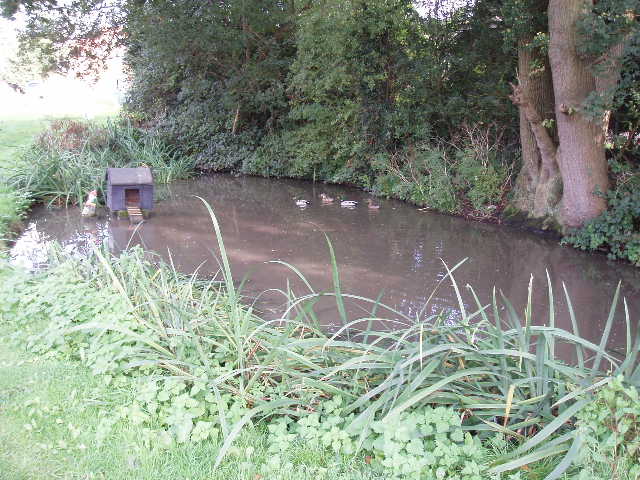
[8] Pond in Whelpley Hill
I followed the road ahead for about 300 yards, before taking a footpath on the right, following the left-hand hedge of a grassy field – the grass was still wet from the night’s rainfall, so I was glad I was wearing my gaiters to keep my trousers and socks dry. Having been walking eastwards so far today, I was now heading south. Towards the far end of this field there was an almost imperceptible round earthwork, apparently the remains of an Iron Age camp. I didn’t bother to photograph it as the embankment was so slight it would be next to impossible to see on a photo – if the map and guide book hadn’t shown it, I would never have noticed it. The next field caused me a slight navigational problem – it took me a minute or two to work out where I was supposed to walk. In fact, it was quite clear where the path should have gone, but it had not been reinstated after the field had been ploughed. I walked around the edge of the field instead – there was such a clear path, I wondered if the correct path was ever actually used. At a corner where the field narrowed, the correct path should have gone diagonally across the field to another corner, but again there was no sign of the path so I continued following the left-hand hedge around the field.
In the field corner I briefly entered a farm yard, only to immediately leave it again by taking a very sharp left turn onto a bridleway (it actually went along the other side of the hedge I’d just come along). The bridleway, partly overgrown with nettles, ran between hedges, then ran between a left-hand hedge and a right-hand fence, with some cattle standing or lying in a circular group in the centre of the field beyond the fence (I saw both Red Admiral and Speckled Wood butterflies when I returned along this path in the afternoon). At the end of this field the bridleway reached a main road (B505), which I followed to the right for about a hundred yards, before carefully crossing it and following a footpath on the other side that ran along an old section of road. It soon turned left, along what was also another old road although much more covered in vegetation. Where this turned right after a short distance, the Chiltern Heritage Trail continued ahead on a bridleway, at first between hedges and then just inside the right-edge of a wood. It soon emerged to run between hedges again, with part of a golf-course on my left, quickly reaching a road at the village of Ley Hill.
There was a funny road junction here, with two roads at a slight angle to each other coming to meet the main road at virtually the same spot, so that I had to cross three roads in quick succession. There were two pubs side-by-side here – opposite them there was another section of the golf course with a cricket pitch next to it. This whole area was quite busy when I passed it again on my way back. The Chiltern Heritage Trail continued down Kiln Lane, next to the pubs, for a few yards before taking a track on the right that led to a Primitive Methodist chapel and the village hall [UPDATE 26/11/17 The modified route now just continues all the way along Kiln Lane (about 750 yards, through Cowcroft wood), turning right at the end to pass a church on the right, rejoining the original route by going through a gate on the left after another 100 yards]. There was meant to be another of the artworks dotted along the route here, a ‘handsome seat of forged steel and oak’, but there was no sign of it. I took a fenced path between the hall and the chapel, running between garden fences and a right-hand hedge. I was now heading south-west, the direction I’d follow the rest of the way to Chesham. The path led to a paddock, where I followed the right-hand hedge to a stile that gave access to Cowcroft Wood.
I had another slight navigational problem here. The guide said to follow the waymarked path, but there were no waymarks visible at all – in fact, on my return in the afternoon, I saw that coming from that direction the paths were waymarked by white arrows on trees. I checked again, but could not see any arrows to follow in the other direction. Anyway, I followed the directions for the path in the guidebook, but came to a dead end. I retraced my steps a few yards, and guessed that the book had said ‘left’ where it meant ‘right’ – this proved to be the case, as I soon came to the stile I needed on the edge of the wood. I wasn’t annoyed with the guide book, just glad someone else confuses right and left occasionally. You wouldn’t believe the number of times I have to correct myself when I’m writing these journals, it must be three or four times per day that I write ‘left’ when I mean ‘right’, or vice versa. And having reread my journals on the web-site recently, I know there are still several mistakes left there. I didn’t learn to tell left from right until I was about 10, and I still get them confused when giving directions.
Across the stile (where I stopped for lunch on my way back), the Chiltern Heritage Trail then turned left and followed the edge of the wood through a large grassy field, with a solitary horse a long way off ahead and to my right. In the shadow of the trees, the grass was still wet from the rain – when I came back this way later, I could see a darker line through the grass where I’d walked before. Near the corner of the field a stile led to a short track that ran between a house and a churchyard on my left to reach a lane. A smart car with white ribbons on it was parked on the lane, so I assume there was a wedding in progress in the church. Over another stile on the other side of the lane [UPDATE 26/11/17 The modified route rejoins the old route here - a gate has replaced the stile], I crossed an empty cattle pasture (if it was empty, how did I know it was a cattle pasture? Well, there was plentiful evidence on the ground!) to reach an obvious stile in the opposite hedge. When I reached the stile I was surprised to see a small child in a pram on the other side – when I climbed over, I saw a man picking berries along the hedge to my right. I continued ahead, following a left-hand hedge. Where this ended, the path went half-right to descend the hillside to a valley bottom. Again there were splendid views of the countryside here, hills and valleys with woods and fields.
[9] View looking back over the valley containing Bottom Lane
At the bottom of the slope, I crossed a bridleway called Bottom Lane and started up the opposite side of the valley, following a wire fence through a grassy field to a stile in a hedgerow. The guide book then said to continue in roughly the same direction. There was a faint path ahead through the stubble which soon petered out. I continued on, following some other footsteps which soon also disappeared, and then made my own way across the field – as I came over the brow of the hill, I could see the gap in the hedge near a field corner that I needed to aim at [9]. Annoyingly, as I got close to this gap I came across a perfectly clear and well-used path running to it from roughly where I’d just come from. In fact, as I discovered on my walk back, I needed to have turned right for about 30 yards after crossing the stile to find the start of the path, but this wasn’t mentioned in the guidebook.
Through the hedge gap I followed the right-hand hedge of a ploughed field, with the playing fields of Chesham Leisure Centre on the other side of the hedge. At the end of the field I crossed the drive to a farm and then went across another empty cattle pasture. Over another stile, I turned right between a fence and a hedge to a field corner, where I went over a stile and followed a right-hand-hedge through more wet grass for a couple of hundred yards to a stile. Across this, the Chiltern Heritage Trail then crossed a large stubble field that started to go downhill, with good views over Chesham and the hills and valleys beyond [10]. The path through this stubble field was perfectly clear, but I was greatly amused to see that someone had marked its route with small cairns [11] of flint stones! I tried hard to imagine that I was following a line of cairns across some barren wilderness high in the Lake District, rather than crossing a stubble field almost in sight of a branch of the Metropolitan Line, but it was difficult.
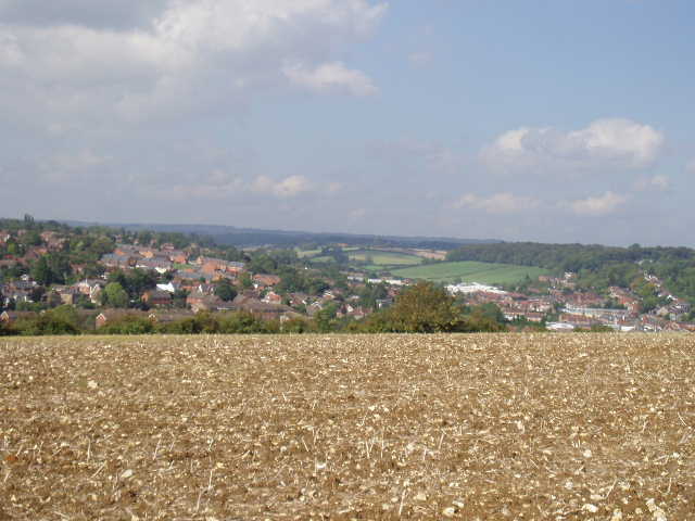
[10] View over Chesham from the 'cairned path'
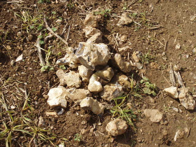
[11] One of the small 'cairns'
Beyond the stubble field, the path continued steeply downhill between hedges – I came across a young couple here with a pram, feeding their two young children. The path twisted one way then the other as it descended, then crossed a bridge over the railway line. I turned right onto a tarmac path [UPDATE 26/11/17 The modified route now goes straight on here, down a flight of steps named 'Jacob's Ladder', continuing ahead along a street to reach the end of East Road, where you go a short distance right along the main road to reach the Market Place and the clock tower, which is now the start and end point of the Chiltern Heritage Trail] and went a short distance to Chesham Station, then turned left down Station Road. At the bottom of the hill, where the High Street becomes the Broadway, I reached the end of the Chiltern Heritage Trail. The shoppers on these busy thoroughfares probably thought I looked a strange sight with my muddy gaiters and my map case round my neck (yes, I know, I look a strange sight at the best of times!). I turned round and headed back towards Ashley Green.
I stopped for lunch about 1.20pm on the stile on the edge of Cowcroft Wood – there’d been a couple of stiles before then, but the first one was partly covered by nettles and brambles, the other one was overlooked by a house. As usual, I enjoyed the walk back, free from the burden of navigating. It was about 3.10pm by the time I got back to my car, feeling quite tired but not too bad – it was a warm afternoon, but never uncomfortably hot.
This was another very enjoyable walk on the Chiltern Heritage Trail. There was nothing of any great interest on the route (the Iron Age camp was hardly detectable) but, as ever, it was very pleasant to walk through the hills and valleys of the Chilterns, with a nice mixture of woods and fields and occasional villages.
Total Distance: 52 miles each way