Pete's Walks - The Chiltern Way (2)
If you are considering walking this route yourself, please see my disclaimer. You may also like to see these notes about the maps and GPX files.
Day 11 16/04/07 Flaunden to Gorselands Lane (7.3 miles each way, approximately)
Parked in street in Flaunden.
This was another nice warm and bright day, but again a bit hazy. I managed to start walking about 9.45am. Flaunden [1], pronounced ‘Flarnden’ locally, has a long history. It now sits on a hilltop, but was originally sited in the Chess Valley, over a mile away. A Roman road to High Wycombe ran through it. In later times the villagers were reputed to make pikes, swords and armour. The original church was unusual in that it was in the shape of a Greek cross (where all four members are the same shape and size). It had a square tower surmounted by a ‘Hertfordshire Spike’, and was originally built in 1235 by Thomas Flaunden. It was abandoned in 1825, as by then parishioners had a long walk to reach it and often found it flooded by the River Chess. The new church was built in 1837, and is noted for being the first church to be designed by Sir George Gilbert Scott, who designed St Pancras station, the Albert memorial and many other notable buildings. The new church contains bells and a font from the old church, and the communion rail and south door are reputed to be made from wood from the old church.
I made my way to the footpath sign on the eastern edge of the village where I terminated my last walk. The footpath went west alongside a right-hand hedge, with a fence separating me from the paddock to my left. Through a gate, I went half-left across the next large paddock, containing two horses, to another gate. In the next arable field, I followed the left hand hedgerow, soon with a wire fence separating me from the crop. To my left I could see over another green field towards Lower Plantation, which I’d walked through on my last walk.
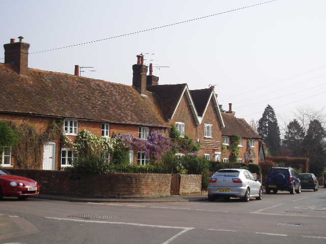
[1] Flaunden
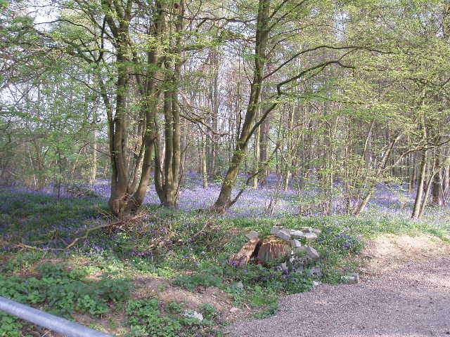
[2] Bluebells carpeting Rosehall Wood, near Sarratt
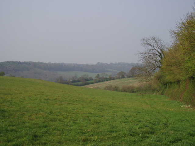
[3] View over the Chess Valley from near Sarratt
The path took me to a lane, where I went right for about 50 yards, passing Newhouse farm on my left. I saw an Orange Tip butterfly flutter along the lane ahead of me (the first I’ve seen for a very long time), and it turned left along the path I had to take. I stopped and watched it fly around for a few seconds, but it didn’t settle anywhere and soon flew back into the lane, so I couldn’t get a photo. I followed the path alongside a left-hand boundary, then crossed the subsequent large paddock half-right – I saw a large bird rise up and fly away here, I’m fairly sure it was a Buzzard. Some steps then took me through the hedge into a lane where I turned left. A short distance along the lane, there was a permissive path running along the right-hand side – sadly, it is for horse riders only (!) so we mere walkers have to walk along the lane, rather dangerous as it is between high banks or hedges with no verge and goes round a sharp bend where visibility is restricted.
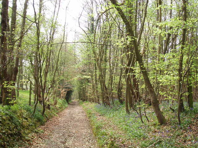
After a few hundred yards, I went half-right across a small paddock by a farm, then followed a short path between hedges to reach another farm. Here I continued along the farm drive, soon passing Rosehall Wood [2] on my left – I have seen Bluebells quite a lot already on this walk, but this was the first time I could describe a wood as being ‘carpeted’ by bluebells. Where the drive turned left at the end of the wood, I took a path going more or less straight on, following a right-hand wire fence through a paddock, then continuing across a larger paddock containing several horses, passing close to Great Sarratt Hall. Across a drive or track, I then went half-right across a meadow to reach another lane, which I crossed to enter another meadow.
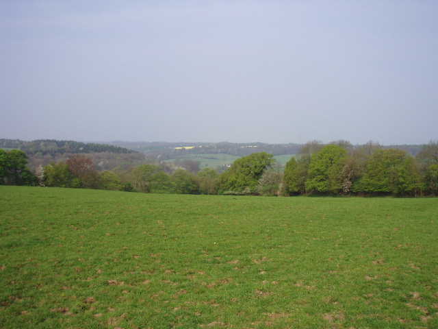
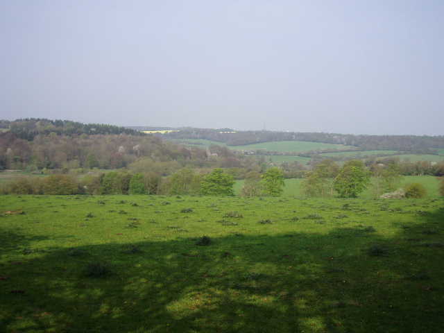
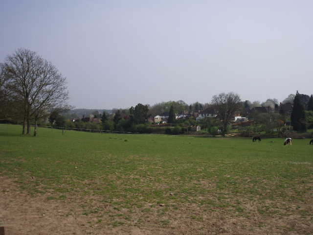
I remember most of the Chiltern Way route from my previous walk two years ago, and can usually go through the day’s walk in my mind beforehand. Oddly, last night I couldn’t recall the next stretch as far as the large field before Sarratt church at all, not even when I tried refreshing my memory by studying the maps and guide book. This is particularly curious, as it turned out to be one of the most charming parts of the walk so far. As I crossed the meadow, following a hedge on my left, I started to remember the attractive view of the Chess valley to my right [3]. In the next meadow, this view was partly obscured by tall hedges until I neared the wood on the far side. At the entrance to the wood a bench had been placed in commemoration of someone who ‘loved the Chess Valley’ – an understandable feeling, as I found the Chess valley to be very charming when I walked through it on Day 1 of my Chiltern Heritage Trail walk.
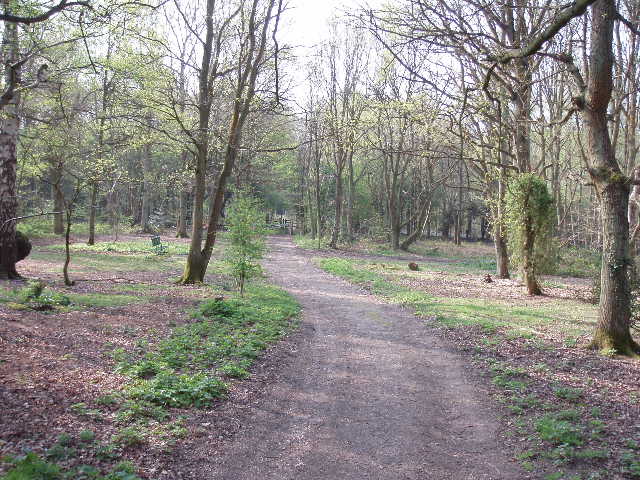
[4] Path through woodland, near Sarratt
[5] View over the Chess Valley from just before Sarratt church
[6] Sarratt church
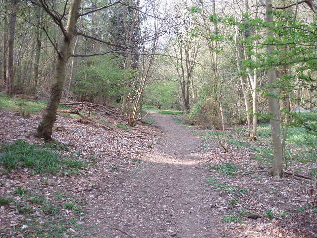
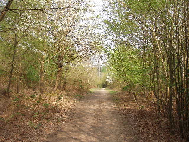
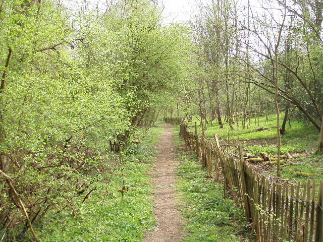
I entered the wood, at first a plantation young enough not to be shown on my map, with a tall hedge of Leylandii on my right. After a hundred yards or so, the path entered the wood proper, with beech and other trees and many Bluebells [4]. I saw another Orange Tip butterfly here. I stopped to photograph some White Bluebells by a metal barrier beside a lane. The very charming woodland path continued on the other side of the lane, where I soon saw a few Primroses. The woods were obviously private and the path was soon running between fences, but this didn’t detract from the sylvan surroundings. After a few hundred yards the path emerged from the wood and continued along a drive with a couple of houses on my right. There was some Greater Periwinkle growing here, the first time I’ve seen it (or at least the first time I’ve identified it). In the grounds of one of the houses were four or five large standing stones, like a miniature Stonehenge – these were clearly a ‘folly’ rather than a genuine ancient monument.
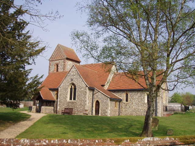
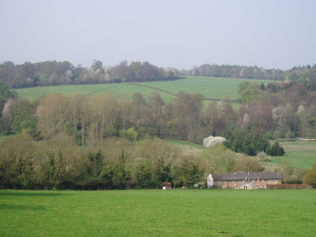
Where the drive turned sharply left, I continued straight on through a kissing gate. I could now remember the path, as I followed more woods on my left for a short distance before continuing southwards across a very large pasture, which sloped down to my right. Here again were lovely views of the Chess Valley, and I stopped for more photos [5]. On the far side of the field I reached a corner – here the Chiltern Way went very sharply right alongside the hedge, but I first went over a stile into the churchyard of Sarratt Church, and spent five or so minutes looking inside this striking building [6].
Holy Cross church was originally built about 1190, appropriately enough in the shape of a cross. Some 12th century work remains, but the church has been altered many times over subsequent centuries, notably when the chancel was extended, first in the 13th century and then again in the 14th century. A major restoration was carried out between 1864 and 1866, the architect responsible being Sir George Gilbert Scott (him again!). The bell tower has a rare saddleback roof, transverse to the nave and chancel – it is thought that only three other churches in the country have such a tower roof. Inside the church there is a small section of 14th century wall painting in the south transept, a 12th century font and a 13th century coffin lid. The pulpit is a fine piece of Jacobean carving dating from 1606. Richard Baxter (1615-1691) preached here and in the surrounding villages. He was one of the most eloquent Puritan preachers and also a hymn writer, who was persecuted and imprisoned for sedition. I bought a guide book for £1, from whence I have gleaned the above information. According to a web site, the church features at the start of the film “Four Weddings and a Funeral”.
Sarratt is a very charming and picturesque village. Its history goes back at least to Roman times, as remains of a villa were found here and there are Roman bricks incorporated into the fabric of the church tower. In Saxon times King Offa granted the manor to the abbey of St Albans. This grant was confirmed by King John in 1199.
[7] View over Chess Valley from near Sarratt church
[8] View over Sarratt Bottom (Chess valley) towards Chenies
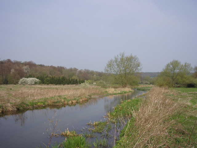
[9] River Chess (looking northwest)
I returned to the route of the Chiltern Way, and followed the hedge for a couple of hundred yards [7] before going through a gate into another pasture. Here I followed the left-hand hedge, going very steeply downhill into the Chess Valley. There were good views along the valley to my right and across the valley towards Chenies [8]. This part of the valley is called Sarratt Bottom, and slightly to my right there were a terrace of flint cottages, very typical of the Chilterns. In the valley bottom I crossed the course of the Chess Valley Walk (one on my list of walks to be done!), and went across the pretty river Chess [9] on a wooden walkway. The valley bottom here was mainly rough grass with some reeds, and a few willow trees scattered about. This area was a nature reserve, apparently inhabited by wetland birds such as Water Rail and Snipe, although all I saw today were two dogs being taken for walks.
Across the valley bottom, the Chiltern Way continued on a path running through a long thin belt of trees [10], mainly conifers of different types. I saw a Speckled Wood butterfly here on my way back in the afternoon. There were a few more Bluebells and some Lesser Celandine, which has been very common throughout my recent walks. This was a pleasant walk for several hundred yards, with 20-30 yards of trees either side of me, very gently rising uphill. The path then left the belt of trees, running alongside its right edge for a few yards before crossing a corner of a meadow to another belt of trees. Again it was very pleasant walking in the shade of the trees, before a path beside a field of yellow oil-seed rape took me to a road on the very edge of Chenies [11].
[10] Path between river Chess and Chenies
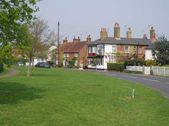
[11] Chenies
[12] Start of bridleway from Chenies to Chorleywood West
Chenies was originally called Isenhampstead Chenies and a neighbouring village was called Isenhampstead Latimers, after the families that owned the manors. The prefixes were dropped in the 19th century, the villages now being known as Chenies and Latimer (I went through both villages on the Chiltern Heritage Trail, and Days 1 and 2 of that journal have photos taken in Chenies). There was once a royal palace near Chenies, which was visited by both Edward I and Edward II. It was Edward I’s shield-bearer, Thomas Cheyne, who originally gave the village its name. Later, Henry VIII and Elizabeth I would sometimes visit Chenies Manor, a semi-fortified manor house built largely of brick in about 1460 by Sir John Cheyne. This was later the home of the Dukes of Bedford, and there is a Bedford Chapel in the village church containing many of their tombs.
[13] Looking back along woodland path on way to Chorleywood West
[14] Unusual combination of paddocks and suburbia, Chorleywood West
[15] More paddocks in Chorleywood West
The Chiltern Way only really touches on the edge of Chenies (I saw far more of the village on the Chiltern Heritage Trail). I turned right along the road for a short distance, then took a path on the left. This followed the edge of the village cricket pitch, with paddocks to my right, and then crossed a couple of empty paddocks before a path between a left-hand fence and further paddocks brought me to a lane. I turned left, and within a few yards reached the end of the lane at a junction with the A404. I was now on the same route as the Chiltern Heritage Trail, which I walked last autumn. Surprisingly I was able to go straight over the main road without needing to wait, and continued along a bridleway on the other side [12]. There was a lot of Greater Stitchwort growing here, as elsewhere on this walk, and within a few yards I passed the first Herb Robert I have seen this year. The bridleway descended gently between hedges, with a field of oil-seed rape on the right and a field of rough grass to the left. The bridleway then passed a wood on the left, and soon after passed under a railway bridge carrying the Metropolitan Line.
Beyond the bridge the path continued through a beech wood, one of surprisingly few that I have encountered so far on the Chiltern Way. The path descended into a slight dip and up the other side [13]. It then continued with paddocks on the left and a continuation of the wood on the right, before running with paddocks on either side [14] to reach a private road leading to a farm or stables on my right. Here I turned left, with the houses of Chorleywood West on my left, and yet more paddocks to my right [15]. This area is part of ‘Metroland’, a curious mixture of suburbia and countryside. Until the arrival of the railway in 1889, this was just a small village centred around its church, one local farm having been the site of the marriage of William Penn in 1672 (he founded Pennsylvania, and is buried at the Quaker Meeting House in Jordans that I passed on the Chiltern Heritage Trail).
At the end of the private road, I went straight ahead down Chalfont Lane with large residences either side [16]. There was a wide strip of grass between the gardens on the right and the road, and a clear path ran through the grass, crossing driveways every few yards.
[16] Looking back along Chalfont Lane, Chorleywood West
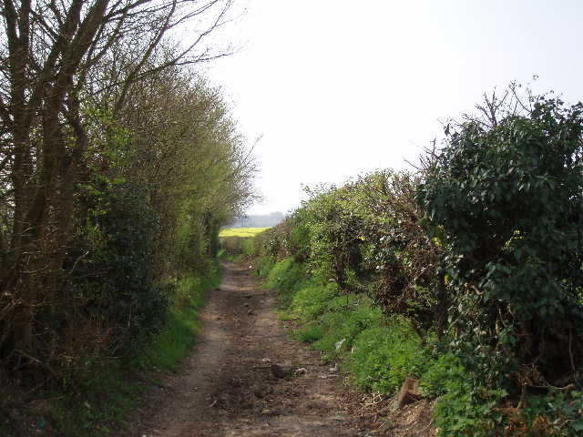
[17] Old Shire Lane, beside Philipshill Wood
[18] Looking back along the path through Philipshill Wood
At a junction at the end, I turned right into Shire Lane – this soon turned sharply left but I continued ahead along Old Shire Lane, formerly the boundary between Buckinghamshire and Hertfordshire. Unlike Chalfont Lane this still had the feel of a true lane, with a few houses on the left and fields over the hedge to my right. After a third of a mile the tarmac ended, and Old Shire Lane continued as a track, now with fields to the left and Philipshill Wood on the right [17]. The wood is owned by the Woodland Trust, and several signs invited people to walk the paths within the wood. The good track went gently downhill for some way – where it turned to the left, I turned and took the second of two paths on the right. I followed the path through the wood, following a wooden paling fence on my left [18]. The path soon turned left to go slightly uphill, and shortly after reached a stile.
Here I left the wood, and followed a hedge on the right of a large meadow. To my left I could see the roofs of buildings in the Chiltern Open Air Museum. This was created by the Chiltern Society (who also devised the Chiltern Way) and opened to the public in 1981. It consists mainly of buildings from the Chilterns of architectural interest which, instead of being demolished, have been carefully dismantled and recreated here. The museum is in the grounds of Newland Park, which is also home to the Chalfont Campus of Buckinghamshire Chilterns University College. Originally built in the 1770’s, Newland Park was later owned by Abraham Newland, Chief Cashier of the Bank of England, whose signature was once to be seen on five pound notes. At the end of the meadow, I crossed a stile and walked a few yards to the right along the drive to the museum and university. I crossed the road, Gorseland Lane, at the end, but then turned round and started to make my way back to Flaunden.
I stopped for lunch about 12.40pm, sitting on a low tree branch along Old Shire Lane. I saw another Orange Tip butterfly and a Brimstone while I ate, and a Comma butterfly just after I started off again. This was easily my best day so far this year for butterflies, as I also saw numerous Peacocks and a few Small Whites. It was a lovely afternoon for walking, very warm (23-24C) but with a pleasant breeze. It remained a bit hazy, so not quite ideal for taking photos of the scenery. I really enjoyed the walk back, and returned to my car by about 2.45pm.
This was another very good walk. The stretch from Chenies onwards I’d already walked twice as it is on the route of the Chiltern Heritage Trail as well as the Chiltern Way, but this didn’t detract from the pleasure of the walk at all. There was a good mix of field paths and sections through woodland, and some picturesque villages with varied historic associations to add interest to the walk. There were some nice views over the Chess valley, and crossing the river was another point of interest on the walk – there aren’t too many rivers in these chalk hills. It was a good day for butterflies, and not bad for wildflowers either. I was very glad that I took the time to visit Sarratt church, which I omitted to do when I walked the Chiltern Way before (there was a flower festival or something on at the church at the time!). So, all in all, it was a very enjoyable walk on a very pleasant day.
Total Distance: 81.3 miles each way