Pete's Walks - The Chiltern Way (2)
If you are considering walking this route yourself, please see my disclaimer. You may also like to see these notes about the maps and GPX files.
Day 12 18/04/07 Gorselands Lane to Penn Bottom (6.8 miles each way, approximately)
Parked in car park in Chalfont St Giles.
This was another nice sunny day – I have been very fortunate with the weather so far, there’s been a long dry spell for two or three weeks now. So much for April Showers! I was a bit slow in setting off this morning for some reason, and drove rather a long way round via Wendover to avoid the traffic in Chesham and Amersham, so it was just after 10am when I started walking. I started by walking the 0.8 miles from Chalfont St Giles back to Gorselands Lane, where I finished my last walk.
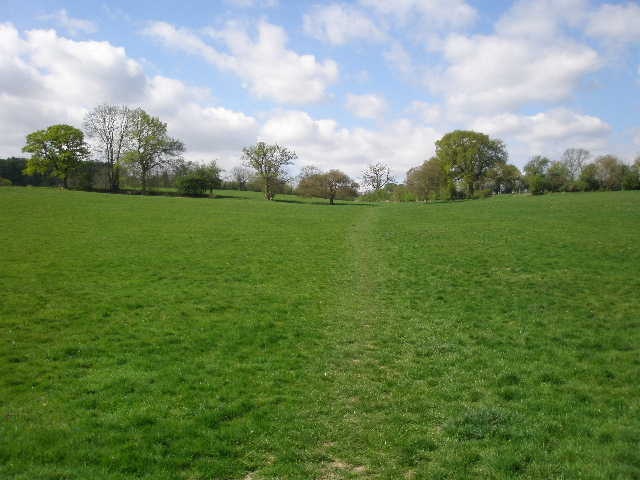
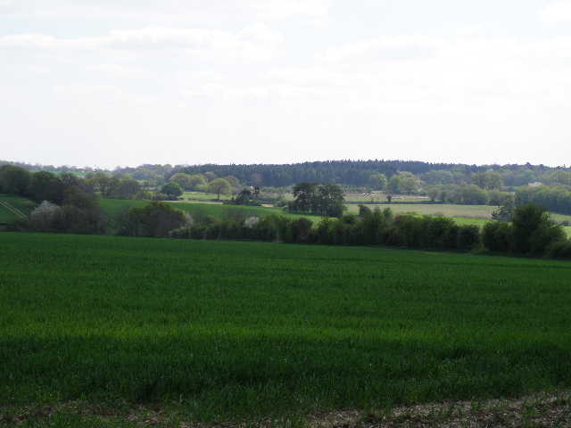
From Gorselands Lane, opposite the entrance to the museum and the university campus, the Chiltern Way continues down a clear path through a long narrow belt of trees [1]. This was once part of the drive to Newland Park, where the university and museum now are. The path was familiar to me, as I also walked it on the Chiltern Heritage Trail six or seven months ago. I saw the ‘usual suspects’ growing here – Bluebells, Lesser Celandine, Greater Stitchwort. The path ended at a lane, where I took the guide books advice to go a few yards left to see the attractive brick and timber seventeenth-century Ashwell farm, before taking the continuation of the footpath on the other side of the lane. This ran between the farm’s garden hedge on my left, and a fence separating the path from a small paddock on the right.
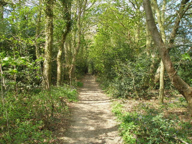
[1] Path leading away from Gorselands Lane
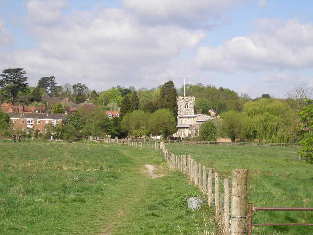
[2] Path across meadow, leading to Chalfont St Giles
[3] Chalfont St Giles
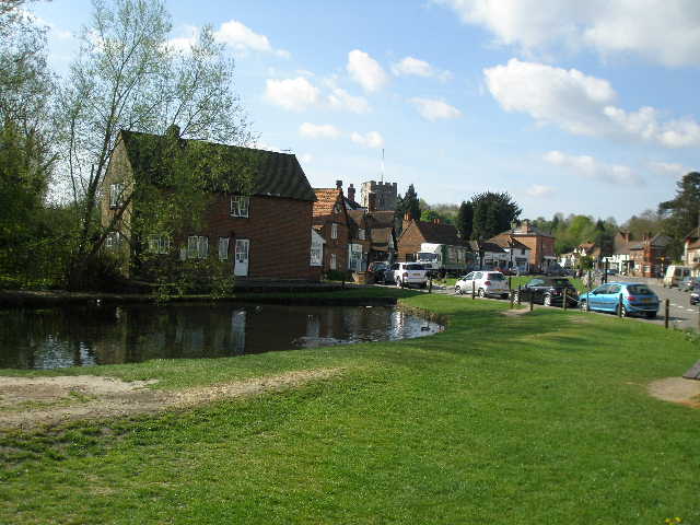
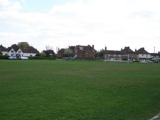
Where the hedge ended, I went through a kissing gate on the left (the Chiltern Heritage Trail went slightly right here, to reach Chalfont St Giles a different way). I crossed two empty meadows, then the path became a narrow alley between garden boundaries, leading gradually downhill. There was some Greater Periwinkle growing here. The alley led to the A413, the main road along the Misbourne Valley. Across this, I continued down another shorter alley between gardens, to reach a wide meadow at the valley bottom, with a view ahead to the village centre and church of Chalfont St Giles [2]. I crossed the meadow following a right hand fence, and crossed a footbridge over the river Misbourne which was completely dry here. I saw an Orange Tip butterfly here. I then continued down an alley to the left of the church (more about the church later), passing through an archway to reach the main street in this large village [3]. There were numerous small shops here, and a short distance to my right was the village green with its pond. The most notable building in the village is Milton’s Cottage. John Milton took refuge from an outbreak of plague there in 1665, and wrote Paradise Lost there. It was also where Thomas Ellwood is said to have inspired him to write its sequel, Paradise Regained.
I crossed the main street and continued on a private drive (I was now briefly on the route of the South Bucks Way, heading NNW along the Misbourne valley). After passing a few large houses on either side, the drive turned left but my route continued ahead through the middle of a small belt of trees, with a fence a few feet to my right and meadows or paddocks beyond. The path led on past a few cottages on the right to a bend in a lane. I followed the lane ahead for a few yards, then continued on a footpath where it turned sharply left. I was now following a right-hand hedge, with a barbed-wire fence on my left separating the path from a pasture containing some young bullocks. I saw some Pink Bluebells along here, and some Ground Ivy – the latter is something I’ve seen a lot of on this walk, but have only recently managed to identify it.
[4] Path along the Misbourne valley, heading away from Chalfont St Giles
[5] Path heading uphill away from the Misbourne valley, towards Hill Farm House
[6] Looking back across the Misbourne valley from near Hill Farm House
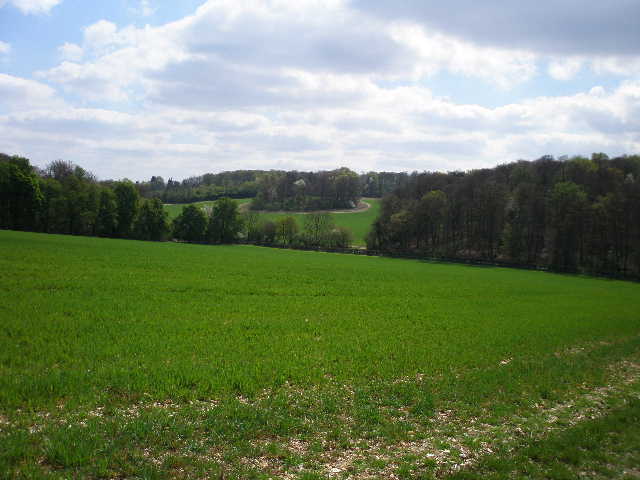
The path continued along the valley, now running through a narrow belt of trees again [4], including some fine specimens of beech. Again, I was close to a right-hand fence, with paddocks and meadows beyond. Sadly I came across two or three posters reporting seven pet donkeys that had gone missing or been stolen – a surviving white donkey brayed loudly over to my right, as I turned left to leave the trees at a stile and take a path heading uphill across a large meadow [5]. Over another stile, I continued uphill between a hedge and a right-hand fence, with green arable fields either side. Towards the top of the hill, I stopped to admire the view back over the Misbourne Valley [6]. I also saw a Red Kite here, over to my right – I’d seen one not far away in the valley bottom on my Chiltern Heritage Trail walk a few months ago. On my previous Chiltern Way walk, I didn’t see any Kites until I reached the end of this section at Penn Bottom – this time round I’ve seen three or four already, evidence that they are successfully spreading through the Chilterns.
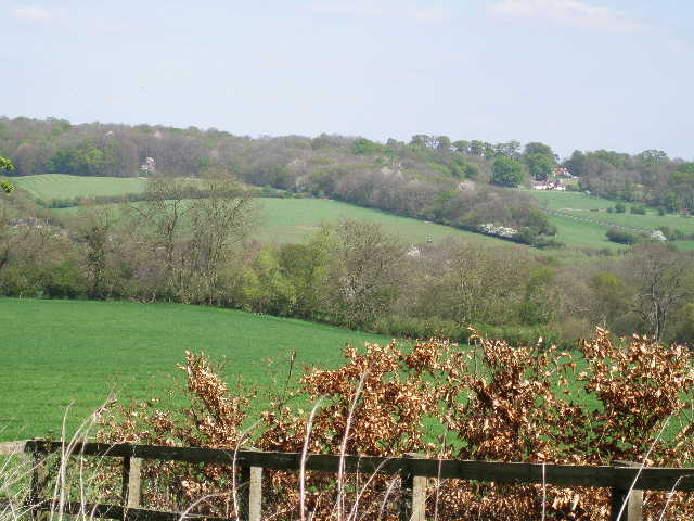
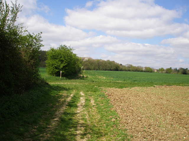
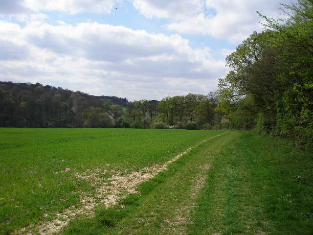
The path took me past Hill Farm House, where I went right on a track for a few yards then left. The track soon turned left again, but I continued ahead on a footpath, between a fence and a right-hand hedge. There were extensive views to my left [7], over the adjacent paddocks towards London – I could just make out the hazy outline of the North Downs on the horizon. The path led to a lane, where I turned right, almost immediately leaving the lane as it turned left. I followed a farm drive for about a hundred yards, until it turned right, when I continued ahead on a clear path through a green arable field. The path went on through the next much larger arable field [8]. There was a stiff northerly breeze so it was quite cool here, where I was exposed to the wind. There were nice views over the woods and field ahead, and towards the Misbourne valley over to the right. The path went down a dip and up the other side, passed a redundant stile (which my usual compulsion forced me to climb over) and then reached a narrow lane.
[7] Looking south from just past Hill Farm House

[8] The path heading towards Coleshill, shortly before the lane crossing
[9] Footpath just before Coleshill
On the other side of the lane, the path continued alongside the right hand hedge of a meadow. Shortly after entering the next field, the path went over a stile and continued along the other side of the hedge, in another meadow with a wood over to the left. I continued through another meadow, and then through a large pasture where several sheep were grazing, along with a white pony. I passed in front of a white weather-boarded house, and went over two stiles in quick succession as I crossed its drive. The path then crossed another smaller meadow, with a farm to my right, then went through a small area of long grass and trees to cross the drive to Brentwood Grange, over to my right. Almost immediately the path switched to the right of the hedge. I was pleased to see a good clear path alongside the edge of this large arable field, as two years ago there was no sign of a path and it had been rather awkward making my way along the field edge by the hedge. After a few hundred yards, the path went slightly downhill to reach a main road, the A355 between Amersham and Beaconsfield.
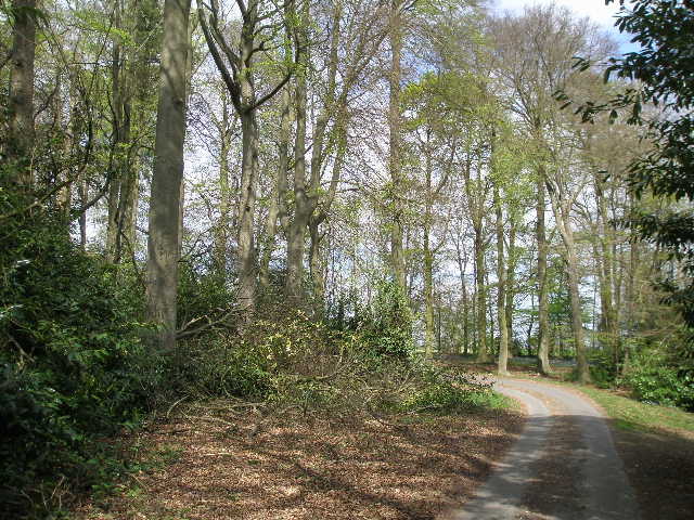
On the other side of the road, a flight of steps took me down an embankment and then I crossed a wooden bridge over a ditch. The path continued in the same direction as before, now with a hedge on my left. At first the field to my right was ploughed [9], but then I came to another area of green corn. The path reached a wood, where it turned right and then curved left, following the outside of the wood [10]. It then became a stony-surfaced track between hedges, which took me to the car park of the Red Lion pub in Coleshill [11,12]. I saw another Orange Tip butterfly here on my way back. As usual I photographed the church and the duck pond here. For the fourth time today I was now also on the route of the Chiltern Heritage Trail, so I was familiar with the route to the next village, Winchmore Hill.
[10] Looking back from near Coleshill
[11] Coleshill church
[12] Duck pond in Coleshill
I followed the path beside the church to another village street, and then took a driveway opposite past some houses, continuing over a stile along a path beside a paddock. I saw two Jays here on my return – they are another bird that seem to be doing well, as I’m sure I see them far more often now than I used to. I kept left at a fork in the path, and soon reached another stile. Here the path went half-left, just below the summit of the hill to my left – there were nice views to my right, typical Chiltern scenery of woods and fields, hills and valleys [13]. I passed a small copse on the right and then followed a wide track that went through a small wood. On the far side of the wood it continued beside a left-hand fence. After that field, it soon reached a lane in Winchmore Hill, opposite a Methodist chapel.
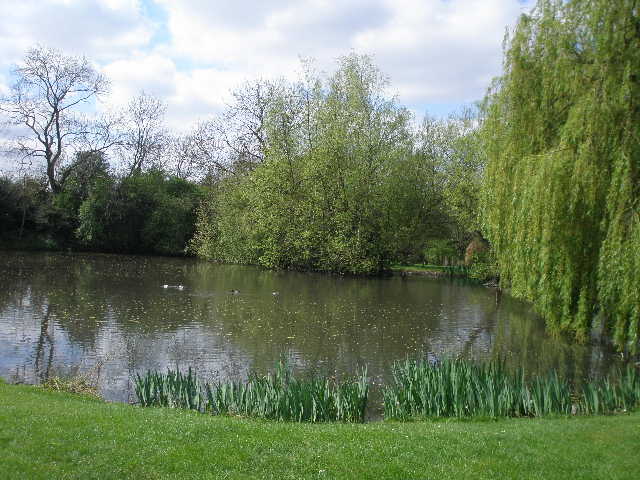
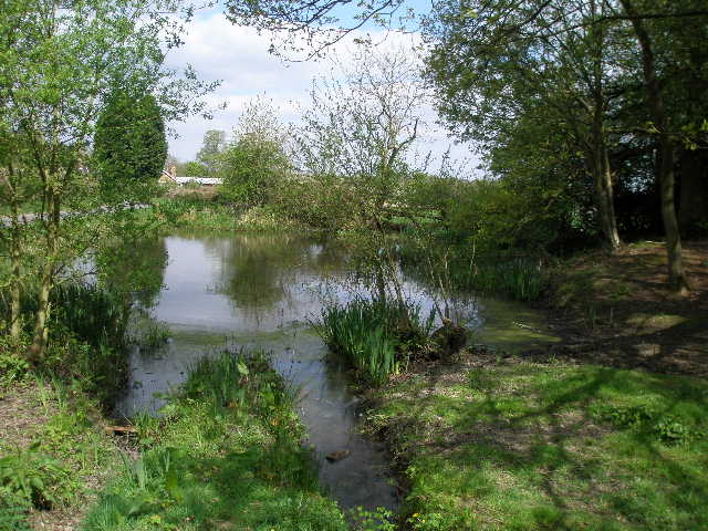
I turned left and after about a hundred yards reached a junction by the large village green (large enough to hold a full-size football pitch and a smaller pitch for children) [14]. I crossed the green half-right, passing just to the right of a protruding holly hedge, and then followed a path between horse paddocks – there was horse with a young foal in the paddock to my left. I went over a stile to reach another lane, with a pond called Gawde Water on my right [15]. There was an information board here, which explained that the pond had been restored in recent years by local volunteers, assisted by the Chiltern Society. The pond could be traced back as far as 1481 in the historical records, and its name is thought to be due to its gourd-like shape. It is also known as Guardswater, from the belief that it was used by Guards on military training exercises – this is possible as the area was used for military training, by the Duke of Cumberland in the 18th century and again later during the Napoleonic wars.
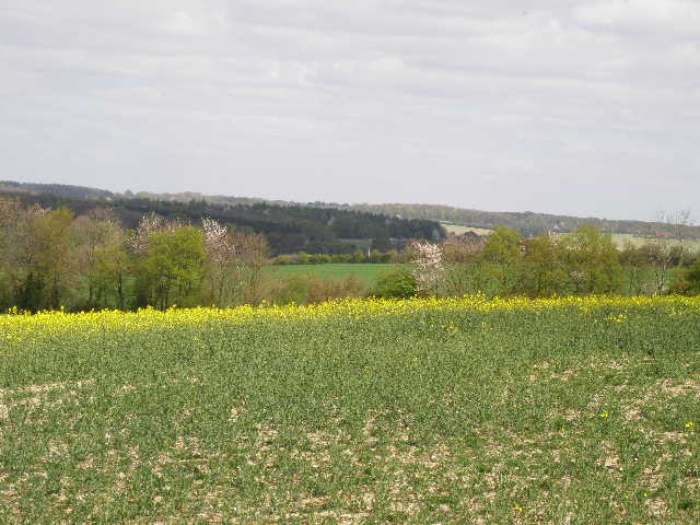
[13] View between Coleshill and Winchmore Hill
[14] Winchmore Hill
[15] Gawde Water, Winchmore Hill
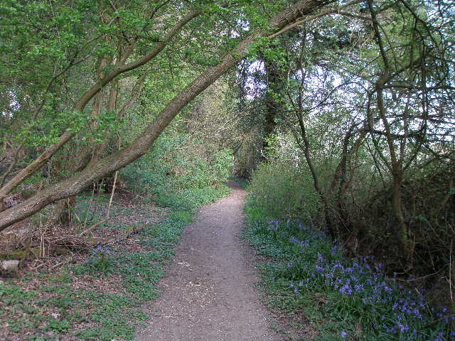
A very pleasant path led on from the other side of the lane, running through bushes and trees. There was more Greater Periwinkle here, as well as all the usual wildflowers I have been seeing regularly so far on the Chiltern Way. After a while I reached the drive to Penn House, where I turned left – this drive was part of a circuit created by the 5th Earl Howe for racing his fleet of cars in the 1930’s [16]. After a couple of hundred yards or so, I turned right off the drive onto a path through a nice beech wood. The path then continued alongside the right hedge of yet another arable field [17], winding its way right then left as it descended the pleasant valley of Penn Bottom [18]. I saw my first Red Kites in the Chilterns here when I did this walk two years ago – today I saw a large bird over the woods on the far side of the valley, but I’m fairly sure it was a Buzzard rather than a Kite.
On reaching the valley bottom, I turned right along a narrow lane – surprisingly busy with traffic. After two or three hundred yards I turned left up another lane, almost immediately reaching a small car park on my right. This was my turnaround point for the day – I had a quick look at a notice board showing some short walks on the Penn Estate, then started to make my way back to Chalfont St Giles.
[16] Looking back along the drive to Penn House
[17] Path approaching Penn Bottom
[18] Looking across Penn Bottom
I stopped for lunch on a bench on the green at Winchmore Hill. The walk back was very pleasant, and seemed to go by very quickly and with surprisingly little effort. It was a lovely warm afternoon now, the cold wind that I felt a couple of times in the morning seeming to have died away. At times I didn’t know what to look at as I walked back – the wildflowers in the hedgerows, the views over the attractive countryside, or the skies over the woods where I hoped to see buzzards or kites. Again this was an afternoon when I felt sorry for people stuck indoors at work!
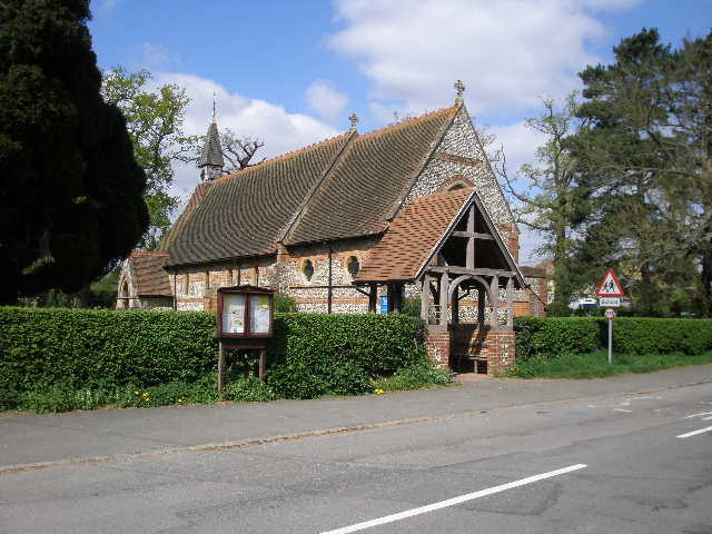
When I got back to Chalfont St Giles, I changed out of my walking boots and dumped my rucksack in the car, and strolled back to the church [19]. It is only open at certain times, when there are volunteer wardens, and had been closed when I passed it this morning. Very little remains of the original 12th century church, most of the existing church dating from the 13th to 15th century (with the usual Victorian alterations). There were some nice wall paintings (much more extensive than those I saw at Sarratt on my last walk) [20]– they date from the early 13th century, and were rediscovered in 1863 after centuries of being covered in whitewash or plaster. They were cleaned and preserved in 1929. Over the chancel arch was a rare example of painted battlements, dating from the 15th century, and also 17th century inscriptions of the Ten Commandments, the Creed and the Lord’s Prayer [21].
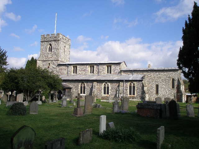
[19] Chalfont St Giles church
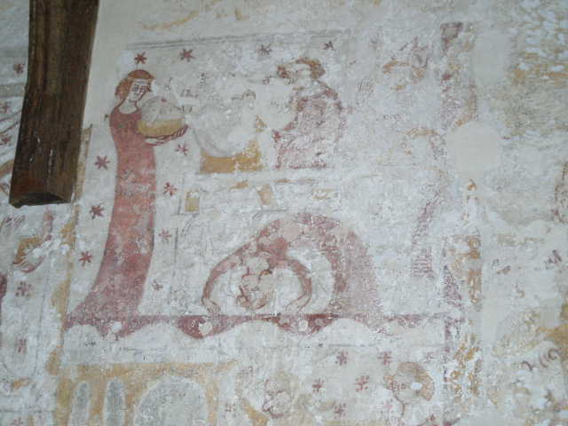
[20] 13th century wall painting, Chalfont St Giles church
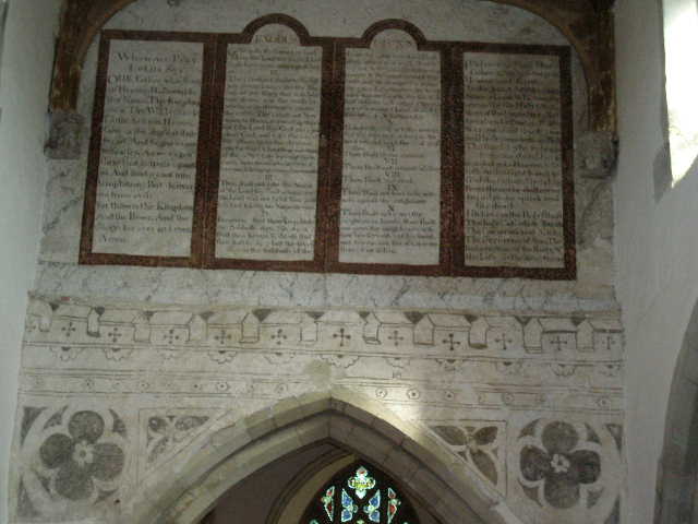
[21] 15th century painted battlements and 17th century inscriptions over the chancel arch, in Chalfont St Giles church
This was another good walk on a really pleasant day for walking. As usual, there were some nice views, a good mixture of woods and fields, wildflowers to add colour to the scene, and a few birds and butterflies to be seen. Chalfont St Giles church was well worth visiting, and greatly added to my enjoyment of the day.
Total Distance: 88.1 miles each way