Pete's Walks - The Chiltern Way (2)
If you are considering walking this route yourself, please see my disclaimer. You may also like to see these notes about the maps and GPX files.
Day 13 20/04/07 Penn Bottom to Burroughs Grove (7.8 miles each way, approximately)
Parked in small car park in Penn Bottom.
This started out as a much cooler day than recently, the temperature being only 7-8C as I left Kensworth whereas it has been 12-13C on the last few walks. It was also completely overcast, though the clouds were a pale grey rather than a dark grey threatening rain. I parked in the small car park at Penn Bottom (presumably it is kindly provided by the owners of the Penn Estate – there is a notice board here showing some walks around the estate). It was cool enough for me to put my fleece on when I got out of the car. I took some photos of some Greater Periwinkle growing here, then started walking about 10am.
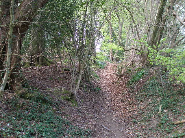
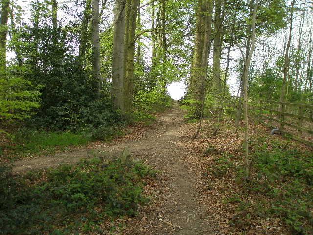
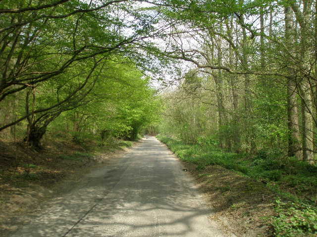
On the edge of the car park, a farm track starts out along the bottom of a side valley, while a driveway goes off right to a house. According to the guide book, the house is built on a knoll that was once the site of a Saxon church. There were some small ‘sarsen’ stones here too, but not as impressive as those at the folly I saw a couple of walks ago. The Chiltern Way almost immediately left the farm track to run between the garden hedge of the house on the right and another hedge, bordering the track. Soon after the garden hedge ended, the track switched to this side of the hedge, and I continued ahead on it. The track followed the left-hand hedge between fields of some young green cereal crop, very gradually rising as it followed a shallow side valley off Penn Bottom [1].
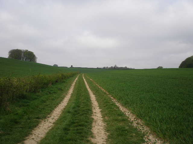
[1] Track leading away from Penn Bottom
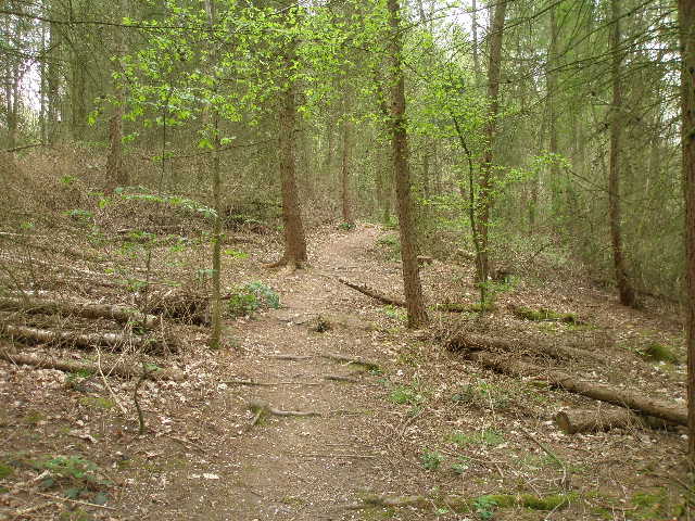
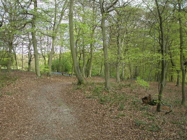
[2] Path through Twichels Wood

[3] Stump Well Lane, towards Burnham Beches
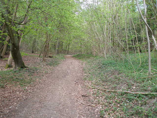
The track curved to the left as another hedge and footpath came in on the right, and then the footpath left the track and entered Twichels Wood, a small plantation of mainly conifers [2]. The path wound its way pleasantly through the trees, before rejoining the track and following it along the edge of the wood to a gate in the field corner. In the next meadow, a well-worn path went straight ahead uphill to a kissing-gate in the hedge, but the Chiltern Way actually followed a much fainter path that went slightly right to another kissing-gate near a corner, then passed through a small area of scrub to reach a road on the outskirts of Penn, where I walked left for about 40-50 yards. A sign here indicated that the clear path I’d just seen was a permissive path for horse riders only – that’s the second one I’ve come across this week, walkers are obviously not too popular in this part of the world!
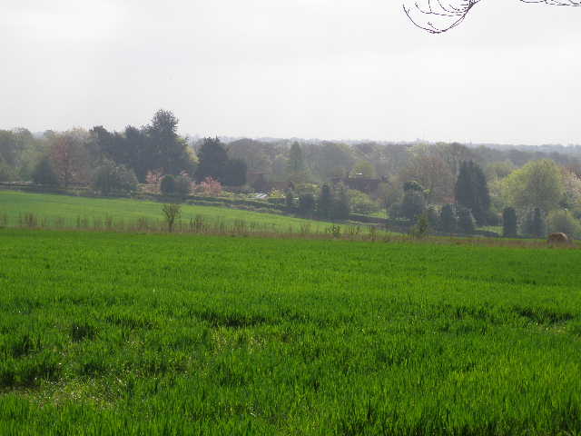
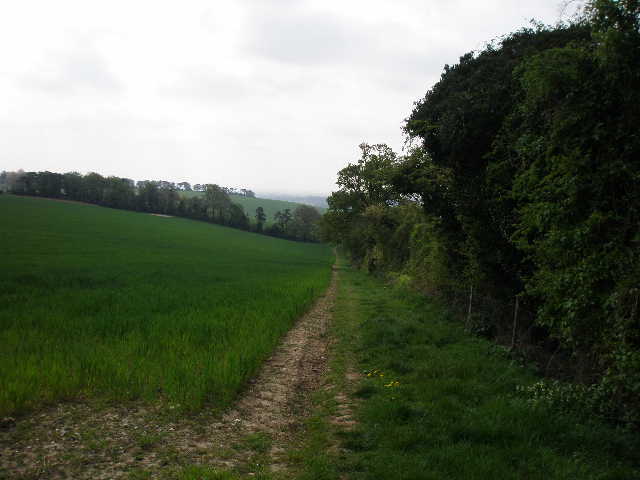
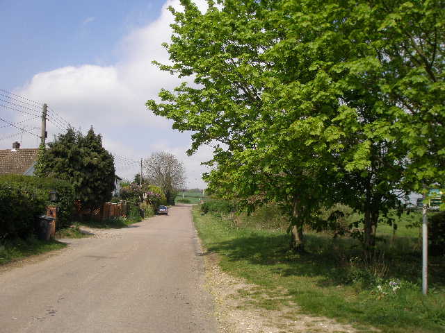
I crossed the road, and followed a path called Stump Well Lane, which initially ran between garden boundaries, then had meadows to the left [3]. I’d seen a Red Kite earlier as I drove through Penn Street, now I saw two of them low over the trees in front of me. The path entered the trees, by what remained of a pond called Stump Well (nothing like the Stump Well I’d seen at Marsh Gibbon on my recent Bernwood Jubilee Way walk). I turned right here along the continuation of Stump Well Lane, but soon took a footpath going left over a stile. This led through a meadow to another stile and a path running between garden boundaries. I turned left at the end along a gravel drive, then turned right along another path between hedges to reach another small meadow. As I crossed this I could see the top of Penn church on top of the hill over to my left [4]. I crossed a stile into another meadow, and turned right alongside the hedgerow. Over to my left, across the meadow, were good views towards Burnham Beeches.

[4] View towards Penn church from near Penn beacon
[5] View south from entrance to Coppice Hoop
[6] Path through Coppice Hoop
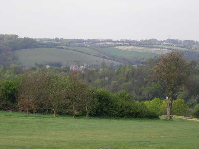
The path entered a wood for a short spell, then followed the left-hand hedge of a large meadow where three horses grazed, one obviously close to foaling. The Chiltern Way then entered another wood, Coppice Hoop [5,6], at first keeping close to the left edge, but then forking right to reach a stile at the far corner. I then followed the left-hand hedge of another meadow and crossed a stile into an arable field. There were nice views here ahead of me, along a small but steep-sided valley to the larger valley of the river Wye [7]. The path now went downhill through the green cereal crop to reach another wood. Here the path went uphill through the trees, close to the right-hand edge of the wood. The path was presumably a very old one, as it had worn a deep groove in the earth like a sunken track [8].
[7] View south towards the Wye Valley, from just beyond Coppice Hoop
[8] The sunken path leading to the golf course
[9]View over the Wye valley towards Flackwell Heath from the golf course
At the top of the rise, I left the wood and went over a stile onto a golf course. Here I turned left, following the edge of the wood around some greens and tees to reach a surfaced track through the golf course. This soon started to go downhill, leaving the side of a fairway to pass between trees for a short while, before turning left and emerging on the golf course again. There were nice views here over the Wye Valley below [9]. I followed the track down, passing more teeing areas, and turned left on a tarmac drive by the golf club car park. The bridleway soon left the tarmac and followed a path beside it on the right, then went slightly further right along a private drive to some houses, before the drive rejoined the road to the golf course. As with last time I did this walk, the Wycombe Heights Golf Centre seemed to me to be an attractive place to play golf, with its holes winding their way round the steep hillsides.
Immediately after a road came in from the right, I left the road from the golf course and took a path going slightly right through trees and bushes. This soon passed under a tall railway arch [10], and led between houses to a busy main road in Loudwater. This was once a village with watermills, but is now largely a suburb of High Wycombe. I took a slight detour, going a hundred yards or so left so that I could safely cross the road at a pedestrian crossing. On the other side of the road, I went over a bridge over the river Wye [11] and turned right, parallel to the river – I saw a Grey Wagtail here, which was still here on my way back, and also saw some Red Campion growing here. I turned left and then right, going round two sides of a rugby pitch on King’s Mead, an ancient common meadow. The path next went left again beside a car park and then right again, parallel to the The Dyke, a branch of the river Wye, with more rugby pitches to my right. I turned left over the second bridge I came to, crossed a road and took the cement drive ahead of me.
The drive went steeply uphill for a short distance, passing two or three houses. Where the cement ended, a pleasant path continued uphill between beech trees on the edge of a wood, with a meadow or pasture a few feet to my right. After a few hundred yards, I had to go through a long, dark tunnel under the M40. On the other side, the path turned right, still going uphill [12]. I saw a pink flower here, which I later identified as Coralroot, a quite rare plant found mainly in the Chilterns. I soon reached the edge of the wood, where I turned left, now on almost level ground. There was a lot of an unusual-looking blue flower here, which I later identified as Borage. I stopped to take off my fleece as I had now warmed up nicely – in fact the overcast conditions had gone, and although it remained fairly cloudy it was generally warm and bright for the rest of the day. I was now on the edge of Flackwell Heath, on a plateau separating the Wye valley from the much larger Thames valley. Flackwell Heath was once a tiny village famous for its cherry orchards, but is now, like Loudwater, a suburb of High Wycombe.
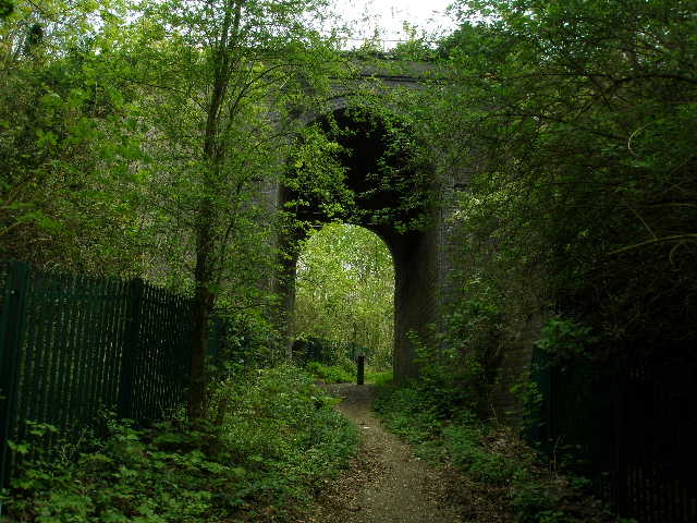
[10] Railway arch, Loudwater
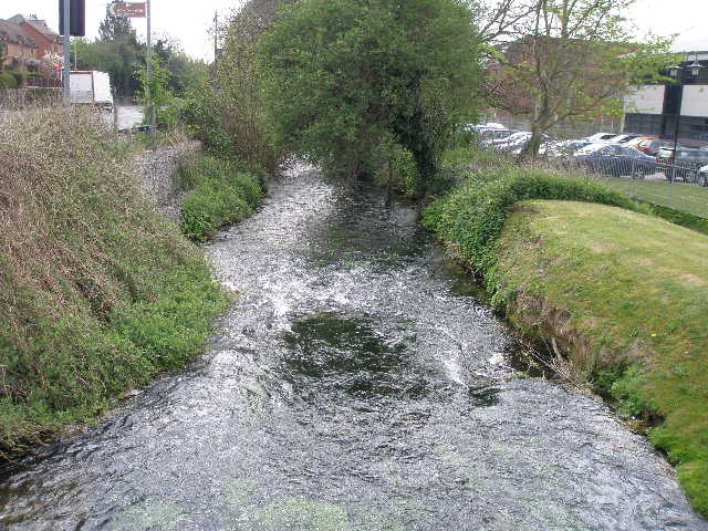
[11] River Wye, Loudwater
[12] Path to Flackwell Heath, just after the tunnel under the M40
I crossed a small grass area and entered another small beech wood, where I turned half-right with houses close by on my left. The path through the trees soon went right and followed the garden fences to a short alleyway that brought me out on to a road through the village. I turned right along the residential road for about 300 yards, before taking a path on the left. This went between garden fences to reach the edge of an arable field, where I saw some Green Alkanet growing. I followed a good clear path [13] that took me steadily downhill beside a right-hand hedge. At the next field boundary I continued on a good clear path between further green arable fields, still slightly downhill, with a minor road and the few buildings of Sheepridge ahead of me.
I turned right along the road, wondering why SheepRIDGE is actually in a valley. Just past the Crooked Billet pub, I took a path on the right which ran through a narrow gap between hedges to reach a meadow in a small valley. The path crossed a corner of the meadow to a hedge, where it turned half-left to follow the hedge to a wood.
The next section of the walk was quite delightful, the longest woodland section so far. I’ve noticed that the trees have just been turning green the last few days, and walking through the woods with the bright new leaves on the trees was very charming. At first, the path through Broom Wood was on a good track, going very slightly uphill between beech and other deciduous trees [14]. I saw a lot more of the rare Coralroot growing either side of the track. Where the track met a crossing track, I continued ahead on a narrow path, now with many Violets to be seen around me. The wood here was now mainly silver-birch and hazel, and I noticed fresh green bracken growing here too [15]. The route of the Chiltern Way through the wood was fairly straightforward, basically going straight on at a couple of junctions, but there were always waymarks at each junction to indicate the way.
[13] Near the start of the path from Flackwell Heath to Sheepridge
[14] Near the start of the path through Broom Wood
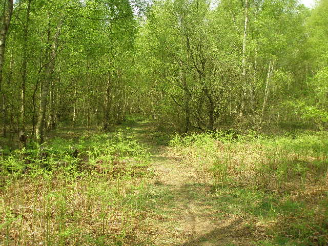
[15] The path through Broom Wood
The path eventually reached a five-way junction, where I took a wide track going half-right. The woods here were now largely beech again. The track soon started going steeply downhill, the surface of the track being a mixture of chalk and stones. This was one of the steepest descents of the whole Chiltern Way so far. At the bottom I reached a lane [16], where I turned left. At first I had woods on either side of me, then a bank and a hedge separated me from a field on the left. After about a third of a mile I turned right, a footpath heading uphill through Horton’s Wood. There was a small section of conifers here, before the wood became predominantly beech again. The path turned slightly left [17], and soon reached another lane.
I turned left along the lane, which was parallel to the A404 dual carriageway on my right. The guide book mentions a ‘short-cut’ that crosses the main road – last time, I had a quick look at the constant thundering traffic going by, and decided that it was not a very sensible idea. It didn’t look much more inviting this time. I followed the lane for about a quarter of a mile until it turned right to pass under the main road. I then turned right again, and followed a track past a farm and then a path between hedges, to reach the point on the opposite side of the A404 from where I first met it. I then turned left on a path beside a left-hand hedge – I remembered seeing several Marbled White butterflies here last time, but there were none today (too early in the year for them, as they only fly during July and August according to my little reference book – it was 1st July when I did this walk two years ago). On the far side of this large grass field, I went through a gate to reach the road through the hamlet of Burroughs Grove [18]. This was as far as I was going today, and I turned round and headed back.
[16] Looking back along the lane between Broom Wood and Horton's Wood
[17] Looking back along the path through Horton's Wood
[18] Burroughs Grove
It was a very pleasant afternoon now, quite warm and bright, although still quite cloudy at times. As I was about to enter Horton’s Wood again, I saw an Orange Tip butterfly, but it wouldn’t settle so I couldn’t get a photo. I’ve seen several of them on the last few walks, but they never seem to settle on a plant, just fly around. I had lunch sitting on a felled tree trunk in one of the woods. The walk back went by very pleasantly, and I got back to my car about 3.15pm.
This wasn’t a bad walk at all, better than I’d expected. The section through Loudwater and Flackwell Heath wasn’t too interesting, but the first part of the walk was pleasant enough and the last part through the woods was very good indeed. I didn’t see too many butterflies today, but saw some new wildflowers that I hadn’t come across before. It was nice to see the Grey Wagtail by the river Wye – they are a bird I associate with fast-flowing streams in the north of England, but they seem to be becoming more common here in the south.
In terms of days, I am now halfway through walking the Chiltern Way, although in terms of miles I am just short of halfway. It seems to have gone by remarkably quickly so far!
Total Distance: 95.9 miles each way