Pete's Walks - The Chiltern Way (2)
If you are considering walking this route yourself, please see my disclaimer. You may also like to see these notes about the maps and GPX files.
Day 14 25/04/07 Burroughs Grove to Colstrope (7.2 miles each way, approximately)
Parked in road in Burroughs Grove.
It is five days since my last walk on the Chiltern Way, but I haven’t been completely idle during that time. Two days ago I did a nice 13-mile circular walk from Therfield Heath, near Royston, with my friend Stu – we started the walk there as it was very roughly halfway between my home and Ipswich, where he lives. The entire walk was on parts of three long-distance paths that I have walked in that area, the Hertfordshire Way, the Hertfordshire Chain Walk, and the Icknield Way. The highlight of the walk was seeing some rare Pasque flowers on Church Hill.
I went rather a long way round to get to Burroughs Grove, following the roads north of the Chilterns then using a short stretch of the M40, so that I avoided driving through Chesham, Amersham and High Wycombe. This actually took 10 minutes longer than I’d expected, so I didn’t start walking until 10.15 am (strangely, going home the same way took the 60 minutes I’d expected, so perhaps I was just unlucky with the traffic this morning). Today the weather was generally grey and cloudy, with just occasional bright periods.
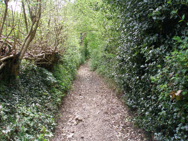
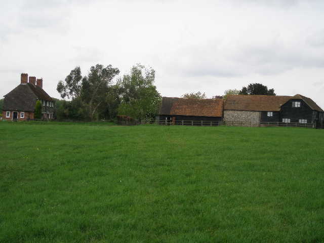
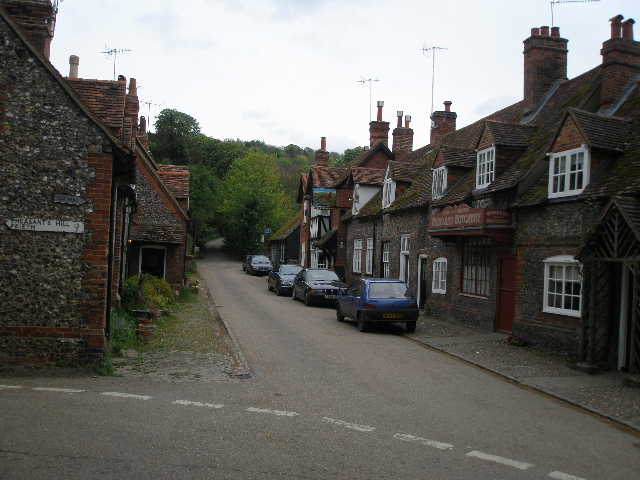
I followed the short road through Burroughs Grove to a T-junction where it met a busy road from High Wycombe to Marlow Bottom. Across the junction, a clear path through a green arable field led to a bridleway, continuing ahead between hedges [1]. This soon took me to a house called Juniper Hill, where the Chiltern Way followed the tarmac drive down and up a small dip to reach a road on the edge of the village of Marlow Bottom. Marlow Bottom is just north of the town of Marlow (which sits on the north bank of the river Thames), and takes its name from the valley where it lies. According to the guide book, it is a new village which didn’t exist 100 years ago, but it developed rapidly during the 1900’s as a dormitory suburb of Marlow.
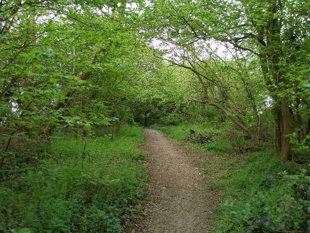
[1] Path from Burroughs Grove to Marlow Bottom
[2] Path through wood just beyond Marlow Bottom (where I went wrong!)
[3] Seymour Court Lane
I crossed the road, and followed the footpath almost opposite. There now followed a sequence of alleys between wooden garden fences. I saw a surprising variety of wildflowers here, including Lesser Celandine and Forgetmenots. At one point, an alley ended at a road, where I had to walk a few yards to the left before picking up the next alley. Eventually, the path went very steeply downhill to reach another road, where I again turned left. The next path, on the right, took me along the left edge of a playing field, with a school over to my right. The Chiltern Way then turned right in the corner of the playing field, following the top of a bank to reach an entrance into a wood.
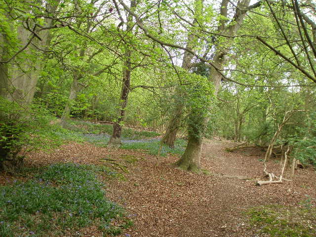
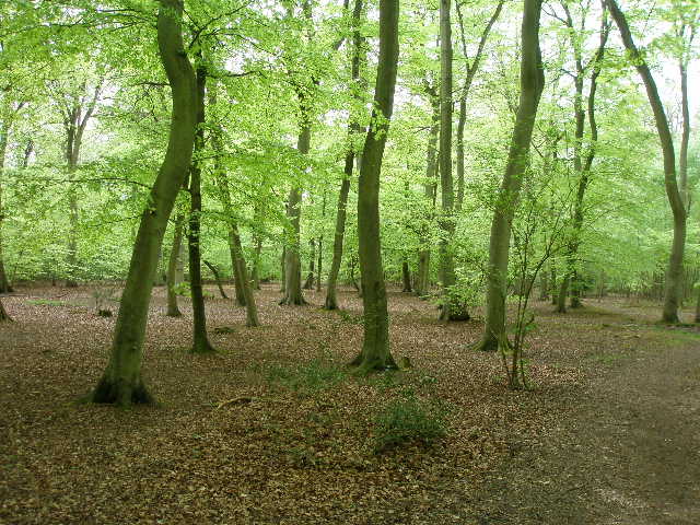
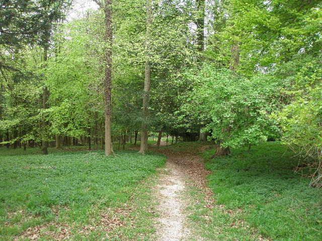
Here I went astray. I followed the clear path through the wood (mainly beech with a lot of holly), but something told me I’d gone wrong. After a few hundred yards I reached a track, but was sure I should have come out on it further to my right. I got the guide book out of my rucksack, and this confirmed that I’d made a mistake – I should have followed a path close to the right-edge of the wood, rather than near to the left-edge as I’d done. So I went right down the track about 100 yards and soon saw where I should have come out (opposite the gateway to a house in the wood). I turned right and walked back to where I’d entered the wood – I can’t really blame myself for having gone wrong, as where the correct path diverged from the path I’d taken it was largely obscured by holly and there was no signpost or waymark. Anyway, I turned round, retraced my footsteps along the correct path through the wood [2], and turned left along the track.
[4] View south over Marlow and the Thames Valley from Seymour Court Lane
[5] The bridleway heading south from Seymour Court Lane
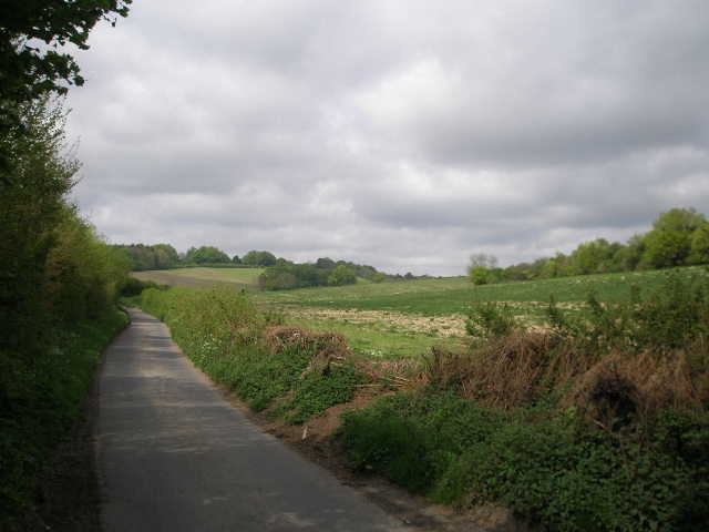
[6] Munday Dean Lane
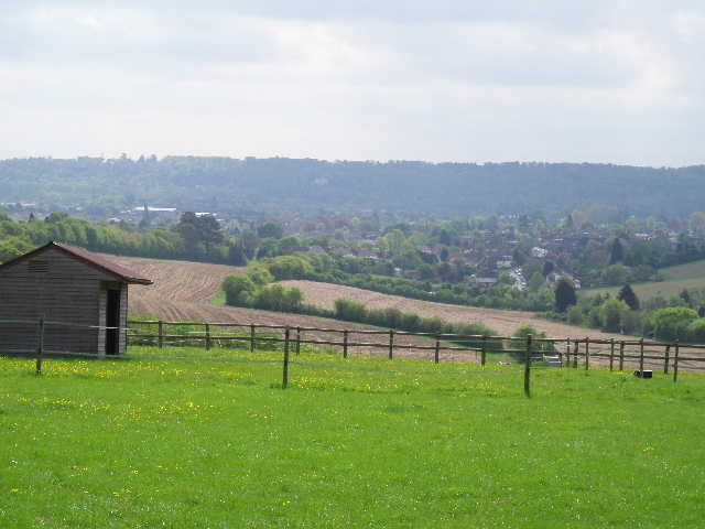
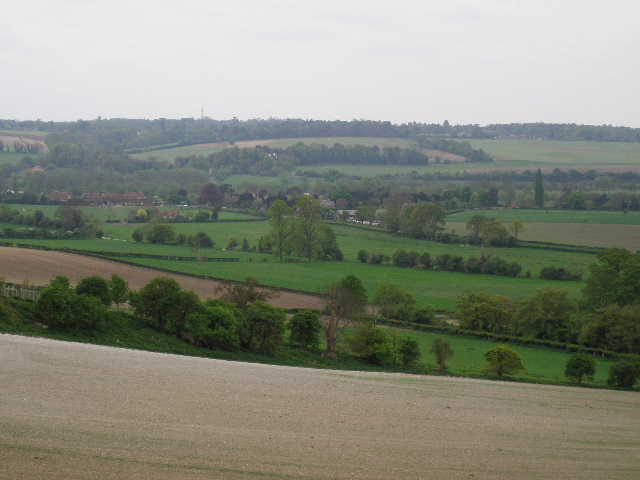
The track went slightly uphill, then when it left the wood ran for about 300 yards between high hedges to a road. I turned left for a few yards then turned right into Seymour Court Lane [3]. I soon passed the outbuildings of Seymour Court on my left – an earlier house on the site is thought to have been the birthplace of Jane Seymour, third wife of Henry VIII who died shortly after giving birth to the future Edward VI. I followed the lane for about half a mile, with occasional views to my left over Marlow to the hills on the south side of the Thames [4]. At a sharp right-hand bend, I turned left onto a stony bridleway [5]. This ran quite steeply downhill between hedges, where I saw some Herb Robert amongst other wildflowers. This was quite a long descent, eventually reaching Munday Dean Lane in a valley bottom [6]. A footpath continued on the other side of the lane, now going steadily uphill. At first the path was between tall hedges (mainly beech) which met overhead, so that I was walking through a green tunnel. Then the hedge on the left was replaced by a wire fence, and as I got further up the hillside I had nice views across the valley and towards Marlow. The path entered a wood, where it turned sharply right. After a short distance the path turned left, passing a farm on the left and then continuing along the tarmac farm drive.
A few yards before reaching a road, the Chiltern Way went right, along a track that joined the road at a sharp angle after about 100 yards. I was now on the edge of Bovingdon Green, almost opposite the village pub. I followed the road a short distance to my right, passing a duck pond on the left [7], then turned left across a corner of the village green [8]. Most of the houses in this attractive hamlet are dotted round the edge of the green – the name comes from the Saxon for ‘Green on the hill’. I crossed the road through the centre of the green and followed a gravel track to the far right corner. I then followed a short lane past a few more houses, and where the lane ended continued on a footpath.
Most unusually, I had already had to check the guide book for directions two or three times, and was now carrying it in my hand as I couldn’t remember too much of the next section. This was strange as, like the previous section I couldn’t remember between Flaunden and Sarratt, this was a particularly charming part of the Chiltern Way. The path ran for several hundred yards between fences, with a number of horse paddocks on either side. As well as a fence, there was a hedge of sorts along the right of the path – it was more a line of mature trees intermittently interspersed with holly and other bushes. Ahead of me, and beyond the paddocks on either side, were woods.
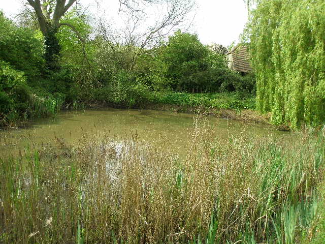
[7] Duck pond in Bovingdon Green
[8] Bovingdon Green
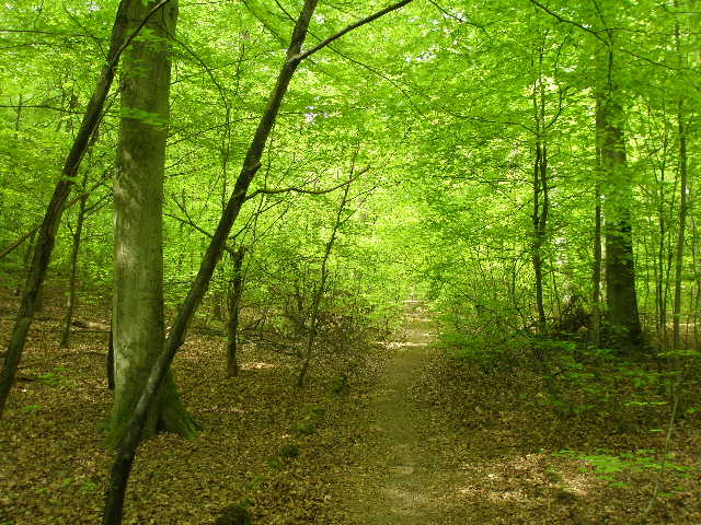
[9] Start of path through Davenport Wood
When the path eventually reached the woods, it continued ahead through the beech trees [9]. As usual in such woods, the path was a clear dirt line between the dead leaves and remains of beech nuts that littered the ground. I was struck, not for the only time today, by the colour of the fresh new leaves on the trees [10]– they seemed a much brighter and lighter green than I’d expected. I have always said that autumn is my favourite season, but I have to say that I am really enjoying this spring – not just the fresh green colours everywhere, but because of the emerging wildflowers and butterflies. Of course, I have been very fortunate with the weather so far this spring – I am certainly enjoying my walking more now than I was during the winter.
After a few hundred yards, the clearly signposted Chiltern Way turned right – I met a pair of walkers coming the other way shortly afterwards. I am surprised at how few other walkers I do come across, it’s seldom more than two or three a day and quite often I don’t see any. I continued on along the pleasant path through the beech trees, which fairly soon turned slightly left and reached a quiet lane through the woods. Crossing the lane, I left Davenport Wood and entered Pullingshill Wood. I soon came to a junction of paths, where I went half-right and almost immediately started a very steep descent. Going down it seemed quite a long descent, but fortunately coming back in the afternoon the ascent didn’t seem as long as I thought it would be.
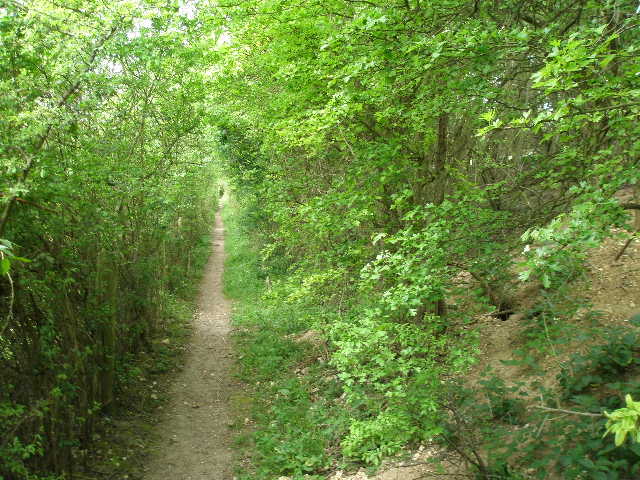
At the bottom of the slope I finally left the woods, and took a path running between hedges with green fields either side. I was now back on a section of the route that I clearly remembered from my previous Chiltern Way walk. Again at times I was in a green tunnel [11], with the hedges meeting above me. The path was fairly level, contouring along the side of a small valley. After about a quarter of a mile, I went over a stile and turned left through a paddock where three horses grazed. Across another empty paddock, I went over another stile to reach a lane, where I turned right. I saw some Red Kites flying here – I had seen several already today. After going downhill a short distance I turned left into the entrance of Homefield Wood, a nature reserve managed by the local wildlife trust.
[10] Path through Davenport Wood
[11] The 'Green Tunnel' beyond Pullingshill Wood
[12] Track through Homefield Wood
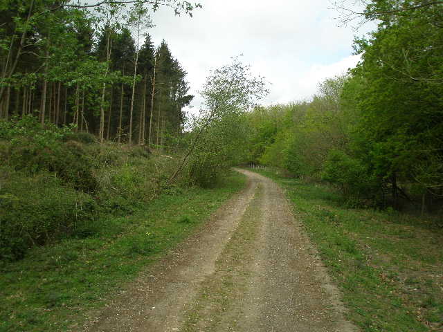
I followed a good forestry track through the wood [12] for about two-thirds of a mile, following a valley bottom. Unlike the previous woods today, this wood was coniferous. I saw several Speckled Wood butterflies here and a few Orange Tips, but again was unable to get a photo of the latter. At some point the wood became Heath Wood. When the valley and track started to curve to the right, I took a path going very sharply left, gradually going uphill at an angle to the slope so that the gradient wasn’t too steep. At the top of the slope I came out on a lane on the edge of the wood, where I turned right.
After about 150 yards I turned left onto a footpath. This crossed a very large pasture where four or five sheep and a large number of bullocks were grazing. Across a stile on the other side, I continued across a large field, where there was no clear sign of a path through the grass, to reach the small hamlet of Rotten Row [13]. I followed the lane from the hamlet for a few hundred yards, before taking a good farm track going half-right between fields. After about a third of a mile this took me to a stile into Rickoll’s Wood [14], a mixed wood of both deciduous and coniferous trees (as with last time I did this walk, I used the stile as a seat when I stopped for lunch on my way back).
The path started descending, soon leaving the wood and heading steeply downhill with a very chalky ploughed field on my left. There were nice views here over the southern end of the Hambleden valley, where it meets the Thames valley near Hambleden Mill [15]. At the bottom of the slope, I turned right on a track for about 100 yards, before a path on the left took me across a playing field (where I saw some Green Alkanet) to the free car park in the picturesque village of Hambleden.
[13] Rotten Row
[14] Path through Rickoll's Wood
[15]View over Thames Valley around Hambleden Mill, from edge of Rickoll's Wood
Hambleden [16.17], set in its valley rimmed by woods, has remained an unspoilt village due to the benevolence of the Hambleden estate that owns much of it, and the National Trust to which most of it is covenanted. It has therefore avoided the ravages of modern development. Its characteristic Chiltern brick-and-flint houses have made it an ideal setting for films and TV (I spotted it recently on an episode of ‘Midsomer Murders’). There is an old pump by a tree in the village square, and several old-fashioned shops. I think it is the most attractive village on the Chiltern Way – hardly a very original thought, as Hambleden and its environs are possibly the best-known and most visited part of the Chilterns.
In the Domesday Book of 1086 it is recorded that the manor of Hambleden was given to Queen Matilda. A mill at Mill End a mile south of the village then paid an annual rent of £1, and there is still a mill on that site today (the weir is said to have been built in the reign of Henry V, 1413-1422). In 1215 the manor was held by King John, through his subsidiary title as Earl of Gloucester. It then passed to Richard de Clare and then his son Gilbert de Clare – these two were the next two signatories of the Magna Carta after King John himself. 1215 is also the first year that mention is made of a Rector of Hambleden, Ralph Neville. He was a prominent statesman, holding five other livings and holding the very important role of Chancellor of England. He became Bishop of Chichester in 1224 and seven years later was appointed Archbishop of Canterbury – however the Pope refused to ratify this latter appointment. St Thomas de Cantilupe, the last pre-Reformation English saint, was born in Hambleden. He too was a Chancellor of England (1265) and became Bishop of Hereford in 1275. He died in 1282, being canonised in 1320.
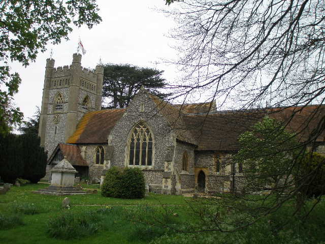
I had revisited Hambleden at the end of January, doing a very pleasant circular walk by following the Chiltern Way to Turville then taking bridleways chiefly through woods back to Hambleden. At the end of the walk I paid a quick visit to Hambleden church [18]. Originally Norman, but on the site of an earlier Saxon church, it has been much changed over the centuries. There is an ancient font that may be early 12th century or even a relic of the Saxon church – it is certainly were the previously mentioned St Thomas de Cantilupe was baptised. In the North Transept is a monument to Sir Cope D’Oyley, his wife and ten children, consisting of alabaster figures in front of a plaque. A few of the figures of the children carry skulls, a sign that they predeceased their parents. In the graveyard is the tomb of W. H. Smith – for many years a church warden here, he was the founder of the stationers that bears his name, an MP and a statesmen, and later the first Viscount Hambleden. His descendants still live in the village. (All the above information is taken either from the guide book or the church guide).
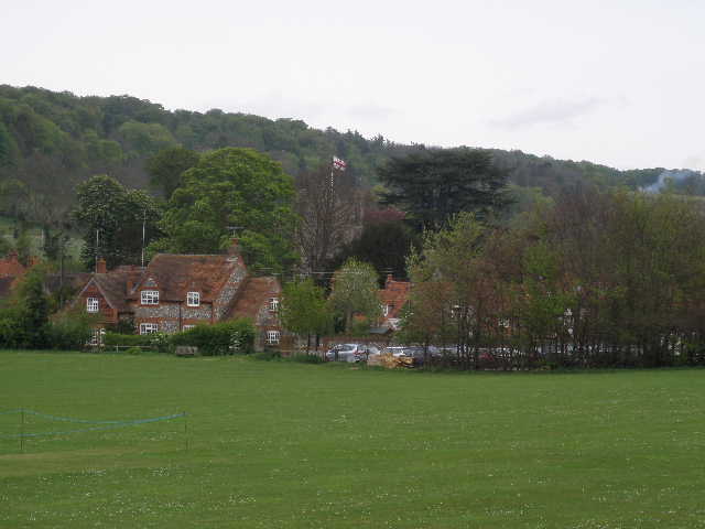
[16] Hambleden
[17] Hambleden
[18] Hambleden church
From the car park I followed a short lane past the village pub and the butchers to the square, with the church on my right. I took another lane opposite, which almost immediately went right, passing another side of the church yard. After a couple of hundred yards, I went half-right, taking a footpath across a flat pasture [19]. There were several bullocks here, away to my left by the Hamble brook. I then crossed an empty pasture, went through a very thin belt of trees, and across a smaller grass field to the hamlet of Pheasant’s Hill [20]. I saw my first Swallow of the year flying low over the paddock to my left. When I walked the Chiltern Way two years ago, there was a humorous topiary face carved in the end of a hedge here, but sadly it was no longer there. I followed a path between hedges and fences – the path obviously divided the gardens of some properties in two. I then crossed a lane and a short track led me to a gate, where I continued along the right hand hedge of a meadow.
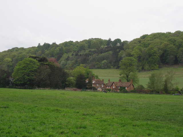
I was heading north along the Hambleden valley, a popular area for walkers and understandably so. The valley runs north from the Thames near Hambleden Mill, past Hambleden itself and on past the hamlets of Colstrope and Skirmett to Fingest, a distance of almost four miles. The valley has quite a broad flat bottom, with steeps slopes either side almost continuously topped by woods. It is a very attractive green valley, and the good path through it makes it a pleasure to walk here. But for me the main attraction here are the Red Kites!
I’d already seen several Red Kites today at many different points on the walk. As I now followed the path beside the hedge, I heard a large commotion from across to my right – it was obviously some Kites, but making noises I’d not heard from them before. I looked over the hedge towards the wood at the top of the hill, and saw eight Red Kites very close together, and very low – some close to the edge of the wood, some over the garden and small orchard the other side of the hedge from me. I’m not sure if it was some sort of boisterous courtship that was going on, but they were making quite a racket. Not that I was complaining, their plaintive calls are one of things that I like about them. When I did this walk ago, I had just one possible sighting of a single kite – that I have seen so many more today, right from the start of the walk at Burroughs Grove, is more evidence of how well they have done over the last couple of years since I first walked the Chiltern Way.
[19] Looking back towards Hambleden
[20] The Hambleden valley, near Pheasant's Hill
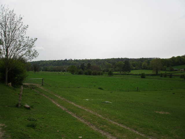
[21] Looking back along the Hambleden valley from near Colstrope
After a second grassy field, the path switched to the left side of the hedge and then reached the hamlet of Colstrope by a farm [21]. I followed a lane through the hamlet for about a hundred yards to where the footpath resumed, then turned round. It had been a really good walk, and I was quite happy about the prospect of now walking it in the opposite direction. Almost straight away I saw another large bird in the sky, and assumed it was yet another Red Kite. But I quickly realised that its wings seemed broader, and soon could see the rounded tail that showed it was a Buzzard (Red Kites have a slightly forked tail). There were now just a few drops of rain as I walked back from Colstrope to Pheasant’s Hill.
As I started back up the hill from Hambleden, beside the chalky ploughed field, I had a couple of interesting wildlife sightings. First I saw three large birds close by – again I wrongly assumed they were all Kites before realising one was a Buzzard. One Kite flew very close to the Buzzard, so I had an excellent chance to compare their relative sizes – I have always thought they were fairly similar in size, though I knew that Kites were bigger. Seeing the two birds together, I was surprised how much bigger the Kite was (in fact, having since checked on the internet, the Red Kite’s wingspan is close to 6ft while the Buzzards is around 4ft). It was also obvious that the Kites wings are more slender than those of a Buzzard. This is not the first time that I have seen Buzzards and Kites in the sky together, the two do seem to co-exist quite happily.
As I got further up the hill I then saw two birds flying down hill, the first very low to the ground and the second not much higher. Again my first reaction was to think them both Kites, but I almost immediately realised that the first bird was far too small and was in fact a Kestrel. It was being chased hard by a Red Kite, which was obviously intent on doing it some harm. The Kestrel zigzagged a few times as it flew low across the field with the Kite in hot pursuit, until it managed to reach the safety of some small trees at the bottom of the hill where the much larger bird was unable to follow it. So it seems that Red Kites tolerate Buzzards, but don’t like Kestrels!
I enjoyed the walk back, and got back to my car just before 3.30pm.
This was a great walk. The short section through Marlow Bottom wasn’t too interesting (though even here I saw several wildflowers), but the rest was very good. There were several quite steep ups and downs, more woodland walking than any previous section of the Chiltern Way (including a lot of beech woods characteristic of the Chilterns), some attractive villages and hamlets, one or two points of historic interest, many fine views over splendid countryside and, last but certainly not least, lots of Red Kites.
Total Distance: 103.1 miles each way