Pete's Walks - The Chiltern Way (2)
If you are considering walking this route yourself, please see my disclaimer. You may also like to see these notes about the maps and GPX files.
Day 17 2/05/07 Crocker End to Sonning Common (8.2 miles each way, approximately)
Parked at Crocker End.
Yet another gorgeous day for walking! Lovely blue skies again, but with a nice breeze to keep the temperatures down – in fact it got quite windy a couple of times. I have been incredibly fortunate with the weather so far on the Chiltern Way – the month just ended was the warmest April on record!
I woke up very early this morning, so managed to set off from home 30 minutes earlier than usual. When I last did this, it was a waste of time as I set off for somewhere near Royston forty minutes earlier than usual, but got there only ten minutes early due to rush-hour traffic. Today, driving in the opposite direction and only passing through small towns and villages rather than the big towns of Luton and Hitchin, it worked quite well and the journey took the same time as normal. There was a slight delay when I arrived at Crocker End, as somebody asked me for directions to Soundess House, which I passed near the end of the last walk. I helped them with that, but unfortunately was unable to help them with their other problem - their car was stuck! They’d driven partially onto the green to allow another vehicle to pass and the front near-side wheel was stuck in a hole. I tried giving them a push, but it was no good – when I left, they were placing stones and bits of wood under the tyre to see if they could get some purchase. They’d gone when I came back, so they obviously solved the problem somehow.
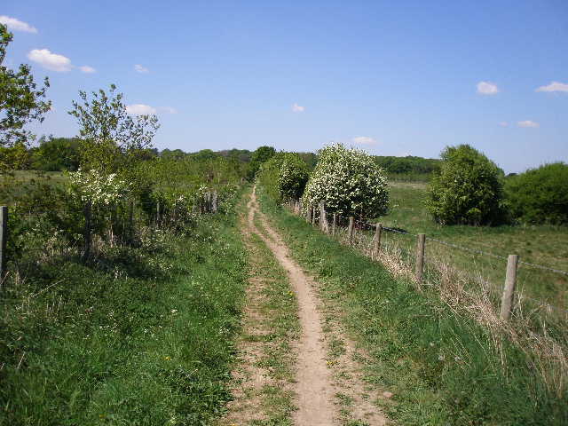
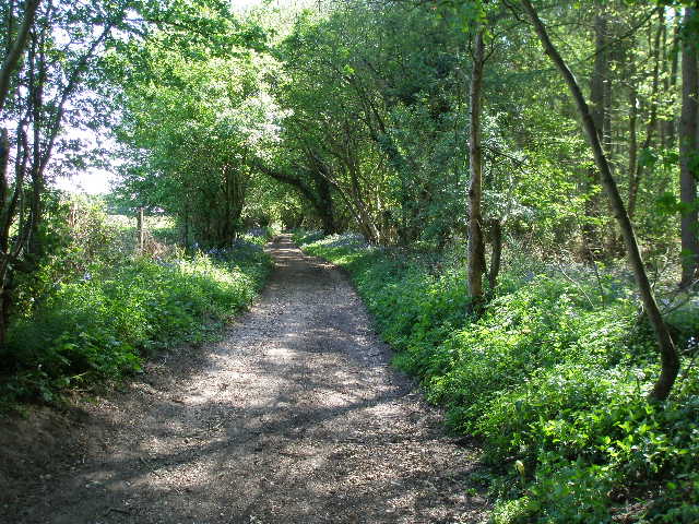
It was 9.55am when I started walking, following the lane through the green at Crocker End [1], then crossing a mown area of grass on a bridleway to reach a stile. This took me back into the large area of parkland that I’d crossed at the end of the last walk, between Crocker End and Soundess House. The path followed the hedge to the right, level at first then descending slightly when the hedge turned further right. This took me to a wood, Wellgrove Wood, where there was an unusual plantation of yew trees initially on my left [2]. I followed the obvious path through the trees, the yews soon giving way to the more typical beech [3]. The path turned slightly left and started going downhill. Soon I was walking on the edge of the wood, with nice views over the field on my right, looking down to a farm in the valley of Bix Bottom - I saw a Buzzard fly off here, the only one I’d see today.
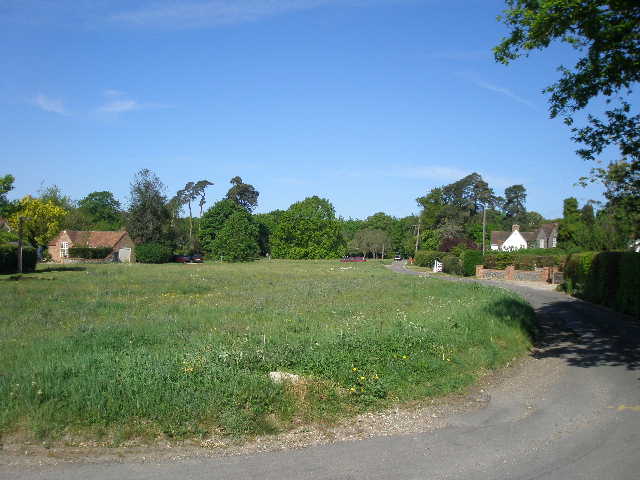
[1] Crocker End
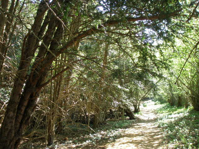
[2] Yew Trees in Wellgrove Wood
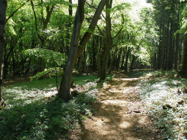
[3] The path through Wellgrove Wood
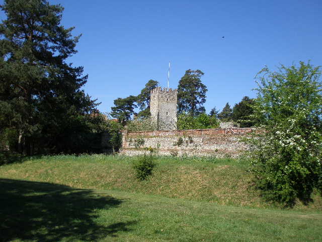
I soon left the wood, the path continuing downhill on a good track beside a right-hand hedge that contained occasional mature trees. Ahead of me in the valley bottom I could see the ruins of Bixbrand church. The track continued steadily downhill into Bix Bottom, arriving at the lane that runs through the valley just a few feet to the right of the ruined church. I went and had a quick look at the ruins [4,5], which I remembered from my previous walk. The lane here was once the main route between London, Henley and Oxford, but the main road now follows a ridge to the sout and the mediaeval village of Bixbrand has disappeared, replaced by the modern village of Bix along the new road. All that remains of Bixbrand are the ruins of its church, of Norman origin and finally abandoned in 1875, and Valley Farm, a quarter mile down the lane.
I followed the lane to the right, soon reaching Valley Farm which I’d seen from the edge of the wood before. I turned right to pass through the farm buildings, and said hello to a group of about 6-8 people sitting there chatting and having a drink. I noticed a couple of what looked like modern metal sculptures nearby, and I wondered if some of the farm buildings were being used as artists’ studios. A quick look on the internet has since shown that they are used by a firm that makes Sundials.
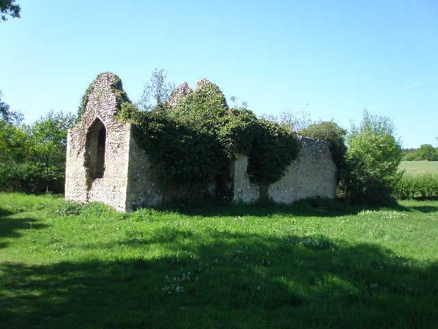
[4] The ruined church in Bix Bottom
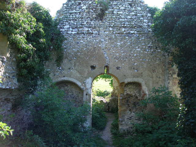
[5] Inside the ruined church in Bix Bottom
[6] Looking back over Valley Farm and Bix Bottom
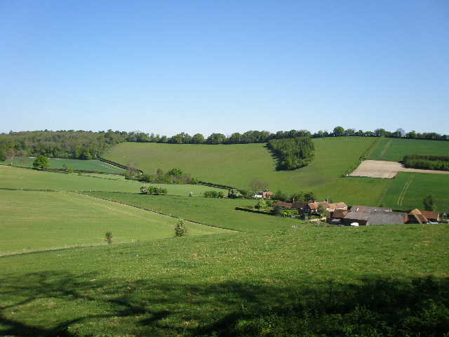
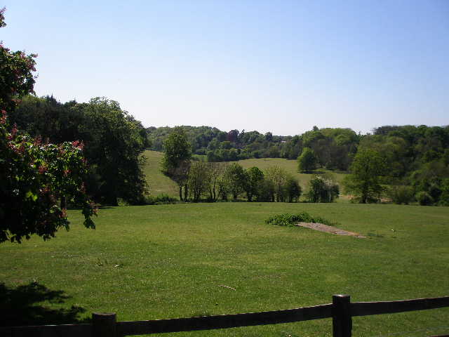
I followed a good track leading away from the farm. After 200-300 yards I went up a steep bank on the left and over a stile, continuing steeply uphill beside a wire fence on my left. A very long way to my right I could see a couple of horses and a herd of cattle at the far end of this field, close to the woods running along the top of the hill. I soon reached a stile into the woods, where I admired the splendid views back over Bix Bottom [6]. The Chiltern Way continued through a narrow belt of trees on a small ridge projecting into the valley, still ascending but much more gently now. I soon came to the main part of the wood, where the path bore left – much of the wood here was coniferous, but as I reached the top of the hill beech trees predominated again. The path almost reached the far edge of the wood, but then turned left and wandered through the trees, close to a field on my right. After 2-300 yards, the path left the wood, and crossed the green arable field on a clear chalky path to reach the A4130 main road running through the village of Bix.
I crossed over, and took a footpath between fences to a stile. I then followed a left-hand hedge through two empty cattle pastures, with a farm ahead and slightly to my right. I then went over a series of four stiles in quick succession, crossing two farm tracks and a much smaller pasture between them. I then went half-left across a corner of another large pasture to yet another stile, where I turned right along a farm track. This went slightly downhill to the corner of a wood, intriguingly named Famous Copse [7], where I went over another stile and turned left through the trees. The path kept close to the edge of the wood on my left, soon passing what the guide book describes as an ancient earthwork, a large ditch and a parallel ridge. The trees here on the edge of the wood were chiefly beech and silver birch, but to my right the bulk of the wood was coniferous. At a gate in the corner of the wood, the path turned right and continued through the trees for about another quarter of a mile.
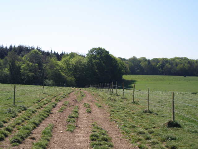
[7] Farm track between cattle pastures, heading towards Famous Copse
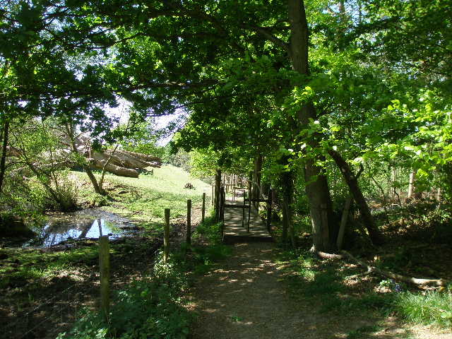
[8] Pond and footbridge on path to Greys Court
[9] Looking back along path, from just before Greys Court
The Chiltern Way finally emerged from the wood, where I took the rightmost of two paths crossing a meadow with a house nearby on the right. It then went over a stile and crossed a smaller meadow, before passing through a hedge and crossing an area of heavily rutted ground by a farm. The path then ran between new wire fences through a small wood where a lot of trees had recently been felled. The path turned left to reach a gate, giving access to another path where I turned right. There was a pond on the left, and the path went over a wooden footbridge [8], apparently pointless now but presumably necessary when the pond overflows. I saw a Green Woodpecker here on my way back. A few yards farther on I went over a stile in the wire fence on my left, then followed the path slightly downhill and up again, to reach another stile [9] which took me into the car park of a National Trust property, Greys Court.
[10] Greys Court
[11] The grounds of Greys Court
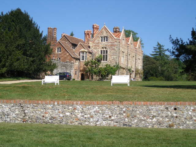
[12] Greys Court
Greys Court [10,11,12] derives its name from the de Grey family who built their castle here in the 14th century. Lord de Grey fought at Crecy and was one of the original Knights of the Garter. He received a licence to crenellate (i.e. fortify) his house in 1347. The de Grey line died out at the end of the 15th century, and the estate was granted to the Knollys family by Henry VIII in 1538. Frances Knollys was later Household Treasurer to Elizabeth I. The house is associated with one of the most notorious murders of the 17th century – in 1613 Sir Thomas Overbury was murdered in the Tower of London, and two years later, the Earl and Countess of Somerset were found guilty of poisoning him. The couple were reprieved, but confined at Grey’s Court, the home of the Countess’s sister. Some towers and a section of wall remains from the original mediaeval buildings, as do the Elizabethan stables and well-house (the water was raised by means of the largest donkey wheel in Britain), but the current building dates largely from just after the Civil War. It contains some fine plasterwork and furnishings from when it was renovated in the 18th century.
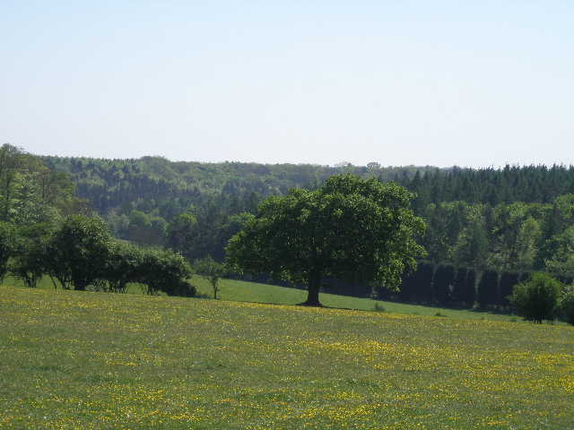
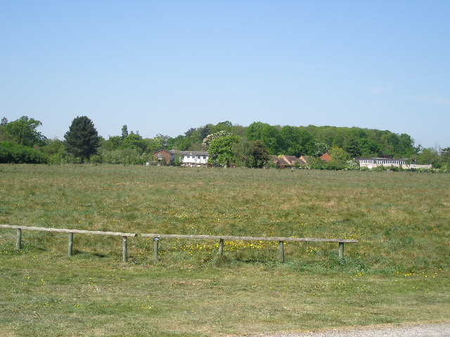
I followed the drive past the house, admiring the view over the parkland in front of the house, and then followed a short path to a quiet lane. Across this, the path descended and ascended a meadow in a small valley, then continued uphill through trees to reach the cricket pitch in the village of Greys Green. I went right, round the edge of the pitch, to the road [13], where I turned right. Just after a junction with a road going right, I turned left on a bridleway between hedges, with a golf course on my right. There was a lot of Red Campion growing here. I followed the very pleasant path for several hundred yards [14] to reach a crossroads called Cross Lanes, where I continued ahead on a good track, soon passing a couple of white houses. The track had a hedge on the left, and a mixed wood on the right [15]. Where the wood ended, the track continued beside some paddocks to reach some isolated dwellings at the end of a lane.
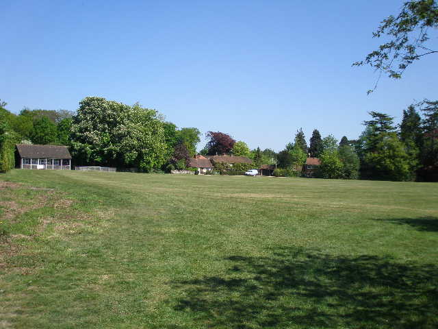
[13] Looking back at the cricket pitch, Greys Green
[14] Looking back along the bridleway beside the golf course
[15] The track from Cross Lanes towards Harpsden Bottom
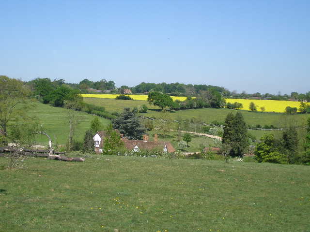
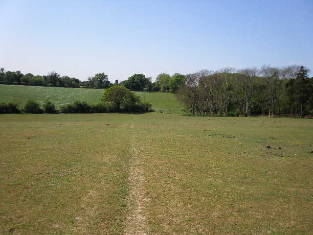
I followed the lane downhill for about a third of a mile, with some nice views over the valley of Harpsden Bottom [16]. At the valley bottom, the lane came to a junction where I turned left by an attractive half-timbered house called Old Place. After about 100 yards I turned right on a footpath that went uphill, following a line of posts across the parkland of Crowsley Park – there were gorse and other bushes, and Horse Chestnuts and several other types of tree dotted around the grassland. There were good views back the way I had come [17]. I crossed an old drive to the house [18], and then the path went half-right. Over to my right I could see a herd of White Park cattle behind a wire fence, though a gate was open and it was obvious that they had been in the area I was walking across. I went over a double stile, and followed a line of Horse Chestnuts through an enclosure where there were four White Park cows and a young calf.
[16] View from the lane over Harpsden Bottom
[17] Looking back over Old Place from Crowley Park
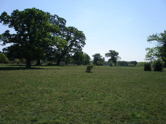
[18] Parkland in Crowsley Park
The path then went through a gate and ran between metal railings for about a hundred yards. Beyond another gate, I turned left along a drive, passing the house of Crowsley Park on my left and with pleasant views over the parkland to my right. A dog, a Basset Hound I think, wagged its tail but then barked at me as I passed the lodge at the end of the drive. I turned left along a lane, but very soon turned right on another lane [19] that took me into the hamlet of Crowsley. After about a third of a mile, I turned left down a path beside a cottage, soon reaching a stile into a large field containing about 20 horses. I crossed the field to a corner of a wood, and continued downhill through the next empty paddock [20], then rose slightly through a grassy meadow. I then went through some bushes, where there was a lot of Green Alkanet growing, to a lane where I turned right to reach Sonning Common [21].
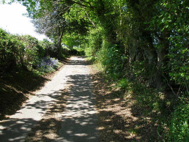
[19] The lane leading to Crowsley
[20] Path heading towards Sonning Common
[21] The Millennium Green, Sonning Common
I turned round, and made my way back to Crocker End, finishing the walk about 3.25pm.
This was yet another really good walk on a lovely day. There was a good mixture of woodland and field walking with a couple of sections of parkland, the countryside was pleasantly undulating, and there was the ruined church and Greys Court to add historic interest. Apart from the Buzzard near the start, there were numerous sightings of Red Kites. As well as the ‘usual suspects’, there were one or two more uncommon wildflowers, although I didn’t see too many butterflies today.
Total Distance: 125.8 miles each way