Pete's Walks - The Chiltern Way (2)
If you are considering walking this route yourself, please see my disclaimer. You may also like to see these notes about the maps and GPX files.
Day 23 4/06/07 Bledlow Ridge to Redland End (7.7 miles each way, approximately)
Parked in side street in Bledlow Ridge.
This was a very grey day weather-wise, completely overcast throughout the time I was walking. It started off a little misty, and there was a slight drizzle two or three times. It was supposed to brighten up as the day went on but totally failed to do so (in the evening, the weather forecasters on TV apologised for getting it wrong). It was a shame, as this meant I missed out on seeing some attractive views today. On the other hand, the grey and murky conditions had a strangely eerie feel, and were quite different to the conditions I’ve previously had on the Chiltern Way. At one point in the afternoon I noticed that everything I could see was either grey or green - grey skies, green fields, green trees. The green corn fields even seemed to have a grey tinge to them under the leaden skies. It was as if all the other colours had been sucked out of the universe, leaving only shades of grey and green.
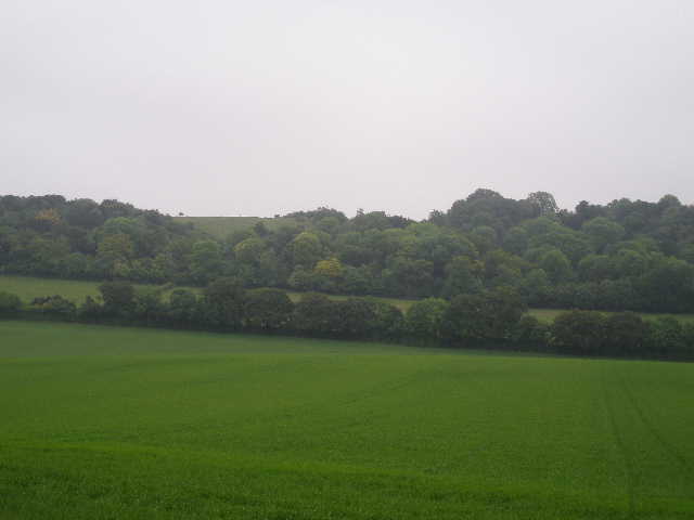
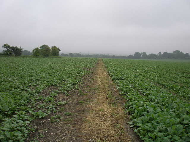
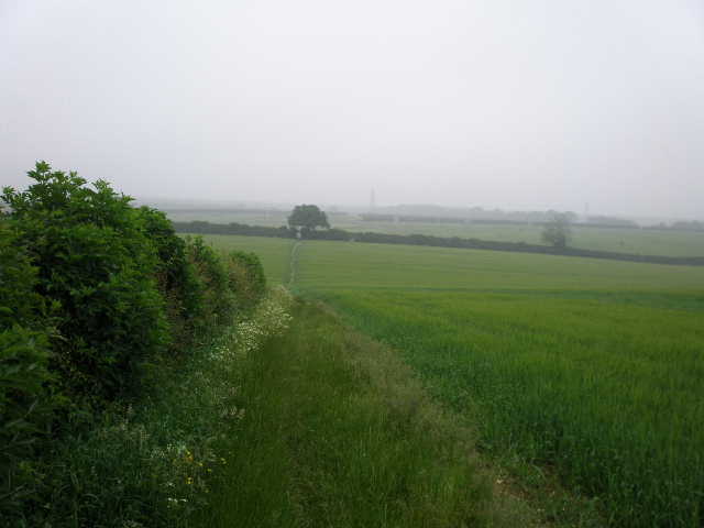
I started walking at 9.55am, first walking about 100 yards back along the footpath where I’d turned back on Saturday, two days ago. There was no stile or gate where the path reached the road, so I was probably sensible to have turned back rather than frighten the stray lamb out onto the road – there was no sign of it this morning, so presumably it was back where it belonged. I turned back and crossed over the road, then went down a gravel driveway opposite, which soon turned left. I passed the gateways to three or four houses, then, when the gravel drive ended at the gate to another property, the footpath continued between a left-hand wire fence and a hedge, with a meadow to my left where I saw a Red Kite. Over a stile, the path continued with a hedge now on the left and a wire fence and meadow on my right [1,2] – there was a profusion of yellow buttercups in the meadow, and a few wildflowers along the path. There should have been pleasant views to Lodge Hill and across the Saunderton Valley here, but the visibility was badly restricted by the grey mist.
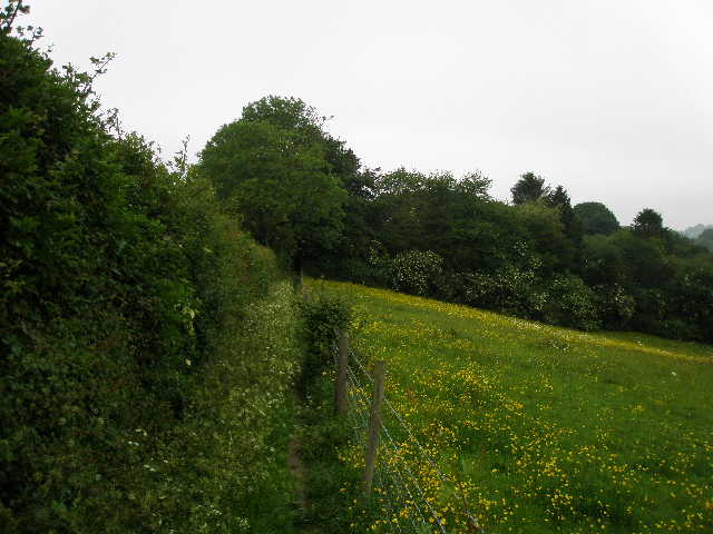
[1] Path beside meadow, leading away from Bledlow Ridge
[2] View across the meadow to the Saunderton valley (photo taken in the afternoon)
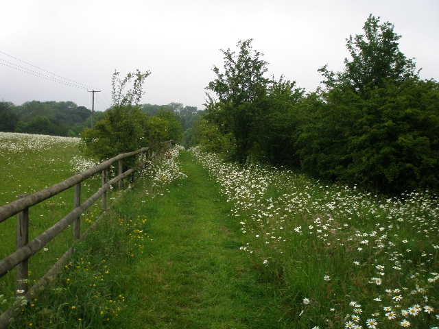
[3] Path beside paddock between Bledlow Ridge and Rout's Green - note the Ox-eye Daisies
There had obviously been some rain fairly recently, as all the vegetation along the paths was damp and my trouser legs were soon very wet – this would be an irritation on and off throughout the day. In the past this has lead to blisters – the wet trousers have caused my socks to get wet, so my feet got wet and therefore blistered. I’ve taken to wearing SealSkinz waterproof socks to avoid this problem – this was the first real test they’ve had, and I was pleased to find that they worked, my feet remaining dry and blister-free. Incidentally, I wear Bridgenorth CoolMax liner socks under the waterproof socks, and think they are tremendous at preventing blisters.
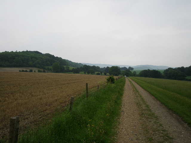
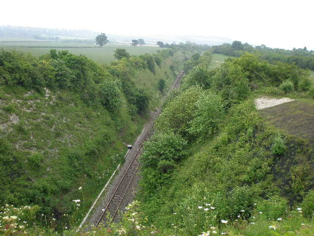
The path then crossed over a track and continued with a wooden fence and meadow on the left and bushes on the right. There were a large number of Ox-eye Daisies along the path and in the meadow [3]. Next the path crossed an irregularly shaped sheep pasture, going down and up the other side of a small dip. Again, views to the right over the Saunderton Valley were very restricted. In a corner of the pasture I went over a stile and followed an alley between garden hedges and fences to reach the hamlet of Rout’s Green. Here I turned left, and after a couple of hundred yards went right at a junction. This lane almost immediately turned left and stopped soon after, when I continued on a bridleway along a rather muddy track. The track went quite steeply downhill, running just inside the left edge of Neighbour’s Wood [4]. At the bottom of the wood, the bridleway levelled out and followed a hedge to the left of a large green corn field, with the wooded slopes of Lodge Hill ahead and slightly to the right [5].
[4] The track through Neighbour's Wood
[5] Lodge Hill, from the path to Callow Down Farm
[6] Looking back along the drive from Old Callow Down Farm, Lodge Hill on the left (afternoon)
I had now descended from Bledlow Ridge (that is the name of a hill as well as the village that is spread along the road at its top for about a mile and a half) into the Saunderton Valley. This valley is an unusual break in the long northern escarpment of the Chiltern Hills, about two miles wide, immediately south of Princes Risborough. Like the few other such gaps in the hills, such as at Tring and Dunstable, it is the route of a major road, the A4010 going south to High Wycombe. Lodge Hill is a small isolated eminence rising on the western side of the valley – the Ridgeway path goes over it, and so I crossed it at the start of Day 4 of my Berks-Essex Walk last summer.
I followed the bridleway, which had now been officially re-routed to go round Callow Down Farm, and soon passed Old Callow Down Farm. The bridleway now joined the farm drive which soon turned left, following a wire fence on the right with a narrow meadow on the right. Two years ago a Red Kite followed me as I walked along here, but today I only saw a Skylark and a Yellowhammer. I keep forgetting to mention the Skylark, which I have heard singing on almost every day of the Chiltern Way so far. I have a pet theory that it is in fact the same Skylark all the time – it’s the one that sang as I was lacing on my boots in the fog at Dunstable Downs at the very start of this walk, and it keeps popping up and singing along the way, to cheer me on. I’m very grateful for its encouragement!
At the end of the farm drive [6] I crossed a lane (Wigan Lane, Day 4 of my Berks-Essex Walk began at this lane, just a hundred yards or so to my right) and then went half right across a large meadow. I should have had good views across the valley to Whiteleaf Cross, a chalk carving of unknown origin, but everything was obscured in a grey haze. I crossed a stile and turned left, briefly joining the route of the Ridgeway. Almost immediately I went through a kissing gate in the fence on my left (it had a ‘Beware the Bull’ sign) into a very large hillside pasture, where I followed the fence and hedge for two or three hundred yards. There were several black cows with calves, but I didn’t see any sign of a bull (the sign has been there the three times that I’ve walked here and I’ve yet to see the bull). I then went over two stiles to cross through the hedge, and followed a path going half right and downhill, through a field of some sort of fodder crop. The path then went through a small thicket of bushes and continued across the field to a track. On the other side, I followed a right-hand hedge through two large fields of green corn, where I saw two more Red Kites. A short alley between garden fences then brought me to Church End [7], a lane in the village of Bledlow
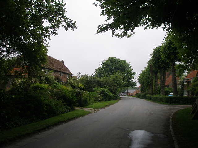
[7] Church End, Bledlow
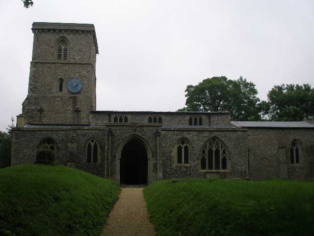
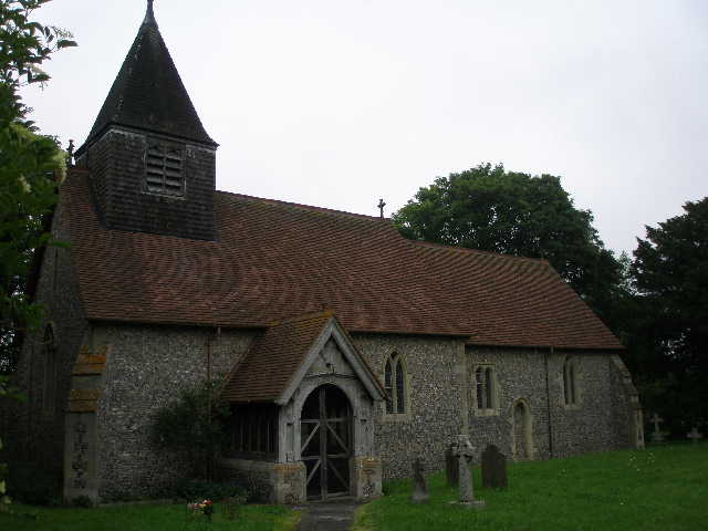
[8] Bledlow church
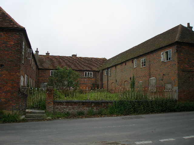
[9] Former Children's Home, Bledlow
The history of Bledlow dates back to at least 1012, and it is believed that the village was sacked by William the Conqueror’s army in 1066. The village church is largely unaltered from the thirteenth century, and contains a Norman font and fourteenth century murals.
I turned right along the lane, passing some sixteenth-century cottages with herring-bone brickwork and the church [8], which was on my left. The lane ended at a minor road (Wigan’s Lane again), where opposite there was a large brick building on three sides of a courtyard – apparently this was a former children’s home [9]. I turned right, and after two or three hundred yards, immediately past the last house on the left, took a footpath going half-left. This crossed a very large field of the same fodder crop I’d seen before. The path went in a clear line diagonally across the field [10], with the interesting blue flowers of Borage all along the path. On the far side I turned right into a hedge-lined track – this was Old Oddley Lane, a green lane along the parish boundary between Bledlow and Saunderton that probably dates back to the Saxons. After just 70 yards, I turned left and followed a path through a field of oil-seed rape (Doh! I have now discovered that the strange tangly crop with lots of very small seed pods is just oil-seed rape – this is what it looks like after the bright yellow flowers have gone) and then followed a farm drive a short distance to reach a bend in Oddly Lane.
[10]The path leading away from Bledlow
[11] Saunderton church
[12] Meadow leading towards the Old Rectory, Saunderton
I followed the lane ahead of me for about a quarter of a mile or so, to reach a T-junction – there was a Red Kite flying overhead here, and a lot of Green Alkanet growing beside the lane. I turned left for a few yards into the village of Saunderton, then turned right, following the sign pointing to the church. There were large ponds in the grounds or gardens either side of this small cul-de-sac lane, and I saw a Mallard on the roof of a cottage on my left. Saunderton is another village that consists of a number of hamlets, in this case spread across the valley that shares its name. It was obviously once a place of some importance, as there were once two churches here and the moat of a Norman castle still remains.
I turned left along a short path and went through a metal gate into the churchyard. The one remaining church here is dedicated to St Mary and St Nicholas [11], and dates from the thirteenth century, though much restored in the nineteenth century. It has its original font and some mediaeval tiles. Again I didn’t go inside – partly because of my wet and very muddy trousers, partly because the grey conditions meant that today was a day when I wanted to get the walk finished as quickly as possible. On the far side of the churchyard, a short path led through some damp vegetation, with the castle moat somewhere in the bushes to my right. I then reached a large meadow, dotted with yellow buttercups and white daisies, where I turned right and followed the edge of the meadow to a field corner. Here I crossed the single track of a railway line (the Birmingham bound track of the Chiltern Line) and then followed a right-hand hedge of another colourful meadow as it curved to the right [12].
At the end of the meadow I crossed a lane and went down the drive of a large property, the Old Rectory, then crossed a few yards of grass to a stile near a corner of its garden. A narrow path led me onwards through the long grass of a hay meadow, until I reached an intermittent line of bushes which I followed to the left – I was again briefly on the route of the Ridgeway. I went through a kissing gate and crossed over the entrance to a railway tunnel (the London bound track of the Chiltern Line) [13]. On the far side I reached a huge corn field, where I left the Ridgeway and went right, following the edge of the field beside the railway line [14]. Just after a slight kink in the field boundary, the Chiltern Way went left on a clear path through the green corn [15], passing the end of an old hedge and continuing across the field to the A4010 main road on the far side.
[13] View from above the entrance to the railway tunnel (afternoon)
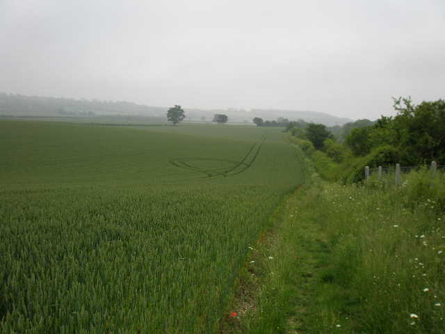
[14] Field path beside the railway line - the crop circle in the field was obviously created by 'Ancient people' (family joke)
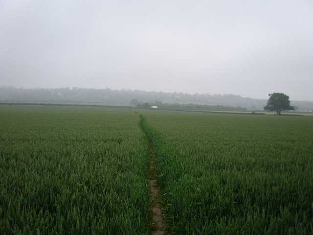
[15] Path through corn heading to A4010
On the other side of the road I followed a right-hand hedge for a short distance to a tarmac farm drive. I crossed the drive and followed a narrow path through some wet vegetation again, only to join the farm drive about 100 yards further on. I followed the farm drive to the right [16], with hedges now on either side. After a few hundred yards it turned slightly left, and started to go uphill quite steeply. I soon passed Collins Farm (no relation!) on my left with a paddock on my right, then continued uphill on a chalky path with a wall on my right and some Horse Chestnut trees on my left. This brought me to a white-painted wooden kissing gate and a road in the village of Loosley Row. I turned right along the residential street, then turned left to go steeply uphill along another street into the adjoining village of Lacey Green.
At the top of the hill I came to a crossroads by the Whip Inn, with Lacey Green windmill just behind it. The windmill is the oldest surviving smock mill in the country. It was originally built at Chesham in 1650, but was dismantled and rebuilt here in 1821, reputedly on the orders of the Duke of Buckingham. It was last used in 1920, and apparently became very dilapidated by the late 1960’s, before it was carefully restored by members of the Chiltern Society in the 1970’s and 1980’s.
[16] The farm drive heading towards Collins Farm and Loosey Row
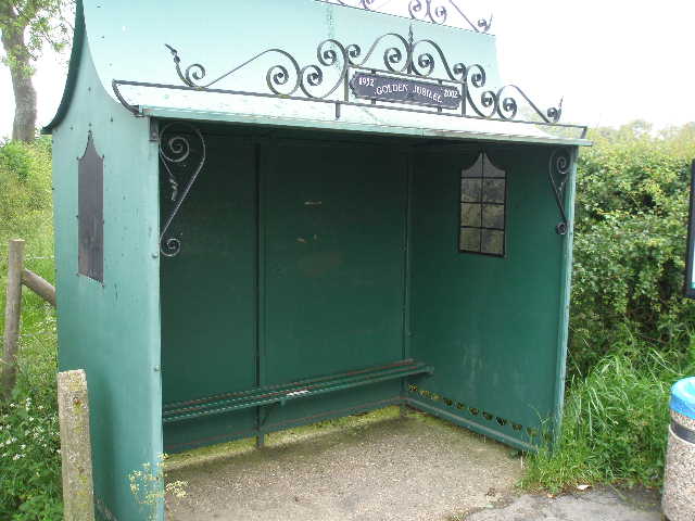
[17] Bus shelter, Lacey Green
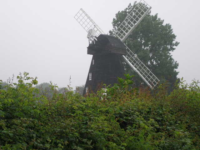
[18]The windmill at Lacey Green
I turned right along the road, then took a footpath on the left (by an ornate bus shelter that commemorates the Queen’s Golden Jubilee) [17]. I followed a hedge on my left through two recently mown meadows, passing the windmill on the other side of the hedge [18]. I continued along the hedge in the subsequent corn field [19], and when the hedge turned left I carried straight on along a clear path through the green crop. A stile then took me into a large paddock containing three or four horses. I went half right, eventually reaching another stile in the far corner of the paddock which took me to a crossroads of tracks. I continued in the same direction as before, following the track between more horse paddocks. I went through a gateway into a meadow of long grass, and followed a faint trail that led to a stile in the opposite hedge. The path then went half-right across the corner of another field.
I now went over another stile, to join what looked like a very muddy bridleway running between small banks surmounted by mature trees and holly bushes [20]. In fact, this was a section of Grim’s Ditch, one of several ancient earthworks with that name. It is thought to pre-date the Saxons, on the grounds that Grim is another name for their god Wodan, and it is unlikely that they would attribute something to one of their gods that they had built themselves (I’m not 100% convinced by that argument myself, but archaeological evidence at certain sections of Grim’s Ditch has proved it to date from the late Iron Age). The earthwork wasn’t really very evident here, and I was only aware of it because I’d read about it in the guide book. I turned right, and followed the bridleway about 200 yards to where it met a crossing track by a substantial brick building.
[19] Path leading away from Lacey Green
[20] Bridleway along Grim's Ditch
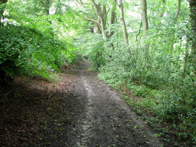
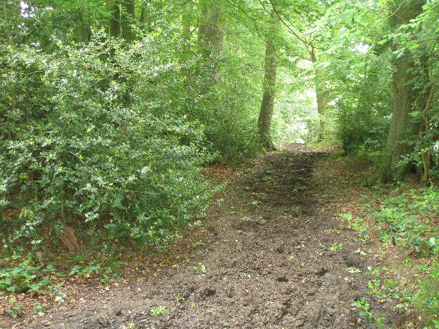
[21] Path through woods, near Redland End
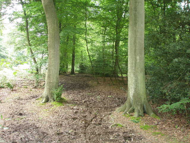
I went a few yards left, then took a path going right, initially along the gravel drive of a house and then entering Monkton Wood. Apparently the path here was also along Grim’s Ditch, but again I saw no real evidence of an earthwork. It was muddy in places as I made my way through the trees [21], emerging after a few hundred yards at a T-junction. Here I followed the lane ahead, with woods still on either side, to reach another junction in the hamlet of Redland End after about a quarter of a mile.
It was about 12.40 as I turned round and started to make my way back. After another 15 minutes I stopped for lunch, sitting on a stile just before the large meadow of long grass. It had been drizzling on and off during the morning, but was dry now. The skies were still completely grey, and the visibility was slightly limited by a very slight mist. The drizzle returned occasionally in the afternoon, and I had a few heavier spots of rain just as I got back to Bledlow. Getting back towards Bledlow Ridge, the visibility was a little better than it had been in the morning, but the views across the Saunderton Valley were still very limited.
This was another good walk. I remember that when I did the Chiltern Way two years ago, I wasn’t looking forward to this walk as much of it effectively goes round two sides of a triangle, meaning that I walked a long way but ended up not too far from where I started. However, when I actually did the walk I enjoyed it, and I did so again today. It was a shame that the grey and slightly misty conditions prevented me seeing some good views, both across the Saunderton Valley and northwards across the Vale of Aylesbury, but the conditions were rather eerie and atmospheric, certainly different to the other days I’ve had so far on this walk.
Total Distance: 171.3 miles each way