Pete's Walks - The Chiltern Way (2)
If you are considering walking this route yourself, please see my disclaimer. You may also like to see these notes about the maps and GPX files.
Day 24 6/06/07 Redland End to St Leonards (7.3 miles each way, approximately)
Parked in Redland End.
This was another grey and overcast day, but without the drizzle or mist that I had on the last walk. Again the weather forecast said it would brighten up later, but it wasn’t until very near the end of the walk that I saw any patch of blue sky. Since passing through Goring on Day 19 I have been getting progressively closer to home, so my journey times have been steadily decreasing. Consequently I was able to start walking at 9.45am.
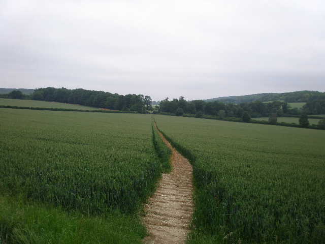
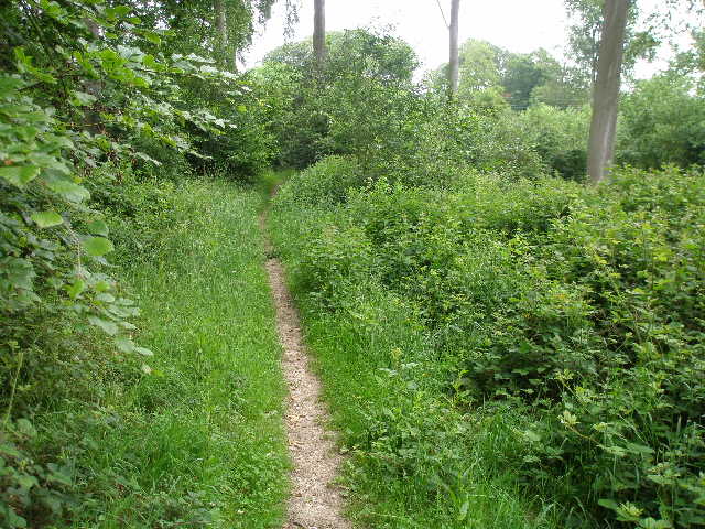
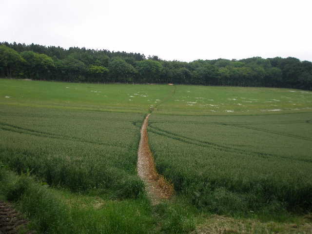
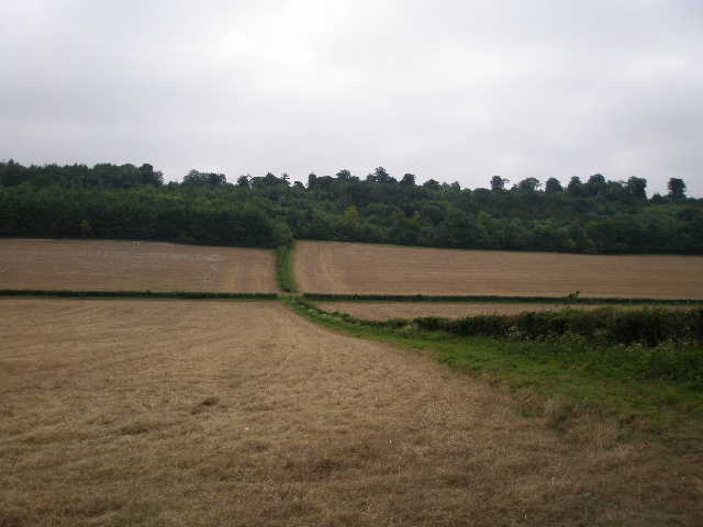
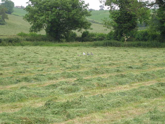
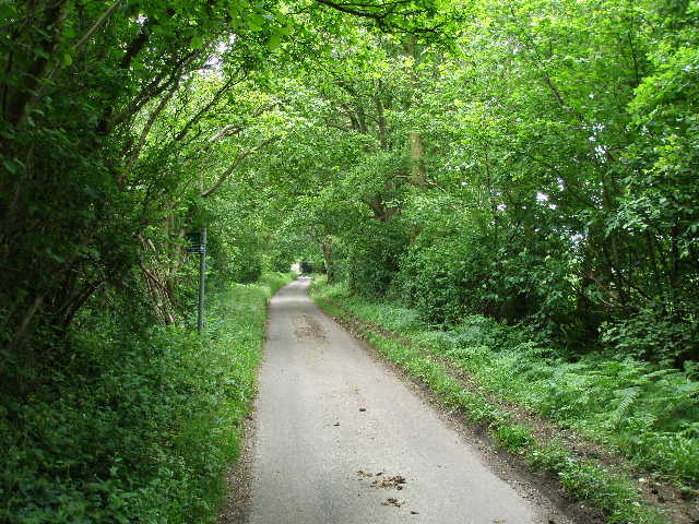
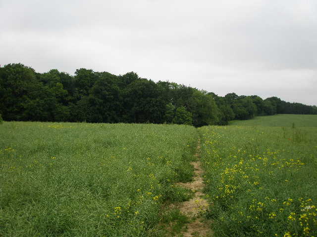
From the tiny hamlet of Redland End, the Chiltern Way continued through another wood, Kingsfield Wood, again on the line of Grim’s Ditch [1] which I’d followed towards the end of the last walk. The ancient earthwork was now visible on the ground, a slight bank between small ditches. After a short distance I took a right fork, still in woodland but now passing through Barnes’s Grove. On the far side of the wood I reached a large corn field – this area had obviously once been part of the parkland surrounding the nearby Hampden House, as it was dotted by occasional mature trees and even had a small clump of trees in it. A clear path went half-right to cross the large field diagonally [2]. I followed it through the green corn, passing a tree on my left and then passing through the clump of trees in the middle of the field, where I saw a Buzzard fly off. The path eventually reached a corner of the field, where I went through a gate and followed a track between fences towards Hampden House.
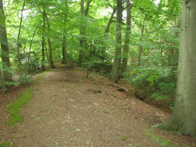
[1] Path along Grim's Ditch in Kingsfield Wood

[2] Path through corn field, heading towards Hampden House
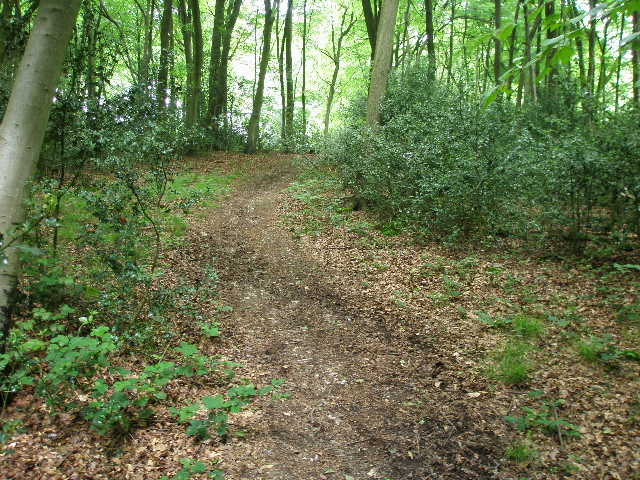
[3] Path through Lady Hampden's Wood
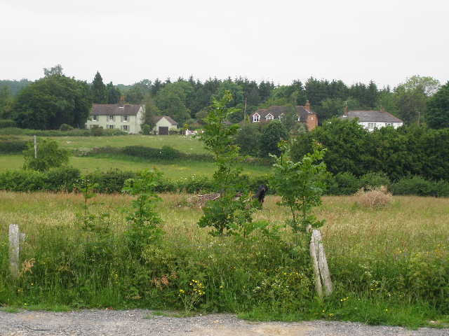
After a short distance, I turned left over a stile to take a path that went across in front of Hampden House, near a ha-ha on the edge of its garden. I passed two lady walkers here and we all commented on the fact that the house looked somewhat artificial, like a wedding cake or something from a fairy-tale. I wondered if the style of architecture was ‘Strawberry Hill gothic’, as it reminded me of Nether Winchendon House which I passed on the Bernwood Jubilee Way earlier this year – I was pretty close, as the web site for the house mentions that the remodelling of the north and west sides by Thomas Iremonger in 1750 pre-dates the work of Horace Walpole at Strawberry Hill by 15 years. The main body of the house is Elizabethan, but the oldest part is the fourteenth century King John’s Tower. The house was the home of the Earls of Buckinghamshire until 1938, and it was subsequently used as a girl’s school and then as a set by Hammer Horrors. It was bought by the Hampden Group in 1986 and carefully restored over the next three years, the restoration winning an award from the Sunday Times for Country Houses brought back to life.
An earlier resident of Hampden House was John Hampden – he was arrested in the house’s Brick Parlour for non-payment of Ship Money, this being a key event in the lead up to the Civil War. John Hampden was a cousin of Oliver Cromwell, and came from a distinguished family that had held the manor of Great Hampden since before the Norman Conquest. He was the leading figure amongst the Parliamentarians opposed to Charles I, and died in 1643 after being wounded at the battle of Chalgrove Field. You can read more about him here - http://www.johnhampden.org/biog1.htm (my usual caveat about not being responsible for external web sites applies). I have come across several places linked to John Hampden on other walks, such as the church at Great Kimble on the Aylesbury Ring. I didn’t take a photo of the house, as I feel it as an invasion of privacy to photograph private residences – as I’ve now discovered that it is owned by a company, I wish I had taken one. However you can take a virtual tour of the house at http://www.movingeye.com/hampden/start.html (again my usual caveat about not being responsible for external web sites applies).
[4] Path from Lady Hampden's Wood descending into Hampden Bottom
[5] Looking along Hampden Bottom
[6] Path through Coach Hedgerow
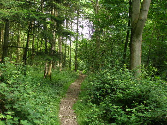
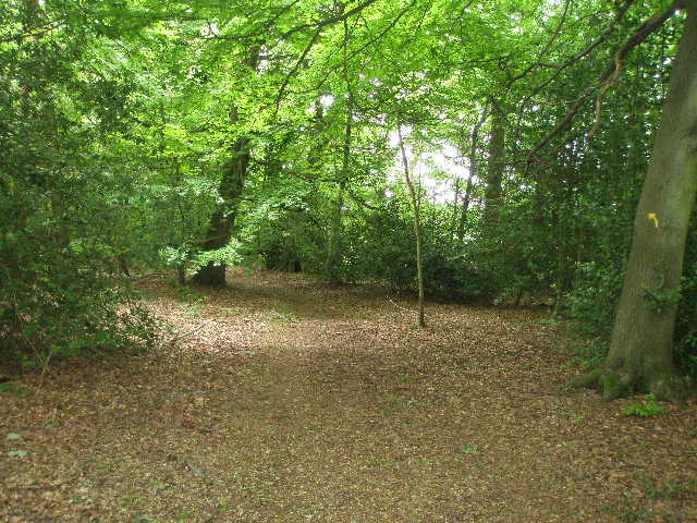
The path soon took me into Lady Hampden’s Wood [3], where it gradually descended between wire fences. The sun broke through the grey clouds very briefly here, but was soon gone again. To my right, the wood was deciduous, but on my left the wood was coniferous, and I spotted an impressive Redwood tree here on my way back. On the far side of the wood [4], the Chiltern Way continued on a clear path through another large green corn field, descending half left to the floor of a large valley called Hampden Bottom [5]. I crossed over a road, and followed a path opposite that ran uphill through a belt of trees called Coach Hedgerow [6]. I saw a lot of Herb Robert here, as I would in many places on this walk. After about a third of a mile, I left the belt of trees and crossed part of a corn field and then a meadow [7] (where there were several Ox-eye Daisies) – on the far side I came to an impressive seat carved from a tree trunk [8], positioned to have a good view over Hampden Bottom [9]. I then continued uphill through a thin section of woodland. The Chiltern Way then went right, on a permissive path along the edge of another corn field, before entering Warren Wood. I followed a path going left through the trees, soon emerging on a track that led past a few cottages to the long cul-de-sac lane through Little Hampden.
[7] Path from Coach Hedgerow towards Little Hampden
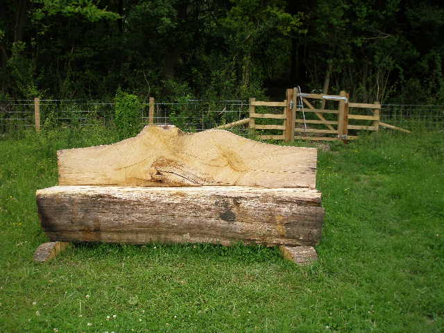
[8] The seat<
[9]View back over Hampden Bottom to Lady Hampden's Wood, from the seat<
Little Hampden has often been described as the remotest settlement in Buckinghamshire. It sits on a high ridge and is accessible only by a single dead-end lane that branches off a minor road between Whiteleaf and Great Missenden. The village has a thirteenth century church (with an unusual two-tier porch and some wall paintings – I didn’t pass the church but would like to visit it sometime) and a popular pub, the ‘Rising Sun’ (Update 22/10/18: sadly this has now closed). There is a good network of footpaths radiating from the village, making it popular with walkers. The South Bucks Way also goes through here, and I would be sharing its route for the next mile or so.
I crossed the lane and continued on a path through another wood, soon forking right and heading downhill. On emerging from the trees [10], I followed a hedge on my right through a meadow. At the bottom of a small valley, the path switched to the other side of the hedge and continued uphill. Near the top of this meadow I saw a clump of Common Rock-Roses beside the path, and I saw another Buzzard here on my way back. There were nice views here, along the small side valley towards Hampden Bottom. I entered another small belt of trees, part of Hampdenleaf Wood, and continued uphill to a stile. I then crossed a narrow pasture where three bullocks grazed, and crossed two further stiles to reach a track, where I went right to reach a lane in the hamlet of Cobblers Hill. When I came through here almost two years ago on the South Bucks Way, I signed a petition here protesting against an application to open up some of the local bridleways to 4x4 vehicles. I saw a faded notice about the petition, but no sign saying whether or not it had been successful.
[10] Field path crossing the valley between Little Hampden and Cobblers Hill
[11] Path through Cockshoots Wood near Cobblers Hill
[12] The railway line, just before Wendover Dean
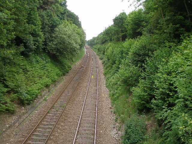
Across the lane I followed a driveway a short distance, then turned off the route of the South Bucks Way by turning left into yet another wood, Cockshoots Wood [11]. The path went gradually downhill, turning to the right and then later more sharply to the left. It then turned right, following a sunken lane that descended more steeply through the trees. Exiting the wood, I followed a grassy track between hedges for a short distance. The track soon became a stony farm track as it crossed a bridge over a railway line (part of the Chiltern Line again) [12,13]. I then went through a couple of gates and crossed some parkland in front of Mayortorne Manor (according to the guide book, a late eighteenth-century house that was once home to the noted Chiltern writer H.J. Massingham). There were some dark brown sheep with long horns grazing here. I next crossed a couple of paddocks, and went over a stile to reach a main road (the A413 between Wendover, to my left, and Great Missenden and the Chalfonts to my right – this was a road I used to get to some of my earlier walks).
I was now in Wendover Dean, so named because it was once owned by the Dean of Wendover. I walked a few yards to my left, then crossed the busy road and went down Bowood Lane. Where this came to a T-junction with another lane, I went over a stile almost opposite, and crossed a large pasture where there were some cattle over to my right. I crossed two stiles either side of a track, then went through an area where assorted farm machinery and implements were scattered, before crossing a recently mown meadow, where I saw about half a dozen Guinea Fowl amongst the hay [14]. I then followed a tractor track through another arable field to a stile in a hedge. The Chiltern Way then took me half-left, ascending quite steeply across a hillside through another large corn field. At the top of the hill [15], I went through two gates either side of a lawned area beside an isolated white house.
[13] Looking back towards Cockshoots Wood from the railway bridge<
[14] Guinea fowl in a hay meadow, near Wendover Dean
[15]View back over Wendover Dean towards Cockshoots Wood
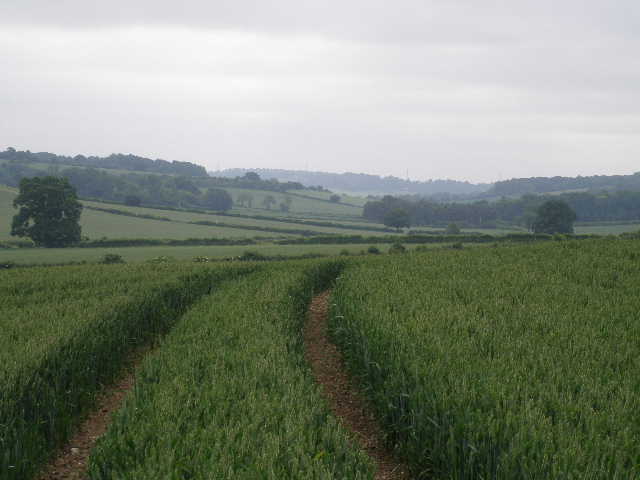
Across a narrow lane, the Chiltern Way continued through another arable field – I wasn’t sure what sort of crop this was, it didn’t seem to be as well advanced as most of the other corn or wheat fields I’ve been through [16]. The path had only just been cut, as had the other paths that came in from either side as I crossed this and the subsequent similar field – another path alongside the hedge separating the two fields was part of the route of the Chiltern Link (see my separate journal). After the second field, I turned left beside a hedge in a totally overgrown field, passed some dilapidated farm sheds on my right and crossed the car park of The Gate pub to reach a road in Lee Gate. The Lee is an upland parish that I have visited on several of my walks (most recently on the Chiltern Heritage Trail) – it consists of a number of hamlets, this one taking its name from the pub.
I went right for a few yards, then turned half-left along a track. It almost immediately turned further left, but I continued in the same direction across a field that obviously hadn’t had a crop for several years – it was all long straggly grass and an abundance of different wildflowers and weeds. The path crossed it in a straight lane, then went over a stile in a hedge and continued across another rather overgrown meadow where I was surprised to see three lambs. Two or three further gates or stiles led me to a track, where I turned right, passing a few houses (one of which was having a new roof put on and an extension added) to reach a lane in Kingswood, by another pub (the Old Swan). Kingswood is another of the hamlets in The Lee.
[16] The footpath leading towards Lee Gate
[17] The path leading away from Kingswood
[18] Arrewig Lane
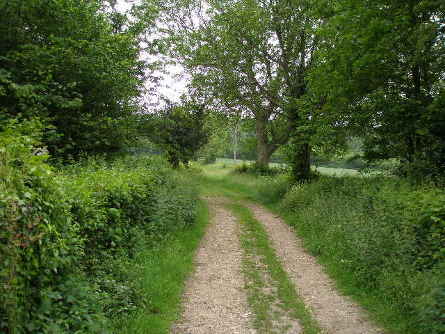
I crossed the lane and took a path almost opposite, which followed a long narrow strip of grass between a hedge and a wooden fence on my left [17]. Beyond the fence was a meadow descending into a small valley with a few houses near the bottom. At the end of the grass area, I went over a stile and turned left on a bridleway. Where it almost immediately turned right, I continued ahead over another stile, entering a paddock containing a single horse. I followed the left-hand hedge and crossed another stile into a second paddock, this time with two horses. I carried on alongside the hedge, descending slightly to a stile into a wood. The path here went half-right through the trees. It soon emerged onto the edge of a corn field, which it crossed on a clear path. On the far side I went through a hedge gap, and turned left to follow the hedge beside another corn field.
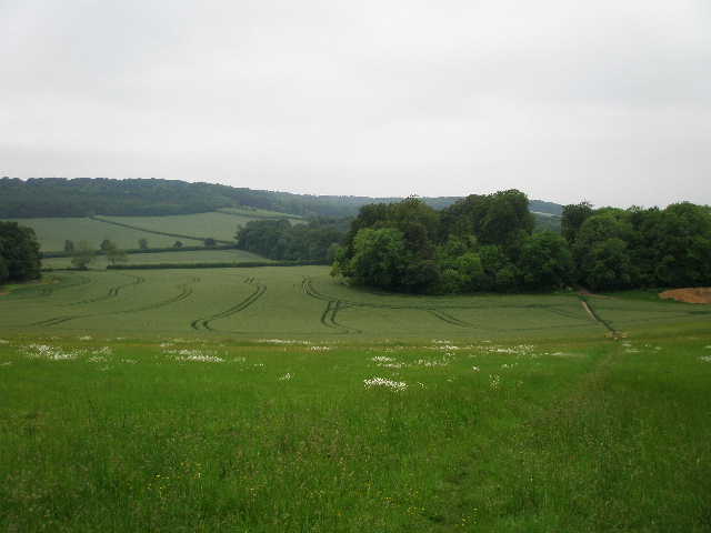
This path took me to Arrewig Lane [18], which follows the ancient parish boundary between Wendover and Aston Clinton – it dates back to the Saxons and its name is thought to derive from the Saxon for ‘way to the arable fields’. I followed the lane for a very short distance to the right, before taking a path on the left which crossed a field of oil-seed rape (green tangly stuff with small thin seed pods, just one or two yellow flowers left). The Chiltern Way then went through a small wood, Lady Grove [19], and continued across another field of oil-seed rape [20]. On the far side I joined a track that ran between hedges, soon becoming tarmac as it passed a farm and then Dundridge Manor (complete with moat and drawbridge – a manor house is thought to have existed on this site since Saxon times). At the end of the tarmac drive I turned left onto a lane. I followed the lane round a corner to the right, then turned left at a junction. In just two or three hundred yards I reached the White Lion in St Leonards [21], my turn-around point for the day. It was now 12.15pm, the walk so far having taken 2½ hours.
[19] Path though Lady Grove
[20] Path between Lady Grove and the track to Dundridge Manor
[21]View from St Leonards towards Buckland Common
I had a late lunch about 1.30pm, on the edge of Cockshoots Wood just past Wendover Dean. It remained grey and cloudy, though the sun did eventually come out and I saw one or two patches of blue sky before I got back to my car just before 3pm.
This was a very pleasant walk, despite the grey skies. There was nothing too exceptional or different about it, but it was just another good walk through typical Chiltern scenery of rolling hills and valleys, woods and fields. It went through some remote hamlets, and passed three old manor houses. I enjoyed the walk very much. My one disappointment was that I did not see any Red Kites today, the first time I’ve not seen any since Day 12. When I did this walk two years ago, I saw one over Lady Hampden’s Wood – this was the last one I saw on the Chiltern Way. As they have obviously increased in numbers and spread out more over the last couple of years, I was hoping to see them further east today. Still, maybe I’ll see them on my last two walks – apparently our neighbour Tony (the chap brought up in Mapledurham) has seen a Red Kite from his garden! It’s only a matter of time before I get to see one in Kensworth, I’m sure. (Update 28/02/02 : I finally saw a Red Kite in Kensworth on 17/02/08)
Total Distance: 178.6 miles each way