Pete's Walks - The Chiltern Way (2)
If you are considering walking this route yourself, please see my disclaimer. You may also like to see these notes about the maps and GPX files.
Day 25 9/06/07 St Leonards to Berkhamsted Common (7.0 miles each way, approximately)
Parked in Buckland Common.
I parked in Buckland Common and started the day by walking the quarter mile back to the White Lion in St Leonards. It was 9.25 when I started walking, my earliest start for a long time – it seemed very strange not even having to drive as far as Wendover to get to the start of this walk. The weather forecast for today said there might be isolated showers and even a slight risk of thunder, with the temperature around 23-24C – it had already reached 17C when I left home. In fact, it would remain remarkably humid all day, very muggy under hazy clouds most of the time, although it would become quite sunny in the afternoon.
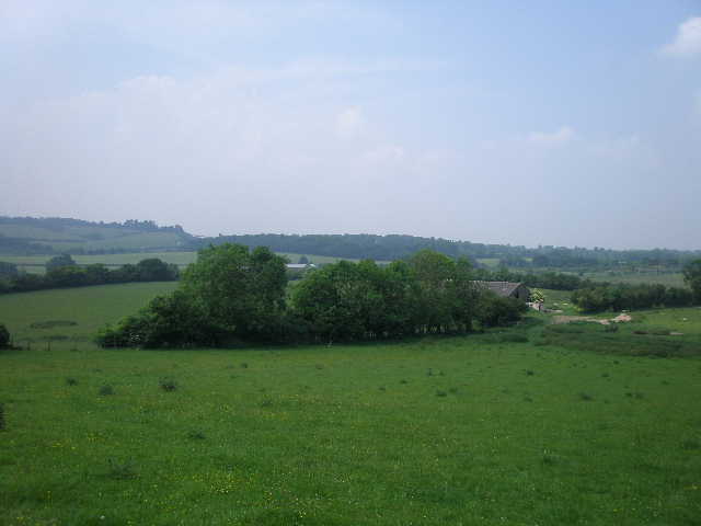
From the car park of the White Lion pub in St Leonards I followed a footpath across a meadow [1], descending slightly. I crossed over a lane, then went half-right across another meadow to reach a second lane (my car was parked to the right, where the two lanes met in the centre of Buckland Common). I turned left, passing a house on my right that had once been the ‘Boot and Slipper’ pub. Where the lane turned slightly right, I went over a style and continued ahead on a clear path through a cornfield. I then went over a driveway or track, and carried on alongside the right-hand hedge of another meadow [2] (there had been horses here when I did this walk almost two years ago). I saw an attractive clump of Foxgloves here. Across a stile in the far hedge, I turned right to follow the hedge with a large meadow of long grass and then Drayton Wood on my left.
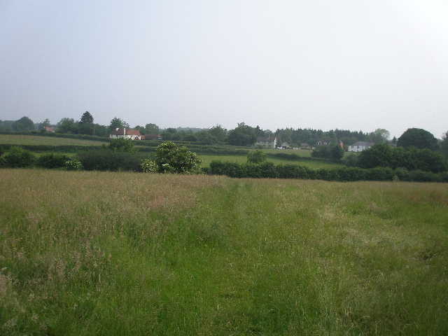
[1] Path through meadow between St Leonards and Buckland Common
[2] Path through meadow near Buckland Common
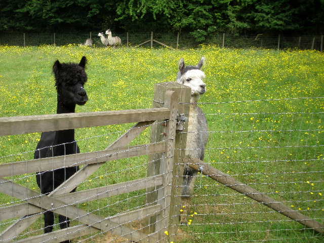
[3] Llamas near Buckland Common (Update 15/07/07 correction - these are alpacas, not llamas, I was misled by the guide book)
I went then went over another stile into an enclosed path, going half-left between a fence and a right-hand hedge. Here I got a bit of a shock. The guide book mentioned, and I remembered from my previous walk, that the next couple of fields would contain llamas, so if there had been some llamas blocking my path I would not have been too surprised. But no – what was now blocking the path was a large black pig! It was happily munching some grass at the foot of the fence, so that its body extended across the path with its rear end virtually in the hedge. It was quite docile, but had no intention of moving, so I had to resort to somehow squeezing between the pig and the hedge. Further on down the path, where it widened slightly, I passed a second pig (white with a black patch). They were obviously kept more as pets than farm animals, and on my way back I saw there was an open gate in the hedge that led into an enclosure for them. The path descended slightly then rose slightly. There were llamas in the fields on the left, a couple of them came over to me inquisitively as I took some photos [3]. Where there were gaps in the hedge I saw more llamas in the field on the other side. (Update 15/07/07 - correction, these were alpacas, not llamas, I was misled by the guide book. My fault, I should have checked. At least I now know the difference - llamas are bigger and have banana-shaped ears).
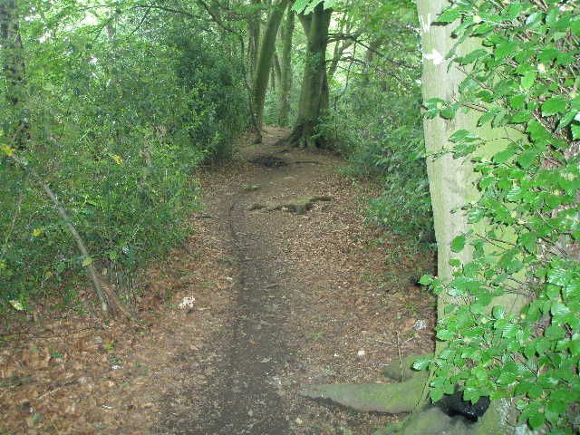
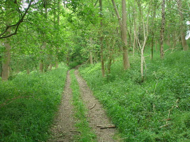
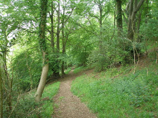
I went over a stile into Drayton Wood, following the waymarked path [4]. This was a deciduous wood, with quite a lot of holly. The path kept left at one junction, then went right at a second. I then left the wood at a further stile, and followed a short path between the fences of two paddocks to reach a lane. This was Shire Lane, so called because it formed the ancient boundary between Buckinghamshire and Hertfordshire – I had followed part of this lane, a little way to my left, as part of the Ridgeway section of my Berks-Essex Walk last summer. The path continued on the other side of the lane, going half-left through a small area of wood and continuing on the same line across a section of a corn field to a projecting corner. The path now went half-left again, along the edge of the field to reach a long thin belt of trees going off to the right.
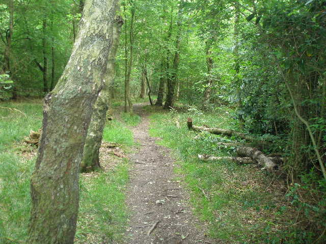
[4] Path through Drayton Wood
[5] Path along Grim's Ditch
[6] Path along Grim's Ditch, just before the road crossing
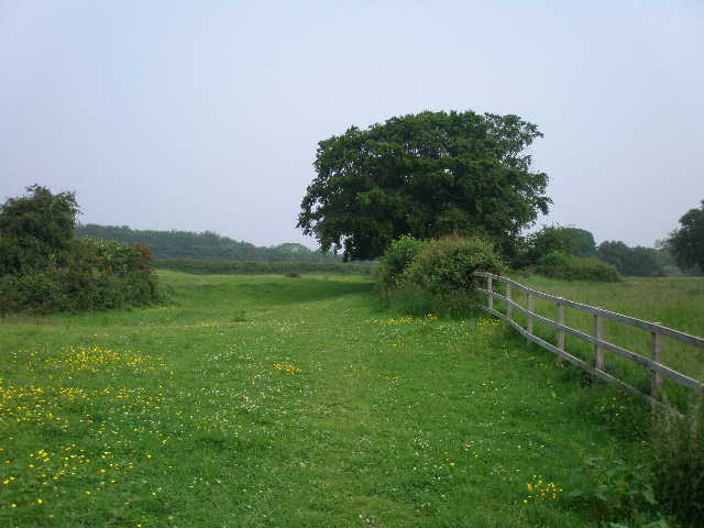
Both the guide book and the map indicate that the path should now have turned right along the near side of the tree belt. In fact there was no sign of a path there, and instead a waymark pointed down a clearly well used path through the middle of the trees. I was now back on the line of Grim’s Ditch again [5], the third successive walk where I have come across this ancient earthwork. There was a pronounced bank here, as I followed the path through the trees – mainly beech, with a lot of holly again. The tree belt ended at a crossing track – this way Brown Lane, an ancient highway. The Chiltern Way continued on a track across a corn field, and then continued along Grim’s Ditch through a short section of Shrubb’s Wood [6].
Across a minor road, the path continued on the line of the earthwork (heading slightly north of east), at first through an area of beech wood then through another long belt of trees, with fields of oil-seed rape either side. After a few hundred yards, the tree belt ended (on the way back I saw some Lesser Stitchwort here for the first time – nice to see it at last having seen so much Greater Stitchwort on the Chiltern Way, including today). There was now a large flower-filled meadow on my left, as I followed a line of gorse separating me from a corn field on my right [7]. At a crossing hedgerow I turned right for a few yards (a fallen tree necessitating a diversion into the corn field), then went through a gate in the hedge and crossed another meadow to reach a road on the edge of Wigginton Bottom. I crossed the road and took a path starting a few yards to the right. This went through a small copse, passing between two ponds, and then followed a path between a wire fence and a right-hand hedge. This path had been allowed to become rather overgrown, and it was inevitable that I’d get a few nettle stings.
[7] Looking back along the line of Grim's Ditch, from near Wigginton Bottom
[8] Path through Lower Wood, Wigginton Bottom
[9] Paddock between Lower Wood and the A41
I turned right along a lane at the end of the path – the hedgerow on the left here was quite colourful, with pink Herb Robert, the mauve of some type of vetch, the bright blue of Germander Speedwell and the white and yellow of daisies and buttercups. After a very short distance I took a path on the right, following the right-hand hedge of a very narrow meadow. In the far corner, a path between hedges led to a gate into Lower Wood [8]. The path now descended fairly gently as it curved slightly left – I saw some Broad-leaved Willow-herb here in the afternoon. At the bottom of the hill I came to a junction, where I turned right for a few yards and left the wood at a gate.
I was now in a large paddock containing four or five horses [9]. I followed the path along the bottom of a small valley, with an electric fence on my left separating me from another paddock. The Chiltern Way next crossed a corner of a corn field, and then turned right down a hedge-lined track which soon became a concrete drive. This was more or less parallel to the A41 dual carriageway on my left, and I could see the busy road stretching out ahead of me. On my right I saw a large bird over the corn field – I was somewhat disappointed that it was clearly a Buzzard, as I was still hoping to see more Red Kites on this walk. The concrete drive soon ended at a minor road, where I turned left to pass under the dual carriageway.
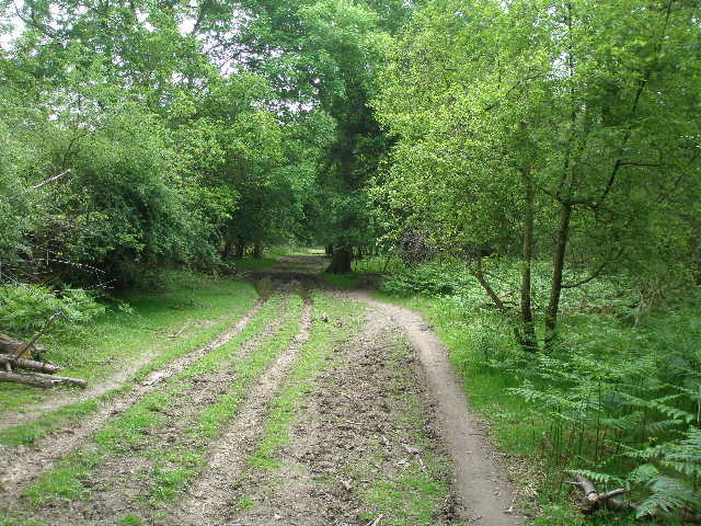
[10]The track leading to Cow Roast
[11] Grand Union Canal at Cow Roast
[12] Grand Union Canal at Cow Roast
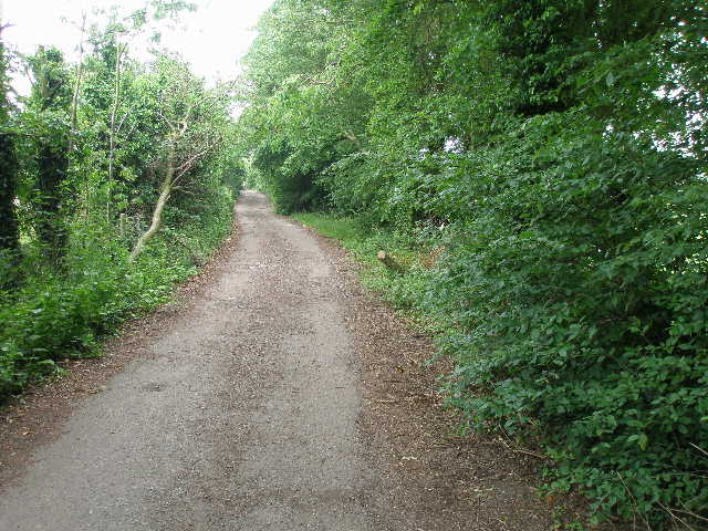
As the road started curving left I took a path going right, at first along the drive of a house and then along a track between hedges. I had to wait very briefly as a tractor with some sort of cutting gear behind it was having difficulty squeezing down the narrow track. It soon turned off into a field on the left, and I followed the tarmac track onwards [10]. There were cricket and other pitches behind the hedge on my right, and on my left I passed a circle of tents and caravans (an event for the North London branch of the Caravan Club, according to a sign). The track ended on a road (the A4251, the old A41 before the dual carriageway, on the line of the Roman Akeman Street), just to the left of the Cow Roast Inn in the village of Cow Roast. The name is thought to have originally been Cow Rest, denoting a stopping place for cattle drovers on their way to London.
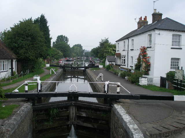
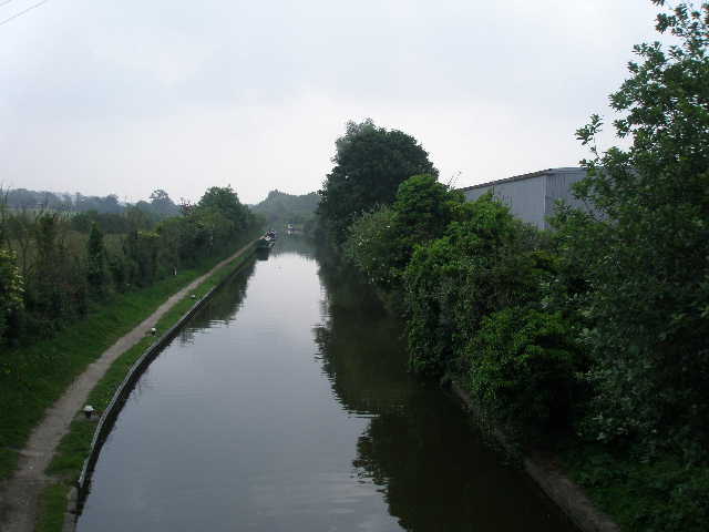
I took a lane almost opposite the pub, soon crossing the Grand Union Canal – there was a lock on my left, and what was presumably once a lock-keeper’s cottage [11,12]. The lane turned to the right, and after about 150 yards I went over a stile in the hedge on my left, and crossed a field of barley on a clear path. I then crossed a bridge over a railway, the West Coast main line – a busy route, as I saw several trains while I was walking the next mile or so. The path went through another barley field, then went right on a bridleway a short distance before turning left on a track leading to Norcott Court Farm. I turned left into the farmyard but then turned immediately right. I then turned half-left on a narrow path through the long grass of a hillside meadow [13]. The path rose steadily across the hillside to the far corner of the meadow. There were pleasant views back over the valley with its various transport routes [14], and I could see the impressive footbridge carrying the Ridgeway over the A41 – unfortunately, it was very hazy in the humid conditions and so my attempts to take a photo were not very successful (there’s a photo of the footbridge in my journal for Day 6 of my Berks-Essex Walk).

[13]The path from Norcott Court Farm
[14] View from near Norcutt Court Farm
[15] Bridleway leading uphill towards Tom's Hill
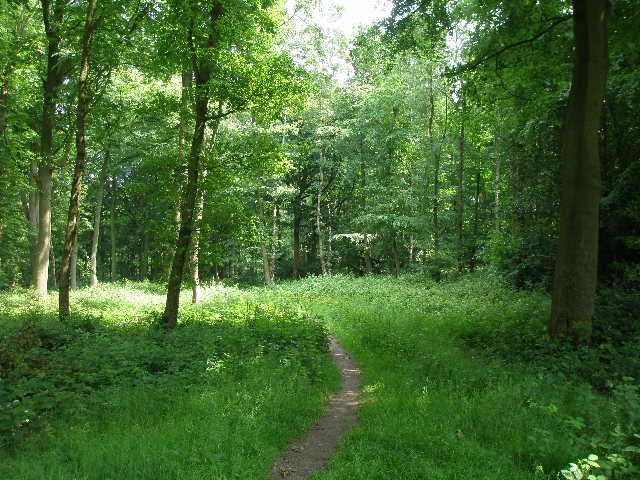
The path next followed a right-hand fence, then hedge, with a cereal field on my left and meadows to my right. The path then went through the hedge and over a stile, and again climbed steadily across the hillside aiming for the far left corner of another meadow – this one with shorter grass and many small wildflowers including some type of Trefoil and some Scarlet Pimpernel (I finally managed to get a reasonably well-focussed photo of this lovely small red flower). Over a stile into a corner of a pasture, I almost immediately turned right through a gate. I now went straight uphill through woodland at a fairly easy gradient, following a bridleway on a wide track [15]. When the gradient eased, I soon went through another gate, where the woodland ended and I had a small meadow on my left. I noticed some tall type of Vetch here, and some Woody Nightshade. The track soon became concrete and passed a small industrial site on my right, then went past a couple of houses on my left and a mansion on my right that was being redeveloped, or at least having some major building work done. This was the small hamlet of Tom’s Hill. The skies were now looking very grey, and as it was so very humid I thought I might be in for a thunder storm before too long.
I was now on a tarmac drive, and as I re-entered the woods I crossed the route of the Hertfordshire Way [16]. I now felt that I was on home territory, as one of my local walks takes me through this part of the Ashridge estate. The woods either side of the drive were carpeted by a plant with many large leaves and a few yellow flowers, which I later identified as Small Balsam. The drive soon came to a hairpin bend on Tom’s Hill Road [17], which goes from Aldbury to Berkhamsted Common, joining the road from Dagnall to Berkhamsted. I carried on a short distance, then took a path going left at an easy gradient down through the trees towards Aldbury [18]. I had occasional glimpses through the trees on my left over the village towards the wood-topped hill of Aldbury Nowers.
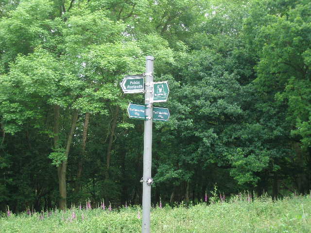
[16] Signpost where the Chiltern Way and Hertfordshire Way cross at Tom's Hill
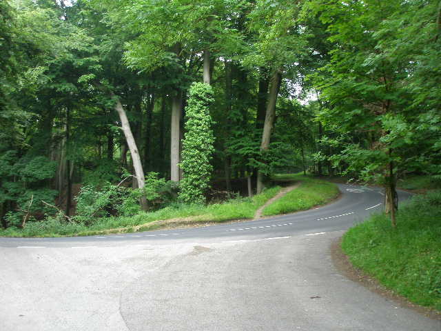
[17] The hairpin bend on Tom's Hill Road
[18] The path leading down from Tom's Hill to Aldbury
The Chiltern Way doesn’t really visit Aldbury, turning right just before reaching the end of Malting Street on the edge of the village. Most walkers who have not been here before would no doubt take a short diversion to visit the centre of this very attractive village – a honeypot for tourists, and frequently used in TV and films As the guide book says, it really is a picture-postcard village, with its duck pond and stocks surrounded by sixteenth- and seventeenth-century cottages (there is a photo on Day 9 of my Hertfordshire Way journal). Having been here so many times before, I just continued along the route of the Chiltern Way, now climbing steeply back up the hill through the trees. I soon crossed over Tom’s Hill Road and continued steeply uphill on the other side. The path went half-left at a five-way path junction, but soon turned right. The climb was quite steep, but didn’t go on for too long, and the path soon flattened out as I neared an isolated cottage in the woods (I crossed the route of the Ashridge Estate Boundary Trail just before the cottage).
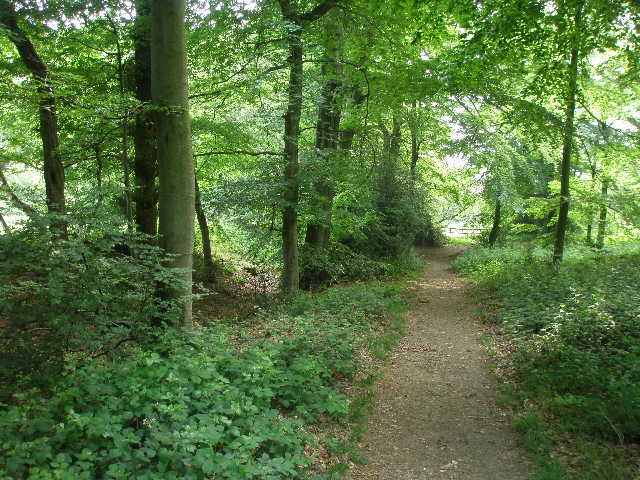
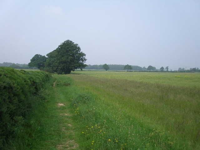
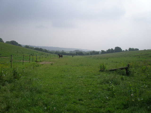
The path now continued on a broad and rather muddy track through the trees. The woods here are predominantly beech, but with other deciduous trees and some holly [19]. I passed a very large oak tree at one point on my left, and saw more Foxgloves too. I met three horse riders coming the other way, just before I reached the B4506 road to Berkhamsted. On the far side of the road I continued on a good path, with a low bank on my left, along an avenue of mature beech trees [20] – this is a much photographed spot, often appearing on calendars and in magazines, usually when the trees are at their best in the golden colours of autumn. I followed the avenue for about quarter of a mile, now in Berkhamsted Common rather than Ashridge (according to the guide book, anyway – not 100% sure about that myself, although I don’t actually know where the boundary lies). I then turned left on a footpath, with a very large empty meadow on my right studded with occasional trees [21]. There are usually some cattle here, and I have twice seen groups of 80 or more Fallow Deer in the meadow. I passed some particularly impressive specimens of beech tree, and when the fence beside the meadow turned half-right I had reached my turn-around point for the day.
[19] Bridleway through the woods of Ashridge
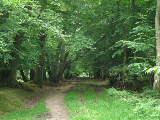
[20] The avenue of Beech trees, Berkhamsted Common
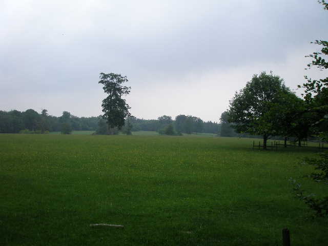
[21] The large meadow or pasture in the middle of Berkhamsted Common
It was now 12.05pm, and it had taken me 2½ hours to walk the seven miles so far. Embarrassingly I went wrong straight away on the way back – when I turned right instead of finding myself on the avenue of beech trees, I went about 100 yards before realising I was on another path – this left the footpath by the meadow just yards before the avenue. What did I say the other day about not often getting lost? Pride before a fall!
I stopped for lunch on a tree trunk by a meadow between Tom’s Hill and Norcott Court Farm. I found the afternoon rather tiring, despite this walk being slightly shorter than usual. I think this was because of the very high humidity – but I was grateful that the grey skies cleared and it was quite bright and sunny as I made my way back to St Leonards. I managed to avoid all the showers that had been forecast.
This was yet another very enjoyable walk. A large proportion of the walk was in woodland, the final lengthy section through Ashridge and Berkhamsted Common being particularly enjoyable. There was a nice mixture of arable fields and meadows, and this was a good day for seeing wildflowers. Grim’s Ditch added a bit of historic interest. I didn’t see any Red Kites on the walk, but I did see one over Bison Hill again as I drove home, so they are definitely spreading eastwards. Sadly, I only have one more walk left on the Chiltern Way.
Total Distance: 185.6 miles each way