Pete's Walks - The Hertfordshire Way
If you are considering walking this route yourself, please see my disclaimer. You may also like to see these notes about the maps and GPX files.
Day 10 1/11/05 Tring station to Hemel Hempstead station (9.2 miles each way)
Parked in Tring station car park.
This walk was a bit longer than usual, probably the longest I’ve walked since I started writing these journals, involving almost six hours of walking (about an hour more than normal). The Hertfordshire Way guide book divides the route into a number of ‘legs’, the seventh leg going from Tring station to King’s Langley. However, it offers an alternative to this of dividing the leg into two walks of about 9 miles each, the first going from Tring station to Hemel Hempstead station, and the second going from Hemel Hempstead station to Kings Langley (these two walks each adding an extra one and a half miles to the main route, almost all of it alongside the Grand Union canal, as Hemel is not on the main route). As I like to walk every possible bit of a long-distance path (my joke with the friends I walk with is that I do “The walk, the whole walk, and nothing but the walk!”) I chose to include this longer alternative route via Hemel Hempstead. On today’s walk between the stations at Tring and Hemel, I also included a short bit through Bourne End which is on the main route but omitted by the alternative route. Consequently my stated distance for this and the next walk may be slightly inaccurate – I have had to calculate some of it myself as the guide book does not give a precise measurement for the extra section into Hemel.
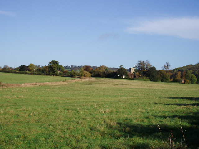
[1] Looking towards Aldbury
I certainly had a perfect day for doing such a long walk, bright sunshine and blue skies throughout with the temperature warm enough for me never to need my fleece (not even when I stopped for lunch). It was a gorgeous autumn day – much of the walk was through Ashridge and Berkhamsted Common, with the beech woods close to their spectacular best.

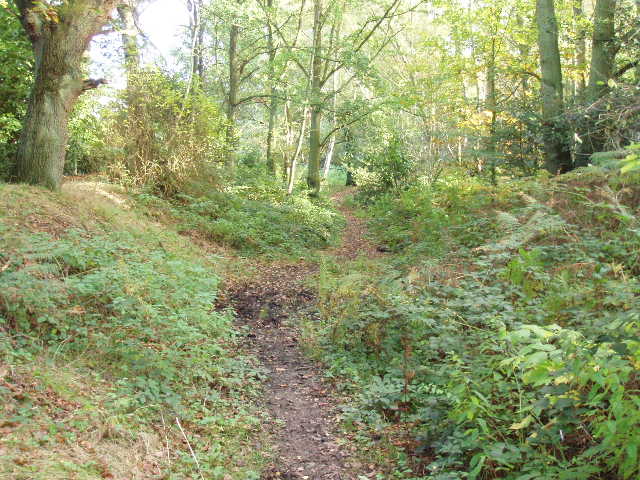
[2] Path through Berkhamsted Common
From Tring station, the Hertfordshire Way crossed a large grass field diagonally, and at the corner of the field followed a bridleway along a hedgerow, at one point crossing a horse gallop (an all-weather one made from some synthetic material) [1]. After crossing a minor road from Aldbury, I continued along a bridleway. Beyond a couple of houses, this entered a wood and followed its edge as it climbed steeply uphill, before turning left and continuing to climb through the woods of Ashridge. The path levelled out by Toms Hill House (where it crossed the Chiltern Way), and continued on in the same direction. After turning slightly right on a couple of paths, the Hertfordshire Way then turned sharply back to the left and followed an avenue of mature beech trees to emerge on the road from Aldbury to Berkhamsted Common. It followed this right for about a hundred yards to a T-junction and then went on in the same direction along another wide path between the trees. It joined a gravel track between Little Coldharbour farm and Coldharbour farm, then joined another path through the trees [2] with Frithsden Beeches a short distance to the left. Eventually it reached Berkhamsted golf course, where it followed a belt of trees between two fairways.
[3]Grim's Ditch, near Berkhamsted Golf Course
From Tom’s Hill House onwards, most of the walk had been on paths that I was familiar with (I’ve walked in Ashridge and Berkhamsted Common literally more than a hundred times) but I still found this section very enjoyable – I just love these Beech woods, especially at this time of year. I was now reaching ‘Terra incognito’, as this part of the golf course was as far as any of my walks had extended. Crossing a fairway and then a road, the Hertfordshire Way continued along a path in trees alongside another fairway, which it then crossed by its tee to reach another section of wood that led to a road. This was followed to the right for 20 yards, before a path the other side continued through the trees – this section of the walk was alongside another section of Grim’s Ditch [3] that I had come across on the Chiltern Way. It is thought to be a Bronze Age territorial boundary. The path crossed another fairway and then through more trees to emerge on a road at Potten End.
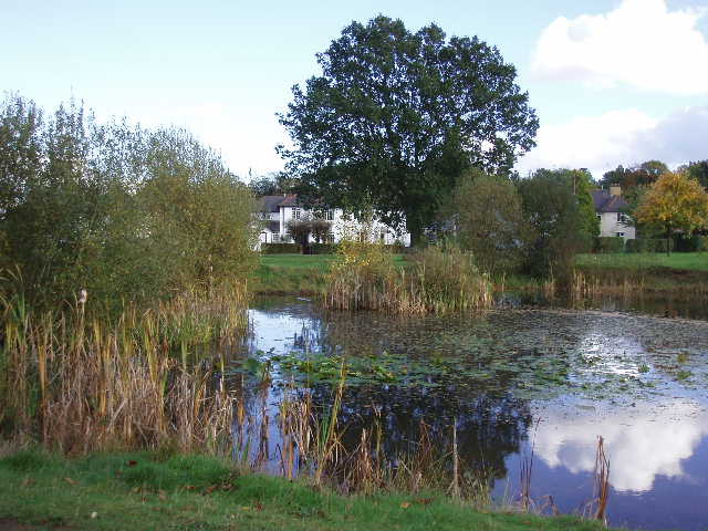
[4] Village pond, Potten End<
Potten End seemed an attractive village, with houses bordering a very large green and a pub near a pond [4]. I took a footpath that led past the bowls club and on to the drive of a large house, before following a short section along a narrow lane (still in the woods of Berkhamsted Common). The next section of the route was quite strange, as I crossed seven stiles in about 300 yards, through a sequence of empty paddocks. The last stile led on to a lane, which went steadily downhill for about half a mile, with good views ahead of the Bulbourne valley [5] (which the river shares with a canal, railway and dual carriageway). At the bottom of the hill, having crossed bridges over the railway and canal, I followed the canal towpath to the next bridge over the canal. Here I took a short diversion into Bourne End, covering the bit of the main route that the two alternative walks via Hemel Hempstead would omit. Bourne End seemed an unusual village, in that it had two pubs next to each other, opposite a hotel that looks very modern but is on the site of a corn mill, and next to the pubs there is a large and very good (though possibly a bit expensive) outdoors shop – I bought some Paramo waterproof trousers and a shirt there about a month ago.
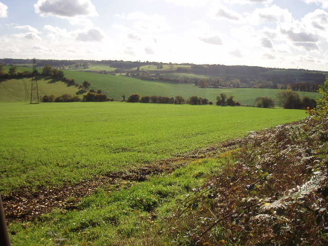
[5] View towards Bourne End in the Bulbourne Valley
Having retraced my steps to the canal, I followed the towpath for about a mile and a third towards Hemel. If you’ve read my notes on the Two Ridges Link you’ll know that I’m not a big fan of walking along canal towpaths, but I was quite happy to follow one for this sort of distance. I passed a couple of locks, a fisherman (who asked the time), and plenty of moored narrow boats although I didn’t see any traffic on the canal (one narrow boat was starting its engines up on the way back, though). At Winkwell [6], there was an interesting information board about the history of the canal, and the sort of goods that were transported on it in this area. It mentioned the sad death of the local lock keeper, drowned in his own lock – the inquest couldn’t explain exactly how he ended up in the water, but pointed out that it was Christmas and that the lock was adjacent to the Three Horseshoes pub!
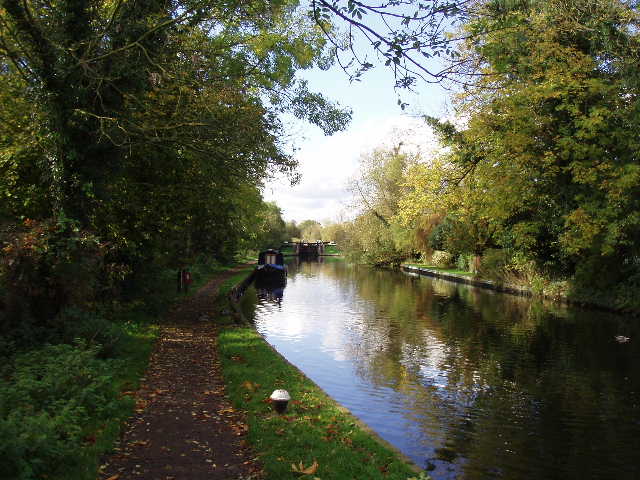
[6] Grand Union Canal, near Winkwell
The canal passed under a bridge carrying the Chiltern Way in Hemel (the second time I’d crossed its path today). At the next bridge, I left the canal and walked the few hundred yards to the railway station, which was as far as I was going. I turned round and started heading back – it was about 12.30, three hours after I’d started out. I had to make a choice as to where I’d stop for lunch, either on a bench by the canal near Bourne End or else further on at Potten End. I chose the latter, though it meant a late lunch about 1.30, as psychologically I didn’t want to leave myself too far to walk after lunch. I got there without feeling too hungry (I’d had a second Alpen bar of the day to keep me going), and had an enjoyable lunch seated by the pond on the green at Potten End – one of the nicest places I’ve ever stopped for lunch.
This was definitely a day that showed up an advantage of doing a walk in both directions, as this afternoon I came across two very nice views that I’d totally missed when walking in the opposite direction. I was quite tired by the time I got back to my car, but not completely exhausted – as I’d expected, the extra three miles today made the walk tougher but not really that much tougher. I thoroughly enjoyed the walk – the weather was perfect, the paths through the beech woods of Ashridge and Berkhamsted Common were delightful (despite the mud!), Potten End and Bourne End were interesting villages to pass through and the walk along the canal added a bit of variety. This was certainly one of the best walks I have done this year.
Total Distance: 78.0 miles each way