Pete's Walks - The Hertfordshire Way
If you are considering walking this route yourself, please see my disclaimer. You may also like to see these notes about the maps and GPX files.
Day 9 29/10/05 Jockey End to Tring station (7.9 miles each way)
Parked in small car park at Jockey End.
Jockey End is only 4-5 miles from Kensworth, the nearest start point I shall have on the Hertfordshire Way, and so I managed to start my walk about 9.20. It was slightly cool as I set off, but I was able to take my fleece off after a couple of miles and didn’t need it again as it remained reasonably warm for the rest of the day. There were a few sunny intervals during the day, but generally it was grey and overcast – around lunchtime it really looked like it might rain, but fortunately this never materialised.

[1] Great Gaddesden
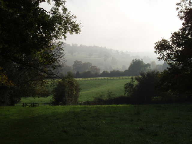
[2] Looking back, between Great and Little Gaddesden
The path from Jockey End initially went past some allotments, before crossing a meadow and then a stubble field (on a clear path). It continued in the same westerly direction past a large house and through a couple of pastures, and then along the edge of another field of stubble beside a wood. It entered the wood for a short distance, leaving it at a point where there was a pleasant view of Great Gaddesden [1] below in the Gade valley. The Hertfordshire Way led diagonally downhill across another stubble field – there were ‘beaters’ here trying to drive up poor pheasants, and I later heard shooting – to reach the road in the valley floor. Across this, I walked through another meadow, crossing a wooden footbridge over the currently dry bed of the river Gade, to reach Great Gaddesden near the church. A footpath at the end of the cul-de-sac lead across another meadow, rising up the other side of the Gade valley, and then another couple of meadows [2] led to a lane at the top of the hill.
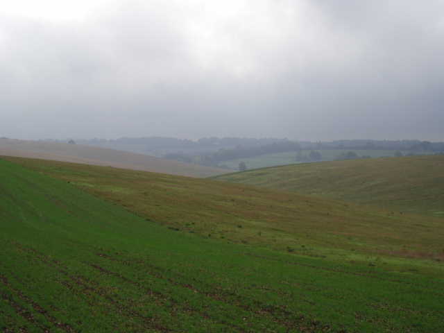
[3] View south towards Nettleden from the path through the large stubble field
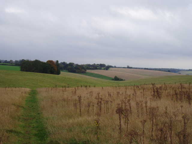
[4] View back from just before Little Gaddesden
I followed the lane to the right for about three quarters of a mile (it deteriorated to a farm track part way), with a farm and occasional houses on either side. I then turned left on another clear path through a very large stubble field [3], heading slightly downhill past a copse on my left to join another path in the same field at the bottom of a small valley. I turned right on this path, which rose slightly up the other side of the small valley [4] to reach a road at Little Gaddesden. A short path through a small housing estate led to a small play area, beyond which I entered the majestic beech woods of Ashridge. Ashridge is a large estate (many square miles) owned by the National Trust, consisting mainly of beech woods but with some more open areas, on or close to the steep northern escarpment of the Chilterns. It is a place I’ve known since childhood, and have enjoyed walking through it countless times.

[5] Path into Ashridge from Little Gaddesden
[6] Path in the Ashridge estate
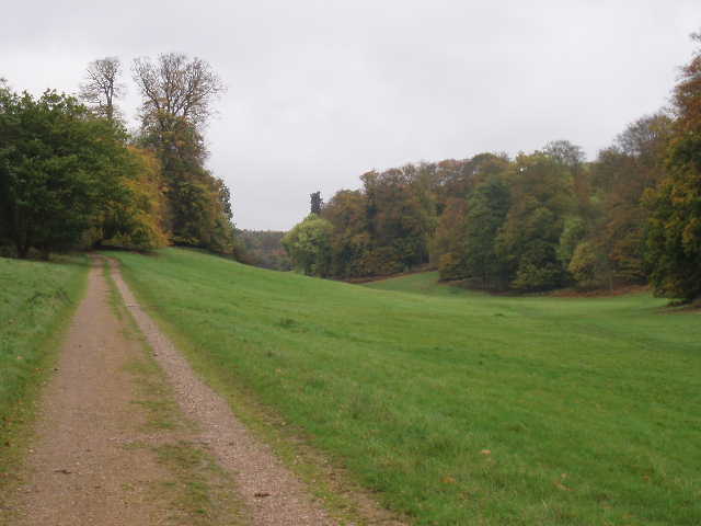
The Hertfordshire Way led downhill through the trees [5] in their autumn foliage to reach a long and wide section of grass [6]. This was left after only a hundred yards, the path re-entering the trees to reach a fence leading to Ashridge House [7], a gothic fantasy of towers, spire and battlements that is now a management college. I walked the full length across the front of this building, across a playing area where some youngsters were having a football training session, and then started off down Prince’s Riding [8]. This is a magnificent grass ride between the trees, a mile and a quarter long, running from Ashridge House to the Bridgewater monument [9]. The monument, a Doric column slightly taller than the surrounding trees, was raised to commemorate the third Duke of Bridgewater, the ‘Father of Inland Navigation’ (i.e. canals), who was a previous owner of Ashridge House.
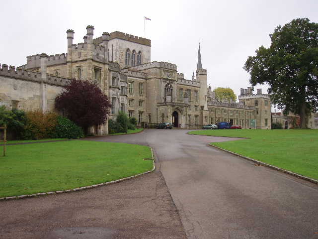
[7] Ashridge House
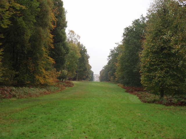
[8] Looking back along Prince's Riding towards Ashridge House
I put the guide book away in my rucksack at this point, as I knew the rest of the route already. At the monument, where there were plenty of cars and people as usual, I noticed that a couple of horse riders that had passed me had hitched their horses to the wooden fence outside the National Trust Tea Shop, rather like cowboys tying up their horses outside a saloon. I took the path from the monument leading steeply downhill to the village of Aldbury [10]. The National Trust sign at the other end of the path always makes me smile – it innocently says ‘Monument and tea shop half a mile’, quite omitting to mention that the half mile is entirely uphill at an average gradient of about one in six! I always half-expect to come across some poor aged tourist on their last legs when I walk this path.
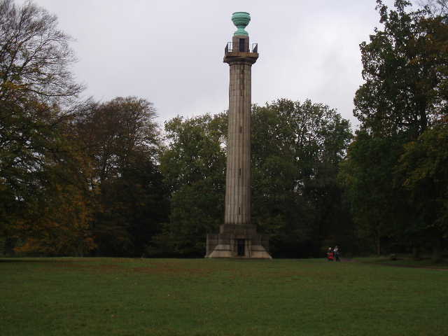
[9] The Bridgewater Monument, Ashridge
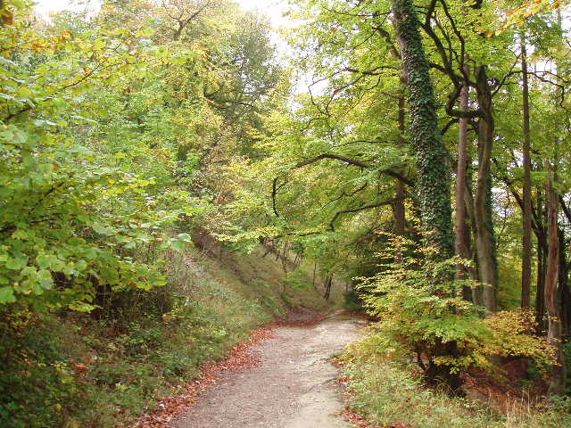
[10] Path leading down to Aldbury
Like the monument, Aldbury is a bit of a honeypot for visitors. It is a very attractive village, often used in films and TV, centred round its pond and its stocks [11] (when I was a boy, there was a magnificent hollow tree there as well, sadly long gone). The Hertfordshire Way took the same footpath I usually use, leaving Aldbury by a paddock next to the church [12] – this was very muddy, much churned up by the horses, but I guess I’m going to have to get used to mud in the coming months. The path went between a fence and a hedge to crossroads of paths by a golf course. Here I turned left, with good views towards the wide valley where Tring is situated [13]. At another crossroads the Hertfordshire Way joined up with the Ridgeway for the last few hundred yards to Tring station. I had earlier crossed the path of the Chiltern Way as I was walking along Prince’s Riding, so as I have mentioned elsewhere, I’m rather spoilt for choice when it comes to long distance paths in this area.
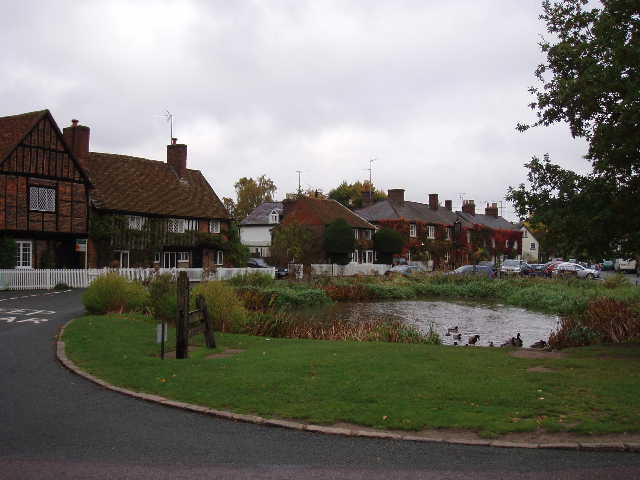
[11] Stocks and pond in Aldbury
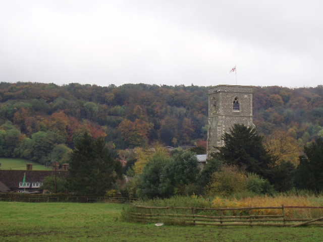
[12] Looking back at Aldbury church and the woods of Ashridge
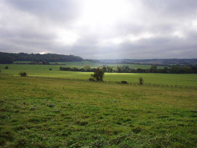
[13] View from the path to Tring Station
On my way back, I stopped to eat my lunch sitting on a log just off a path in the woods by Ashridge House. As I eat, I saw some Fallow deer, including a stag with impressive antlers, on the path about 30 yards in front of me. There are many deer in these woods – I usually see three or four together but occasionally larger groups of 20 or 30 and my record is a group of over 80 – and I have always wanted to get a reasonable close-up photo of them. So when I finished eating, I got up slowly, took my digital camera out and advanced carefully down the path. One of the deer was standing right in the middle of the path, nicely framed by the surrounding trees and undergrowth. I pointed my camera and pressed the shutter – the screen went blue and a sign came up, ‘battery flat’! Typical! Never mind, as a consolation I managed to take a photo of two more deer in the small play ground at Little Gaddesden.
This was a very enjoyable walk, even if the paths were rather muddy in places and the skies were rather dark at times. The trees looked near their best as their leaves were changing colour, the route was pleasantly up and down over the rolling Chiltern Hills, and their were several places or buildings of interest on the way. I am sure that I will use at least some of the route between Jockey End and Little Gaddesden again, as part of a circular walk I can do from home.
Total Distance: 68.8miles each way