Pete's Walks - The Hertfordshire Way
If you are considering walking this route yourself, please see my disclaimer. You may also like to see these notes about the maps and GPX files.
Day 18 21/11/05 Watersplace to Hertford (6.9 miles each way)
Parked in road in Great Amwell.
It was another cold morning, certainly the most frost we have had so far this autumn. Consequently I drove slower than usual this morning in case of ice on the roads, and this fact combined with the total lack of signposts for Great Amwell meant that I didn’t start the walk until almost 10.30am. There was nowhere to park at the place the previous walk finished (Watersplace farm in the charming Ash valley), so I started this walk in Great Amwell and walked back the two miles or so along the Hertfordshire Way to that point, then turned round and walked to Hertford before retracing my steps to my car.
Just after I set off, I got into conversation with a local gentleman out walking his black Labrador. He was very knowledgeable about the local footpaths and was surprised at the rather circuitous route the Hertfordshire Way takes in this area – I could only assume that it took an unnecessary diversion in and out of Great Amwell because it was felt there was something worth seeing there. With hindsight, it’s possibly because it’s the first opportunity for a pub stop on the route since Stanstead Abbotts, about four miles back.
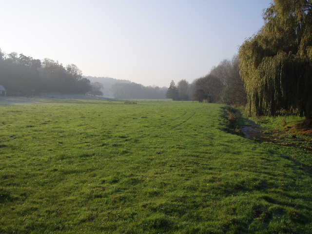
[1] The Ash Valley, near Watersplace
The walk back to Watersplace farm took longer than I expected, mainly because I had to watch my step carefully most of the way because of the very frosty conditions. I wore my thermal hat and my fingerless mittens because of the cold, but felt snugly warm in my new Paramo coat that I treated myself to last week (I went back to the shop that I passed in Bourne End, and bought another Paramo shirt as well as the coat). The day was very sunny, with clear blue skies with hardly a cloud all day.
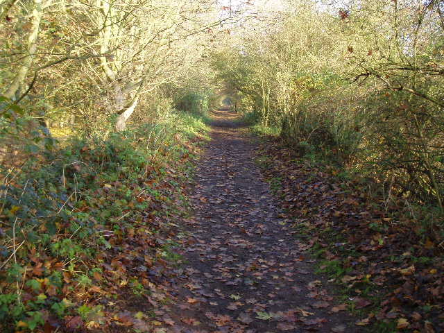
[2] Path along the old railway line
I turned round at the footbridge over the delightful river Ash [1] that I reached on my last walk, and headed back to Great Amwell. The Hertfordshire Way followed a wide gravel farm track that lead away from the river for a 100 yards before turning right to go parallel with the river. After a few hundred yards, at a bend, I crossed a stile and continued in the same direction through a very large pasture with the river on its right and a thin line of trees at the top of the slope on the left. The path followed the right-hand boundary fence or hedge of this pasture for almost half a mile, always close to the river. By a stile close to where the river turned to the right, I followed the hedge to the left before crossing another stile to reach the track of the dismantled railway that I’d come across at the end of the previous walk. I followed this hedge-lined track [2] across a footbridge over the river Ash, under a road bridge and then across another bridge, this time over the river Lee navigation (a canal running parallel to the original river, for boat traffic). A couple of short paths then led across a railway line and on to the main road through Great Amwell.
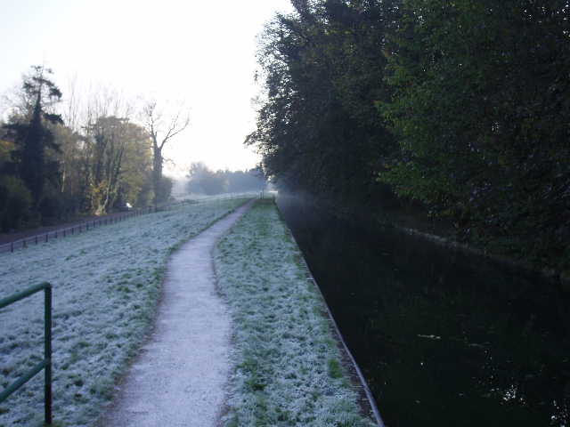
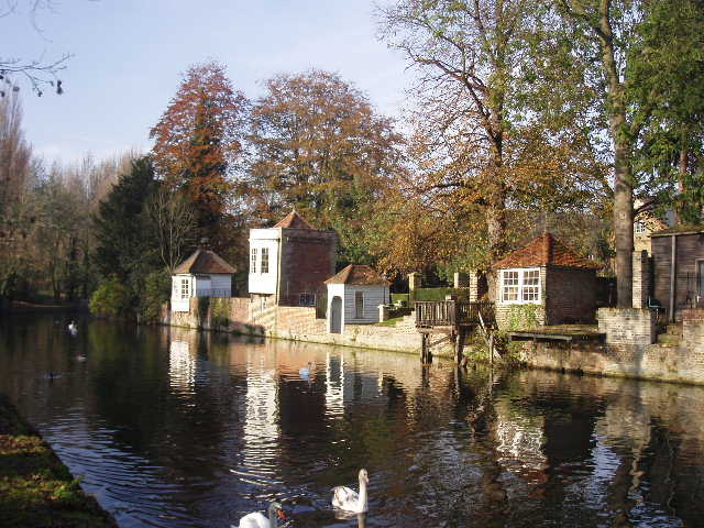
[3] Path along the New River at Great Amwell
I crossed the road and took some steps up to the path along the New River [3], which I followed to the right for a hundred yards to a footbridge. I crossed this and went up some steps to the village churchyard. The church is one of only three in the county to have a Norman apse, another one being at Bengeo which I passed later on this walk. From the other end of the churchyard, a narrow path led back down to the river path again – here, on an island in the New river, was a monument to Sir Hugh Myddleton the builder of the New river (as I said before, it’s not a river but an aqueduct carrying spring water from near Hertford to London – one of the springs, Emma’s Well, is close to the monument). I followed the path for about a third of a mile to a road (where I’d parked).
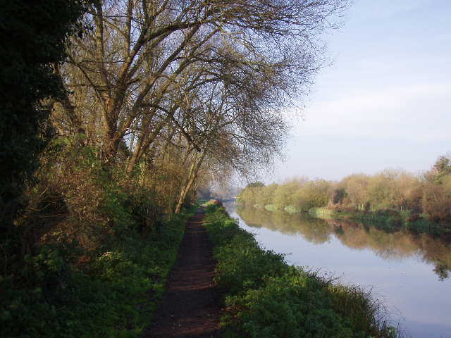
[4] The river Lee navigation, heading towards Ware
Across the road, I took a gravel track that led back across the railway line and on to the towpath of the river Lee navigation. I turned left along the towpath, and followed it for about a mile [4] to the town of Ware, passing some very smart-looking new riverside apartments as I reached the town centre. Across a main road, I continued along the towpath. Shortly afterwards there were several gazebos [5] or summer houses on the opposite bank, which dated from the eighteenth century.
[5] Eighteenth century gazebos in Ware/p>
I followed the towpath for almost another mile before crossing a footbridge to the other bank. The path then led through a sports ground, before passing under a viaduct carrying the A10 across the Lee valley. The Hertfordshire Way then left the side of the canal/river to follow a RUPP (Road Used as Public Path) for almost half a mile, passing some cottages (one with a very fierce dog, fortunately fenced in). Immediately before the track met a road, I took a footpath on the left that crossed the river Rib on a footbridge. A clear path through two grassy fields then led to the church at Bengeo [6] (second Norman apse of the day) – this church looked simpler and therefore much older than the one at Great Amwell, which had been much modified in the fifteenth century and more recently.
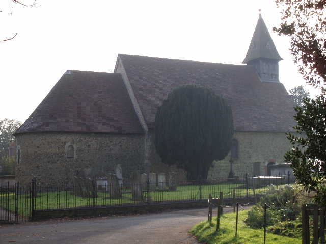
[6] Bengeo church, with its Norman apse
From Bengeo, a tarmac path led downhill and across a footbridge to a large park with sports pitches on the edge of Hertford. Beyond this I came back to the river Lee navigation, and crossed a long footbridge beside an impressive weir (presumably separating the navigable canal from the original river). The towpath continued on towards Hertford town centre. I took the next road crossing of the waterway, and a short walk through the pleasant town centre (lots of character due to an abundance of old buildings) to Parliament Square. This was my turn round point for the day, as it is where the alternative route I’ve been following for the last few days rejoins the original route.
I eat my lunch on a bench in the park, and set off back to Great Amwell. The four and a half miles back went very quickly, only taking about an hour and a quarter – but then it was flat almost all the way and with no worries about navigation. There was still frost on the ground in places, even some ice in puddles. There was a very slight mist, which combined with the golden foliage of the trees seemed to create a rather strange light –a pleasant but very unusual atmosphere [7].
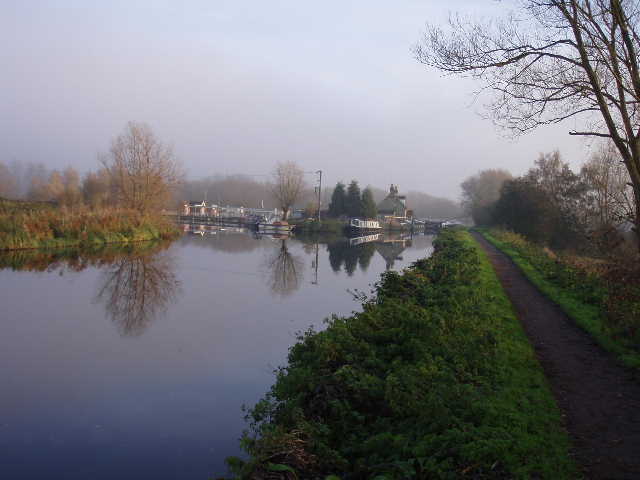
[7] The River Lee Navigation
This was a nice enough walk, but not one of the best. The Ash valley was charming, but most of the walk was along waterways which became a bit repetitive after a while. Too much of it was through built-up areas, although the tow path was vastly better than walking along streets and roads. I don’t really remember going to Hertford before (though I’m sure I must have been when a child) but I was quite impressed with it – the guide book says the museum there is small but excellent, so I might pay it a visit one day.
I have now finished the alternative section (Legs 10A and 10B in the guide book), so my next walk will start back at Cuffley. The walk after that will go through Hertford again, passing the end of today’s walk, and then I’ll continue on towards Bishops Stortford and Royston. I’ve walked two thirds of the Hertfordshire Way now, and am still on schedule to finish by Christmas.
Total Distance: 135.8 miles each way