Pete's Walks - The Hertfordshire Way
If you are considering walking this route yourself, please see my disclaimer. You may also like to see these notes about the maps and GPX files.
Day 26 1/02/06 Hare Street to Nuthampstead (5.1 miles each way)
Parked on main road in Hare Street.
This was fourth short walk in a row – it feels like cheating to only walk 10 or 11 miles! Another grey and misty day, with slightly limited views. This walk went through one or more two villages than yesterday’s did, but it was still very rural – more rolling hills with many small woods and clumps of trees, fields that were mainly stubble or recently ploughed and a few meadows.
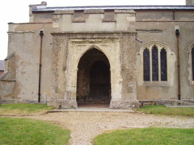
From Hare Street, a footpath led across playing fields to a footbridge. From here, a path crossed a very large field of stubble, heading uphill, to reach a meadow. This contained evidence of recent occupation by cows, the first signs of livestock that I’d come across for several days. At the far side of the meadow, two stiles were crossed either side of the drive to a big house, and then a few yards walk across the corner of another meadow led to a stile and a path beside the house to Great Hormead church. This contains a memorial to someone who was killed at the battle of Waterloo.
On the other side of the churchyard I crossed a road and took a track opposite, which went between two fields that had been ploughed (two farmers were going over them with harrows when I came back, with three Spaniels having a great time running around them). I turned left at track junction, and where this track turned left continued ahead on a path over a stubble field and then through another meadow to reach a road in Great Hormead. The Hertfordshire Way followed this to the right, then turned left down a lane. Just before the entrance to a large farm, by a duck pond with some geese, I took a path that followed a hedge round one side of the farm and then turned left across a meadow to reach the track on the other side of the farm. The track was followed for about a quarter of a mile, beside a ploughed field, to a lane.
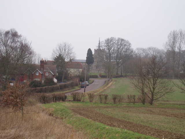
[1] Anstey
[2] View from Anstey
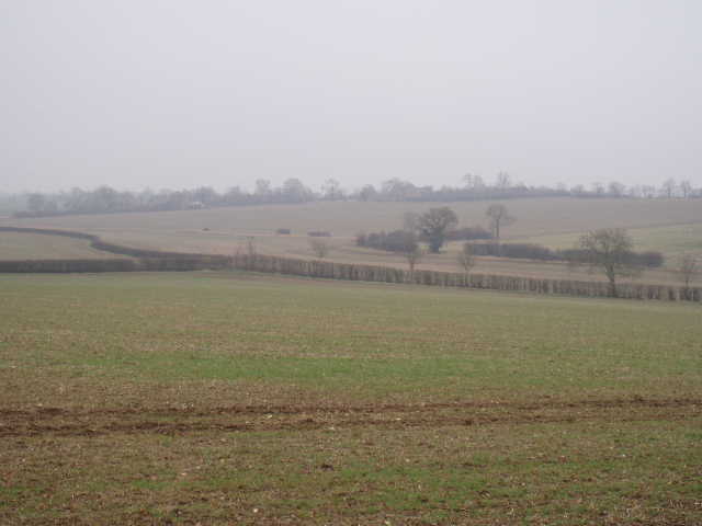
I turned right and followed the lane for quarter of a mile, meeting a woman with two barking but friendly black Labradors on the way. A path then led diagonally across a field of brassicas (I think that’s the technical term for cabbages and similar vegetables). On the far side of a hedge I joined a good track between large arable fields – I could hear shooting going on around here, and saw some people, probably beaters, getting in a Land Rover and driving off. As with most of this walk, there were nice views here of the rolling hills with their fields and woods, although the grey and very slightly misty conditions did limit how far I could see. After following the track for about half a mile, I crossed a minor road or lane and then crossed what the guide book described as a small nature reserve – it’s obviously very new, as it seemed to be just a small plot of grass with some recently planted trees, though there was a bench to sit on. The path then continued downhill across a large paddock (no horses in it, though there were some in the next paddock). A kissing gate in the corner gave access to a track that continued downhill. At the valley bottom I turned left and followed a ditch to a road [1]. I turned right, and followed the road uphill to Anstey [2].
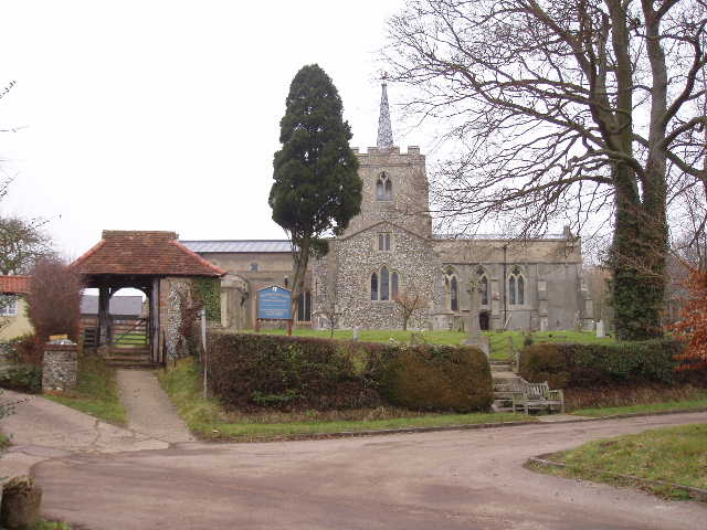
[3]Anstey church
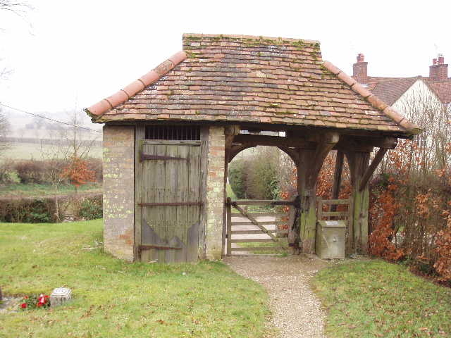
[4] 'Lockup' in the entrance to Anstey church
Anstey was one of the most interesting villages that I have passed through on the Hertfordshire Way. The entrance to the church [3] had a ‘lockup’ built into it [4], something I’d never seen before. The church itself was large and impressive, unusually having a central tower. There was a very old AA road sign on the wall of a cottage, and an old pump [5] for a well at a traffic junction.
[5]The porch of Anstey church
[6] Old pump, Anstey
Beyond Anstey, the path crossed a small meadow towards a wood. I saw some Fallow Deer several hundred yards away close to the edge of the wood, and as I approached the corner of the wood I saw some more in the wood. As my path went along the side of the wood, this group of deer leaped out about 20 yards ahead of me and ran across the field of new grass on my left – one of them was a buck with quite impressive antlers. Where the path turned into the woods, the Hertfordshire Way continued on a permissive path, soon joining a long concrete drive. This area had been an airfield during World War II, and the existing rights of way disappeared when the military took over the land – walkers are now dependant on landowners giving them permissive paths such as this. After a quarter or mile or so, I took a path on the left that lead to the Woodman pub in Nuthampstead. Here there was a memorial to the 398th bomb group of the US Airforce, who flew from the airfield here during the war [7].
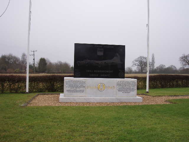
[7] Memorial to US Airmen, Nuthampstead
I turned round and walked back to Hare Street, eating my lunch when I got back to my car about 1.20pm. Today’s was another enjoyable walk, very similar in terms of scenery to the previous couple of walks but with the added interest of the unusual things I saw in Anstey.
Just one more walk to go before I finish the Hertfordshire Way!
Total Distance: 189.6 miles each way