Pete's Walks - The Hertfordshire Way
If you are considering walking this route yourself, please see my disclaimer. You may also like to see these notes about the maps and GPX files.
Day 27 3/02/06 Nuthampstead to Royston (7.6 miles each way)
Parked on road in Nuthampstead.
I have given the distance as 7.6 miles each way, which is the distance shown in the guide book, although I actually walked about half a mile more than this due to some confusion over the route. This was the first day since I started writing these journals that I ended up walking further after lunch than I did before lunch.
This was another very grey and misty day, which was rather a shame as it meant I missed out on the view from the hilltop near Reed that the guide book describes as the best panoramic view on the whole of the Hertfordshire Way. On a clear day I should have been able to see for miles over Cambridgeshire to the Fens, but today visibility was limited to about a mile – I couldn’t see as far as Royston. Never mind. At this time of year I couldn’t afford to wait for a day with clear skies, I was just grateful for a dry day – in that respect, I have been very lucky as the last month or so has been remarkably dry and I’ve not had to put off any walks because of wet weather. Today was a very cold day, with the temperature very close to freezing – the mud was frozen solid all morning, although it had thawed and started sticking to my boots in the afternoon.
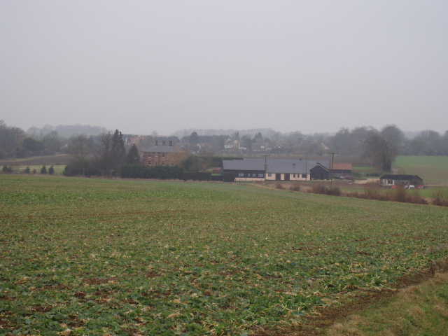
[1] Approaching Barkway
From Nuthampstead, the Hertfordshire Way took a footpath across a meadow to a stile, and then followed the edge of another meadow to skirt a farmyard. A clear path then led across a small field to a small thicket. On the other side, the path followed a ditch dividing two large fields of stubble, descending slightly. About halfway, it crossed the ditch on a foot bridge and headed diagonally across the field. The path then went between a garden and another farmyard to reach a minor road. A few yards to the right, a stile gave access to a grassy field. Across this and over another stile, the path in the next grassy field went diagonally to the left, reaching the corner of a wood on the right. A clear track followed the edge of the wood, and then descended a slope [1] to pass some converted barns at the valley bottom before rising gently up the opposite slope. Where the track turned right at a field corner, a footpath continued ahead between gardens to reach the main road through Barkway.
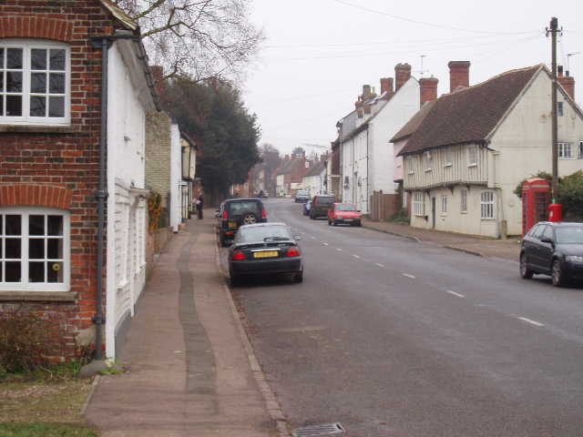
[2] Barkway
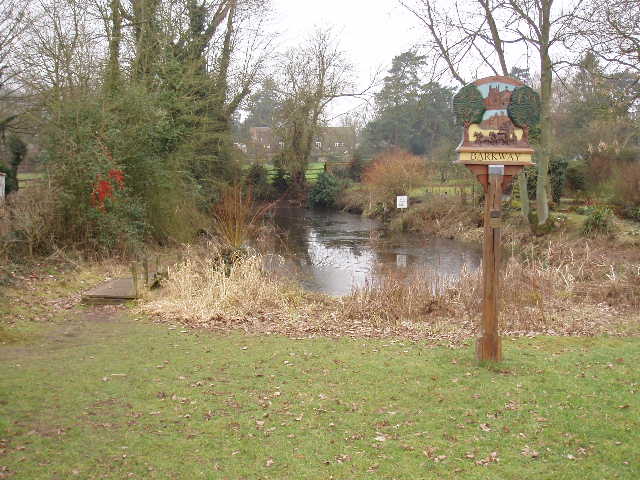
[3] Pond in Barkway
Barkway [2] is a very pretty village, with lots of old and characterful houses – it reminded me a little of Much Hadham. I took a slight detour to explore the full length of the main street, before returning to Church Lane and continuing on the Hertfordshire Way. I passed three different ponds [3] in the village, the guide book suggesting that the one by the church was a horse wash. After passing through the churchyard [4], where there was a memorial to a doctor who had served in the Crimean War [5], I followed a lane for a short distance until it became a grassy track. A few hundred yards along the track, I turned right onto another track between green fields. The way then turned left along another track, initially with a wood on the right. The track then crossed a small field of stubble and passed another smaller wood. Shortly after this, a clear path through a cabbage field cut a corner off the track (the guide book warned it might be necessary to stay on the track, but the footpath was very clear here). Rejoining the track by a belt of trees, the route turned to the left and followed the trees to their end.
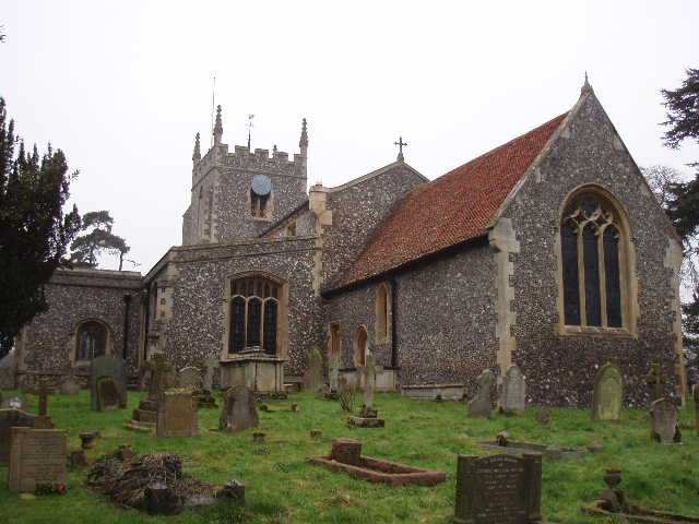
[4] Barkway church
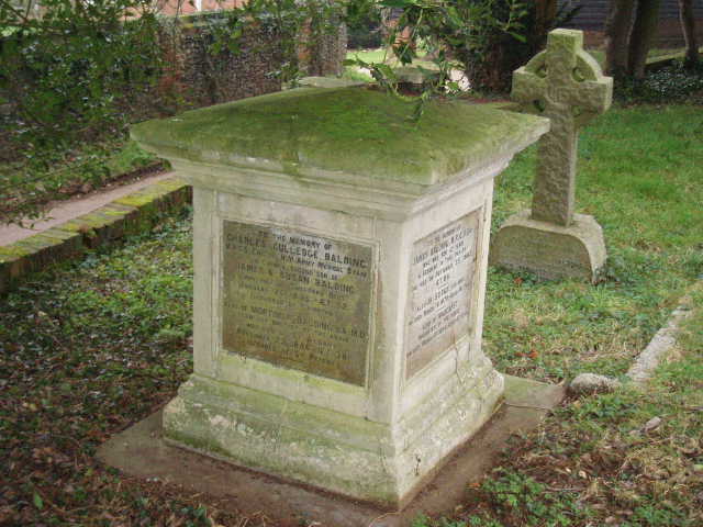
[5] Memorial to Crimean War doctor in Barkway church
This was where the confusion over the route occurred, and quite frankly I’m still confused and don’t know which is the correct route. Where the belt of trees ended the track turned to the right, but the guide book said to continue straight ahead over two fields (divided by a sunken path) to Reed church which was clearly visible ahead. However, there was a Hertfordshire Way waymark clearly pointing to the right along the track. There was no clear path ahead across the field – there was a set of tractor ruts that possibly marked the path, but then again there was a similar set just a few yards to the left. I decided to follow the waymark, and continued on the track to the right. After two hundred yards it came to a junction, with a second track going off to the left (towards the church, although it only went as far as the sunken path). Between the track to the left and the one continuing ahead was a stile and a footpath going across a meadow half left – another Hertfordshire Way waymark on the stile indicated that this was the path to take. I crossed the meadow, and came out on a track (the continuation of the sunken path) near a bend on a road. From the bend I could see a pub ahead on my left and new I was back on the route described in the guide book – I’d just cut a corner that visited Reed church. I knew that the Hertfordshire Way had changed its route in some places, and that the guide book said that the waymarks for the old route would be left in place for a couple of years, so I wondered if I’d accidentally followed the old route (very annoying if the old route was waymarked but not the new!). But the map showed the old route was slightly different, it didn’t cross the meadow but took the track to the left and then went right on the sunken path to reach the bend. So the guide book, the waymarks and the map all disagreed!
Somewhat confused, and feeling slightly guilty about cutting the route short by not visiting Reed church, I continued along the road through Reed, passing the pub. When it ended at a T-junction, I continued on the path opposite to another road a couple of hundred yards further on. A few yards to the left and on the opposite side of the road, a clear bridleway between two enormous stubble fields began – the signpost said ‘Royston 2½ miles’. After a hundred yards or so, the bridleway came to the top of a steep escarpment descending towards Royston – this was where the guide book said there was the best panoramic view of the whole walk, but today I could only see as far as a smaller hill that I would reach just before Royston [6]. The next section of walking was particularly enjoyable, as the bridleway continued in a more or less straight northerly direction for about two miles, passing a couple of farms and taking a slight diversion to follow the boundaries of a house with a small paddock. I noticed that the ploughed fields were much paler here, I was back on chalky soil again, also shown by the plentiful flints in the fields.
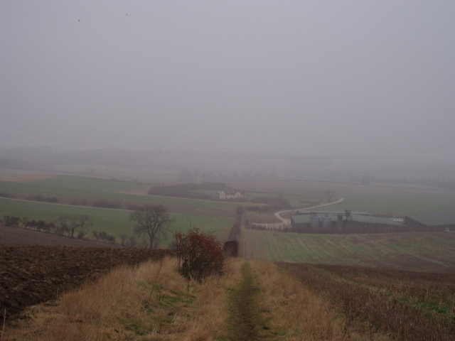
[6] Misty view from the escarpment near Reed
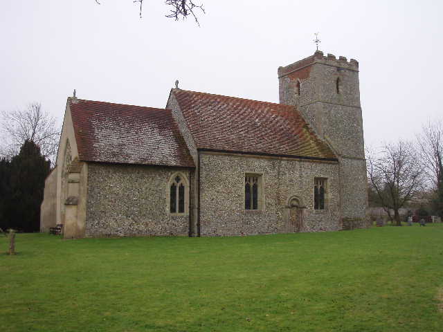
Having climbed the small hill I’d seen from the top of the escarpment near Reed, the path continued downhill through a wooded dell to reach modern housing on the edge of Royston. I continued in more or less the same direction, veering slightly left, as I continued along three roads and then crossed the A10. The Hertfordshire Way then went through the Priory Gardens and followed a path round the Priory church [7] to emerge on the main road through the centre of Royston [8]. About a hundred yards to the left, I reached my destination, the Royse stone (originally the base of a cross put up to mark the crossing of Ermine Street and Icknield Way) which marks the start and finish of the Hertfordshire Way. I had thus completed my anti-clockwise journey round the county, now I just had to walk back to Nuthampstead to complete the walk in the opposite direction.
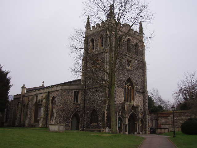
[7] Priory church, Royston
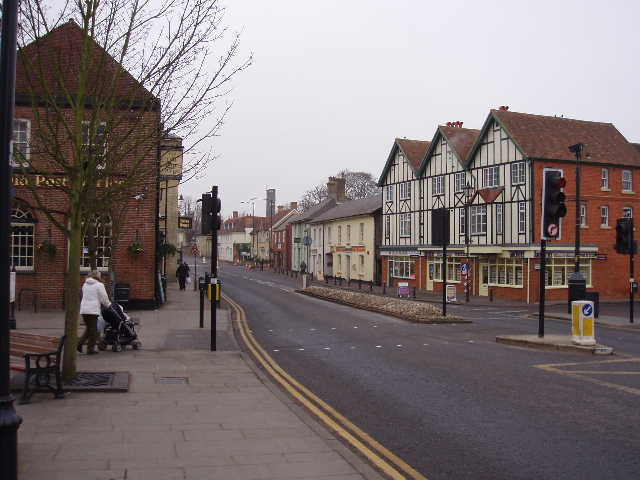
[8] Royston
I eat my lunch on a bench in the Priory gardens. This was about 20 minutes earlier than I would normally, and it meant I had almost as far to walk after lunch as before, but I had not seen any other suitable spots to stop. As I ate my sandwiches, I studied the map again – I still felt that I had somehow cheated by not following the guide book and taking the path to Reed Church. I decided to investigate this more on the way back. So when I reached the bend in the road in Reed, I turned right to where the footpath from the church came out – there was no Hertfordshire Way waymark, but the path was visible. I crossed two grassy fields, the second containing a horse that ran over to greet me when it saw me coming, to reach the church [9]. The path went round the church, where I said ‘Hello!’ to a lady cleaning the church, to a gap in a hedge. Again there was no clear path (that should have crossed two fields divided by a sunken path) back to the point on the track where the route confusion began. However there were some obvious tractor ruts, so I assumed they marked the path. But it turned out they went too far to the right, joining the sunken path at another footpath junction. So I had to follow the sunken path to the left – a footbridge soon indicated where I should have reached the sunken path. I turned right and crossed the next field, following one of the sets of tractor ruts I’d seen before. Although I’d seen plenty of footpath signs and waymarks, there’d been none at all to indicate the Hertfordshire Way.
I turned round and retraced my steps along the tractor rut. Over the sunken path and the footbridge, I managed to find another tractor rut that meandered across the field slightly to the right of the gap in the churchyard hedgerow – it wasn’t visible from the other end, which is why I’d followed the one that took me to the incorrect path junction. I walked around the outside of the church again, and crossed the other two fields (greeting my new friend the horse again!) and back to the bend in the road. I then continued back the way I’d walked in the morning. So I walked both the waymarked route and the guide book route in both directions. I think I’ve mentioned previously that the route shown on some maps is out of date – I noticed that on this one, as well as the difference at Reed, the route through Barkway shown on the map was out of date. As I walked back along the main street in Barkway, I noticed a Hertfordshire Way sign for the old route. I can understand why the old signs have been left in place for a couple of years, to give people who bought the previous version of the guide book their money’s worth – but it is very confusing. The new book should always indicate where this might happen – indeed, it does do this in some cases, telling you to ignore old waymarks that might still be in place, but apparently not everywhere. I still don’t know whether the route I followed this morning was the correct one or just the old one – as I said, it didn’t match the old route shown on the map. As I didn’t come across any Hertfordshire Way waymarks on the guide book route I followed this afternoon, my best guess is that the waymarks I followed show the correct route which has been altered again since the guide book was published (which is within the last twelve months). But then why didn’t they simply go back to the old route marked on the map? It’s all very confusing.
[9] Reed church
I got back to my car in Nuthampstead just after 3.30pm. Strangely, no-one had thought to lay on a champagne reception to mark my achievement of completing the Hertfordshire Way in both directions! As with when I finished the Chiltern Way, I didn’t feel any real elation at completing the walk, nor any great sense of satisfaction in having achieved the modest goal I’d set myself. I felt rather disappointed that the walk was finished – I’d enjoyed doing it, and rather regretted that it was over. Still, now I just have to choose another of the several long distance paths in this area to keep me occupied!
Total Distance: 197.2 miles each way (this total is a little higher than that stated in the guide book, because of the alternative route I did in addition near Bourne End and Hemel Hempstead)