Pete's Walks - The Hertfordshire Way
If you are considering walking this route yourself, please see my disclaimer. You may also like to see these notes about the maps and GPX files.
Day 6 20/10/05 Wheathampstead to St Albans (8.2 miles each way)
Parked on main road by start of Dyke Lane in Wheathampstead.
This was a very pleasant walk on good clear paths throughout. The morning was bright and sunny, for a change, and although it clouded over about lunchtime it had brightened up again by the time I got back to Wheathampstead. It was quite cool to start off with, but was warm enough for me to take my fleece off after about 1.5 miles. I put it on again when I stopped for lunch and kept it on, though unzipped, for the rest of the afternoon.
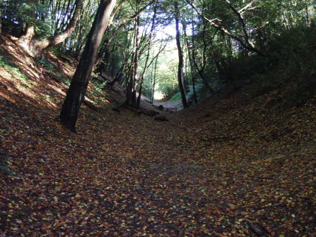
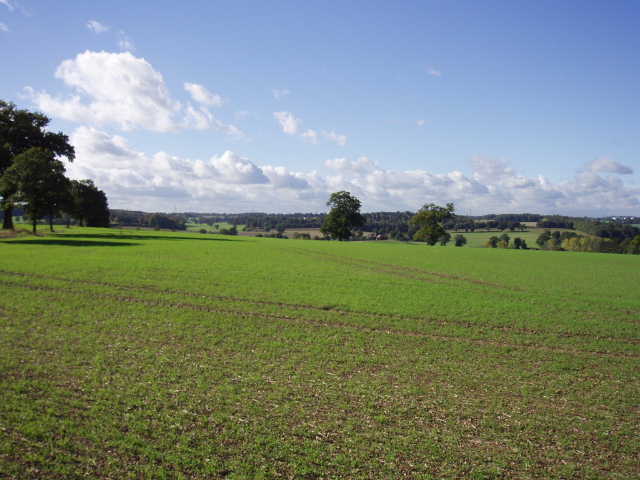
[1] Devil's Dyke, Wheathampstead
Starting along Dyke Lane in Wheathampstead, the Hertfordshire Way soon turned off on to a path along the bottom of Devil’s Dyke [1]. This is part of the earthworks of an iron-age settlement of the Cattevellauni, possibly the site of the battle where Julius Caesar defeated them in 54 BC. The Dyke was much bigger than I’d imagined, probably 20-30 feet deep – certainly more impressive than Grim’s Ditch which I encountered on the Chiltern Way. From the end of Devil’s Dyke, I rejoined Dyke Lane and then turned off to follow a track that lead through a farmyard to a narrow lane. This was left almost immediately, as the Hertfordshire Way crossed a grassy field and passed through a small wood to reach the hamlet of Coleman Green which has associations with John Bunyan (not sure how he’d feel about having the village pub named after him!).
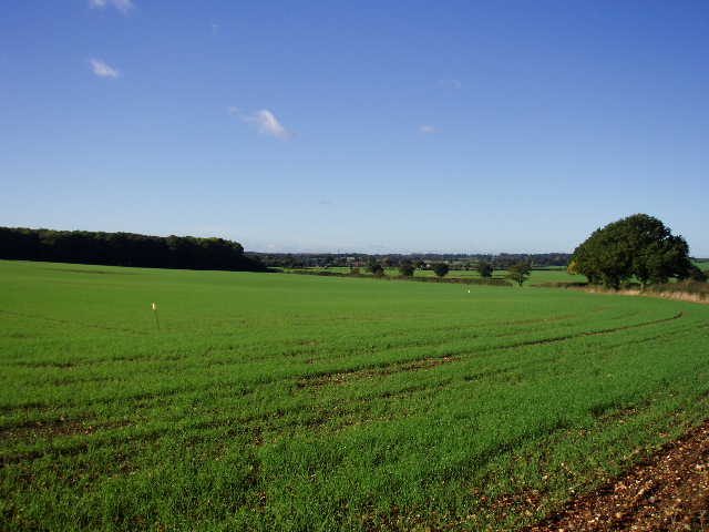
[2] Looking towards Sandridge
Crossing the road through the hamlet, a path led alongside a couple of hedgerows before crossing a large field to a wood. It then followed the outside of the wood for a while, before crossing a paddock to reach another lane. This was followed for about a third of a mile [2], before another hedgerow path was taken on the left. This led to another wood, where the path ran along just inside one edge of the wood, before emerging to follow the outside edge of the wood and then crossed more fields to reach the village of Sandridge. I passed by the church [3], which is one of the oldest in Hertfordshire having been founded as a chapel by monks from St Albans Abbey in the early twelfth century.
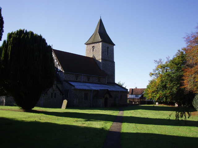
[3] Sandridge church
From Sandridge, the Hertfordshire Way followed the edge of a recreation ground (there were some Highland cattle amongst other cattle in an adjacent field) and then crossed two paddocks to reach a lane. Across the lane, a well-made and well-used bridleway led onwards, eventually crossing a bridge over a main railway line to reach a farm. Here I followed the tarmac farm drive for about a third of a mile to reach a busy road. I crossed this carefully and turned right along its footpath. After about 300 yards, I turned left between impressive iron gates and followed the tarmac drive of the Childwick Manor estate. This soon passed through Childwick Green [4], a ‘model’ village built for estate workers with its own small church, and then passed in front of Childwick Manor itself.
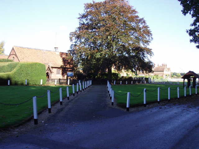
[4] Childwick Green
After another half mile or so, the Hertfordshire Way left the drive, forking left by a goat farm (I heard but didn’t see any goats). Shortly afterwards, the path crossed a field, with nice views other the valley of the River Ver on the right [5], before following the edge of a golf course for about half a mile. So far the entire walk had been almost entirely flat, but on reaching the exit road from the golf course I started to descend slightly, with views of St Albans ahead of me [6]. At the end of the golf course road, I had to cross two main roads by a roundabout on the edge of the city which took a little time, but then it was a short walk to the car park of the Roman Museum where I turned round (I went to the museum about a year ago, and it’s well worth visiting if you are interested in Roman history).
[5] View across the valley of the River Ver
I saw two Buzzards soaring by the edge of the golf course as I walked back, another smaller bird of prey seemed to be bothering them. There weren’t any good places to stop for lunch, so I finally had lunch on a bench by the recreation ground in Sandridge at about 1.30pm.
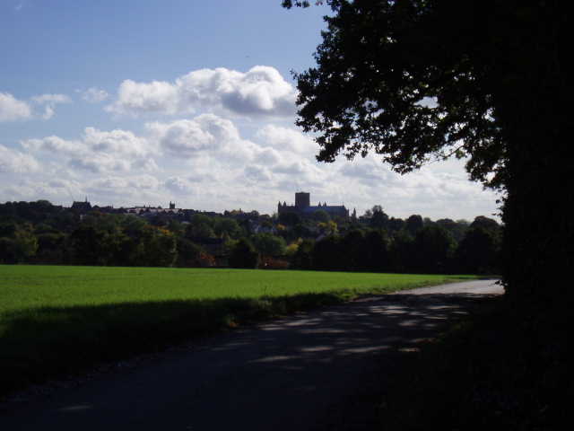
[6] Looking towards St Albans and its Abbey
Today’s walk was the same length as Tuesday’s, at 8.2 miles a bit longer than my average distance, but it seemed to go much quicker and indeed it did, as I was back at my car about 3pm, half an hour earlier than Tuesday having started a few minutes later. I guess this was due to the fact that the paths were very clear throughout, with little trouble navigating, plus the fact that there was quite a lot of walking on tarmac – not much proper road walking, but quite a lot on farm roads and the estate road.
Total Distance: 46.9 miles each way