Pete's Walks - The Hertfordshire Way
If you are considering walking this route yourself, please see my disclaimer. You may also like to see these notes about the maps and GPX files.
Day 7 25/10/05 St Albans to Redbourn (6.2 miles each way)
Parked in Roman museum car park, St Albans.
St Albans is only about a dozen miles or so from my home in Kensworth, and I have walked to Redbourn and back from my home, so this was almost a ‘local’ walk for me. It wasn’t the most interesting of walks scenically (although by no means bad) as it just followed the same river valley throughout, but it more than made up for this by passing many buildings of historic interest.
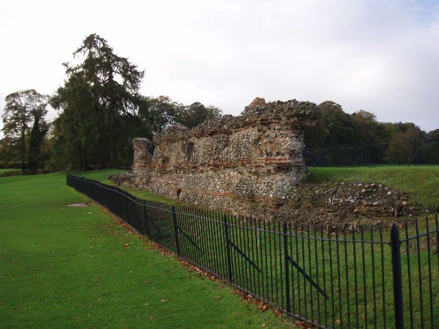
[1] Section of Roman wall, St Albans
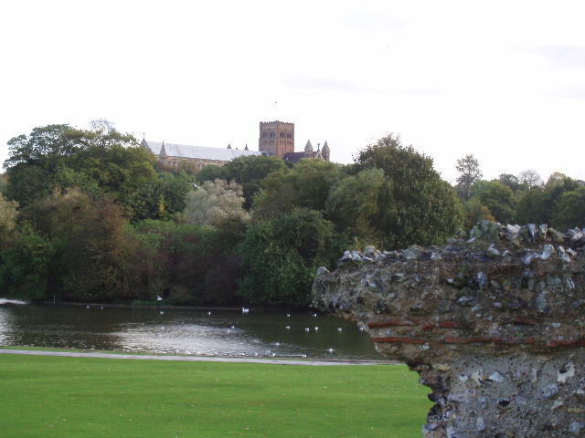
[2] Roman Wall, Verulam Park and St Albans Abbey
This was a shorter walk than usual. I generally try to plan my walks four or five ahead, selecting the start and end points according to where there are likely to be convenient places to park and trying to make the walks about 7½ miles in each direction. It just so happened that this one was shortened so that the previous two and following two walks were all a suitable distance and started and finished at suitable points. As this was one of the closest walks to Kensworth, it was rather a shame that this particular walk was a shorter one – it would obviously be better to have a shorter walk on a day when I had to drive a long way, and longer walks on days like this when I didn’t have to drive so far.

[3] Fighting Cocks Inn, St Albans
The walk started with a 35-minute tour round the historic sites of St Albans. From the car park at the Roman museum, the Hertfordshire Way entered the large public park and visited a section of the old Roman town wall [1,2]. A little further on it came to the remains of a gateway into the Roman town and another, longer, section of the wall. It then crossed the river Ver and went past the Fighting Cocks Inn [3], reputedly one of the oldest pubs in the country. It then continued uphill through another park to the Abbey [4] (it’s both an Abbey church and a cathedral). Having visited the Abbey about six months ago, I didn’t go inside this time but would definitely recommend a visit to anyone interested in historic monuments and/or churches. I then walked through the impressive Abbey gatehouse [5] – an information sign said that it once housed the third ever printing press in this country, and was besieged during the Peasant’s Revolt. It was later used as a gaol and is now part of St Albans School. The Hertfordshire Way then went back down to the river Ver, passing a watermill. I was very impressed by what I saw of St Albans, and feel sorry that I haven’t explored it more thoroughly before as it really is on my doorstep.
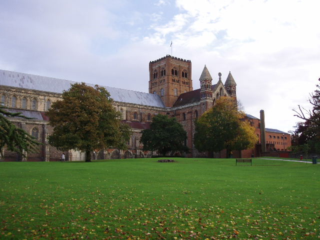
[4] St Albans Abbey
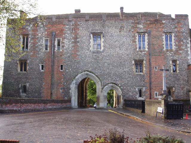
[5] Abbey gatehouse, St Albans
Having done the circular tour, I left St Albans along the drive of the Gorhambury estate (a permissive path), passing the site of the Roman theatre. The drive headed north, parallel to the river Ver. After almost a mile, I turned right onto another estate drive. When this had crossed the small river, I turned left onto a footpath and followed the river bank. After about a quarter of a mile, the path reached the A5 road (the old Watling Street). I crossed this and continued along another tarmac drive, still to the right of the river Ver. The drive soon led between a watermill and a farm, and then continued northwards as a farm track. When this turned right, the Hertfordshire Way continued straight on as a footpath, soon passing a waterworks and then reaching the tiny hamlet of Redbournbury where the path crossed the river on a footbridge. I read a notice board by Redbournbury farm, about the local wildlife and about how it was part of the Gorhambury estate which is part of the Crown Estates.
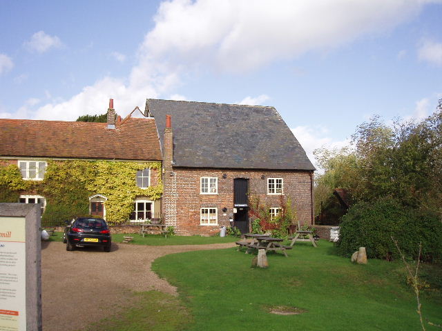
[6] Redbournbury watermill
I then took a footpath beside Redbournbury watermill [6], which went through a couple of kissing gates and then followed a hedge/fence around the side of a large arable field to reach the A5. Having crossed the road again, I went through a garden and took another path that followed a hedgeline through several fields to reach the edge of the village of Redbourn. Here the Hertfordshire Way followed the course of an old railway line (the ‘Nicky line’ that ran between Harpenden and Hemel Hempstead – the Chiltern Way followed another section of it near Harpenden). After about three quarters of a mile, I turned right to reach Redbourn Church [7]. I then turned round and retraced my steps back to St Albans (yes, I did walk the circular tour in the reverse direction as well!).
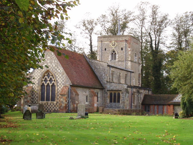
[7] Redbourn church
I did my good deed for the day on my way back. By the kissing gates just after Redbournbury, I had come across a calf on the footpath that had obviously managed to get out of the adjacent field of cows (and a bull). It was further along the footpath, on the edge of the arable field, when I came back, so I went into Redbournbury farm to tell someone there about it. They immediately set off in their JCB/tractor to retrieve it.
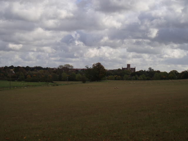
[8] Distant view of St Albans and its Abbey from the Gorhambury estate
There were a couple of very brief showers as I started the walk through the park in St Albans, but after that it remained dry and quite warm for the rest of the day. It got very windy, though, as I was getting back towards the city, particularly as I was walking the long section of the Gorhambury estate drive [8].
Total Distance: 53.1 miles each way