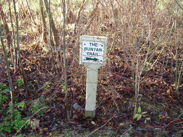
Pete's Walks - John Bunyan Trail
If you are considering walking this route yourself, please see my disclaimer. You may also like to see these notes about the maps and GPX files.
Day 5 16/12/06 Cranfield to Bromham (8.2 miles each way)
Parked in road in Cranfield.
There were strange weather conditions as I drove to Cranfield. The forecast said that overnight rain and cloud would clear by morning, but in fact the sky was still overcast as I left Kensworth at 8.50am, and a few minutes later I was in thick fog as I drove over Dunstable Downs. It was still overcast as I drove north from Dunstable, but not long after I saw clear blue skies ahead and soon I passed under the trailing edge of the blanket of grey cloud. By the time I got to Cranfield the skies were almost completely blue, with clouds only on the southern horizon. I had a bit of a problem parking, as the place I was going to park originally turned out to be next to a bus stop (the sign was partially obscured by bushes) and I drove round for several minutes before finding a suitable place. I eventually started walking at about 9.45am.
From the road junction in Cranfield where I finished the last walk, the John Bunyan Trail went northwards down an alley between the fences of some modern houses. At the end of the alley, I crossed a road and went through a kissing gate into a grassy field, leaving the village behind me. I went half-right across the field, following the deep indentations made by horses’ hooves on this bridleway – the ground was very wet after the overnight rain. I went through another kissing gate in the field corner, and continued alongside a right-hand hedge in a large sheep pasture. It was now a lovely day for walking, with bright sunshine and clear skies, not too cold, and views eastward over Marston Vale, with the brickworks at Stewartby and Brogborough Lake prominent landmarks. At the next field corner I went through another kissing gate and turned right on another hedge-side bridleway, which soon turned left on a farm track heading towards Roxhill Manor Farm. Here I followed the track as it turned right, then I went left across the very large concrete farmyard, exchanging greetings with the farmer standing by some machinery with his sheepdog. I continued north-eastwards on a hard-surfaced track running between hedgerows for over half a mile [1], with occasional glimpses of extensive views over the lower ground to my right [2]. The track turned left and then right, to reach a lonely white cottage. Here the track turned left again, still surfaced but muddier. After a couple of hundred yards I turned right along a muddy bridleway.
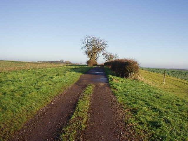
[1] The track heading north from Roxhill Manor farm
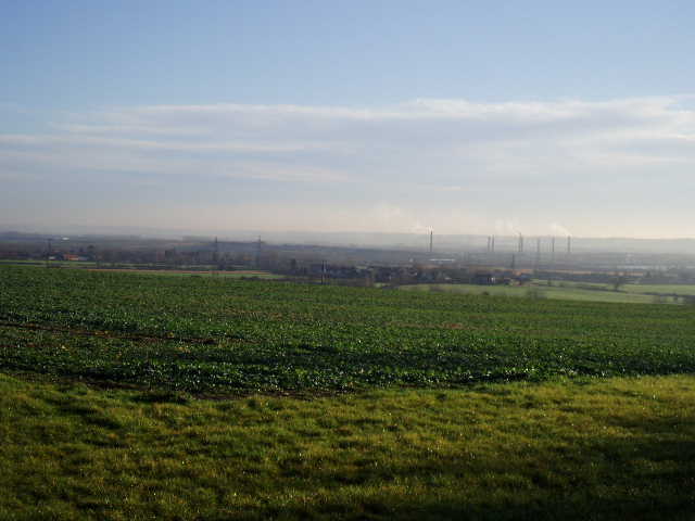
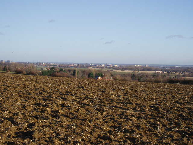
[2] View towards Stewartby and Bedford from near Roxhill Manor farm
The bridleway followed a right-hand hedge and ditch, with the ground now rising slightly on either side. The ground was very wet underfoot – I was now definitely on clay soil (in fact I passed many waymarks for a route called Clay Way during today’s walk). After about a third of a mile, the hedge was replaced by a long thin belt of trees [3] – at about the same time, the bridleway officially changed to a footpath (horse riders could continue on a crossing bridleway) but there was no cessation of the obvious hoof prints in the mud – indeed I met a couple of horse riders coming the other way along here. Presumably the landowner allows them to ride round the edge of these fields, as they obviously hadn’t crossed the stile I came to a few hundred yards further on. The stile took me into an empty green pasture, with a farm up to my left. I followed the right-hand hedge, then turned right on another footpath just before the field corner. This followed the left hand hedge of another larger green pasture, rising slightly then descending. In the field corner I crossed another stile, and then followed a footpath across a field of cabbages or similar crop (again this footpath was obviously used by horse riders). On the far side, I again had nice views over Marston Vale towards Bedford [4]. The John Bunyan Trail then followed a track descending downhill to a road near the village of Wootton, where I saw three more horse riders.
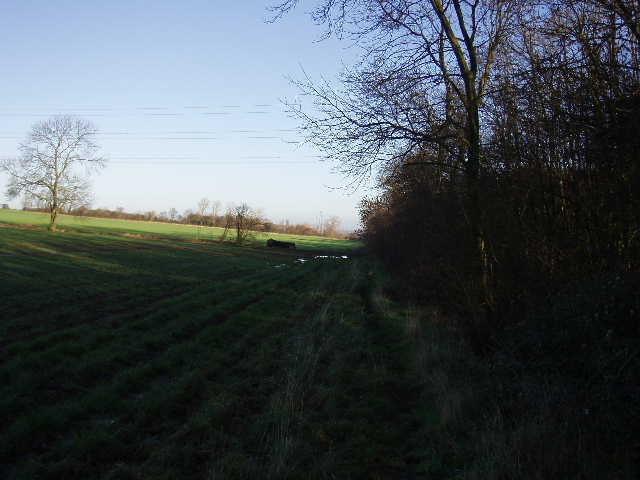
[3] Path between Roxhill Manor farm and Wootton
[4] View over Wootton towards Bedford
Over to my right I could see the tower of Wootton church. John Bunyan was once imprisoned overnight in a lock-up in front of the church (the lock-up is no longer there, but I remember seeing one at the church gate in Anstey on the Hertfordshire Way). Wootton is now mainly a dormitory village for Bedford and Milton Keynes, but has a long association with brick making and in the 18th Century many church bells were made here.
I followed the road to the left, passing through a part of the village called Hall End. After half a mile the road ended at a junction, where I continued ahead on a footpath across two grassy fields and then along a short track to another road in Wood End, now in the parish of Kempston Rural. I followed the road to the right and kept right at a junction by a pub, then turned left on a footpath. Here I entered the intriguingly named Buttons Ramsey [5], formerly an arable field but recently planted as a community woodland (part of the ‘Forest of Marston Vale’ project). The Ramsey part of the name comes from the same Abbots who held the manor of Cranfield. I followed the right-hand hedge for a few hundred yards, then went through a kissing gate to go half-right across a very large pasture containing a solitary horse. Across a drive and through another kissing gate, I then followed a hedgerow as it curved round to the right, screening the grounds of Kempston House.
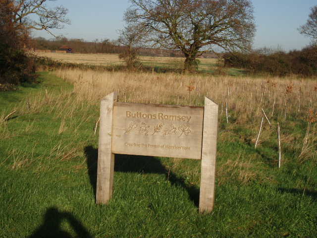
[5] Buttons Ramsey community woodland
Kempston was once the largest village in England, but is now a town with a population of 20,000. Until the 19th Century it was largely rural, with no central village but rather a number of ‘Ends’ or hamlets (I’d be passing through Wood End, Green End and Church End on this walk). Then East End, Bell End and Up End developed and merged together to form the core of the town of today. In 1896 the original parish was divided between Kempston Urban District and the civil parish of Kempston Rural. Kempston, like Wootton, is now mainly a dormitory settlement for Bedford and Milton Keynes.
[6] Unusual type of footpath sign, by the cemetery at Kempston Church End
[7] View near Kempston Church End
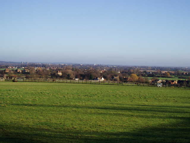
Where the path and hedge reached a road, I turned left to pass through Green End, then turned left on a footpath that passed to the left of a cemetery [6], with Kempston Church End and its church further to my right. Beyond the cemetery the path crossed another field of cabbages or similar crop to reach another road, where I saw two more horse riders. I followed the road to the left for about a quarter of a mile (there were good wide verges either side) [7]. Having been headed roughly north since Wootton, I was now going north-west, crossing a very flat area of land but heading back towards the low ridge I’d been on for most of the way from Cranfield to Wootton. At a corner of the road I took a footpath on the right and followed a hedgeline for a few hundred yards to a stile. I then crossed a paddock with a single white horse (I suppose I should really call it a grey) to reach a road opposite a farm and close to a few other properties (this settlement doesn’t appear to be named on the map, but is still part of the parish of Kempston Rural). This section of the walk now seemed to be conforming to a repetitive pattern – cross a couple of fields on a path, do a short road walk, repeat.
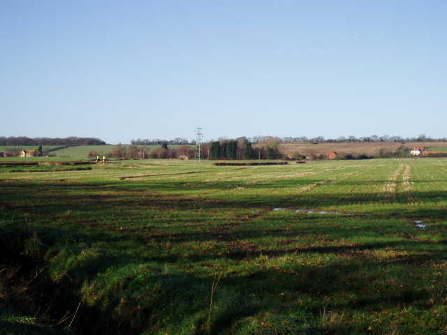
[8]View towards Bedford from pathless ploughed field
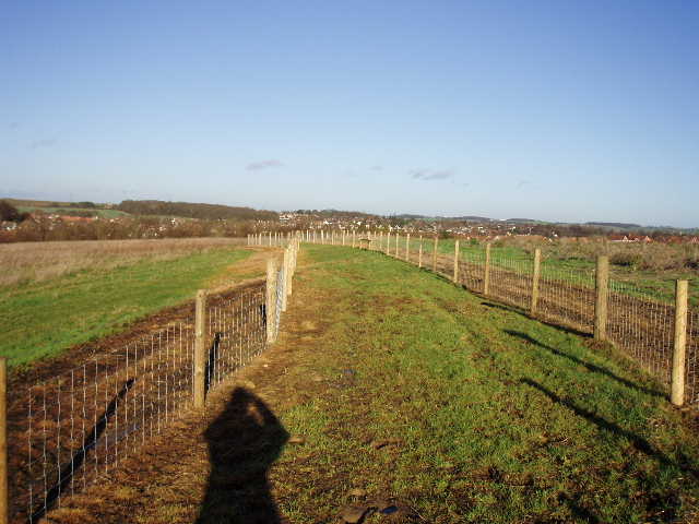
[9] View from bridleway leading to Bromham
I followed the road a short distance to the right, then turned left onto a footpath rising uphill across two ploughed fields. In the first field the path was worn and quite clear, but the people who walked it obviously turned off onto the broad grass strip beyond the crossing hedgerow (although it’s not shown as a right of way on the map), as the path completely disappeared in the second field. I had to make my way as best I could across the ploughed earth, accumulating a lot of it on my boots by the time I reached the other side. Still, there were nice views back here [8], over the lower ground of Marston Vale and towards the greensand ridge, and I did see a hare here on my way back. The path continued on a short distance between a hedge and a right-hand fence to a path junction by a wood. Here I turned right along a bridleway, with the wood on my left. Where the wood ended, the bridleway continued on north-eastwards between wire fences across a large open grass area [9] – the bridleway had obviously been recently relocated a few yards as to my left I could see the churned up mud where it used to go.
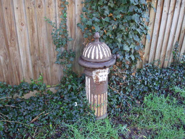
[10] Victorian Lion's Head tap, Bromham
After about a third of a mile, the bridleway descended to the A422 on the edge of Bromham. Safely across this busy road, I followed an alleyway and then a track between houses to a road– there was an interesting Victorian Lion’s Head cast iron tap beside the track [10]. I turned right, and followed the road for about half a mile to the centre of Bromham. My walk really should have finished where a footpath went off to the left, but I carried on for another hundred yards to see Bromham Mill [11] (a flour watermill, an earlier mill on the site is mentioned in the Domesday book) and the mediaeval bridge over the river Ouse [12].
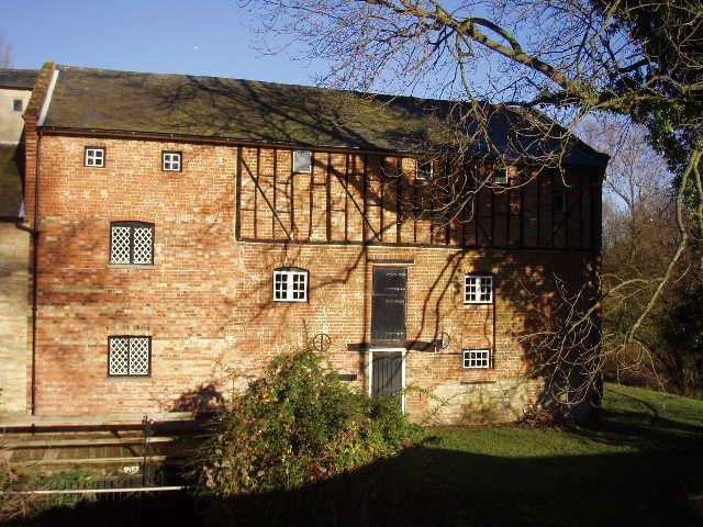
[11] Bromham Mill
I enjoyed the walk back, although at times as the afternoon wore on I was walking straight towards the very low sun and needed to shield my eyes. I had my packed lunch on a bench at Buttons Ramsey, later than usual about 1.40pm. Just past Roxhill Manor Farm, I met a group of about a dozen people riding mountain bikes along the bridleway – I meet mountain bikers occasionally, but can’t recall meeting a large group like this before. I counted at least nine horse riders today, too, but surprisingly didn’t meet any other walkers today (this was a Saturday walk again). I got back to my car at Cranfield at 3.30.
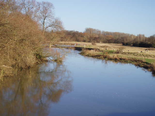
[12] River Great Ouse, from Bromham Bridge
This was a good walk, which I enjoyed more than I’d expected too. The weather was pretty much ideal, considering the time of year, and the only slight problem I had was that some of the paths were rather muddy – especially the bridleway and footpath north-east of Roxhill Manor farm, where I constantly had to watch where I was treading. But this was part of the best section of the walk, from Cranfield to Wootton, where I only passed two farms and a cottage. From Wootton most of the rest of the way to Bromham, the walk was somewhat ‘bitty’ with short sections on footpaths interspersed with shorter sections of road walking, but it was still a pleasant walk. There were some nice views along the way, especially over Marston Vale towards Bedford and the Ouse valley.
Total Distance: 37.6 miles (each way)