Pete's Walks - John Bunyan Trail
If you are considering walking this route yourself, please see my disclaimer. You may also like to see these notes about the maps and GPX files.
Day 4 14/12/06 Ridgmont to Cranfield (5.6 miles each way)
Parked at Brogborough Hill picnic site.
There was nowhere convenient to park on the edge of Ridgmont, where I finished the last walk, so I used the car park at the Brogborough Hill picnic site and started today’s walk by walking back from there to Ridgmont. I set off from home about half an hour later than usual, knowing this was to be a shorter walk than usual, and then had a bit of difficulty finding the picnic site, so I didn’t start walking until 10.30am. It was a very grey day, with dark, overcast skies, and quite windy too.
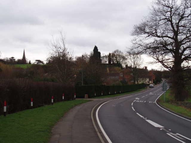
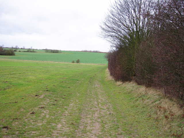
[1] Looking back along the road to Ridgmont
From the end of the lane where I finished the last walk, I followed the road to the right. This went downhill, passing a few houses on the right, then continued on the level between green fields. The road was quite busy, but there was a footpath beside it all the way [1]. After about half a mile, the road turned right and went through a bridge under the M1. Immediately beyond this, I turned right along a bridleway beside the embankment carrying the motorway. On my left, people and machines were working on the Ridgmont bypass. Part of this area was cordoned off, and there were three or four archaeologists at work (they had ‘Albion Archaeology’ on their yellow safety jackets). I’m sure the archaeologists on Time Team excavate very gently with trowels – these ones were using pick axes!
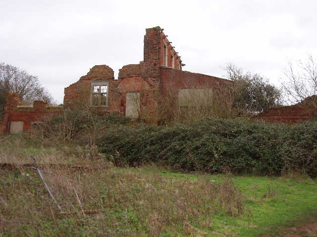
[2] Ruins of Round House
After 250 yards the bridleway turned right, passing across where the new road is to go between orange plastic fences. It crossed a recently planted field, and then followed a right-hand hedge for about a third of a mile through two or three fields (on my way out to Ridgmont earlier I had seen two hares and about a dozen red-legged partridges along here). The bridleway turned left at a field corner, soon joining a track by the entrance to a farm. After a few hundred yards the track crossed a railway bridge. On the far side of the bridge there were several options and no signposts – if I hadn’t just walked through here in the opposite direction I’d probably have gone wrong, as I needed to go slightly right and then left here. This track soon brought me to the ruins of Round House, which was very obviously not round at all [2]. I’d seen a Roe deer here earlier. A bit later the bridleway crossed a footbridge over another path – this was along the route of a former conveyor belt taking clay to Brogborough Brickworks from the pits. These pits (over to my right) have now been flooded to form a lake that is solely used for windsurfing. A few yards further on I came to the very busy A421(T) road – I had to wait patiently for a few minutes before I was able to cross.
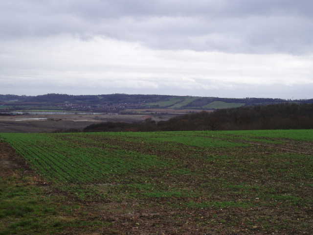
I climbed the steps on the opposite embankment to reach the Brogborough Hill picnic site (where I’d parked). There was a good view from here over Marston Vale to the Ouse Valley, with the greensand ridge over to the right [3]. An information board explained what could be seen, and I recognised a few places that I’d passed on the Greensand Ridge Walk such as Kings Wood (near Houghton House) and, in the far distance, the transmitter near Sandy. The board also said that Round House, which I’d just passed, dated from the 1650’s and got its name from the fact that you could walk all around its first floor rooms to complete a circle. It mentioned an impressive chimney, which isn’t there now so the house has obviously deteriorated further since the notice board was put up.
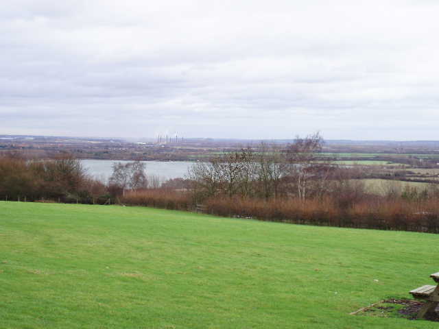
[3] View from Brogborough Hill picnic site
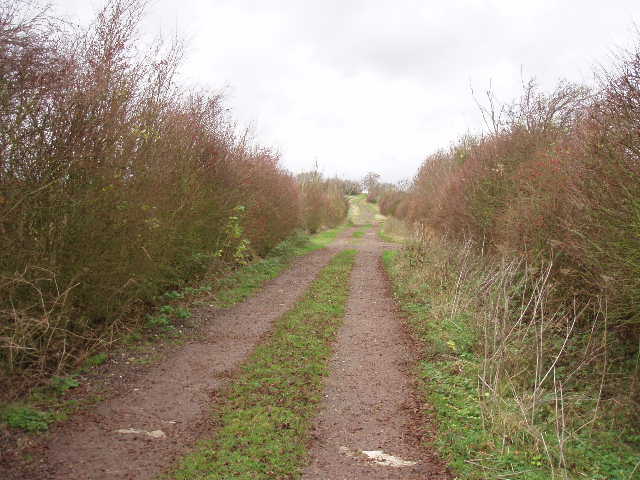
[4] Track leading away from the Brogborough Hill picnic site
On the far side of the picnic site, the John Bunyan Trail followed a concrete drive. Where this turned right to a farm, I continued ahead on a gravel track between hedges [4]. Where the left hand hedge ended and the farm building behind the right hand hedge also ended, the track changed from gravel to dirt but continued straight on. There were quite extensive views to the right towards Milton Keynes (the peculiarly shaped ski-centre was an obvious landmark) – they would no doubt have been better if it hadn’t been such a dark and gloomy day. The good track turned right, then left by a corner of a wood [5]. For the next half mile or so I had this wood, then a large plantation of young trees and finally another wood on my right. The bridleway then turned slightly left before following a hedgerow for a few hundred yards. It then turned right along a headland between large open fields and headed towards Wood End farm on the brow of the hill.
[5] Path beside wood, heading towards Cranfield
[6] View back to the Greensand Ridge, from lane into Cranfield
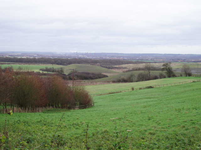
[7] View towards Bedford from lane into Cranfield
As I neared the farm, I again started to get a view over the lower ground to the east and the greensand ridge [6] to the south. From the farm, the John Bunyan Trail followed a lane north for almost a mile, gradually passing more and more houses as it entered the village of Cranfield – again there were good views to my right towards the Ouse Valley [7]. This was the first time I’d walked north of the greensand ridge, and it was nice to look back and see it as a long escarpment, quite similar to the chalk escarpment of the Chilterns. The lane ended near the church and lower school in Cranfield [8,9], and then I followed a road for about three-quarters of a mile to the right. I was a bit disappointed with what I saw of Cranfield, it was mainly modern houses with a few older brick-built cottages – I suspect there are nicer parts to it that I didn’t see. I passed three pubs and a long bungalow-like building that housed a fish and chip shop, a Chinese takeaway and a combined Pizza/Indian Restaurant (so I’d be able to survive if I lived here!). At a road junction, where a path continued ahead, I turned round and started back to the picnic site at Brogborough.
I would hazard a guess that Cranfield is unique amongst the villages of Britain – there certainly can’t be many that can boast an Airfield, a University and a Technology Park! (If that combination is not enough to make it unique, then I also noticed there was a car showroom where they had Morgan sports cars for sale!). Construction of the airfield here was started in 1936 as part of a general response to the increasing threat of war. It saw active service during World War II, and it was attacked in the late summer of 1940 as part of the Battle of Britain – bombs damaged both the airfield and local villages (windows in Cranfield church were blown out). After the war, the Empire Test Pilots School was transferred here from Boscombe Down, producing test pilots for Britain and around the world. A College of Aeronautics, a post-graduate centre of aeronautical study, was also established here after the war. In the 1950’s, it was decided that this should expand into other areas of technology, eventually leading to the creation of Cranfield University in 1969. This is now split between three campuses (here, at the nearby village of Silsoe, and at Shrivenham in Wiltshire), and is one of the leading academic centres in Europe for strategic and applied research, development and design. It is almost entirely focused on post-graduate work. The University Library was designed by Sir Norman Foster. In 1989, Nissan created a European Technology centre at Cranfield, which three years later won a commendation in the Civic Trusts awards.
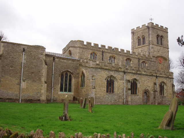
[8] Cranfield church
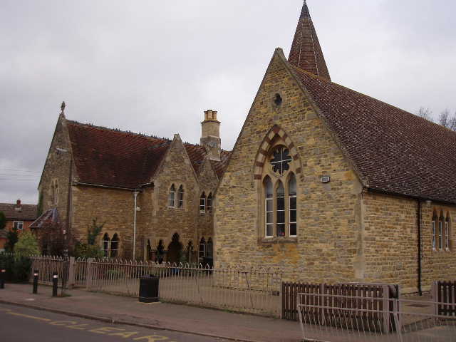
[9] School in Cranfield
The village of Cranfield was first mentioned in 918 when the manor was given to Ramsey Abbey, who held it all the way up to dissolution of the monasteries in 1539. In 1144 Cranfield was pillaged by King Stephen during his civil war with the Empress Matilda. In 1349, many villagers were killed by the Black Death, including the priest. In 1568, refugees from Flanders settled in the village and introduced lace-making. In 1845, during restoration work on the church almost 2000 small bronze coins were discovered in a fourth century Roman jar. In 1863, a niece of George Washington was buried in the churchyard. Today the village is a flourishing community of about 5000 people – it has its own very good web site, from which most of the above data was gleaned.
I had my lunch on a bench on the edge of Cranfield, with a nice view out towards the Ouse valley and along the greensand ridge. I then had just a short walk back to the picnic site, and I got back to my car at 2pm.
This was a pleasant shorter walk, very straightforward as it was entirely on bridleways and roads (possibly a first for any of the walks I’ve done). I’m sure that on a nice summer’s day it would be very pleasant indeed. There were some nice views for much of the walk, and the Round House and the village of Cranfield added some historic interest. It was quite good for wildlife sightings too, as I saw two hares, a Roe deer and numerous partridges.
Total Distance: 29.4 miles (each way)