Pete's Walks - John Bunyan Trail
If you are considering walking this route yourself, please see my disclaimer. You may also like to see these notes about the maps and GPX files.
Day 3 9/12/06 Ampthill to Ridgmont (7.3 miles each way)
Parked in side street in Ampthill.
I was looking forward to this walk, as much of it was along the route of the Greensand Ridge Walk which I’d enjoyed walking earlier this year. In particular, I’d walked the stretch from Ampthill to the M1 on a very gloomy, grey, overcast day which severely restricted the views and so I was looking forward to seeing if it was an even more enjoyable walk on a clear bright day like today.
I had a bit of trouble parking in Ampthill. I went to park where I’d twice parked before when I walked the Greensand Ridge Walk, but a new traffic calming scheme meant there was no longer a space to park there. I next parked in the free car park by the supermarket in the town centre, but as I was walking out of it I saw a sign saying parking was restricted to two hours. I eventually had to park in a side street, and walked back to the Market square where today’s walk started.
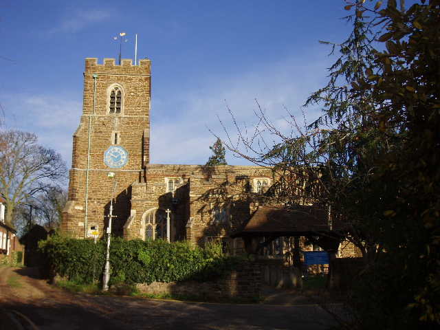
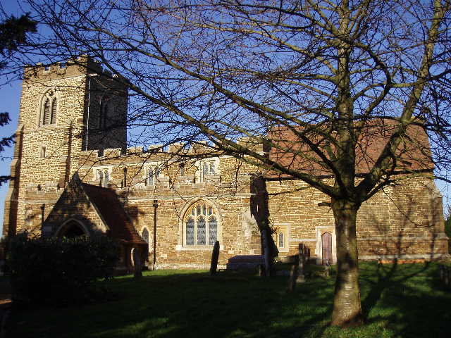
[1] Ampthill church
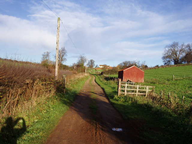
[2] Gas House Lane
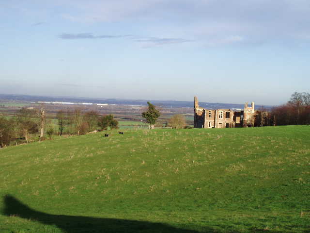
[3] View over the Ouse Valley from near Houghton House
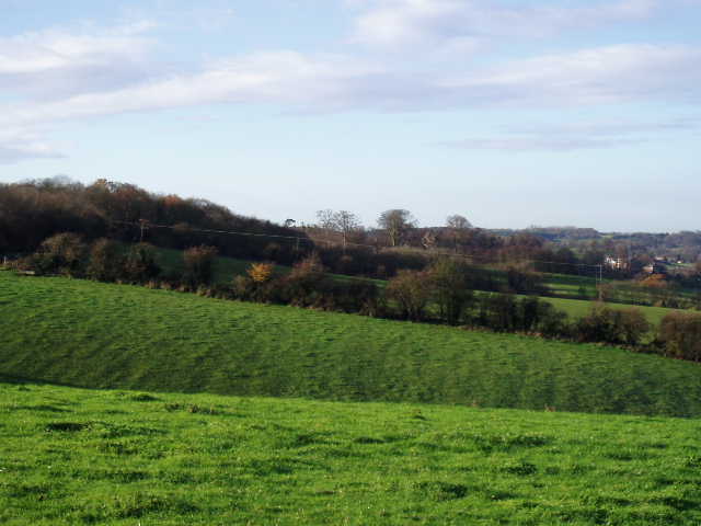
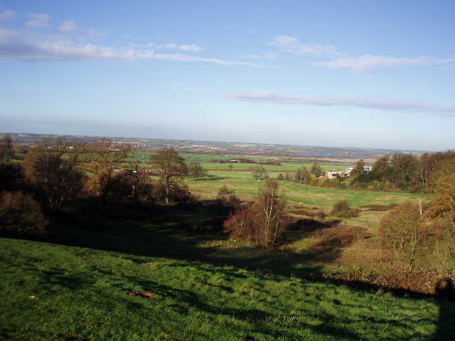
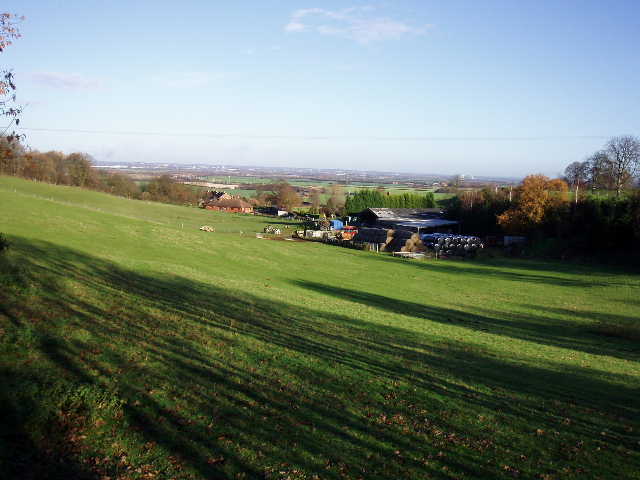
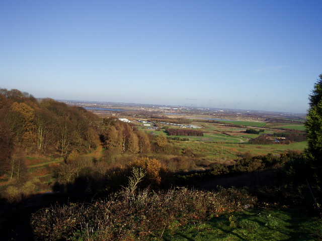
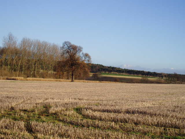
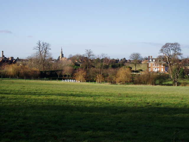
I followed the main road heading east from the town centre, passing the church [1] set a little way back from the road between two impressive Georgian houses, and then on the edge of the town I turned left down a track called Gas House Lane [2]. This went past a few cottages and some empty paddocks before entering a pasture in front of a farm. Here I took a footpath heading half-right, rising uphill past four or five cows and a tiny calf, to a kissing gate to the right of a farmyard wall. The John Bunyan Trail followed the wall, then continued along a very muddy field-side path to reach a crossing cement drive. The path crossed this, went through a hedge to another farmyard and turned left along the farm drive to another cement drive, with some cottages to my left. I was now on the route of the Greensand Ridge Walk. Ahead of me, I had a great view looking down the steep north slope of the greensand ridge to the flat lands around Bedford, with the ruins of Houghton House on the hillside to my right [3,4]. The John Bunyan Trail (and the Greensand Ridge Walk) went left here [5], but I first took a detour to look at the ruins.
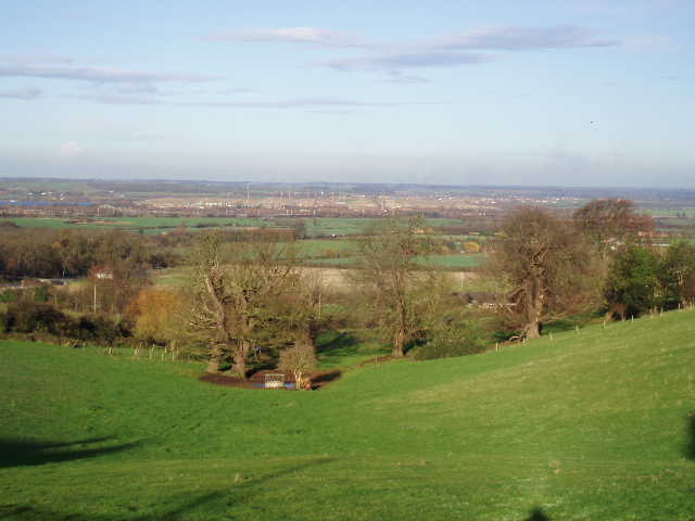
[4] The Ouse Valley around Stewartby from near Houghton House
[5] Looking west along the Greensand Ridge from near Houghton House
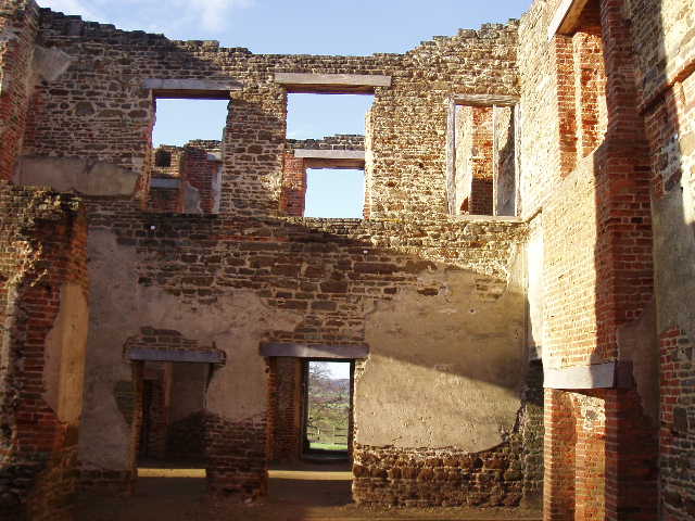
[6] Inside the ruins of Houghton House
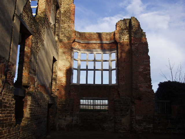
I was pleasantly surprised to see that the scaffolding and plastic sheeting that surrounded part of Houghton House [6,7,8,9] on my last visit had now been removed – one of my brothers had told me it was still in place not long ago. I was now able to go into the remains of the building and wander from room to room. There was no roof, nor any ceilings, just the walls with empty windows and doorways, but it was still an impressive structure – I’d assumed it was all made of bricks, but it was actually a combination of bricks and green sandstone. I noticed a frieze above the columned entrance on the west front (I later found out from the internet that the frieze depicted the coats of arms of the Sidney and Dudley families, and that it was apparently one of the first examples of the Jacobean style in Britain, possibly created by Inigo Jones). Houghton House was built in the Jacobean style in 1615 for the Countess of Pembroke, and at one time it was owned by the Dukes of Bedford. A 1688 staircase from the house, possibly the work of Christopher Wren, is now at the Swan Hotel in Bedford. The house’s main claim to fame is that it is thought to be the inspiration for Bunyan’s ‘House Beautiful’ in Pilgrim’s Progress.
[7] Inside the ruins of Houghton House
[8] View towards Bedford and the Ouse Valley from Houghton House
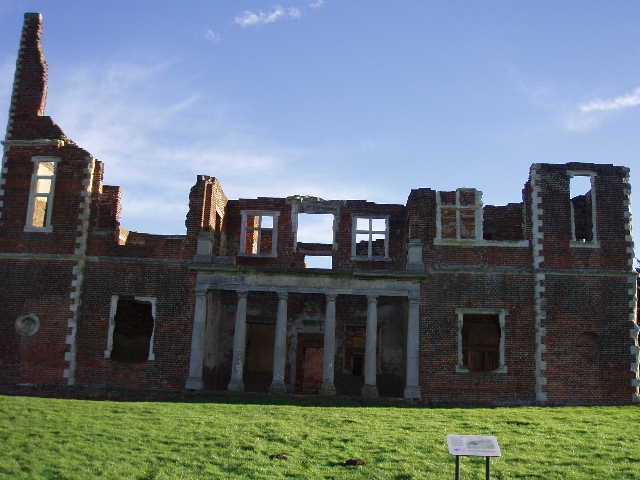
[9] West front of Houghton House
Before leaving the ruins, I had to stop and take off my left boot to remove a stone that was annoying me. I also had an Alpen bar, as for some reason I suddenly felt very hungry. Back on the route of the John Bunyan Trail, I followed the concrete drive westwards. In contrast to the steep slope to my right, on my left the greensand ridge sloped down quite gently, with a nice view towards the line of the Chiltern Hills to the south. At the end of the drive, I carefully crossed a road by a bend, and walked a few yards downhill to the left to a kissing gate on the right that gave access to Ampthill Park – this was where I had ended Day 3 on the Greensand Ridge Walk, and I would be walking all of that day’s walk but describing it in the reverse direction.
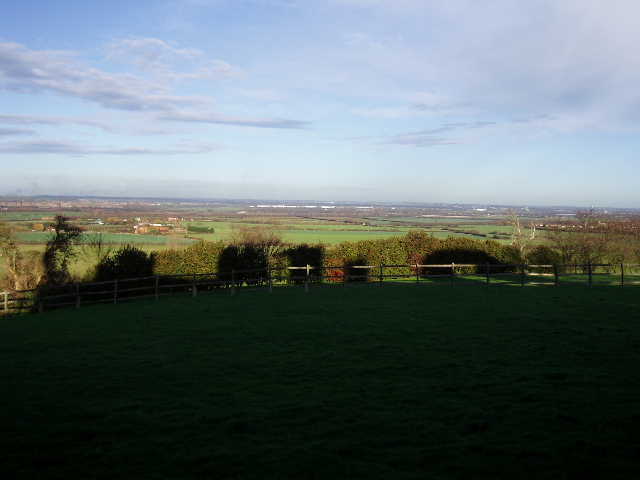
I started through a small area of woodland, turning left at an unsignposted junction where I had gone wrong on my earlier walk here. Beyond a gate, I left the wood for the main part of the park, a large open grass area dotted with mature trees. There were again fine views over the lower-lying land to the north of the greensand ridge [10], with the tall chimneys of the brickworks at Stewartby clearly visible, as were the huge hangars for airships at Cardington. There were occasionally view southwards too, but generally these were hidden by trees. I counted at least 22 dogs being walked in the park [11], all of them very well-behaved as they mixed amongst themselves with no barking or fighting. I passed the cross raised as a memorial to Katherine of Aragon, Henry VIII’s first wife who was imprisoned here while their marriage was being annulled [12]. There was another similar cross nearby, commemorating the training camp established by the Duke of Bedford for volunteers during the First World War.
[10] View north from Ampthill Park
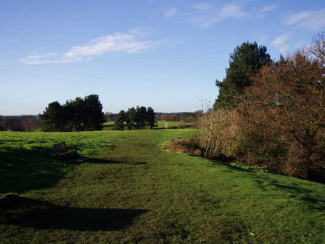
[11] Ampthill Park

[12] Katherine's Cross, Ampthill Park
On the far side of the park, I crossed a small meadow (where there was a plaque with a short verse on a block of sandstone, one of seven along the route of the Greensand Ridge Walk commemorating the Queen’s Golden Jubilee) and then passed through a thin belt of trees (the path here was diverted round a recently fallen tree). The path then ran between wire fences around two sides of some paddocks, where I remembered seeing both llamas and alpacas last time – I think they were just llamas here now. Having passed a farmyard on my right, the path joined a track continuing ahead towards Millbrook church ahead [13], still with good views over the flat ground to the right and also down a small secluded valley sheltering a farm on my left. Another valley here [14], on the right, running down from the ridge to the lower ground, is thought to be Bunyan’s ‘Valley of the Shadow of Death’ in Pilgrim’s Progress. From the church (like most of the ones I’ve passed recently, made of the local green sandstone), a steep tarmac path led downhill to a road. Here I turned right through the village of Millbrook to a road junction, where I turned left and then a few yards further on turned left again on a bridleway.
[13] Millbrook church
[14] View north from near Millbrook church
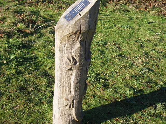
[15] A plaque and a carved newt, one of seven such markers commemorating the Queen's Golden Jubilee along the Greensand Ridge Walk
The bridleway gradually ascended, between a golf course on the left and the Millbrook Proving ground (where cars are tested) on the right. I saw and heard both a Green Woodpecker and some Jackdaws along here. Not long after passing a slope marked ‘1 in 1’ in the Proving Ground, the path turned to climb the same steep hillside – it was probably at a gradient of about 1 in 2, but fortunately was only a very short climb. At the top, the path turned left along the top of the hill, still between the golf course and the Proving Ground. There was a good viewpoint here, looking down to the lower lying land around Bedford to the north, with another of the Greensand Ridge Walk plaques on a wooden post – I hadn’t noticed the newt carved on the post last time I was here [15,16]. A bit further on the path entered some woodland, and then I took a turning on the right to head away from the golf course. The path very soon turned left, by a woodland pond, and continued on through the trees. Soon the trees on my left ended, replaced by what had presumably once been a large field but was now covered by low brambles, with a belt of conifers on the far side. On my right was the steep north slope of the greensand ridge, here covered by a mix of beech and oak trees [17].
After a few hundred yards, the bridleway reached a gate giving access to the garden of Jackdaw Hill House. I continued on along the drive of the house, with nice views now southwards over the paddocks to woods and farmland beyond. The drive ended at a crossroads of bridleway tracks, where I continued on ahead between more paddocks, passing a farmyard or stables on my left to reach a road. Here I went left for 200 or 300 yards, before taking the second footpath on the right. This went downhill, following the left edge of a belt of conifers to reach a lane. Across this, the path continued ahead, crossing a field of root crops diagonally to reach a busy road by a small cluster of houses. I turned right along the road for a few yards, then took a footpath on the left that ran between a wooden fence on the right and a line of mature trees on the left, with what appeared to be a scrap yard on the other side of the trees. The path then crossed a strip of grass between two arable fields, and went over a sturdy and fairly new wooden bridge over a ditch, before turning right alongside a hedge. I followed the hedge for several hundred yards [18] to a lane, and beyond this I continued on beside a line of young saplings protected by tubes of plastic. On the far side of this field, I crossed a footbridge over the M1 motorway – I’d heard the roar of traffic on and off since Jackdaw Hill House, but it was never too loud or intrusive.
[16] View looking north over the Millbrook Proving Ground
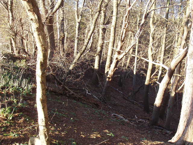
[17] Wooded slope at Jackdaw Hill
[18] View from near the M1
Beyond the motorway, I followed a right-hand fence a short distance, before passing through a cluster of trees and then a metal kissing gate (new since I walked the Greensand Ridge Walk), and continuing on alongside a left-hand hedge. There were nice views to the right along all this stretch, towards Segenhoe Manor and the tall tower and spire of Ridgmont church beyond [19]. Segenhoe Manor was built of red bricks in the early 18th century - a former resident, Thomas Potter MacQueen (1791-1854) was a prominent figure in the colonisation of New South Wales, and a settlement there was named Segenhoe. At another kissing gate, the Greensand Ridge Walk turned left beside a wood, but the John Bunyan Trail continued ahead along another side of the wood. I could see an old moat in the corner of the wood, which I remembered from my previous walk here. At the end of the wood, the path turned half-right through a new plantation that has been created as a nature reserve, then continued across a sheep pasture to reach the graveyard surrounding All Saints church, Segenhoe [20].
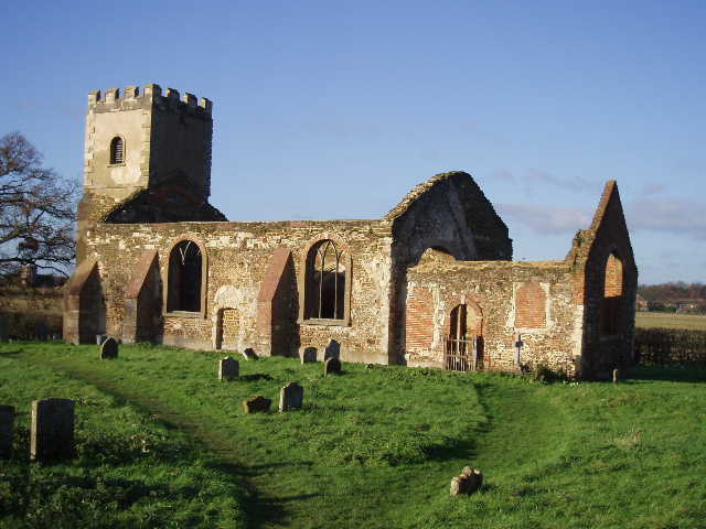
I mistakenly thought there were three churches close together here when I walked the Greensand Ridge Walk, but I now realise that the ruined church that I noticed marked on the map was actually one of the two I could see – I hadn’t seen from a distance that this one lacked a roof. Built in the 11th century, it was modified in the 14th, 15th and 19th centuries (the west tower was built in the 1820’s). Like St Mary’s church at Clophill, which I passed on the Greensand Ridge Walk, this one was declared redundant due to structural problems. The nearby church at Ridgmont was built in the 1850’s to replace it (it was designed by Sir George Gilbert Scott).
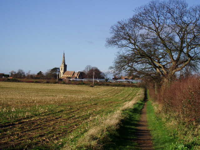
Having had a quick look at the empty shell of the church, I took a paved footpath on the other side of the churchyard that ran between hedges for about a quarter of a mile to the end of a side street in Ridgmont [21]. I followed the street to the main road, where I turned right. Here I went wrong. I took the first footpath I saw on the left, but when it entered a wood and I checked the map to see which way I should then go, I realised I was on the wrong path. In fact the footpath I wanted went down a lane – it’s most unusual for a path to be marked on the map along what looked like a normal lane rather than a track, and there had been no footpath sign, so my mistake was partially understandable. The lane led to a few houses by a road, which was where I turned round.
[19] Looking towards Ridgmont and Segenhoe Manor
[20] The ruined church at Segenhoe
[21] Path leading towards Ridgmont
I stopped for lunch on a bench alongside the path between Ridgmont and Segenhoe church. The skies had been quite clear all morning, but a few clouds developed in the afternoon, although it remained bright and sunny all the time. As I passed between the golf course and Millbrook Proving Ground on the way back, I heard and then saw a buzzard. As it was calling, I assumed it wasn’t alone, and waited until after a minute or so a second buzzard appeared, and then a third. I got back to Ampthill about 3.30pm.
This was a great walk, on a lovely sunny day. The route was quite up and down, passing through a good mixture of woods and farmland, as well as Ampthill Park. There were some great views along most of the walk, especially northwards from the greensand ridge over the lower lying land around Bedford, and there was a lot of historic interest too, including the ruins of Houghton House and Segenhoe church. I enjoyed having the time to look round these, and also to stop and watch the buzzards. This was definitely one of the most enjoyable walks I have done since starting these journals.
Total Distance: 23.8 miles (each way)