Pete's Walks - John Bunyan Trail
If you are considering walking this route yourself, please see my disclaimer. You may also like to see these notes about the maps and GPX files.
Day 2 6/12/06 Harlington to Ampthill (8.3 miles each way)
Parked at Harlington.
The weather today was similar to that of my last walk, two days ago, in that it was bright and sunny in the morning before clouding over in the afternoon. But it was never as dark and grey as it had been that afternoon, there was always some blue skies to be seen in the east, and the sun managed to pierce the clouds and shine a couple of times as I got back towards Harlington. It was windier too, with quite a strong wind especially in the afternoon, which was quite chilling when I was walking back into it.
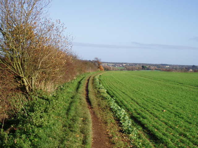
I managed to park very close to the road junction where I’d turned round on the previous walk. Setting off about 9.45am, I continued along the road on the northern edge of Harlington, heading east. After a few hundred yards I turned left along a footpath running uphill between wooden fences, with a large school and its playing fields on my left. Towards the top of the hill, the left hand fence ended and I entered the playing fields, continuing along the fence on my right. After about a hundred yards I reached the end of the playing fields, where I went through a gate and turned left to follow a hedgeline. There were reasonable views towards Pulloxhill and back towards the Chiltern escarpment, but not as good as the views I’d had on the previous walk as there was too much of the recently ploughed field in the foreground. The school playing fields were on the other side of the hedge, and I noticed that the ground here was littered with crisp packets and other junk food wrappers [1].
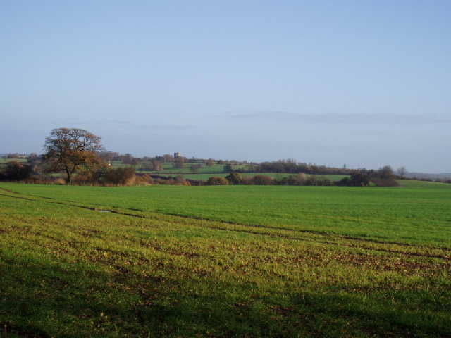
[1] View towards Pulloxhill from near Harlington School
At the next field corner, the path went through a gap in the crossing hedgerow and continued in the same direction as before, now in a large field of tall rough grass. The paths on the ground here were quite different to those shown on the map. I should have gone half right to a projecting hedge corner on the far side of the field, but there was no evidence of such a path at all. Rather than tramp through all the very long grass, I continued on the path I was on, then turned right on another path to reach the corner where there was a yellow post and a footpath sign. I went through a gap in the hedge here, entering another large field of similarly tall rough grass which sloped down towards a railway line with the village of Westoning visible beyond. Again the paths on the ground did not match those on the map. After following the hedge a short distance towards the railway line, instead of going half-right to the far bottom corner of the field I took a path going right through the long grass, then turned left down the opposite hedgerow to reach the corner. Here I went through a hedge gap and continued along the field edge, following the railway line on my left. At the end of the field I reached a road, where I turned left, immediately passing under a railway bridge and entering Westoning.
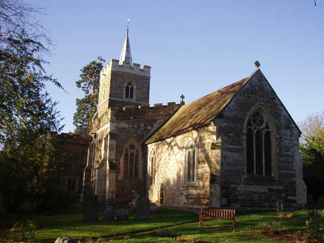
[2] Westoning church
I followed the road to a crossroads in the centre of the village. Across the main village street, I continued onwards, bearing left at a junction to reach the village church [2]. Just past this, I turned left along a farm drive, then went through a kissing gate on my left into a paddock containing four or five horses. Here the path followed the left-hand hedge, then fence, to another kissing gate in the corner. Here I stopped to study the map as I was a bit confused as to whether I should turn right here or at the next field boundary – a lady dog walker that I’d just passed kindly told me the path went right here (if I’d read the John Bunyan Trail print-out I’d got from the web I’d have seen straight away that I should have turned there – I didn’t bother, because so far the instructions had been of almost no help whatsoever). While I stopped to look at the map, I saw a buzzard over the conifers at the far end of the field.
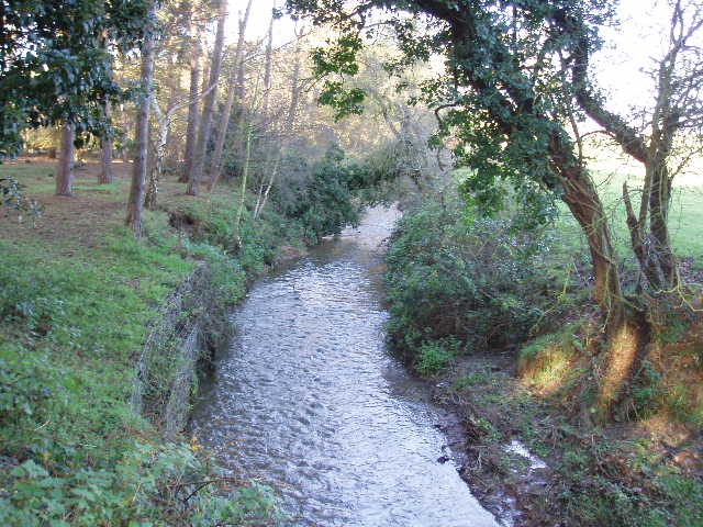
[3] River Flit
Having turned right, I followed the fence to the corner, where I went over a stile and through a narrow belt of conifers to a wooden footbridge across the river Flit – a small but attractive stream [3]. I turned left, initially along the river bank until the river turned left, passing through two empty pastures to reach a farm (with its own shop). I continued onwards along the farm drive, which turned slightly right, from a north-westerly to a northerly direction. At the end of the drive, I crossed a road and followed a footpath continuing northwards, following a left-hand fence in another empty pasture. After a few hundred yards, as I neared the field corner, I saw another buzzard take off from the next field. At that corner, I went over a stile on my left, then one on my right, to enter a very large pasture containing cattle. I crossed this diagonally half-left (now heading north-east again), rising slightly uphill as I crossed to the opposite corner with the cows and bullocks to my left. There was somebody else in this field, not on the footpath but appearing to be checking the overhead power lines that crossed the field.
Over another stile, I reached a corner of very large arable field that had been recently planted. The path had been planted over, but I could just make out where it went as it crossed the field diagonally. At the far corner, I turned right along a muddy track between a hedge and a paddock on my right. I turned right at the end of the paddock towards a farm, then turned left immediately before the farm on a surfaced drive. This took me past some cottages, and then turned right, where it became a lane as it passed some more houses on the edge of the village of Steppingley – as with Westoning, I could see that the village church was built from the local green sandstone. At the end of the lane, I followed the road to the right – there was no verge, and coming back in particular it was a bit dangerous walking round a blind bend. After a few hundred yards, I turned left on a good track that went gently uphill [4]. I could tell that I was getting close to the greensand ridge, as the soil here was noticeably sandy. I then took another good farm track that went left, initially beside a left-hand hedge, with a large open field to my right and a wood beyond. The track went slowly down before levelling out, passing an assortment of farm machinery. I then turned right on another track, to reach the end of the wood on the far side of the field. Here I turned left between a line of trees and garden fences on my right, along a very clear path that was obviously well-used – I stopped and had my lunch on a fallen tree trunk here on my way back.
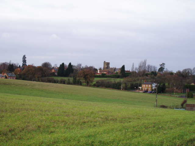
[4] Looking back towards Steppingley
The path ended at a road junction on the edge of Flitwick (pronounced Flit-ick, incidentally). I walked down the street opposite, passing under a railway bridge. At the end of the street, I turned right (I recognised this road as the main road through this small town, I will be driving along it on the way to Ampthill for my next walk). After about quarter of a mile, I turned left opposite a pub. After about three hundred yards, this street forked and I took the left-hand fork, which was roughly surfaced and ended after another couple of hundred yards. A footpath continued onwards, soon leaving the houses of Flitwick behind as it followed the left-hand hedge of a large and recently planted arable field [5]. Over to my right, behind a line of trees was an industrial estate where there was a peculiar tall white square building, which I’d noticed from afar on my previous walk. Where the hedge turned left, the path continued onwards across the field for several hundred yards to reach a road. Here I turned left and followed it towards a roundabout – there was only a very rough verge here, so I was frequently stepping on and off it as vehicles went by.
[5] Path leading away from Flitwick
At the roundabout, I carefully crossed the busy A507, and turned half-left on a path through a field of rough grass then stubble. After about a hundred yards, I turned slightly right off the clear path, to cross the stubble towards a yellow footpath marker, then continued across the stubble to a second marker. Here I entered the edge of a playing field, which I crossed to reach a road on the edge of Ampthill (which is pronounced Amp-till, rather than Amp-thill). I turned left along the road, following it as it turned sharply right but then leaving it as it turned left. I followed the instructions in the print-out to make my way through the residential streets of the town, finally turning left down a long alley called Kings Arms Path. This emerged into a courtyard with a few businesses (including a tempting looking Mexican restaurant) then went through an archway [6] to reach the Market square in the town centre. The centre of Ampthill is an attractive collection of mainly Georgian buildings (the town has over 200 listed buildings), but when I got there the roads were somewhat jammed with traffic [7,8]. I took a couple of quick photos and turned round, the time now being about 12.15. I managed to get to the far side of Flitwick for lunch just after 1pm, and got back to my car in Harlington about 2.55pm.
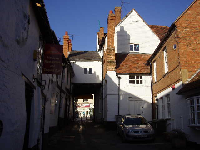
[6] Courtyard leading into the centre of Ampthill
This was one of those walks that I think of as a ‘necessary walk’, one that doesn’t hold any great interest in itself but is necessary to get from one interesting part of a route to another. There was nothing of any great interest, the print-out didn’t mention any connections with Bunyan or any other historic matter along this section. There was a lot of road walking, through Westoning, Flitwick and Ampthill, and on the outskirts of Steppingley –some of this required a bit of caution as there were no pavements or decent verges. The section from Westoning to Steppingly was quite pleasant, but nothing special. Generally the route was quite low-lying so there were few extensive views. The walk was also fairly flat, with only one descent between Harlington and Westoning and a gentle rise and fall between Steppingley and Flitwick. There was next to no woodland on the route. So overall I found it a rather dull, though not unpleasant, walk – but I’m sure the exercise did me good and I did get to see a couple of buzzards.
Total Distance: 16.5 miles (each way)
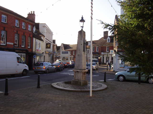
[7] Ampthill
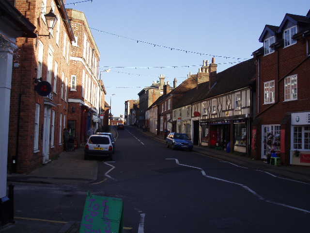
[8] Ampthill