Pete's Walks - John Bunyan Trail
If you are considering walking this route yourself, please see my disclaimer. You may also like to see these notes about the maps and GPX files.
Day 7 20/12/06 Clapham to Elstow (4.1 miles each way)
Parked in road in Elstow.
This was an unusual walk in many respects. It is the shortest one that I have recorded so far in these journals, and it was the first one where I walked in trainers rather than my walking boots. It was one of the first, if not the first, where there was a hoar frost (not just the ground but the twigs on trees and bushes where white with ice). It also had the highest percentage of road walking of any of these walks – consequently, I hadn’t been looking forward to it as I thought it would just be a boring plod through Bedford. In fact, mainly because of the weather conditions, it turned out to be a most enjoyable morning.
The reason this walk was so short is partly because I rather mucked up my planning for the John Bunyan Trail (I made one or two silly mistakes when splitting the route into seven or eight mile sections) and partly because I wanted to have time to explore both Elstow and the Bunyan Museum in Bedford. It would certainly be possible to do the John Bunyan Trail both ways in ten days rather than the eleven it is now going to take me.
I was about ten minutes late leaving the house this morning (I’d taken it a bit easy as I knew this was a very short walk), and then I realised I’d need to spend five minutes de-icing the car. When I reached Dunstable Downs I simply had to stop to take some photographs – the Downs looked lovely under a white frost, but it was the view that caught my eye. Normally on a clear day you can see for about 50 miles northwards from the top of the Downs, but this morning you could only see about half a mile from the bottom of the steep slope, to the far side of the London Gliding Club. Beyond that the ground was covered by a sea of thick fog – it really looked as if the clouds had dropped from the sky and settled on the ground (perhaps that character in the Asterix cartoons who is permanently worried that the clouds are going to fall on him isn’t so daft after all!). I drove into the fog as I left Dunstable, but fortunately it wasn’t too thick (visibility was never less than quarter of a mile) and I had come out of it again by the time I reached Toddington. As I came out of Ampthill and went over the greensand ridge I had a similar view to that from the Downs – I could see the lower ground for a mile or so, but then there was another blanket of fog smothering Bedford and the Ouse Valley. The entire journey was through a marvellous hoar frost, with everything glistening white.
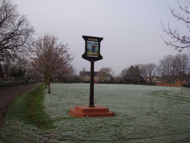
[1] The village green, Elstow
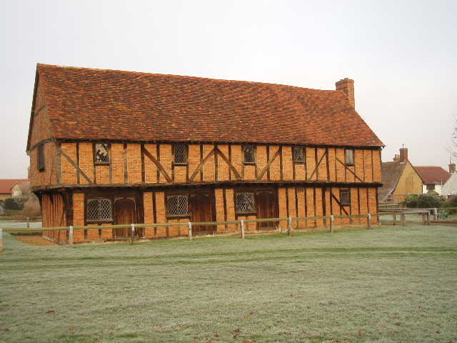
[2] The Moot Hall, Elstow
[3] Green, Moot Hall and base of Maypole, Elstow
I parked in Elstow, as I’d decided to do the walk ‘backwards’ to save having to drive through Bedford twice. I’d also decided to walk in my trainers rather than my walking boots as the vast majority of the walk would be on pavements – I sometimes get sore shins when walking on hard surfaces and thought the trainers would solve this problem. My training shoes are of a type designed for walking, but I was a little concerned as I’d not actually walked in them for more than a couple of miles before. As it turned out they were fine, I had no problems at all with sore shins or blisters or sore feet, and as the muddy parts of the walk were largely frozen the trainers didn’t get too dirty.
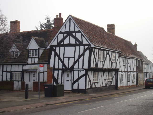
Before I started the walk I had a look round Elstow, which was John Bunyan’s birthplace and has many associations with him. The main village street, where I’d parked, contained many charming half-timbered houses, some of which have recently been restored by Beds County Council. I wandered the few yards to the village green [1], where I discovered that the Moot Hall [2], which now houses a small museum, was closed for the winter! So much for my plan to spend some time exploring it! The Moot Hall is a very attractive Tudor market house, built with bricks but timber framed. The lower floor once contained small shops. The museum the Moot Hall now holds illustrates 17th Century English Life, with especial reference to the life of John Bunyan. Outside the Moot Hall was a notice board, which included a section about this long-distance path I’m walking (I noticed that it was called The Bunyan Trail, rather than the John Bunyan Trail).
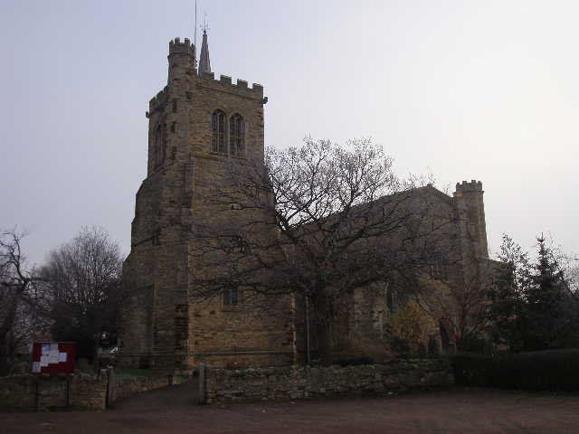
[4] Elstow church - it is not clear in this photo, but the tower is separate from the rest of the church

[5] Abbey ruins, Elstowk
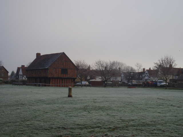
[6] Elstow
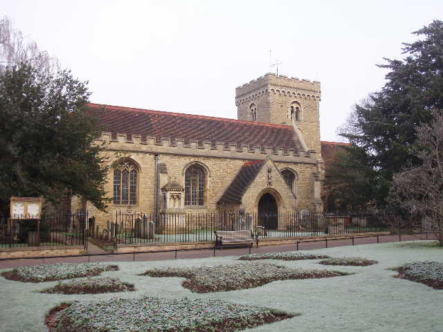
The Moot Hall is situated on the village green, where there is also the stump of a may-pole [3]. Fairs were held on the green in Bunyan’s day, and these are thought to be the inspiration behind ‘Vanity Fair’ in Pilgrim’s Progress. Elstow Abbey Church [4,5] stands to the south of the green. The Abbey was founded in 1078 by the Countess Judith, a niece of William the Conqueror. It became one of the richest of the 106 Benedictine nunneries and at its peak in the 14th century the building was twice its current size. It ceased its life as an Abbey in 1539, as part of the dissolution of the monasteries under Henry VIII, and the church was reduced to its current size during the reign of Elizabeth I when it became the parish church of the village. The church is one of the very few in the country where the tower is separate from the main body of the building. John Bunyan was christened at the church, and attended services there for many years. His parents and sister are buried in the graveyard.
Having had an enjoyable few minutes exploring the centre of Elstow [6], I set off about 10.30am to walk north through Bedford to where I finished my previous walk in Clapham. I’ll describe the walk back in the opposite direction, so that it continues on from the previous walk descriptions.
[7] The drive to Clapham Park
[8] Path between Clapham and Bedford
[9] Looking back along the path between Clapham and Bedford
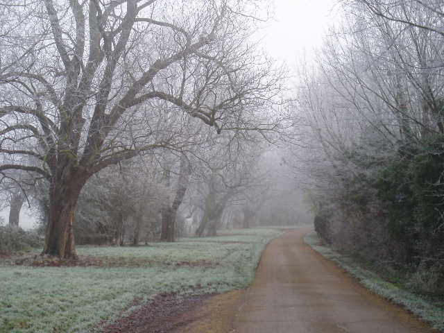
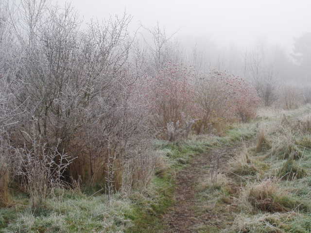
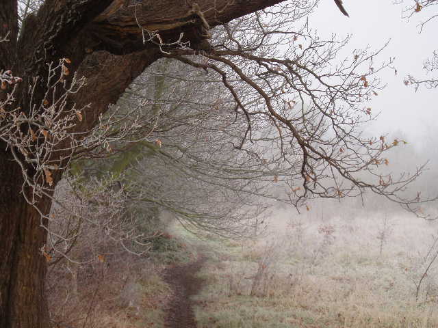
From Green Lane in Clapham, I turned east along the drive to Clapham Park [7]. After passing one or two properties, this ran between a right-hand hedge and a line of mature trees. Everything was still covered in frost and it was slightly misty, making it very atmospheric. Just past a Lodge, I continued ahead on a track as the drive turned left, and after a few yards turned right by a footpath sign. I was now heading roughly south, and would continue to do so until I reached Elstow. The path crossed a section of the grounds of Clapham Park that was being planted with trees to form a community woodland. Beyond a kissing gate, the path crossed an area covered by low bushes [8], then passed through a small nature reserve [9]. It then continued between hedges, with allotments on the left and an industrial estate behind the more mature hedge on the right. I stopped along here to take some close-up photos of berries on the frost-covered bushes [10], and even took a photo of the allotments – the hoar frost made everything very photogenic.
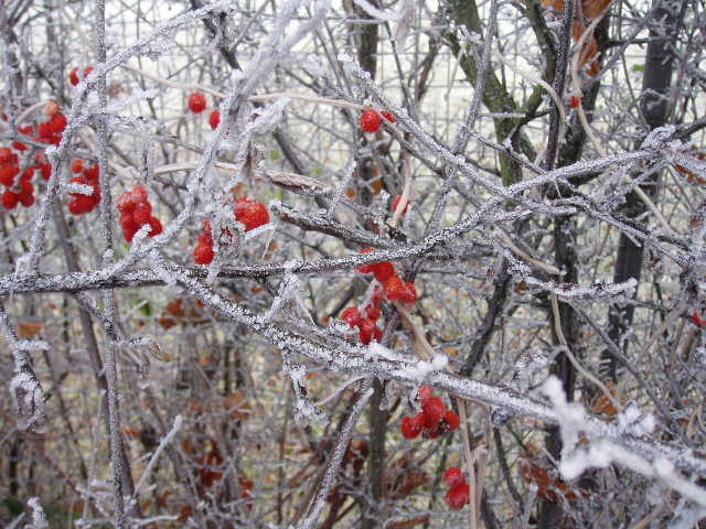
[10] Hoar frost on branches and berries, just north of Bedford
[11] Path beside the cemetery
[12] Bedford Park
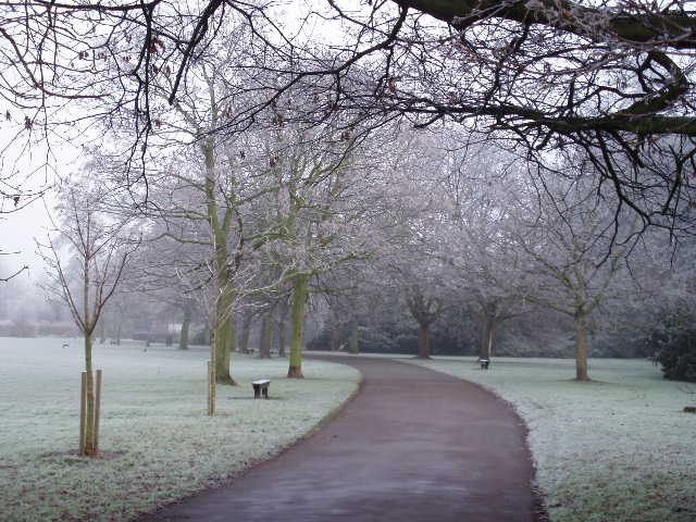
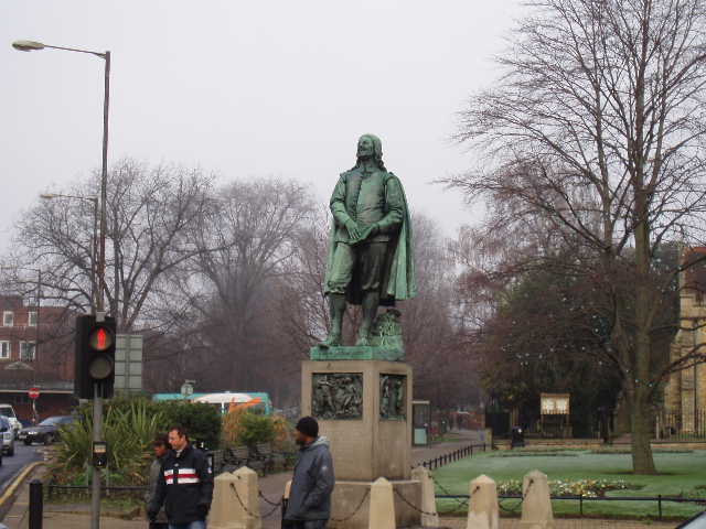
The path soon reached a road on the edge of Bedford. On the other side of the road, the path continued on a hard surface, running downhill with the wall of Bedford cemetery to the left [11] and houses to the right. The footpath ended at a corner of a road, where the John Bunyan Trail went ahead for a few yards before turning left into Bedford Park [12,13]. Again the trees and grass in the park looked stunning in the frosty conditions. The park was designed by the celebrated landscape gardeners William Banon and sons of Derby, and opened in 1888. It is now Grade II listed, and managed by Bedford Borough Council. I went out between the gates at the entrance to the park, crossed Park Avenue, and continued southwards along the tree-lined De Parys Avenue. Here I passed the entrance to Bedford School. At the far end of the avenue I carried on towards the town centre, almost immediately passing the church of St Peter de Merton on my left [14]. This is another church that dates back to the Saxons – apparently evidence of where the church was burned by the Vikings in 1010 may still be seen. The church was altered during the Early English period, and again during the 19th century. Just beyond it, by a busy traffic junction, I passed the Bunyan Statue [15]. This nine foot high statue was donated by Hastings, Duke of Bedford, in 1874.
[13] Bedford Park
[14] Church of St Peter de Merton, Bedford
[15] The Bunyan statue, Bedford
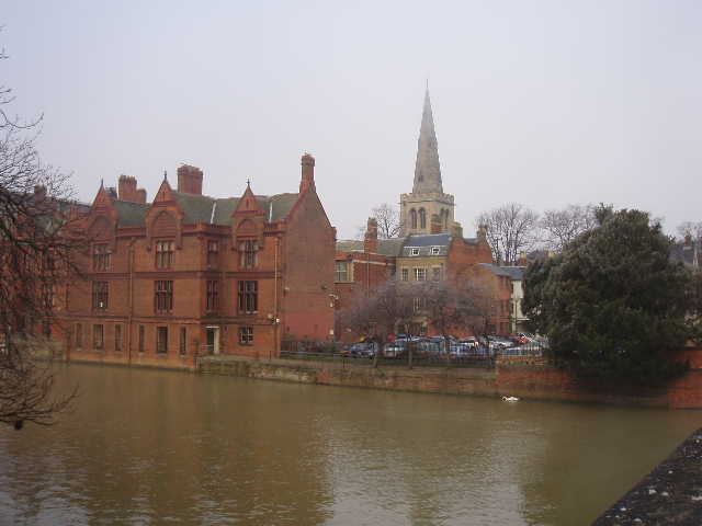
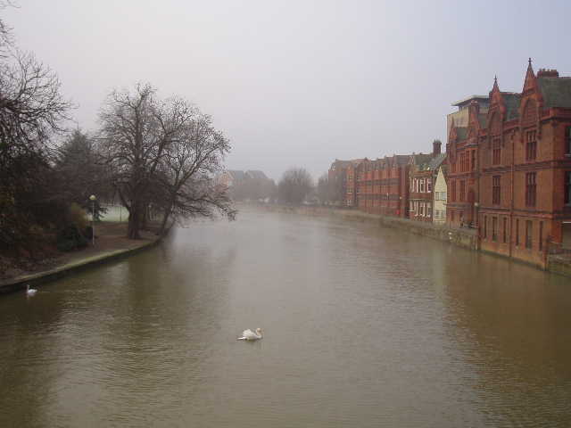
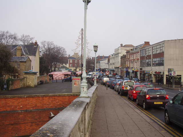
I walked on along the busy pavements, and turned left down Mill Street to visit the Bunyan Museum. Of course, that too was closed for winter! I wasn’t quite so disappointed about this, the Moot Hall being closed had made me possibly expect the same to be true of the museum (Doh! I’ve just noticed that the print-out mentions that the museum in the Bunyan Meeting House isn’t always open). I returned to the main street and continued on my way southwards I passed the busy market on my right, and then crossed the bridge over the Great Ouse, much wider here than when I’d seen it previously [16,17,18]. Continuing southwards, I saw a blue plaque on a building next to the church of St John the Baptist. It was here that Bunyan received his spiritual awakening through the work of John Gifford, Rector of The Independent Bedford Gospel Church who met in St Johns. When the rector died, Bunyan was elected to replace him as preacher. The rectory appears as the ‘House of the Interpreter’ in Pilgrim’s Progress.
[16] River Great Ouse at Bedford
[17] River Great Ouse at Bedford
[18] Bedford from the bridge over the river Great Ouse
Continuing southwards through Bedford, I crossed a roundabout and went across a bridge, where I turned right into Elstow Road. This was another avenue, but nowhere near as nice as De Parys Avenue – I passed a Salvation Army outreach centre, which was conveniently placed next to an off-licence (there were at least two more down the road). Across another roundabout at the end, a paved path led to a road that passed a chapel (named after Bunyan, of course) and a school. I continued ahead at a junction to reach the old part of Elstow where my car was parked. It was now 1pm, and I sat and ate my sandwiches in the car. According to my car’s thermometer the temperature was still zero as I drove off from Elstow, although it had reached a sultry 1C by the time I reached Flitwick. I again stopped to take more photos on Dunstable Downs – the fog had now risen almost to the level of the top of the Downs, so the Gliding Club was now hidden from view. So too was Ivinghoe Beacon which had earlier been visible rising out of the fog – looking in that direction, I could only see part of the woods of Ashridge above the grey blanket of fog.
I really hadn’t been looking forward to this walk at all, as I thought it would be a dreary boring plod through the streets of Bedford. I was hoping to make the walk more enjoyable by breaking it up by visiting the museums in Elstow and Bedford. Even though the museums were closed for the winter, this turned out to be a very enjoyable morning’s walk. I really enjoyed looking round Elstow, and will no doubt go back again sometime when the museum in the Moot Hall is open. The walk through Bedford wasn’t as bad as I’d feared, and was made more interesting by several features of historic interest. The walk through the park and the footpath to Clapham were made much more pleasant than they would normally be by the hoar frost. Everything was covered in white frost, and there was a slightly misty atmosphere. This made even mundane things such as the allotments look quite different and interesting – I took 51 photos (admittedly 9 were on Dunstable Downs which wasn’t part of the walk) which I think is more than I’ve ever done before on a walk, and this was a very short walk. Despite the frost, I never felt cold at all, nicely wrapped up in my Paramo gear, my thermal hat and my fingerless mittens.
Total Distance: 50.3 miles (each way)