Pete's Walks - John Bunyan Trail
If you are considering walking this route yourself, please see my disclaimer. You may also like to see these notes about the maps and GPX files.
Day 8 22/12/06 Elstow to Shefford (8.5 miles each way)
Parked in road in Elstow.
It was probably a mistake to do this walk today. It was foggy all day, and so I really didn’t see much on this walk because of the severely restricted visibility. I was keen to do another walk this week, because I have been slipping up badly in my aim to do three 15-mile walks each week. I was hoping that the weather conditions would be similar to two days ago, when the lower land around Bedford was in fog but the higher ground on the greensand ridge was clear, so that at least part of the walk would have good visibility. In the event, perhaps I would have done better to have just done a local walk in the fog today, and to have left this walk for a nicer day – but I know it would have been hard to motivate myself to do a local walk, as I’d be constantly thinking ‘I’ve walked all this way, but I’m no nearer finishing the John Bunyan Trail!’. The only times that I’ve done any local walks while in the middle of walking a long-distance path is when I’ve been recovering from an injury.
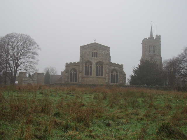
[1] Abbey ruins, church and tower in Elstow
I parked in the same place in Elstow as I did two days ago, and headed off southwards down the road at about 10.10am. I passed several more old houses, some timber-framed and some thatched, and there was a nice view to the right to the church and the abbey ruins [1]. The road crossed a bridge over the A421 Trunk road, and I then turned left down a side road to head south-east, the direction I’d be following for almost all of the rest of the walk. The road ran past a few houses on the right and then became a tarmac farm drive, part of an ancient bridleway that I would be following all the way to Haynes. Apparently this was the route used by John Bunyan when he went to preach in Haynes. After half a mile I passed Medbury farm on my left, and went over a cattle grid into a very large pasture where a small flock of sheep stood close to the tarmac drive. A short distance further on, the tarmac ended as it reached a cottage, the bridleway continuing on a track that went left a few yards then right by a farm building. I soon left the large pasture over another cattle grid.
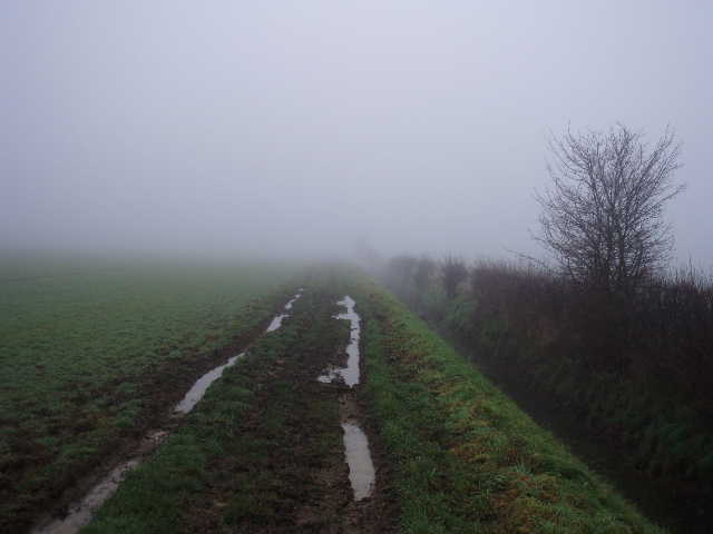
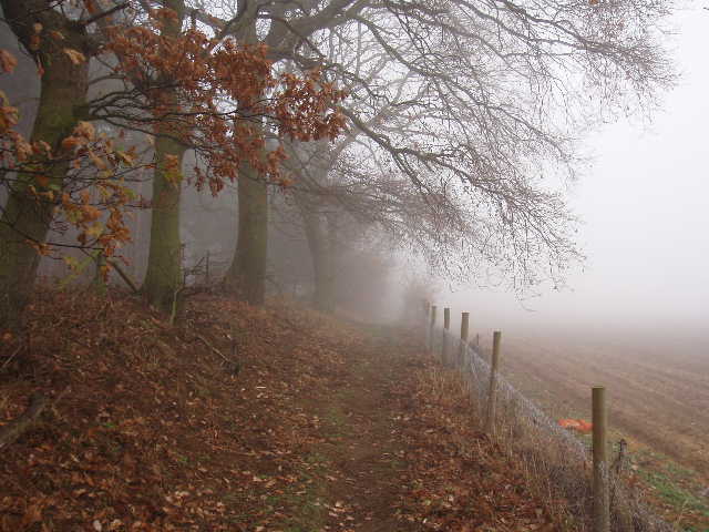
[2] Foggy bridleway between Elstow and Wilstead
The bridleway now continued for almost another two miles as a grassy farm track, with some evidence of a stone surface under the mud in places but very wet and muddy in other places. The track followed a ditch and hedge on the right [2], the ditch being quite impressive as it was about 10 feet deep. There were several inches of water at the bottom of the ditch, and I should imagine that the ditch needed to be deep because this flat clay land must be prone to flooding after prolonged heavy rains. The hedge contained many berries, mainly haws with occasional sloes and at least one blackberry bush. The succession of fields either side were grass or arable or root crop. The fog reduced visibility to about 100 yards, so I couldn’t even see as far as the field boundaries on the other side of the fields. I met two horse riders coming the other way, and the numerous hoof prints showed that the bridleway was well used.
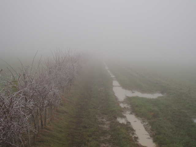
[3] Foggy path near Hammerhill farm
The bridleway eventually reached a minor road on the very edge of Wilstead (I noticed that on the map the parish is actually called Wilshamstead, presumably an old name for Wilstead). I turned right for a few yards, passing a couple of houses, then turned left down Elms Lane. After a quarter of a mile, I passed through the yard of Manor farm and continued south-eastwards on another bridleway. There was now a slight change in the scenery, as the ditch and hedge were now on my left! So far the walk had been completely flat, but after about half a mile the bridleway climbed the slope of the greensand ridge, a gain in height of only about 100 feet and at a gentler gradient than I’d expected – in fact this short ascent was so easy I wasn’t sure that there wasn’t more to come until I’d checked the map and walked on the flat at the top of the rise for a short distance. The printout of the John Bunyan Trail said there was a good view back from the top of the hill, but I’ll have to come back another time to see it! A new hedge here was covered in ice, the nearest I saw all day to the wonderful hoar frost I’d experienced two days ago [3]. I should have been able to see Hammerhill farm across the field to my left, but it was lost in the fog. A little further on I reached Northwood End farm, where there was a small old brick and timber corn store, raised off the ground on ‘staddle stones’ to prevent rats from eating the grain [4]. At this point the bridleway joined a lane which continued onwards into Haynes.
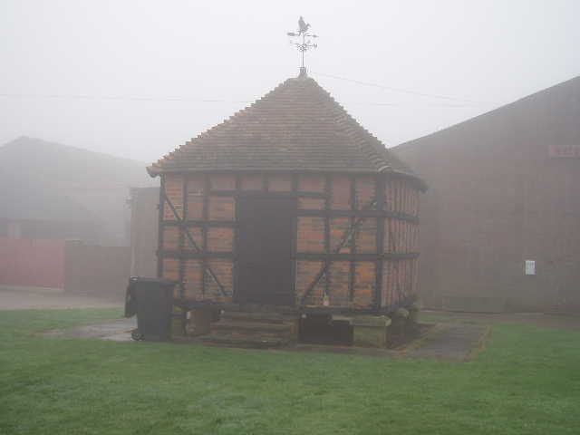
[4] Old corn store at Northwood End farm
Haynes is one of those villages consisting of a number of small hamlets or ‘Ends’, although Northwood End where I now found myself was a respectably sized village in its own right (Eversholt, which like Haynes is on the route of the Greensand Ridge Walk, consists of no less than 13 Ends – I read this in the leaflets I used for that walk and, a little doubtful, I have since counted them on the map). At the end of the lane, I turned right for a few yards then turned left down Northwood End Road. I passed a children’s playground outside the village hall (there were some benches here where I’d have my lunch on my way back), and a bit further on there was a short stretch of the road I’d walked before as it was on the route of the Greensand Ridge Walk. I passed the Greyhound pub on the right, and a few hundred yards further on, having left the buildings of Haynes behind, turned right on a footpath. This crossed an irregularly shaped field, containing long grass and looking as if it was reverting to scrub land. On the far side I crossed a lane, and continued on a path following tractor tracks across a recently planted arable field. This took me to a concrete farm drive, where I turned left.
[5] Path near Firstlodge farm
I followed the concrete drive (it was covered in tarmac in a few places) for some distance. After a while there was a wood on my left – mainly coniferous but with a line of oak trees immediately next to the drive. A number of ploughs, harrows and other farming machinery was parked along the right side of the drive here. I went through the yard of Secondlodge farm, crossed a lane, and then went past Firstlodge farm. The bridleway was now a narrower path, still with the wood on the left and a fence on the right with fields beyond [5]. Where the wood ended, the path continued alongside a hedge to reach a road junction with a roundabout. I continued alongside the road opposite for about half a mile to reach the edge of Shefford, Here I turned right into a cul-de-sac and at the bottom turned left, to follow a path with bungalows on the left and the river Flit to the right. This path soon reached a road, where I turned right to cross a bridge over the river Flit [6] and reach the town centre in a few hundred yards.
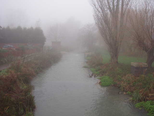
[6] River Flit, Shefford
The name Shefford is derived from ‘sheep-ford’ – it is thought that it was probably around the time of the Danish invasions in the 9th century that shepherds found that this was the easiest point to cross the river with their flocks. In 1225 the town was granted a Charter allowing it to hold a market, and in 1312 another Royal Charter granted Shefford the right to hold a fair. The fair is still held every 11th October, and the weekly market was revived successfully in the 1960’s (it’s every Friday, so was there today [7]). The town’s most famous resident was the poet Robert Bloomfield, who lived here from 1799 until his death in 1823. His most famous work ‘The Farmer’s Boy’ sold 26,000 copies, an incredible amount for that period.
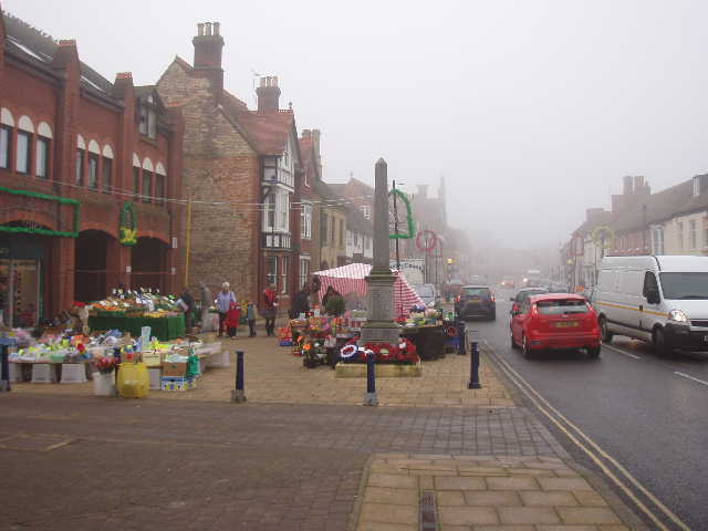
[7] Shefford market
I took a couple of photos near the road junction at the town centre, and one of the church (another one built from the local green sandstone) [8]. Near the junction there was a modern replica of the old town pump. I turned round, but before heading back I took a quick detour to follow the river Flit a few hundred yards eastwards, to where it was joined by the river Hilt to form the River Ivel Navigation. This river had been canalised in the 19th century, but like many canals soon became redundant after the advent of the railways.
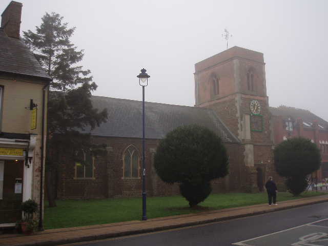
[8] Shefford Church
I wandered back through the fog, stopping to eat my lunch in Haynes. As I was approaching Elstow the visibility increased briefly to around 200 yards, but soon closed in again. I got back to my car at about 3.20pm which, allowing for my short lunch break, meant I’d walked for five hours. It had been cold all day, and it was still only 1C when I drove away from Elstow. It was down to -2C when I went over Dunstable Downs, and the frost on the bushes and grass was so thick it looked as if it had snowed.
This turned out to be a walk just for the sake of the exercise, as I really couldn’t see anything through the fog at all. It was a real shame, as I suspect that on a clear day this would be a very good walk. At the start of the walk you would be looking towards the long line of hills that form the greensand ridge, and once you’d climbed that ridge there’d be good views back over the lower land around Bedford. The walk was on good clear paths throughout so there was little difficulty with navigation. Despite the fog, I still enjoyed this walk today but regret that I didn’t save it until a better day.
Total Distance: 58.8 miles (each way)