Pete's Walks - John Bunyan Trail
If you are considering walking this route yourself, please see my disclaimer. You may also like to see these notes about the maps and GPX files.
Day 9 27/12/06 Shefford to Hexton (7.1 miles each way)
Parked in free car park in Shefford.
This was a very grey day, the sky remaining dark and overcast throughout the walk, although the clouds cleared as I drove home in the afternoon. It was a little misty at the start of the walk, restricting what would otherwise be extensive views in places, but the mist had gone by mid-morning. I was determined to walk today, as I wanted to walk at least one day between Christmas and New Year in an attempt to remedy the effects of too much turkey and Christmas Pudding.
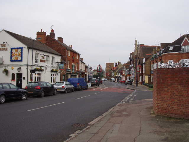
[1] Looking back along Bridge Street, Shefford
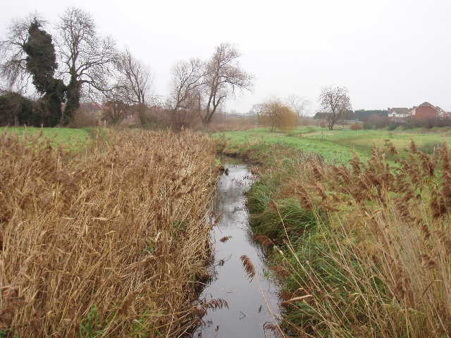
[2] River Hilt, Shefford
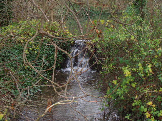
I started walking at 9.55am, following Bridge Street away from the road junction at the centre of Shefford, passing the church on my left. A little past The Bridge public house on my right [1], I turned left into New Street and followed this through an older section of the town and then went on through a new housing estate. An iron fence forced the path to turn to the left where it went through a hedge gap into an area of rough grass. Here I became confused over where the John Bunyan Trail actually went. The print-out I’d got from the web was out-of-date and of no use here, as the paddock and stile it mentioned were now obviously buried under the housing estate. The OS map was downright misleading. It showed the route going straight on in the same southerly direction as New Street, so I turned right alongside the hedge to reach the bypass on the other side of the rough grass field. I could see no sign of any footpath continuing across the other side of the bypass (the map shows the path restarting across the bypass but, as I found out a few minutes later, if it did it would have to go straight across an impassable river!). The print-out said that the John Bunyan Trail went through a subway under the bypass. There wasn’t one here, so I turned left and walked another side of the field, parallel to the bypass. Near the field corner, I found a bridge over the river Hilt, and across this, I turned right to go under a subway below the bypass [2]. On my way back, I walked round the other two sides of the rough grass field, which is where I think the proper route is (there was a clear path all the way round the field, but only footpath signs round the two sides I walked in the afternoon).
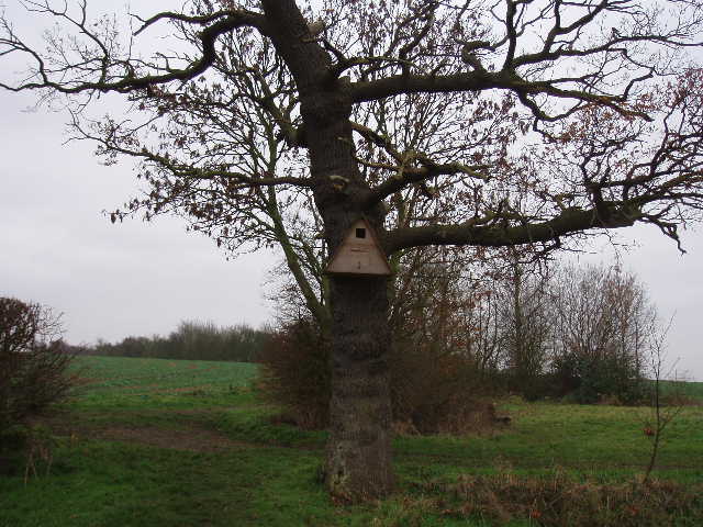
[3] Large Nesting Box, between Shefford and Meppershall
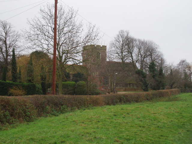
[4] Meppershall Church
On the other side of the bypass, the path followed the river as it turned right. It soon came to a path junction, where I turned left to follow a hedgerow path towards Polehanger farm. The path then went diagonally across a large grass field, going through a hedge gap in a field corner to join a farm track [3]. I continued on along the track, with a hedge on my right, then turned right through a gap in the hedge to follow a left hand fence. Here there were nice views over the farmland to the west. At the next field corner, the track turned left and passed a recreation area with a children’s playground on the left, before passing Meppershall village hall to reach the main road through the village. I turned right, and followed the road for about half a mile through Meppershall. At a junction, I took a path going slightly right across a paddock with a solitary horse. The village church, which dates back to the Normans, was over to my left [4], and on the right were some good views over the lower lying ground to the west. Beyond the paddock, I followed a left-hand hedge. A little further on I could see mounds and ditches on the other side of the hedge, very obviously the remains of a Motte and Bailey Castle (which the map confirmed) [5].
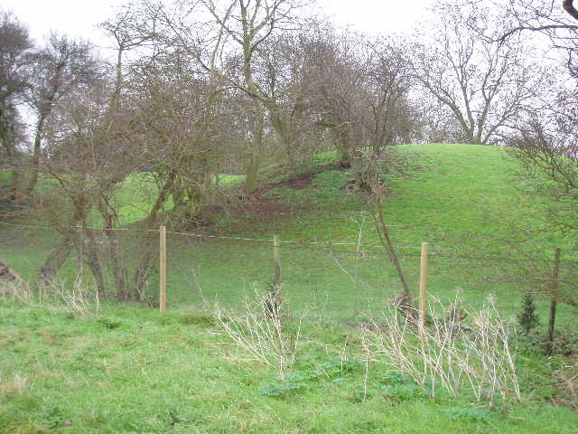
[5] Remains of a Motte and Bailey castle near Meppershall
[6] Dilapidated cottages, Shillington
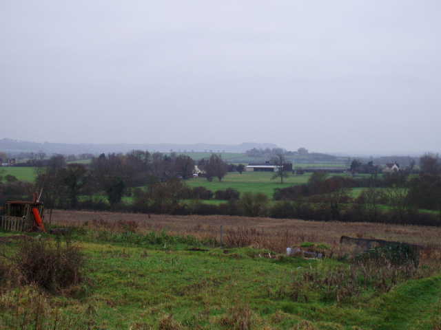
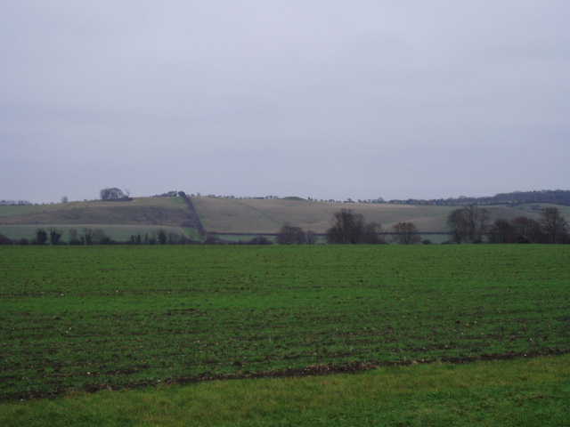
I turned right at the next field corner, then went left through the hedge after about a hundred yards, then right again through a hedge gap (a clear path through the grass cut the corner I’d just walked round, but the map and the signposts indicated that I’d gone the correct route). There were now extensive views to the south, with Shillington church prominent on its small hill and the line of the Chilterns beyond. I followed a left hand hedge for a while, then continued southwards on a good track that was descending slightly. The grey and slightly misty conditions restricted the views slightly, but I could make out Sharpenhoe Clappers in the distance, and also the water tower at Pulloxhill. This was unusual for me, as I don’t think I’ve often seen landmarks from the start of a circular route as I’ve neared the end. As I followed the track, soon with a hedge on my left, I could see two churches not far apart ahead and to my right – checking the map, I could see these were at Lower Gravenhurst and Upper Gravenhurst (even at a distance, I could see that the latter was built of green sandstone).
[7] View from near Shillington church, looking towards Sharpenhoe Clappers
[8] Shillington church
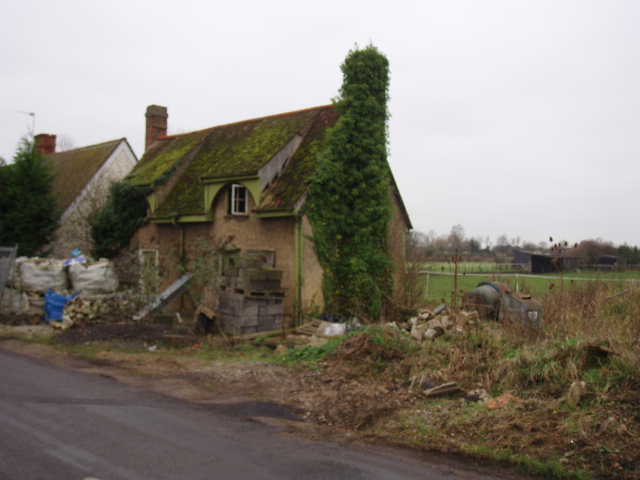
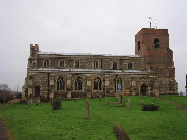
The track ended at a road, where I turned left for a hundred yards or so before turning right into Bury Road (there was a seat by this junction, where I would later eat my lunch). I followed this road for about half a mile through the village of Shillington (or at least through part of the village, as Shillington is another of those villages that consists of several ‘Ends’). In 1999, Shillington was the winner of the Bedfordshire, Anglia and Home Counties Sections of the Village of the Year competition, and also won a special award for Care in the Community for the Elderly. I passed a pair of very tiny semi-detached old houses that were derelict [6], but were obviously about to be redeveloped judging by the piles of sand and cement outside them. The road turned to the left, and shortly afterwards I took a paved path on the left which led uphill towards some allotments [7] and then the church [8]. This church, too, was mainly built of green sandstone but most of the tower was brick. There were good views in most directions from the church’s hilltop situation, but my eye was particularly drawn to the Chiltern Hills to the south.
[9] Weir in Apsley End
[10] Looking towards Knocking Hoe and Knocking Knoll
I took a path through the churchyard, round to the right of the church to a gate. Here there was again a slight discrepancy over the route of the John Bunyan Trail. The map clearly showed it going right along a track and then left, whereas the print-out and a waymark indicated it went half-right across a meadow. That was the way I went. The two routes rejoined at the opposite field corner in any event, where the path went through a hedge to reach another road. I turned right on the pavement alongside the road, soon reaching Apsley End, another part of Shillington. I went straight on at a crossroads, the pavement now on the left side of the road alongside a stream – I soon saw a weir where the water escaped from what was marked as a moat on the map [9]. I carried on, passing The Musgrave Arms pub on my right. The pavement ended shortly before I reached the entrance to Shillington Manor. There was just one more house after that, and I continued on down the quiet road for another third of a mile. To my left, across the fields, I could see a low ridge running north from the Chiltern escarpment at Deacon Hill. The ridge was Knocking Hoe, and on its summit I could clearly see the large burial mound (or Long Barrow) of Knocking Knoll [10].
[11] Path leading towards Hexton
[12] View towards Deacon Hill
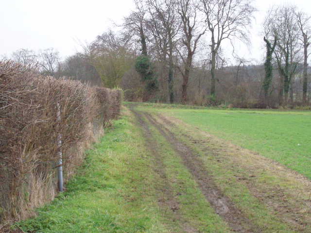
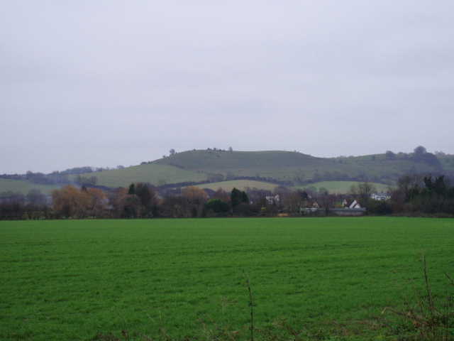
I turned right off the road onto a good, but muddy bridleway. After a short distance this turned left alongside a hedge [11]. There were now views ahead to the Chilterns, Deacon Hill being prominent to the left [12] and I could also see where the Chiltern Way went up Pegsdon Hill. Further right, somewhere in a wooded section of the steep slopes, was the hill fort of Ravensburgh Castle. At a path junction, the John Bunyan Trail turned right alongside a belt of trees, soon passing an isolated house that was once a mill. The bridleway then continued westward along the tarmac drive of the house, before turning left into the small village of Hexton (somewhere since leaving Shillington I had crossed the county boundary from Bedfordshire into Hertfordshire). The John Bunyan Trail took the first turning on the right, but I left that for my next walk as I went on a few yards to where the village pub stood opposite the village hall [13,14]. A plaque on the hall said the clock tower was added by the grateful tenants of the Hexton estate to commemorate the Diamond wedding of Sir John Hill, Baronet, and Lady Hill, who had had the hall built.
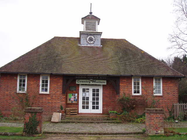
[13] Hexton Village Hall
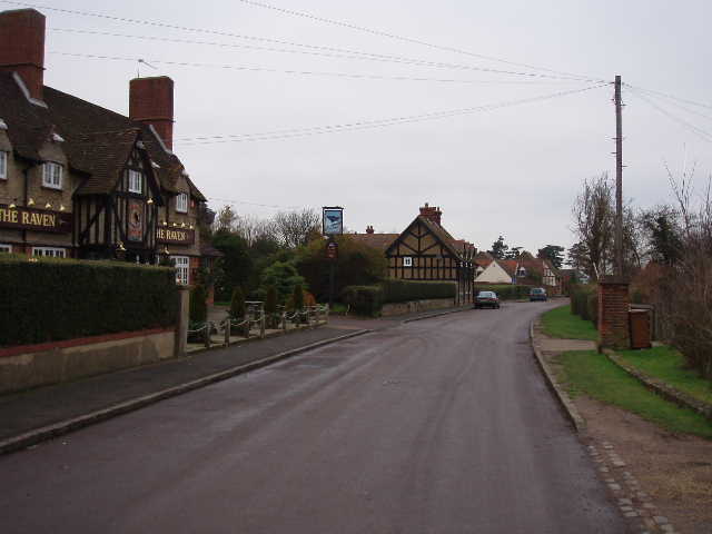
[14] Hexton
It was about 12.15pm as I turned and started on my way back to Shefford. I stopped for lunch on the far side of Shillington, and got back to my car just after 2.30pm.
This was a pleasant walk, despite a considerable amount of road walking. There were some nice views for much of the way, and I’m sure that on a sunny day they would have been even better.
Total Distance: 65.9 miles (each way)