Pete's Walks - Marsworth Canal Walk
I did this walk on Sunday, 17th January 2010. It was basically the same route as an 8-mile walk I'd done twice before, but in the opposite direction. I started at the Grand Union Canal at Marsworth, followed the Aylesbury Arm of the canal westwards for a few miles, turned south for a mile or so to reach the Wendover Arm of the canal, which I then followed eastwards to return to the main part of the Grand Union Canal about half a mile from Marsworth. After all the snow we had had recently, followed by a heavy overnight rain, I expected the footpaths and bridleways to be incredibly muddy, so I thought a canal walk on fairly solid towpaths would be a sensible choice. I also decided to avoid the field paths I usually use between the two arms of the canal, and instead stuck to lanes and minor roads for that section.
I started out from the large 'Pay and display' car park at Marsworth about 10.05am. I was rather surprised to see large chunks of ice on the Grand Union Canal, as the 3-4in of snow we'd had had almost entirely been washed away. I followed the canal a short distance north-westwards and turned left along the Aylesbury Arm. Here the ice was thicker, completely covering the canal for most of the way that I followed it and it was clear that no boats had travelled along here recently. I followed the Aylesbury Arm for a few miles westward. I was pleasantly surprised by how few people I met on this Sunday morning, just one or two other walkers and a handful of joggers. The last time I walked this bit of the canal in this direction was when I walked the entire Aylesbury Arm back in July.
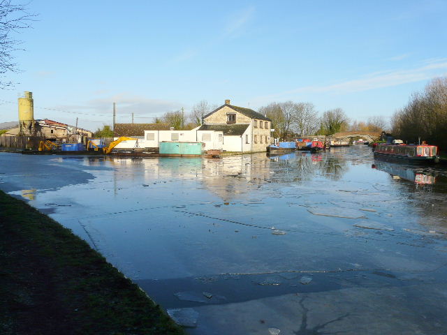
The canal junction at Marsworth, where the Aylesbury Arm branches off left
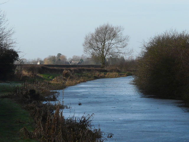
Thick ice on the Aylesbury Arm
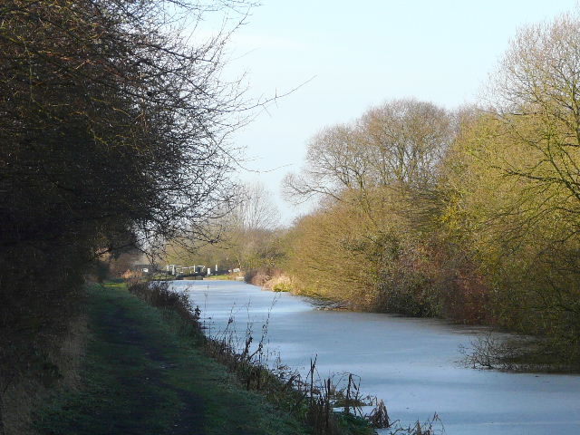
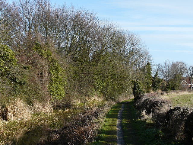
The Aylesbury Arm
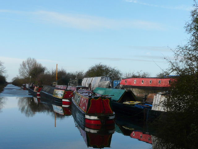
Boatyard along the Aylesbury Arm, one of the few bits that were free of ice
The Aylesbury Arm, shortly before I turned off
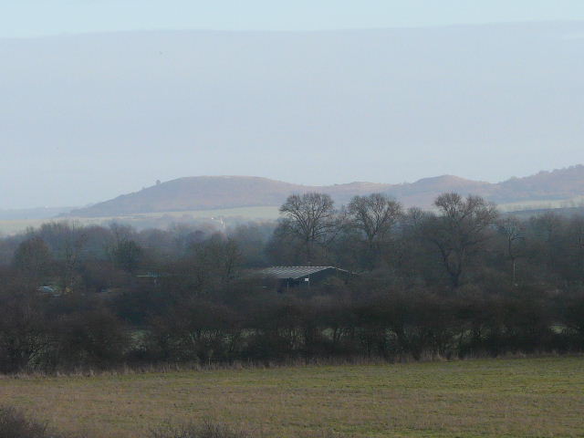
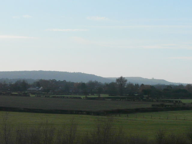
After a few miles I turned off the canal at a brick-built bridge, and followed a minor road (College Road) south towards the village of Buckland. As I crossed a bridge over the A41 dual carriageway, I could see a section of the Chiltern Hills stretched out before me. Ivinghoe Beacon and Pitstone Hill were to my left, with Aston Hill directly in front of me, and Coombe Hill and Beacon Hill to the right.
Usually I take some footpaths into Buckland after crossing the bridge, but because of the muddy conditions I just stayed on the minor road. I passed through Buckland, and turned right to cut through Aston Clinton to reach the Wendover Arm at Wellonhead Bridge.
A close-up of a distant Ivinghoe Beacon, taken looking left from the bridge over the A41 dual carriageway near Buckland
Coombe Hill and Beacon Hill, taken looking right from the bridge over the A41 dual carriageway near Buckland
Buckland
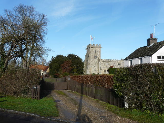
The first part of the Wendover Arm that I followed eastwards had water in it, but was very shallow and not navigable. I passed Bucklandwharf and went under a bridge on the A41. I don't think I'd ever noticed Drayton Beauchamp church before (it would be screened by trees when they are in leaf), and I took a brief detour up the steep steps of a footpath to the churchyard to take a photo.
The Wendover Arm, near Bucklandwharf
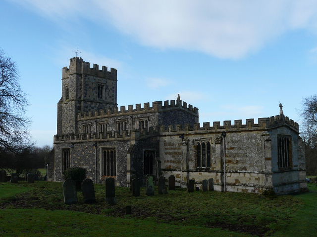
Drayton Beauchamp church
A little further on I came to the middle section of the Wendover Arm that is currently being restored, and found there is now water (or ice!) in the first part of it (I walked the whole of the Wendover Arm back in June, by the way). I passed a couple of sturdy footbridges put in to carry footpaths across the newly repaired canal, and enjoyed the view to my left over Wilstone Reservoir and the surrounding countryside.
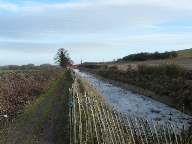
Water and ice in the newly repaired section of the Wendover Arm near Drayton Beauchamp
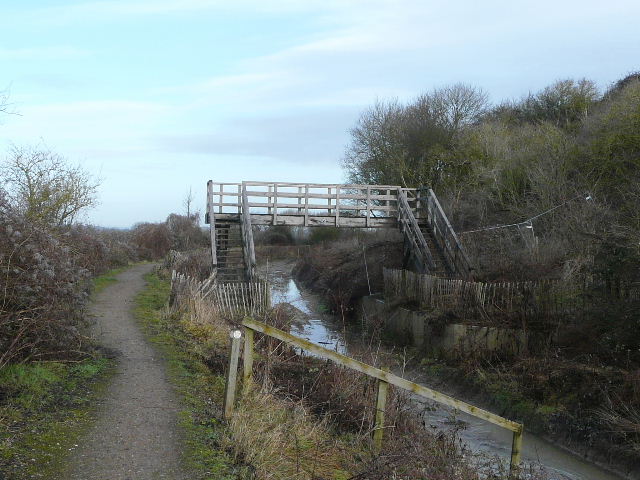
As part of the repair work along this section of the Wendover Arm, a couple of smart new footbridges have been put in
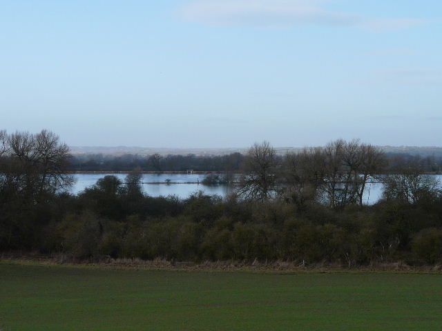
View north from the Wendover Arm across Wilstone Reservoir (thanks to Paul Ager for pointing out that I originally got the direction wrong on this caption!)
At Little Tring there was a brief road walk before I joined the navigable section of the Wendover Arm - there were initially some very large chunks of ice, but the canal was soon ice-free. Beyond Tring Wharf I came across around half a dozen fishermen, and this part of the canal was quite busy with other walkers (presumably doing shorter walks along the canal and around the Tring Reservoirs).
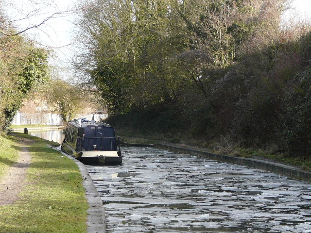
Near the start of the navigable section of the Wendover Arm - note the ice on the canal here
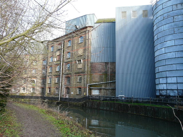
Tring Wharf
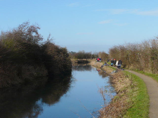
The Wendover Arm - there were several fishermen here and a number of walkers too
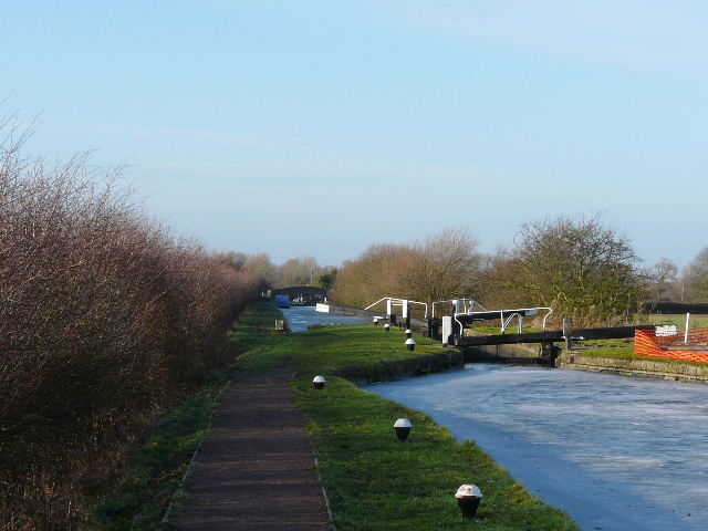
I reached the main section of the Grand Union Canal just west of Bulbourne, and turned left to return to Marsworth. I almost slipped here a couple of times, as the path was very icy where it was in the shade. Part of Marsworth Reservoir was still frozen (I'd seen ice on others bits of the Tring Reservoirs too).
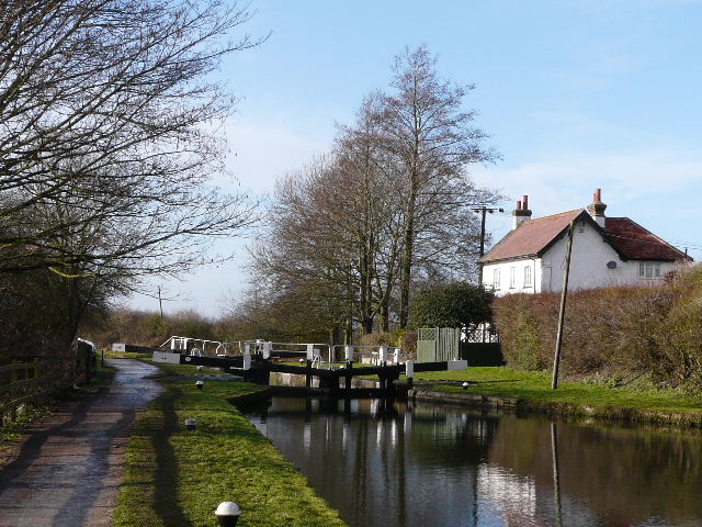
Lock on the Grand Union Canal near Marsworth
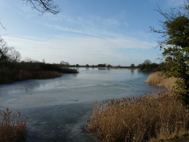
I always like this view over Marsworth Reservoir
When I got back to my car, the car park was full and one or two cars were waiting for people to leave. It was only about 1.20pm, so I drove home and ate my packed lunch there, having carried it all the way round with me. It had been an enjoyable morning's walk (about three and a quarter hours) on a pleasantly sunny day, a nice change after the grey and gloomy conditions of the last week.