Pete's Walks - Swan's Way
If you are considering walking this route yourself, please see my disclaimer. You may also like to see these notes about the maps and GPX files.
Day 6 15/09/07 Near Kimble Wick to Bledlow (6.5 miles each way, approximately)
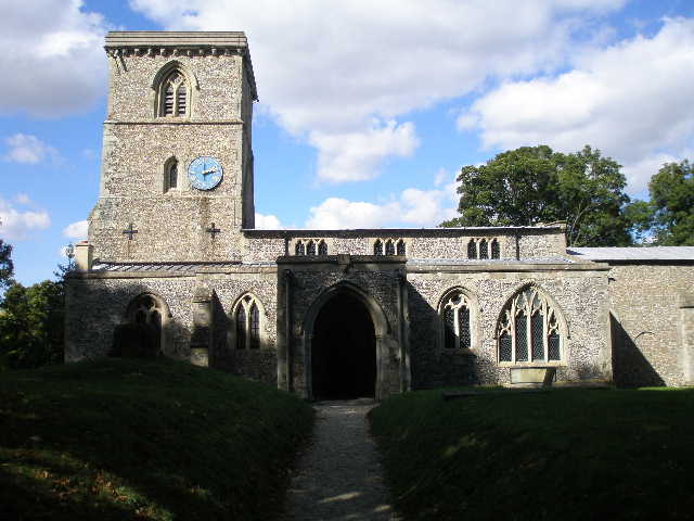
Parked on road outside Bledlow church.
There was a four-day gap since my last walk. At the start of my walk last Saturday (Day 4) I’d been through some long grass that was wet with a heavy dew – the bottoms of my walking trousers therefore got very wet and this had soaked through my walking socks causing my feet to be wet and consequently I got a few blisters. When I walked on Monday, my feet got sore again so I decided to give them a bit of a rest. I rarely get blisters nowadays, and walking through long wet grass is the only circumstance that ever really causes them (it’s not a problem in winter when I wear my waterproof Paramo trousers). I’ve taken to wearing SealSkinz waterproof socks to combat this problem, but they obviously don’t seem to work very well.
This was a great day for walking. The temperature was a very pleasant 19-20C and the skies were bright blue with just a few puffy white clouds dotted about. I decided to do the walk ‘backwards’ as I didn’t think I’d be able to park in Kimble Wick, so I parked outside the church in Bledlow and started by walking back to the end of the previous walk near Kimble Wick. I didn’t stop to take any photographs, other than three at the beginning in Bledlow, so managed to get there in an hour and three quarters.
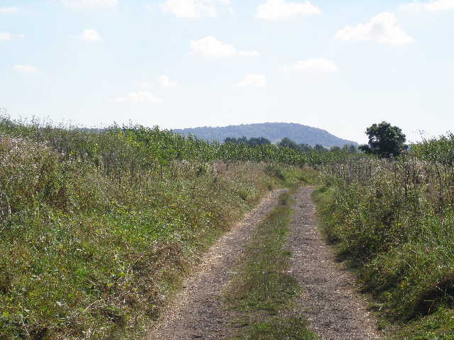
[1] The farm track leading to Kimble Wick, Pulpit Hill in the background
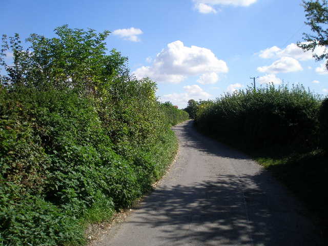
[2] The lane leading to Kimble Wick
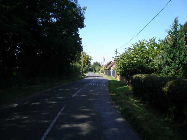
[3] Minor road by Stockwell Lane Farm
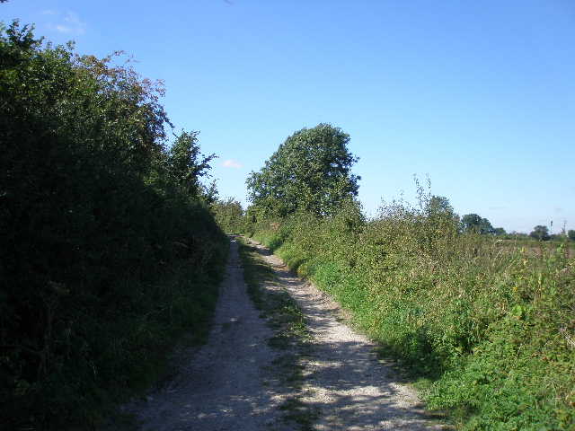
It was about 11.45am as I turned at the path junction I reached last time. I continued on the same farm track as before, now heading south-east towards the long line of the northern escarpment of the Chiltern Hills – I could see the wood-covered slopes of Pulpit Hill directly in front of me [1]. The track was now hard-surfaced with a layer of broken asphalt, new since I walked here last on the Aylesbury Ring about eighteen months ago. After about half a mile the broad hedge-lined track gave way to a tarmac lane, and I passed a couple of farms and a few houses as I followed the lane [2] for a further third of a mile to the centre of Kimble Wick at a crossroads.
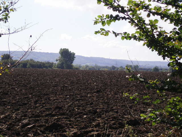
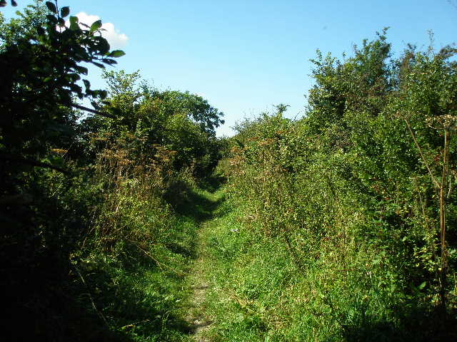
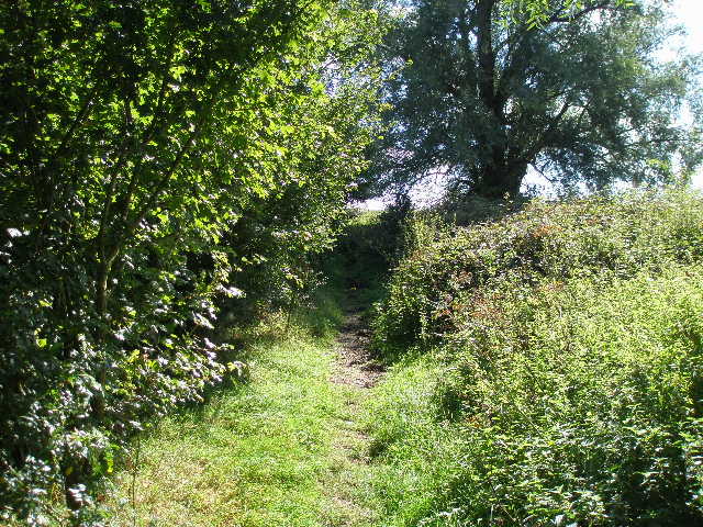
Here I turned right on another lane, now leaving the route of the Aylesbury Ring and the North Bucks Way and entering virgin territory. I followed the lane for about a mile, with occasional glimpses to the Chiltern escarpment that ran parallel about two miles to my left. There were generally fields of stubble either side, waiting to be ploughed. The lane ended at a minor road, where I turned right and immediately passed Stockwell Lane farm on my right [3]. After roughly a third of a mile I turned left on to another minor road [4]. Where this turned to the left after a quarter of a mile, I turned half-right onto a bridleway called Green Lane [5] – an accurate description as it was a track between hedges. This was the first of only two sections of the day’s walk where I was not on a hard-surface. The hedges either side were quite thick, so I seldom saw what was in the fields either side, though I did notice at one point that there was a sheep pasture on the left. There was also a gateway on the left somewhere, giving me a view across ploughed fields towards the Chilterns beyond Bledlow, where I could see the wooded slopes around Bledlow Cop and Chinnor Hill [6].
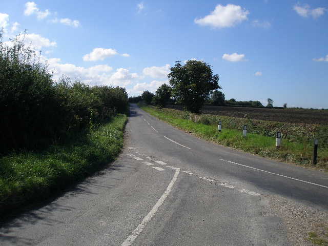
[4] Road junction, leading to start of Green Lane
[5] Start of Green Lane
[6] View towards the Chilterns from Green Lane
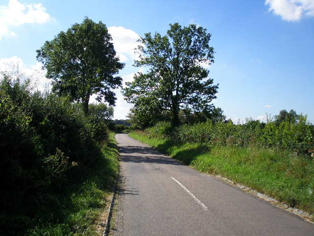
After three-quarters of a mile, Green Lane [7] ended at a road junction. I crossed the A4129 (from Princes Risborough to Thame, I’d used it a couple of times to reach places on the Bernwood Jubilee Way) and continued ahead on a lane towards the small village of Ilmer. As I followed the lane [8], I got a distant view of Whiteleaf Cross, a chalk figure carved on the Chiltern slope near Princes Risborough. After half a mile or so, I reached the village and passed under a brick railway bridge [9]. Swan’s Way goes left on a bridleway almost immediately after the bridge, but I continued ahead for another quarter of a mile, as the leaflet for Swan’s Way says the village and its church are worth visiting. Ilmer is a small village at the end of this dead-end lane, and seems to comprise of a small number of very large houses well spread-out along the lane. The church [10] apparently has Norman traces but was rebuilt in 1350. It has an unusual shingle spire (like the one at Little Berkhamsted, it reminded me of churches I’d seen abroad) which was restored in 1979.
[7] Green Lane
[8] Lane to Ilmer
[9] Old railway bridge, Ilmer
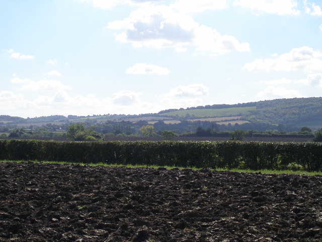
I returned to where Swan’s Way left the lane, and followed the bridleway, initially with an empty grass field on my right. This was the second and last section of today’s walk that wasn’t on a hard-surface. Soon I had a high hedge on my right, and a young plantation on my left [11] – there were one or two apple and other fruit trees here. I then came to a recently ploughed field, the bridleway following the left-hand hedge. I was again walking directly towards the line of the Chiltern escarpment, but directly in front of me was a rare gap in the line of hills, the Saunderton Valley that I remembered crossing on the Chiltern Way earlier this year [12]. I was pleased to see a couple of Red Kites here, but not surprised as I’d seen several here earlier as I’d made my way to Kimble Wick.
[10] Ilmer church
[11] Bridleway from Ilmer
[12] View towards Chilterns around Bledlow Ridge
I went through a hedge gap in the corner into a much larger field, which a farmer was currently ploughing. Now I counted a total of fourteen Red Kites and a Buzzard over this field! Several of the Kites were flying low over the field, presumably looking for worms exposed by the plough. The other birds seemed to be spiralling higher on a thermal over the field. The only time I’ve seen a bigger number of Red Kites was near Stokenchurch on the Chiltern Way this Spring. It was good to see that they are doing well and spreading out from the Chilterns to the Vale of Aylesbury to the north.
At the end of the long field I reached a T-junction of bridleways, where I turned right. The bridleway here was quite narrow, running between hedges and fences and with a hard-surface of asphalt. Again I had views towards the wooded slopes of Bledlow Cop and Chinnor Hill. The path turned left and then right to reach some buildings where it became a surfaced lane – one of the houses here had evidently been a watermill, as there was the remains of a large waterwheel in its garden [13]. A few yards further on I stopped for lunch on a stile where a path went off to the right – it was now about 1.30, and I’d already had a second Alpen bar to keep me going.
I continued a short distance along the lane, then turned left down another lane that ran through Pitch Green, a settlement within the parish of Bledlow. I soon crossed the course of an old railway line, and passed a couple of farms and a few cottages. As I continued down the lane, I heard and then saw a World War II bomber fly overhead, with similar vintage fighters either side – I presumed it was the Lancaster, Hurricane and Spitfire of the Battle of Britain Memorial Flight, on their way to or from an air show (I read later that the Army Air Corps was celebrating its 50th Anniversary at Middle Wallop in Hampshire).
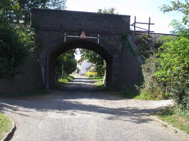
After about half a mile the lane reached the B4009 by an ‘S’ bend – I know the road well, as it runs parallel to the Chiltern escarpment and so I’ve used it to get to many of my Chiltern Way and other walks. I carefully crossed the road and took the road almost opposite. This went very gently uphill, soon passing under a railway bridge [14] – I’d been hearing the whistle of a steam train regularly for some time, and had heard it puffing along the line a couple of times, but didn’t get to see it. I passed a few residences on the left, noticing that one was called ‘Rannerdale’ which was a coincidence as a couple of days ago I’d added some photos of a bluebell-filled Rannerdale to this website.
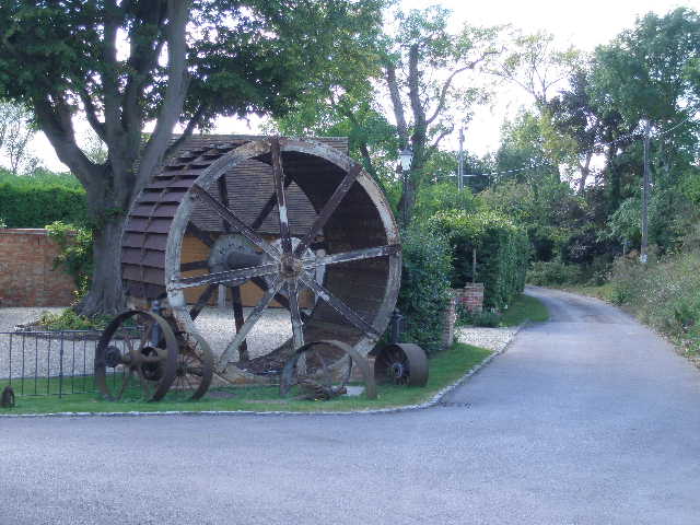
[13] Old Waterwheel near Pitch Green
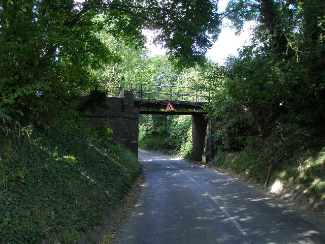
[14] Looking back to the railway bridge on road into Bledlow
[15] Former Children's Home, Bledlow
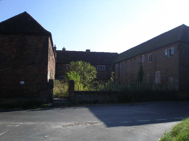
Where an old Children’s Home [15] stood on the left, familiar from my Chiltern Way walks, I turned right into Church End, Bledlow. My car was just a short distance along here, parked outside the church, but before I got there I decided to visit The Lyde Garden on my right – I’d twice passed here before on the Chiltern Way, but hadn’t had time to take a look. There is a small gorge here where some springs emerge to form the river Lyde - such springs are very common all along the foot of the Chilterns, as rain water sinks through the chalk hills until it hits the impervious clay below, and so emerges at the surface along the boundary where the chalk and clay meet. The small gorge has been turned into an attractive garden [16] – a plaque outside the entrance indicated it had been awarded the Millennium Marque for Environmemtal Excellence. I followed a path down to the right of the stream, then crossed a wooden bridge and followed a boardwalk back up the other side. There was a pool with a metal sculpture like a flower in it, beside a wooden pavilion with some seats [17].
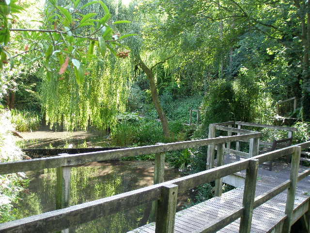
[16] The Lyde Gardens, Bledlow
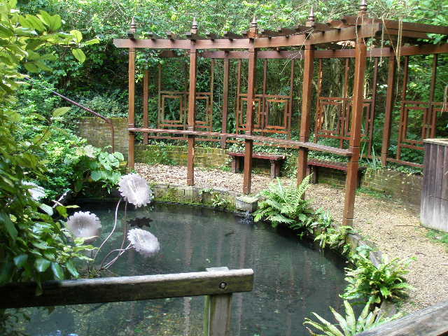
[17] The Lyde Gardens, Bledlow
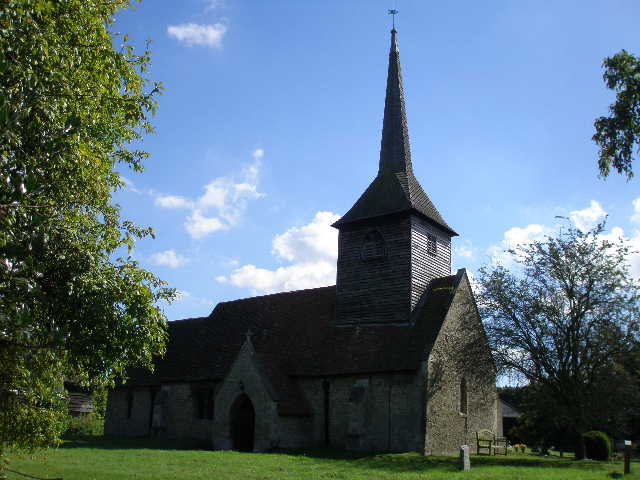
[18] Bledlow Church
It was just after 2pm when I got back to my car outside the church [18]. This had been a straightforward and enjoyable shorter walk, although the vast majority had been on hard surfaces. The weather had been really good, and I’d really enjoyed seeing so many Red Kites over the field that was being ploughed. The diversions to see Ilmer church and The Lyde Garden also added to the enjoyment of the walk.
Total Distance: 43.9 miles each way, approximately