Pete's Walks - Swan's Way
If you are considering walking this route yourself, please see my disclaimer. You may also like to see these notes about the maps and GPX files.
Day 7 17/09/07 Bledlow to Watlington (7.5 miles each way, approximately)
Parked on road outside Bledlow church.
I parked in the same place as two days ago, and started walking about 9.50am. It had been dull and grey as I’d driven to Bledlow, but the skies had brightened up quite a bit as I started walking through Bledlow. According to the weather forecast I would be walking more or less under the boundary between a band of cloud to the south and a brighter area to the north – in fact, the skies soon greyed over again and it would remain more or less overcast for the rest of the walk apart from a brief brighter spell about 1.30pm.
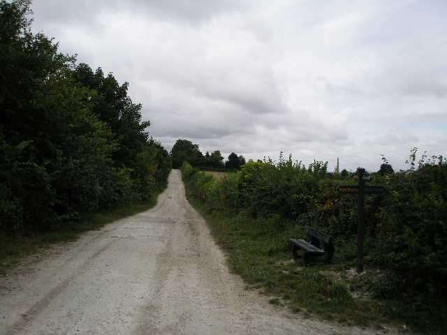
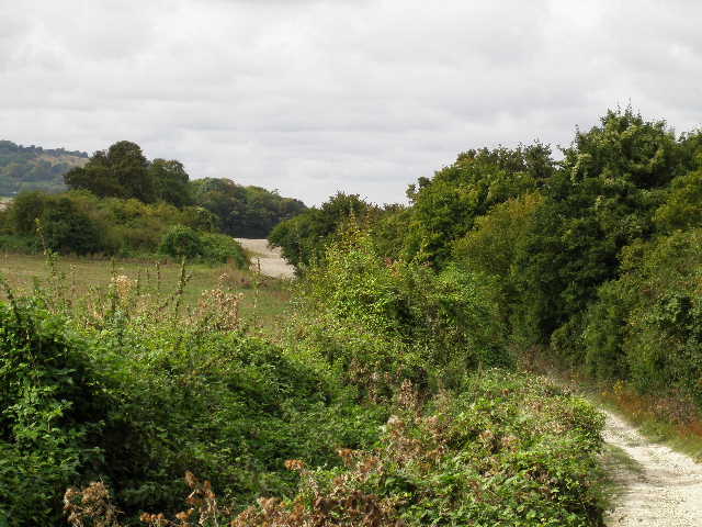
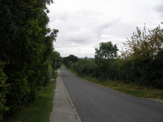
I saw a Red Kite straight away, circling low over the houses of Bledlow, so that was a nice start to the walk! Where the lane through the village turned sharp right, I turned sharp left beyond the pub (The Lions) [1] on a stony hedge-lined track heading straight towards the steep escarpment of the Chilterns [2]. I soon passed the pub car park on my left, where a large group of walkers were obviously assembling at the start of a walk. A short distance further on I turned right onto another bridleway, again surfaced with gravel and stone and initially between hedges.
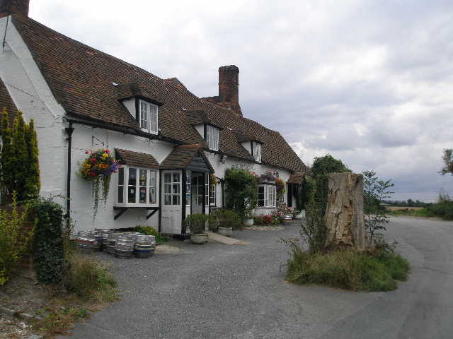
[1] The pub in Bledlow - 'The Lions'
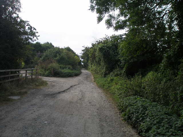
[2] Start of the bridleway from Bledlow
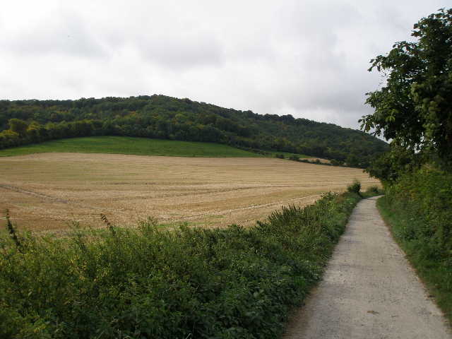
[3] Bridleway heading towards Chinnor Hill
The rest of today’s walk would now remain pretty much the same – I’d be walking roughly southwest on a good track, with the north slope of the Chilterns a field or two to my left, and the B4009 about half a mile to my right. I have used that road a lot to get to walks on the Chiltern Way and for my Berks-Essex Walk, so as I progressed along the track today I would mentally tick off the places that the road passed through – Chinnor, Crowell, Kingston Blount, Aston Rowant, Lewknor, Shirburn and finally Watlington.
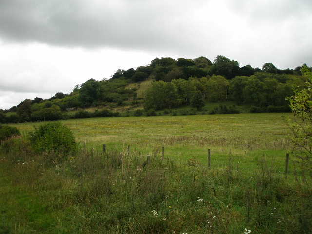
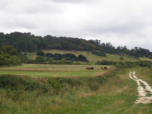
The hedge on the left ended after a pasture containing young bullocks, and then I could see across a field of stubble to the wooded slopes of Bledlow Cop and, further ahead, Chinnor Hill [3]. The track rose slightly for about quarter of a mile to a cottage on the edge of the woods. Here I joined the route of the Ridgeway path, which I’d be following for the rest of today and for some of the last two walks on Swan’s Way. In fact, the rest of today’s walk would be the same part of the Ridgeway that I followed on Day 3 of my Berks-Essex Walk, although I’d be doing it in the opposite direction. Also, this point marked the end (or rather, start) of the Midshires Way which Swan’s Way has followed the entire way from the start. Midshires Way does have some footpath alternatives to the route I’d followed through Buckinghamshire though, and it goes all the way north to Stockport. It was also around here that I crossed from Buckinghamshire into Oxfordshire.
[4] The bridleway around the foot of Chinnor Hill
[5] Bridleway just beyond the woods of Chinnor Hill
[6] View towards Chinnor
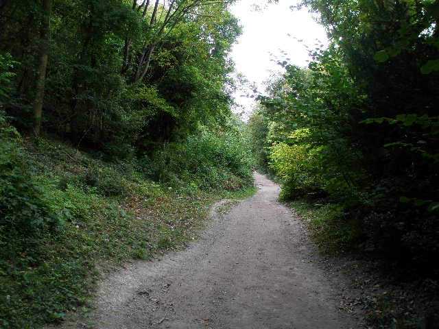
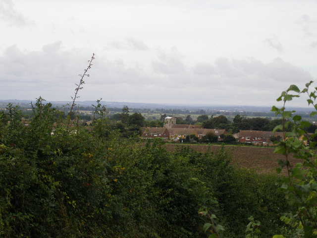
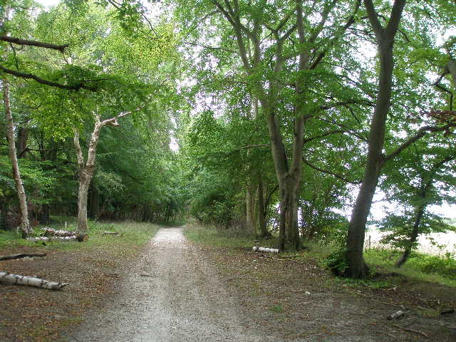
I now followed a chalky track running through the bottom edge of the wood [4], crossing a couple of bridleways heading up to Chinnor Hill on my left. I passed an entrance to the Chinnor Hill nature reserve (run by the Berkshire, Buckinghamshire and Oxfordshire Wildlife Trust) where I had a quick look at the information board (it mentioned Dark Green Fritillary butterflies and Chiltern Gentians, amongst other things). After half a mile or so, the track emerged from the trees, and I now had a few houses on my left [5] with Chinnor visible over the hedge and across the fields on my right [6].
I passed an information board about Red Kites, and then crossed a road (running from Chinnor to Bledlow Ridge, a few miles to my left – I passed through there on the Chiltern Way) before continuing along the chalky track. Here it was again running between high hedges, but I could occasionally glimpse the large chalk quarries either side [7]. A bit further on I’d pass an old cement works on the right, but would only really see it looking backwards later on [8], or on my return trip in the afternoon. I saw some Purple Toadflax growing along here, only the second or third time I’d seen it. The track had a couple of undulations in it, and as I came to the top of one of them I glimpsed what I’m fairly sure was a Muntjac deer crossing the track. I then passed an entrance to another nature reserve, Oakley Hill, again run by the B,B & O wildlife trust. Again the information board mentioned Chiltern Gentians, as well as Clustered Bellflower which I’ve seen quite often this summer (not so much on my walks, but when looking for wildflowers at places like Totternhoe Knolls, Ivinghoe Beacon and Barton Hills).
[7] The bridleway where it runs between the chalk quarries
[8] The old cement works at Chinnor
[9] The bridleway heading for Beacon Hill
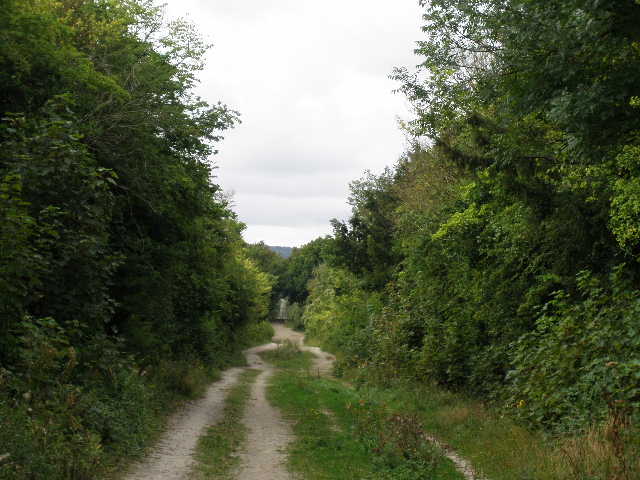
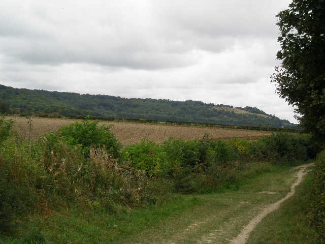
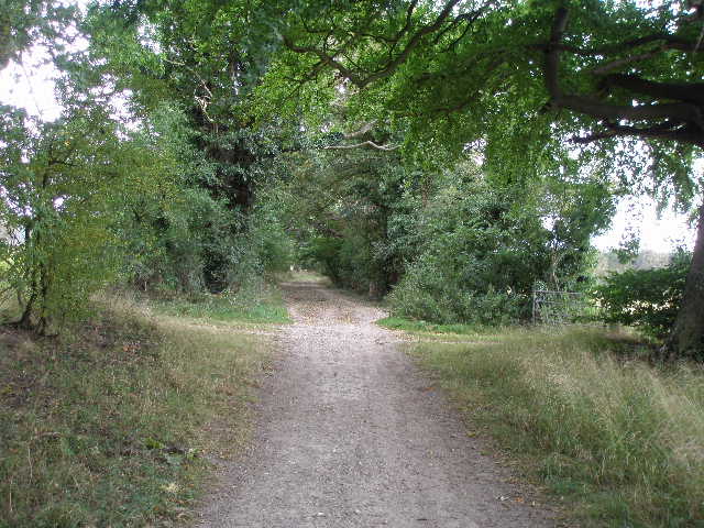
Beyond the quarries and cement works, there followed a long section of track with generally a high hedge on the right and views over stubble and other fields to the wooded slopes of the Chilterns on my left [9]. I could occasionally see ahead to Beacon Hill [10], a less wooded eminence close to the M40. I noticed that a few of the trees were already starting to change colour to yellow and gold. There were several horse chestnuts along this part of the track and at one point I passed an impressive Oak tree in the hedge on the left [11] – I heard a very loud call from a Red Kite as I got near the tree, and then saw the bird fly out and start circling (I’d already seen three or four more Red Kites, I won’t bore you with every sighting!).
I crossed a lane and continued along the chalky track. Some parts of it were like a green lane, a broad grassy track between hedges. Somewhere to my left the A40 wound its way through the trees and up the steep slope of Aston Hill. Eventually I reached the A40, with the village of Aston Rowant about half a mile to my right. On the other side of the road, I almost immediately passed an entrance to the Aston Rowant nature reserve (this one run by Natural England). The information board here mentioned Chiltern Gentians again, as well as the Red Kites. The track passed through a small area of beech trees [12] and I could now hear the traffic on the M40 motorway.
[10] The bridleway heading for Beacon Hill
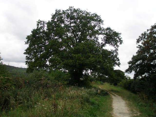
[11] Impressive oak tree where I heard and saw a Red Kite
[12] View out towards the M40 and Lewknor
I could soon see the bridge where I’d walk under the motorway. Beacon Hill [13] was now on my left, a meadow at its foot being part of the nature reserve, with its steep slopes then covered in scrub leading to woods at its top. As I went under the motorway bridge [14] I saw a dog walker coming the other way – her three dogs ran towards me barking, but wagged their tails as they got near. She apologised for their barking – I don’t mind when the owners apologise, but it infuriates me when I have dogs running and barking at me and the owners just walk by as if that’s perfectly acceptable. I’ve had a couple of slight contretemps with people over this. The owner said the dogs barked because I was wearing a hat, something other owners have said.
[13] Looking back at Beacon Hill
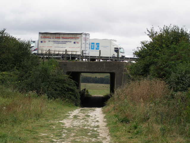
[14] The M40 bridge
[15] View over the Oxfordshire plain from just past the M40
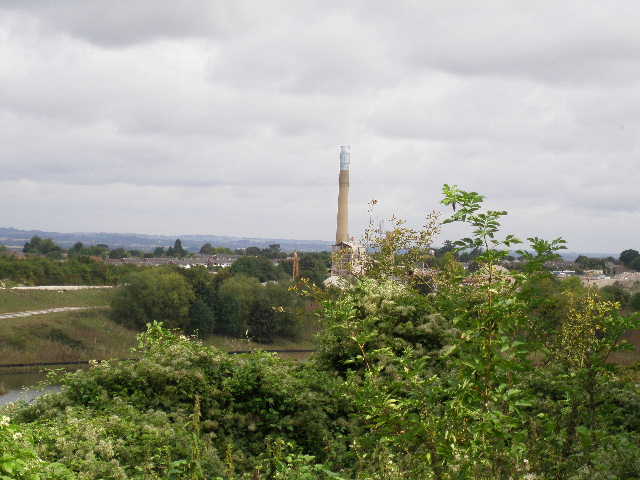
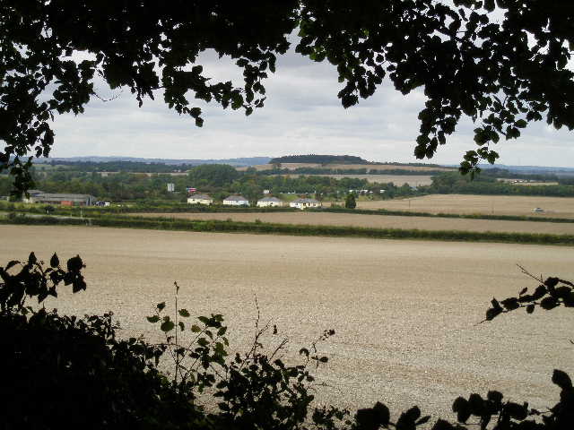
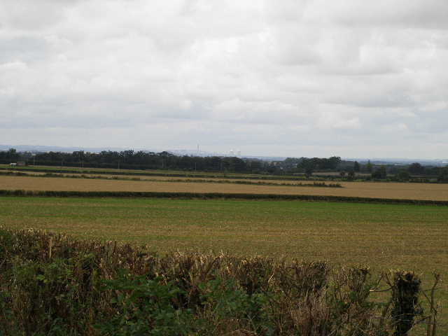
There was now a slight change of scenery, as the slopes of the Chilterns to my left were mainly covered in grass and scrubby bushes rather than cloaked in trees, although there were sometimes woods along the top of the hills. Just past the motorway I had a view ahead and to my right where I could see Didcot Power Station in the distance [15], with the low line of the Wessex Downs also in view. Looking back and to my left I could see the huge chalk cutting where the motorway breached the Chiltern escarpment [16] between Aston Rowant and Stokenchurch. I passed a field on my left where some more young bullocks crowded into a corner – on the way back, one of them was standing in a kissing gate as if puzzling how to get out [17].
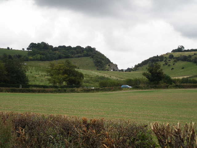
[16] Looking back to where the M40 cuts through the Chiltern escarpment
[17] The bridleway just past the M40 - note the bullocks trying to work out how to get through a kissing gate!
[18] Where I stopped for lunch on my way back
The track passed through another small section of trees, including some nice beech trees and some silver birch. I stopped for lunch here on my way back, sitting on a tree stump [18]. Further on the track ran between hedges again [19] – I passed a couple of young men and their young dog, camped in the hedgerow with a small fire going. Further on I crossed a lane or drive that was part of the route of the Oxfordshire Way [20]. The following field on the left was being ploughed – this had attracted a large number of birds, including about half a dozen Red Kites, some of which circled low overhead as I passed by. It was then just a few minutes along the hedge-lined track until I reached a road heading into Watlington to my right [21]. This was my turn-around point for the day, it having taken me about 2 hours and twenty minutes to walk here from Bledlow.
[19] The bridleway near Shirburn
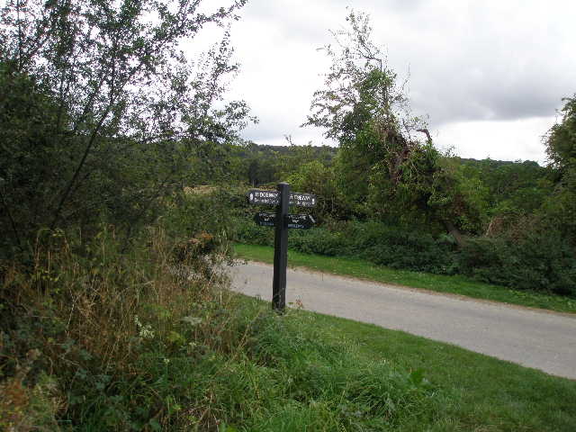
[20] Where the Ridgeway crosses the Oxfordshire Way
[21] The road into Watlington at the end of the walk
The walk back was straightforward and uneventful. The skies brightened around 1.30 pm, but then grew very dark and quite threatening. I thought I was in for some rain or at least a heavy shower, but fortunately that wasn’t the case – there were just a few spots of rain at one point as I drove home, though.
This was a pleasant walk, one of the most straightforward I have ever done in terms of navigation. The vast majority of the route was the same as Day 3 of my Berks-Essex Walk, and I’d found that a little boring as the route was pretty much the same throughout, just following a broad chalky track along the foot of the Chilterns for mile after mile. However I didn’t find it boring at all today, and enjoyed the walk. Having done the route before and not having to do much navigating gave me more time to just relax and enjoy the walk. It was interesting to see the three nature reserves along the route, and of course all the Red Kites greatly added to the enjoyment.
Total Distance: 51.4 miles each way, approximately