Pete's Walks - Swan's Way
If you are considering walking this route yourself, please see my disclaimer. You may also like to see these notes about the maps and GPX files.
Day 8 19/09/07 Watlington to Grim’s Ditch (7 miles each way, approximately)
Parked on road on edge of Watlington.
Being retired, I have the flexibility to pick and choose which days I go walking, so I usually only walk on days when the weather forecast is good. However I was quite keen to walk today for some reason, even though the forecast was for showers. I wore my Paramo waterproof trousers as a precaution – although they might be a bit warm for this time of year, I thought that would be preferable to having to keep stopping to put on and take off waterproof overtrousers. It rained slightly most of the way to Watlington, so I donned my waterproof jacket before I started walking and kept it on for the whole walk. In the end I was quite lucky with the weather – the skies were dark grey and threatening for most of the walk, but I just had two brief and very light showers.
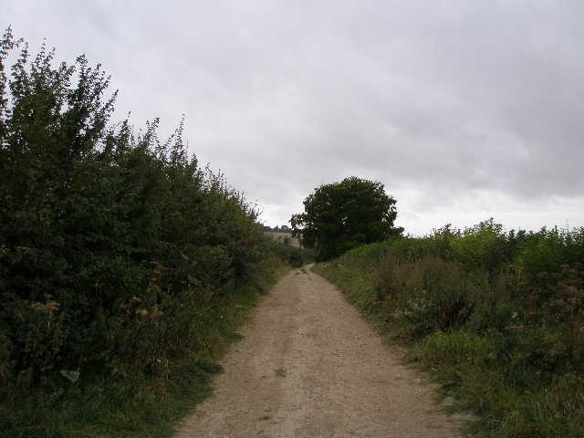
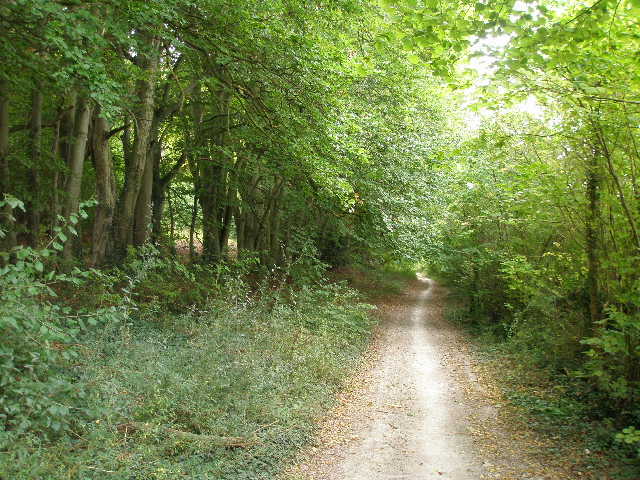
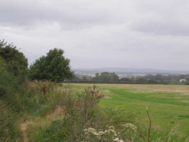
My previous walk had ended at a road on the edge of Watlington, with residences along the far side of the road all the way to the main part of the village half a mile to the right. I took a continuation of the bridleway I’d been on, another chalky track between hedgerows [1]. At first the track was right up at the foot of the steep slope of the Chiltern Hills [2], but soon there was a large field across the hedge on my left where cattle grazed – I didn’t see any now, but when I walked here on Day 2 of my Berks-Essex Walk I had seen nine Red Kites in this field.
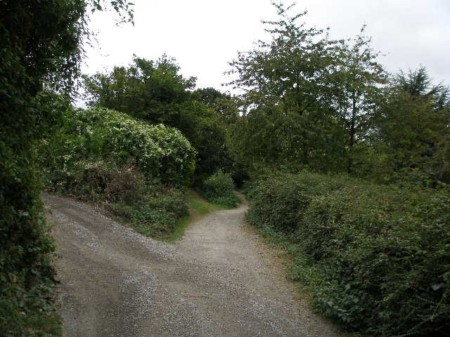
[1] Start of the Ridgeway from the road in Watlington
[2] The Ridgeway near Watlington
[3] The farm drive, near Watlington
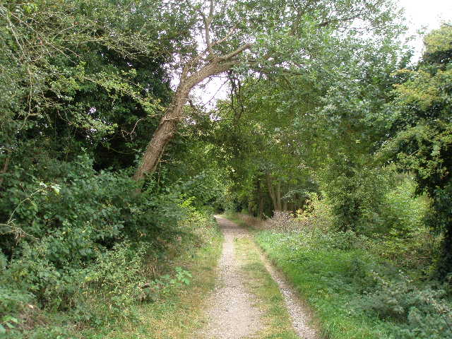
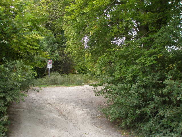
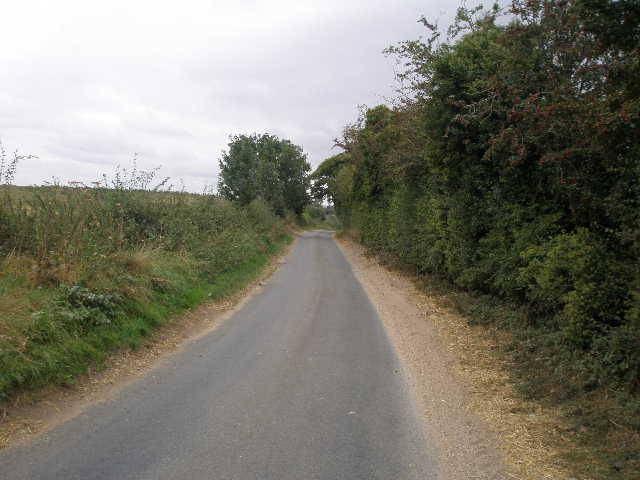
After about half a mile the track ended at a road (one I’ve driven several times, between Watlington and Nettlebed). On the far side the bridleway continued along a farm drive [3], which was tarmac and looked just the same as a lane. There was actually a permissive footpath running along the other side of the hedge to my left, but as I am following a long-distance bridleway I chose to stay on the hard surface as horse riders would have to do. I was glad I did, because some way along the farm drive I saw a flower that was new to me – I later identified it as Pale Toadflax. There was also some White Campion. After a third of a mile I passed the farm, and the bridleway reverted to being a chalky track between hedges [4], initially with very limited views either side.
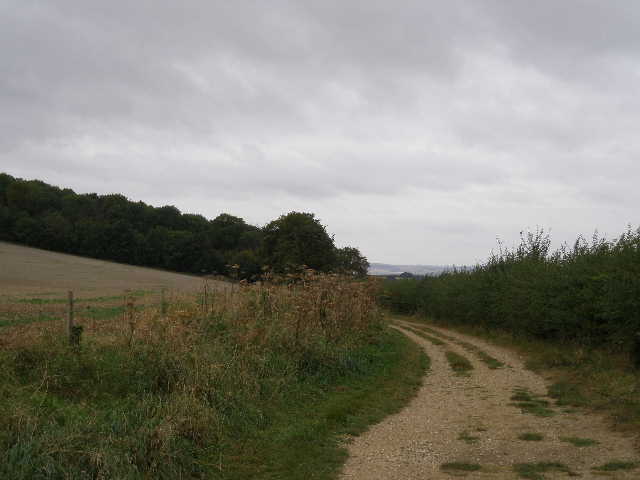
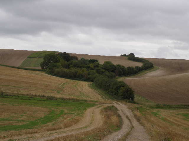
Three quarters of a mile or so further on I crossed a lane. A few hundred yards further I reached another farm on my left – here the Ridgeway took a footpath going left and rising over the left end of Swyncombe Down. Swan’s Way however continued ahead along the bridleway, now surfaced with gravel and sand [5]. After a while there was a wire fence on my left, with a huge ploughed field sloping up towards the top of Swyncombe Down which projects for almost a mile out of the main Chiltern escarpment. I remembered from my Berks-Essex walk how insignificant the hill seemed from this northern side, whereas it is steep and covered in trees and scrub on its southern side.
[4] The bridleway just beyond the farm
[5] The bridleway heading towards Swyncombe Down
[6] Bridleway approaching wood at foot of Swyncombe Down
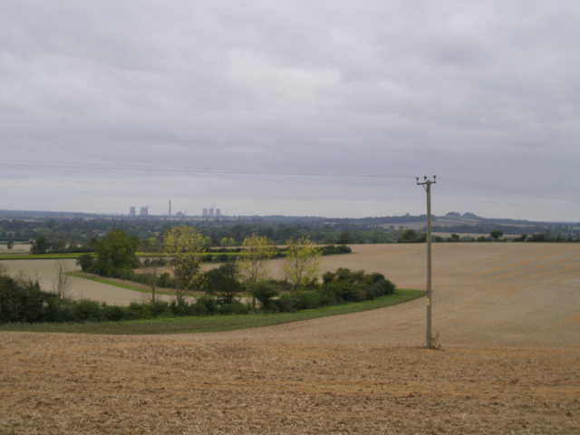
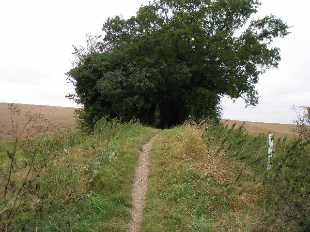
The track headed towards a wood at the foot of the steep western end of Swyncombe Down [6]. Just before reaching the wood, there was a gap in the hedge on my right where another track came in – here I had views to Britwell Salome House a little way to my right [7], and ahead over the Oxfordshire plain to the unmissable eyesore of Didcot Power Station [8]. I carried on, with a hedge on my right and the wood on my left [9] – it was mainly beech, a typical Chiltern wood. At the end of the wood I reached a car park [10] by a bend in a lane, where I crossed the route of the Chiltern Way (heading from Ewelme to go up the steep wooded slope of Swyncombe Down). I followed the lane ahead for about a hundred yards, then turned left onto another bridleway.
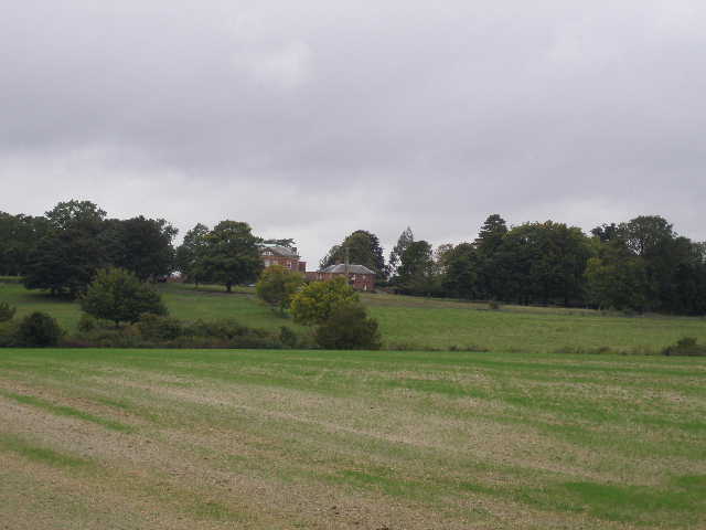
[7] Britwell Salome House
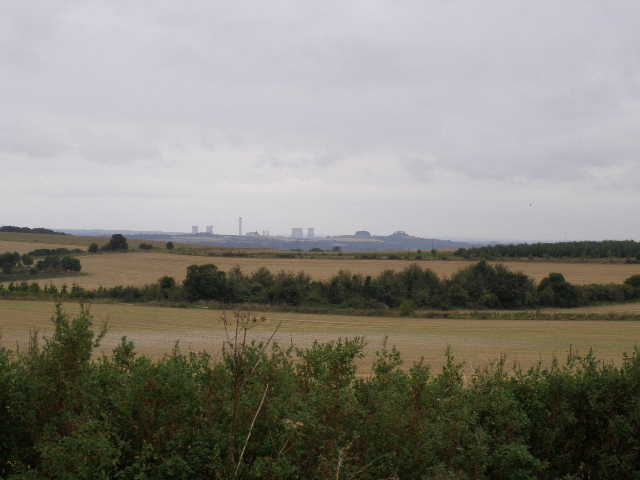
[8] Looking towards Didcot Power Station from near the foot of Swyncombe Down
[9] Path through the wood at foot of Swyncombe Down
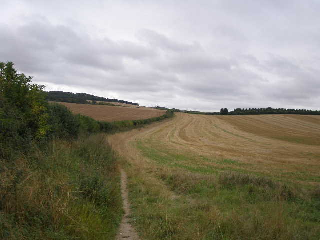
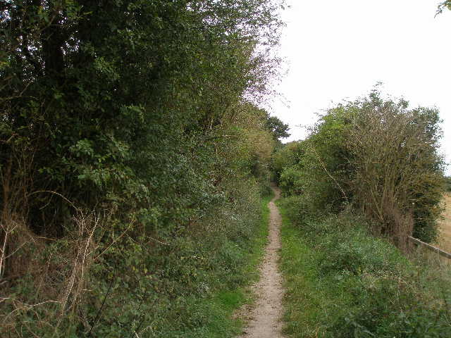
This next section was the pleasantest part of the walk. I followed a narrow path along the left-hand hedge of a large stubble field [11], having to step aside at one point to let five mountain bikers go by. The landscape here was gently undulating, with the Chiltern escarpment to my left less distinguishable now as it petered out towards the river Thames. Across a farm drive the bridleway again became a chalky track, but without hedges or fences. I noticed several Poppies growing along the edge of the field on my right [12]. To my left, the fields sloped up to Ewelme Downs, where I could make out a large house in the woods at the top. I came to the brow of a slight rise, where there was a nice view ahead over a small valley with chalky fields. I could see the bridleway rising ahead up the other side of the valley, passing a small wood where I knew there was a ruined farm because that part of the bridleway was on the route of the Chiltern Way. But I didn’t go that far, Swan’s Way turning right in the valley bottom [13].
[10] Car Park at foot of Swyncombe Down
[11] Start of the bridleway
[12] Looking back to Swyncombe Down
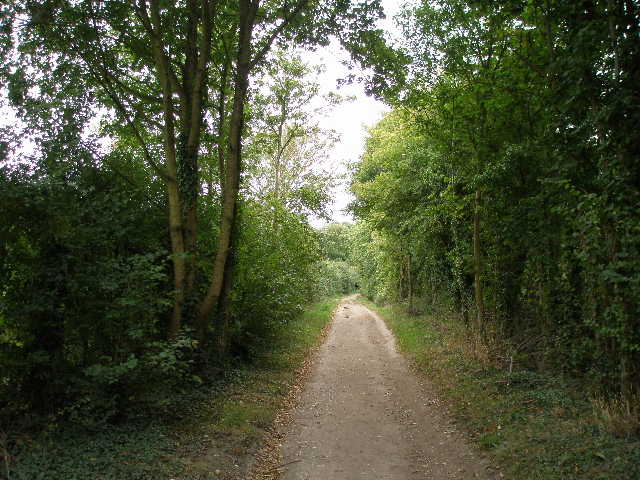
I went wrong here initially – where I turned right there were two tracks either side of a grass headland that soon became a hedge. The waymark post was by the left-hand track, and the map clearly showed a boundary on the right of the bridleway, so I took the left-hand track. Wrong! After a hundred yards this turned left into the middle of the field, with no evidence of a path continuing alongside the hedge. So I turned back and took the track to the right of the hedge. After a couple of hundred yards this had hedges either side, as it went gently uphill [14]. I passed a turning where another bridleway went right, and shortly afterwards came to a T-junction of bridleways where I turned right.
I knew this spot well – within yards I was at another junction where a footpath came in on the left. There was a large barn here, with Potter’s Farm a short distance to the left. This junction is where the southern extension of the Chiltern Way rejoins the original route, and I had been here three times on each of my Chiltern Way walks (two walks ended here, one started here) [15,16]. On previous visits I had smelled or heard pigs in the barn, but today it appeared to only contain straw bales.
[13] The bridleway descending into the small valley where I turned right
[14] The bridleway towards Potter's Farm
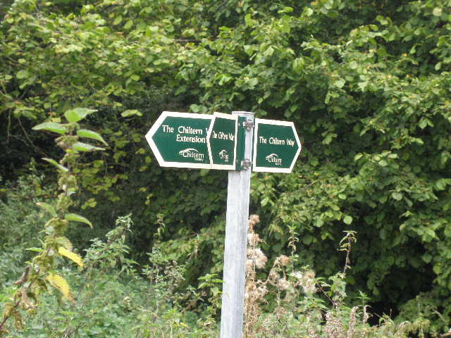
[15] Signpost at Potter's Farm, Ewelme, where the Southern extension rejoins the original route of the Chiltern Way
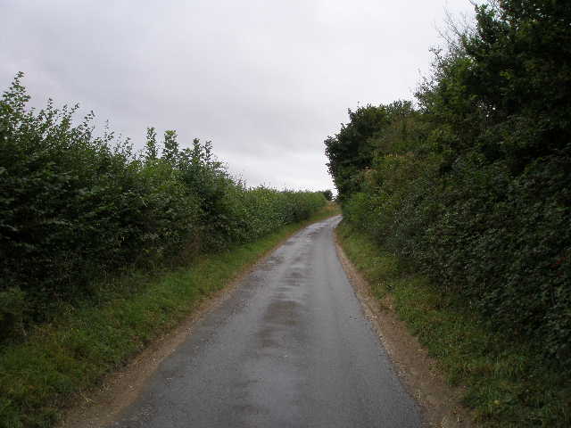
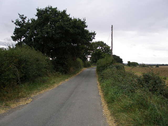
I now followed the route of the Chiltern Way along Potter’s Lane [17], a fairly narrow track between hedges. Occasionally there were views to Swyncombe Down and Ewelme Downs to my right, or to Didcot Power Station and the twin hills of Wittenham Clumps over to my left. A Red Kite circled low overhead at one point. The bridleway ended at a lane, where I left the route of the Chiltern Way and followed the lane to the left [18].
This was the start of about two and a quarter miles of road and lane walking as far as Grim’s Ditch, where I would turn round and have to do it again! The lane soon widened as it passed between some gravel pits that were now being used as landfill sites, and several large lorries carrying rubbish passed me here. The road surface and the surrounding hedges were covered in chalk dust. For some reason I smiled as I thought to myself that this was probably one of the low points of all my walks – a road busy with large lorries through a landfill site, at the start of the longest section of road walking I’d ever done and, of course, it was now spitting with rain. Well, there’s nothing like positive thinking to keep your spirits up! J
[16] Swyncombe Down from Potter's Farm, Ewelme
[17]View towards Ewelme from Potter's Lane
[18] Start of the long road/lane walk
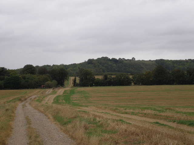
This section was fairly short, and I soon came to a rather complicated road junction (actually a sequence of three junctions in rapid succession). I continued more or less straight on, though now heading south rather than south-west, the direction I’d been going ever since the start of the previous walk. The first three or four hundred yards was along a hedge-lined minor road with no verges, so I was glad to get off it onto a quieter lane, which carried on ahead where the road turned right. This lane was also lined with hedges, restricting the views although I got the occasional glimpse towards Didcot Power Station [19]. I occasionally saw Common Mallow growing along this lane, as I did elsewhere on this walk. At one point I took a photo looking ahead down the lane, and as I did so I noticed a stoat scurrying down the lane and into the hedge.
I passed a recycling and landfill site on my left, and then came to a main road. I crossed over and a few yards later on crossed over a lane. I was again on familiar territory, as I was now on the route of the southern extension of the Chiltern Way. I heard dogs barking here, as usual when I go by, and I soon passed the kennels and cattery on my left [20]. A bit further down the lane I passed a pottery on the left, with example of ceramic plaques and name plates outside. Soon I could see ahead across fields to the line of Grim’s Ditch, running perpendicular to the lane and slowly rising from the Thames Valley up to the Chilterns (I’d followed it for several miles on the first two days of my Berks-Essex Walk). By a bend in the lane I came across several Common Toadflax plants, the third variety of Toadflax I’d seen on my two walks so far this week.
[19] Another view of Didcot Power Station, from the road walk
[20] The lane leading to Grim's Ditch
[21] Grim's Ditch going south towards the Thames from where I ended the walk
I turned round where the lane crossed the line of Grim’s Ditch [21], leaving myself a short section of lane walking on my next walk. There are several different Grim’s Ditches in the country, with various origins. This one is thought to be a boundary between iron age kingdoms, according to the Swan’s Way leaflet, and runs for about five miles in a straight west-east line between Mongewell, on the Thames, to Nuffield, on the Chiltern escarpment.
The long lane and road walk wasn’t as bad as I thought it would be, and seemed to pass very quickly. Going back it only took about 37-38 minutes. I had another Alpen bar to keep me going, and then had lunch about 1.30pm on a log at the car park at the foot of Swyncombe Down. I got back to Watlington about 2.45pm.
This was an OK walk. The first two thirds were fine, although fairly flat, but the long road walk at the end wasn’t particularly enjoyable. This went quicker than I thought though, and wasn’t too bad – there was only the initial landfill area and a short section of the road where there was any real traffic. I did see several Red Kites today, so it can’t have been that bad a walk!
Total Distance: 58.4 miles each way, approximately