Pete's Walks - Greensand Ridge Walk
If you are considering walking this route yourself, please see my disclaimer. You may also like to see these notes about the maps and GPX files.
Day 1 10/04/06 Leighton Buzzard to Woburn (8.5 miles each way)
Parked at Leighton Buzzard railway station.
Rather surprisingly, this was my first walk on a long distance footpath for four weeks, since I finished the Aylesbury Ring. I haven’t been inactive in the meantime. I did three local walks all of about fifteen miles, before resting up for almost a week before going to Keswick in the Lake District with a friend. We had a very soggy week there, but managed to do some sort of walk each day – one proper mountain walk, a half-day mountain walk and the other days lower level walks. I rested for a few days when I came back, just doing a couple of short local walks. Then I walked 14 miles along the Grand Union Canal with my friend Stu (he’s the one who likes walking canal paths) – it was good to see him again, and the walk along the canal was more enjoyable than I’d expected.
Strangely enough, this morning I parked at the railway station in Leighton Buzzard, which is where I’d started with Stu on my previous walk three days ago (we followed the canal to Berkhamsted and got the train back). It was a cold morning, and as I walked through the station car park I decided I needed to put on my thermal hat and my woolly fingerless mittens. It was a short walk from the station to the road bridge over the Grand Union Canal [1], where the Greensand Ridge Walk begins. I had a quick look at the noticeboard there about the walk (I’d seen it before, when Stu and I were here the other day and when I walked the Two Ridges Link, which goes from here to Ivinghoe Beacon and thus joins the Greensand Ridge Walk with the Ridgeway). I then set off northwards along the canal towpath.
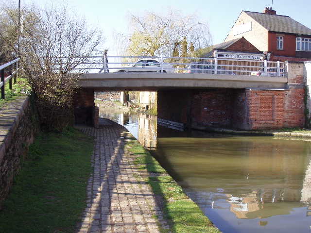
[1]Bridge over the Grand Union Canal where the Greensand Ridge Walk starts
This stretch of towpath had recently been renovated or improved – there was a sign up saying that it was now part of the national cycle network, Sustrans having paid part of the cost of the work. Consequently the towpath was a good, firm gravel path, and so a bit hard on the feet. There were several narrow boats moored along the first few hundred yards and a few more a bit later on – on my way back, I noticed a firm on the other bank that hired out narrow boats. I recognised the name, Wyvern, as a friend of mine had taken his family on holiday on one of their boats, and had given me a leaflet in case I ever wanted to try it out. They had about a dozen narrow boats moored up, up to three abreast, and two or three families or groups were being shown how to operate the narrow boats and work the locks as I walked past in the afternoon.
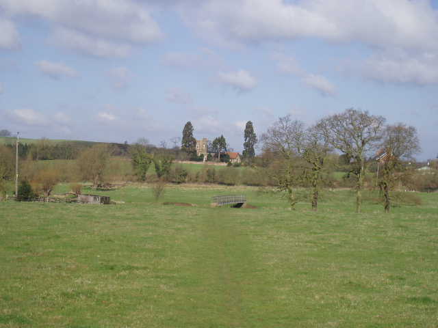
[2]Looking back over the water meadow by the river Ouzel - the church at Old Linslade is in the background
The walk along the canal to the Globe public house (where I’d finished the Cross Bucks Way earlier this year) seemed to take longer than I’d expected – curiously, the mile and a quarter seemed to fly by on my way back. Just past the pub, the Greensand Ridge Walk turned off the towpath, crossing a short section of board walk parallel to the canal and then turning right to cross a water meadow to a footbridge over the river Ouzel. The route continued slightly uphill [2] to reach a track (a tarmac farm drive) where I turned left to reach a kissing gate (a clear path went straight here from the footbridge, so I had to resist the temptation to cut a corner on my way back). I had warmed up by now and had removed my hat and mitts, although I was frequently zipping or unzipping my coat as the temperature varied throughout the rest of the morning. I turned left along a sandy track called Firs Path. This led along the edge of a large wooded area, with the water meadows and the river on my left, the trees on my right. I stopped a couple of times to use my binoculars, having sighted a woodpecker in the trees. The path was quite muddy in places, but this was a very enjoyable section of the walk – already the Greensand Ridge Walk was proving to be more varied and interesting than my two previous routes, the Aylesbury Ring and the Cross Bucks Way.
Near the end of the woods, a Greensand Ridge Walk waymark pointed me along a rising path through the trees, which soon emerged to follow the right hand side of a meadow. Just before reaching the road, a path turned right to go parallel to the road uphill and through another wood. Here I met a lady walking her dog who, seeing my binoculars, asked if I’d seen anything. We talked for a few minutes about the different types of woodpeckers (I’d heard but not seen several Green Woodpeckers, and had seen a Great Spotted woodpecker) and about where I was going.
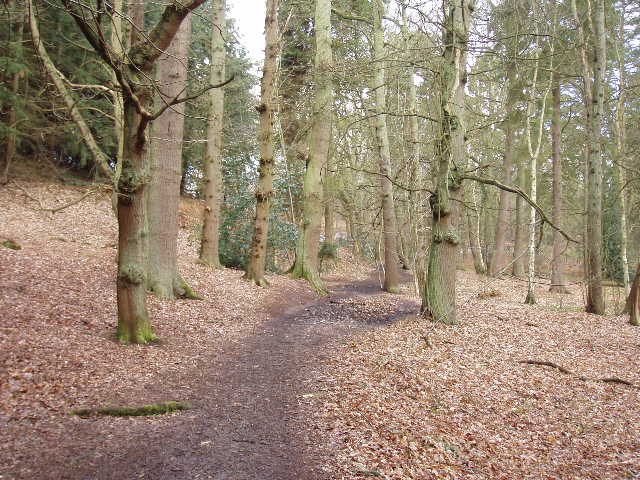
[3]Path through Stockgrove Country Park
The path came out at a crossroads, which I recognised when I saw the sign pointing to Leighton Buzzard golf club – my grandfather was the club pro there for many years. I took the lane on the left, but turned off it after only a few yards to take a path on the right. This was the start of another very enjoyable section, through the woods of Stockgrove Country Park [3]. As with the rest of the walk, the route was well waymarked so there was no problem knowing which of the many woodland paths to take. There had evidently been some snow the night before, as small patches remained in places on the ground. The woods were quite different to the beech woods I’m used to walking through on the Chiltern Hills – the woods here were mainly coniferous, with a few deciduous trees along the edges. In one more open section I passed quite a number of Scots Pines [4].
Eventually, after a mile or so, the Greensand Ridge Walk emerged from the woods on a track that passed some cottages and a clock tower (I guess part of a former stable block) on the right, to reach a road. This was the only point on the route where I was a bit confused – the leaflet referred to a layby 20m down the road, but I think it was a misprint for 200m. Anyway, I soon found the path leading from the layby, which took me around the edge of Rammamere Heath, a more open area of pine trees and heathland. Here I saw someone ahead of me obviously laying out a trail by scattering some white powder occasionally, and using it to make signs at path junctions – presumably some walkers or runners would be following the marked route later on.
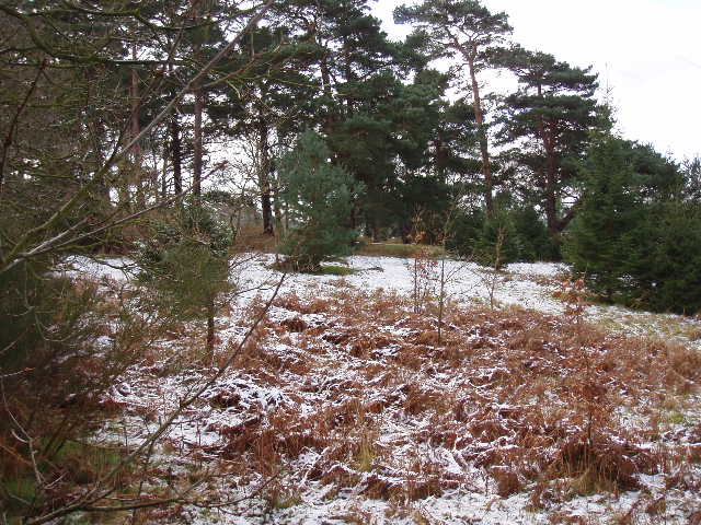
[4]Remnants of snow in Stockgrove Country Park
The path reached a gate where I crossed a field containing four cows and four very tiny calves. On the other side of the field, instead of going through the gate, the Greensand Ridge Walk followed the hedge to the right, where a stile gave access to another cattle pasture – very muddy in places where it had been heavily churned up by the cows. Beyond this, the path continued alongside the left-hand hedge of a very large grass field to reach a stile by a corner of a wood. The Greensand Ridge Walk turned left here, following the edge of the wood through a couple of small fields to reach the A5 road. Having crossed this carefully – the traffic here was travelling very fast, but there were plenty of long gaps between vehicles – my route continued across a couple of fields planted with some arable crop [5]. The path was clearly visible through both fields, but it was very muddy and my boots were heavy with mud when I eventually got across and reached a road.
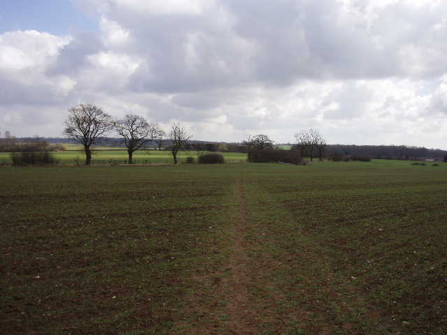
[5]Path across fields just beyond the A5
A few yards to the left, a really good path started back to the left – this was called Nun’s Lane [6], a wide green lane that ran for some while between fields before entering another area of woodland. It continued as a broad track through the woods for about half a mile, to a crossroad of paths marked by a large sandstone rock with a small plaque on it. Here I turned right, and followed the path until it emerged from the woods and continued as a farm track for half a mile or more, passing a farm where some fenced-up Alsatians barked as I went by. Where the track ended, a short bridleway on the left prevented the need to walk along the road where there was no pavement. It took me to a road junction, beyond which there was a pavement – I followed the road ahead for a few hundred yards, before the Greensand Ridge Walk took a path on the right. This followed a track through a field to gate, beyond which was a wide ‘ride’ – a long thin grass field between trees, heading straight toward Woburn Abbey. The footpath went down the left-hand-side, before turning off through the thin belt of trees and passing round the sides of Woburn Fire Station to reach a main road, with the high boundary wall of the Woburn Abby estate on the opposite side.
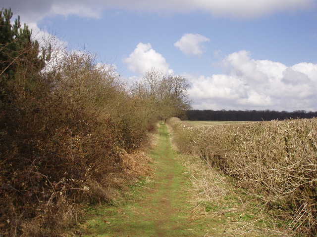
[6]Near the start of Nun's Lane
Having crossed the road and taken a couple of photos [7,8], I turned round and headed back. It had taken me about 2 hours and 50 minutes to walk the 8.5 miles, having set off from the railway station about 9.30am. About 20 minutes into my walk back, at the start of the long drive past the farm with the barking dogs, I came across a couple of lady walkers – they were lost, and asked for my help as they could see I had a map. They were trying to do a six-mile circular walk from Bow Brickhill, but realised that they were not where they thought they should be. They didn’t have an OS map, only a foldout leaflet with a map showing paths in the area of the Brickhills (Bow, Little and Great Brickhill are all villages close to the A5 south of Milton Keynes). At first I couldn’t match up their map with my OS map, but then I twigged that where we were wasn’t on their map! I showed them that they needed to go up the long drive and on into the woods to the crossroads of paths (which was just on their map) and turn right there to head back to Bow Brickhill.
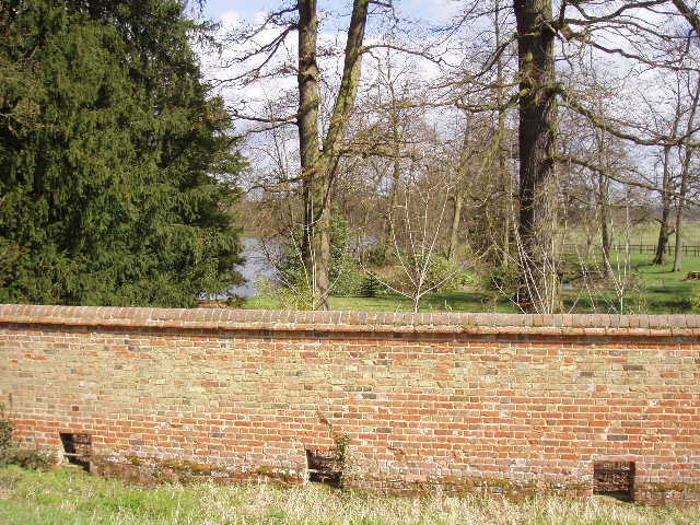
[7]The boundary wall around the Woburn Abbey estate
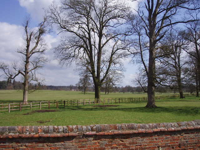
[8]Part of the Deer Park surrounding Woburn Abbey
I sat on a fallen tree in the woods along Nun’s Lane to eat my lunch about 1pm. I’d seen a Muntjac deer near here earlier, which was good as these are the symbol for the Greensand Ridge Walk, used on all the waymarks and fingerposts. I heard and saw some large birds go overhead as I ate, but through the branches of the trees I wasn’t sure whether they were Buzzards or Red Kites – most likely they were Buzzards. The rest of my walk back was very pleasant. The day had gradually been getting warmer, and I was able to take my coat off for the last hour or so. Even though this was a longer walk than usual (including the extra walk to and from the car park at the station, I probably walked 17.5 or even 18 miles today) I still felt quite good when I reached the car. I thought the hard canal path and the pavements at the end of the walk might make my feet feel sore, but this didn’t happen. I think I felt more comfortable at the end of this walk than I did after my 14-mile canal walk on Friday.
This was the best walk on a long-distance path that I have had for some time. It was very varied, with the canal, water meadows, several woods of various character, a heath, a green lane, arable fields and cattle pastures. Although it went close to several houses and farms, it didn’t pass through any villages or hamlets anywhere between the start in Leighton Buzzard and the finish in Woburn. The landscape was different to what I’ve been used to on most of my walks, which have mainly been on the chalky hills of the Chilterns or the flatter clay lands of the Vale of Aylesbury – it was a novelty here to be walking on paths that were distinctly sandy in places. The woods were different too – there were still some good examples of beech trees, but there was much more coniferous woodland than I’m used to, and the Scots Pines came as something of a surprise to me. I’d be happy to do all or part of the walk again, and I’d like to explore Stockgrove Country Park more.
Total Distance: 8.5 miles each way