Pete's Walks - Greensand Ridge Walk
If you are considering walking this route yourself, please see my disclaimer. You may also like to see these notes about the maps and GPX files.
Day 2 14/04/06 Woburn to M1 (about 5 miles each way)
Parked in free car park in centre of Woburn.
The Greensand Ridge Walk is divided into five sections, with a separate Beds County Council leaflet for each section. The second section covers the 10 miles from Woburn to Ampthill. Originally I was going to do this as one very long walk of about 20.5 miles (10 miles each way, plus the distance from the car park to the Greensand Ridge Walk each way), but eventually I decided that I would rather split this into two shorter walks of about 10 miles each. I’m quite confident that I could walk 20.5 miles (I walked 19 miles on the Aylesbury Ring recently), but I don’t think I’d particularly enjoy the final hour or so. Believe it or not, I do these walks for pleasure not punishment, so I thought I’d rather split the walk into two shorter sections that I knew that I would enjoy walking. The M1 crossing near Ridgmont seemed the best place to split the section, as it was the nearest identifiable point to the middle of the section. (Update: I did eventually go back and walk the 10-mile section from Woburn to Ampthill each way, on 2nd April 2009 - see here for details.)
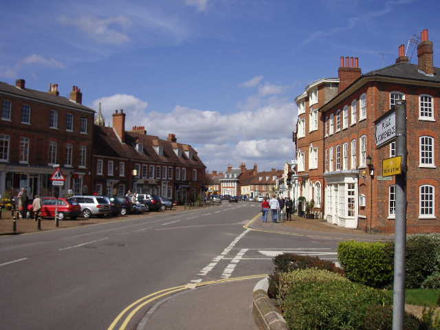
[1]Woburn
Today was Good Friday. The weather forecast predicted a grey morning with occasional showers but a brighter afternoon, so I chose to do this 10 mile walk in the afternoon, setting off from the car park in Woburn [1] about 2pm. I had actually walked about two thirds of this route before – about a year ago I did a very good circular walk (from an Ordnance Survey book of walks) starting and finishing at Woburn. From the centre of Woburn I took the road heading south until I reached the point where my previous walk finished. I continued a little further along the road, until I reached a footpath by a Lodge on the edge of the Woburn Abbey estate. The fenced path led beside a large paddock with half a dozen horses in it. The path was very muddy in places, not a problem for me with by boots and gaiters on, but some older walkers were having quite a struggle to avoid the worst bits.
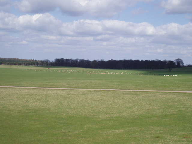
[2]Part of the Deer Park around Woburn Abbey
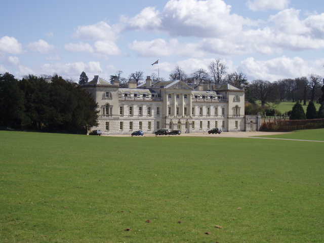
[3]Woburn Abbey
A large kissing gate then gave access to the Deer Park [2] that surrounds Woburn Abbey. There are nine types of deer in the park (including Pere David’s, Chinese Water deer and Sika). I saw several groups of deer in the distance as I followed the waymarked footpath that took me to the left of the great house, but wasn’t able to identify any of them (I looked on the Woburn Abbey website afterwards to check what the different deer looked like). As this was Good Friday, there were several other people walking around the Deer Park, not all of them obeying the instructions to keep to the marked rights of way (I saw a park ranger in a truck apparently ask someone to keep to the paths). This section of the Deer Park was basically a large expanse of grass in front of the main façade of the house [3], with a series of three ponds going from right to left and some large old trees over to my right. The path took me to the left of the house, across the visitor’s car park, and then along a drive, where there were a large number of fine old oak trees to the left [4], before crossing another grassy area to reach another large kissing gate (actually two kissing gates and a stile!) where I left the Deer Park.
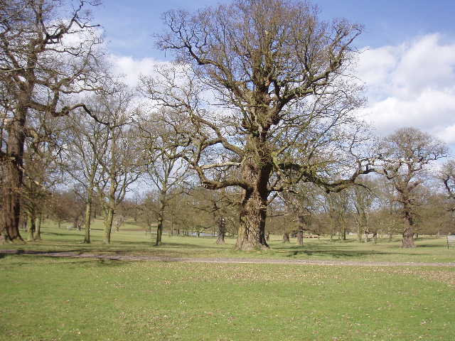
[4]Trees in Woburn Deer Park
The Greensand Ridge Walk continued slightly downhill though a small plantation of young trees and across a border between arable fields. It then crossed a bridge over a stream in a narrow grass field, before continuing through two further grass fields to reach another large kissing gate that gave access to a road (the gate marked the boundary of the Woburn Abbey estate, there was a notice board just inside it welcoming walkers to the estate but asking them to keep to the waymarked rights of way). I followed the road a short distance to the left to reach the very pleasant village of Eversholt. The leaflet explained that it is a rather widespread village as it consists of thirteen ‘ends’ or hamlets, and that the name comes from the Old English for ‘wood of the wild boar’. I passed the church [5], which was built in the 12th century but greatly restored in the 19th century by Sir George Gilbert Scott – it certainly looked more Victorian than Norman to my untutored eyes.
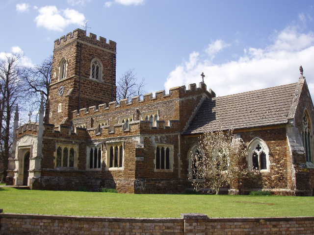
[5]Eversholt church
Just past the cricket ground, I took a lane on the right which passed a few cottages and then became a bridleway. After a few yards I came to a footpath junction, where I had my first real problem with route finding so far on the Greensand Ridge Walk. The leaflet clearly stated that I should turn left over a plank bridge and a stile, then immediately turn right and follow the hedgerow for a couple of hundred yards before crossing another stile and rejoining the bridleway, which continued straight ahead of me. However, the waymarks (and the map) clearly indicated that the Greensand Ridge Walk continued along the bridleway. I decided to compromise - I followed the instructions in the leaflet now but followed the bridleway on the way back. As it happened, it was much better to walk on the left-hand side of the hedge as per the leaflet, as the bridleway on the right-hand side became the bed of a stream for about 50 yards (this probably explains the unusual phenomenon of two public rights of way on either side of a hedge).
Where the two routes rejoined, I continued along the bridleway, which was now a broad farm track between hedges. This area of countryside was quite undulating rather than flat, with a good deal of woodland to be seen. The bridleway was crossed by a number of footpaths, presumably linking the various ‘ends’ of Eversholt. After about a third of a mile, I reached a road near some cottages. The Greensand Ridge Walk continued on another broad track on the other side, passing another house after a couple of hundred yards – this was where the circular walk I did a year ago turned left, whereas the Greensand Ridge Walk continued on the track ahead so I was now entering unknown territory. The very pleasant farm track continued through hedgerows, and then passed a wood on the right. I saw two buzzards over the wood ahead of me (I saw another one here on the way back, as well as three Muntjac deer crossing a field). The track then passed through the wood, emerging to continue with the wood now on its left and a field on its right. I saw my first butterfly of the year here, a Peacock. Through a gate, the Greensand Ridge Walk crossed a pasture and then a gate near a farm gave access to a continuation of the track. This led on downhill, with a wood on the right and a large field containing the shoots of an arable crop on the left – I saw about six Fallow deer here as I came back, one a stag with antlers that looked quite impressive from a distance (annoyingly I forgot my binoculars today).
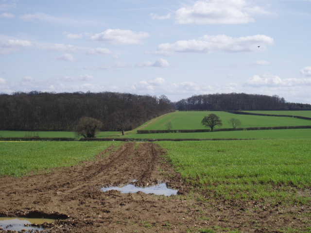
[6]Looking back along the path from near where a bridleway crosses it
I crossed a lane at the bottom of the slope, and continued on another track almost opposite. There were about half a dozen people picking a crop of daffodils here. The track led gradually uphill [6], and continued ahead where another bridleway crossed at the next field boundary. There was another wood soon on the left, where I saw a well-preserved moat (indicated on the map) [7]. The bridleway came to a T-junction, where I came across some dog-walkers. Ahead of me I could see an impressive house called Segenhoe Manor and the village of Ridgmont [8]. They are obviously keen on churches around here, as I could see two less than half a mile apart in the village (as the map indicated, one with a tower, one with a tower and spire) and the map indicated there was the ruins of another church on the other side of the wood. I followed a path to the right along hedge rows for a few hundred yards to reach a footbridge over the busy M1 (this path was also part of the John Bunyan Trail, another long-distance path I’d like to do sometime). I crossed the bridge and then turned round and headed back to Woburn. The whole 10-miles of the walk took me just over three hours, just right for an afternoon walk.
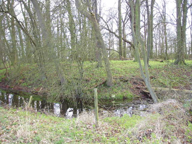
[7]The moated site in the wood, near Segenhoe
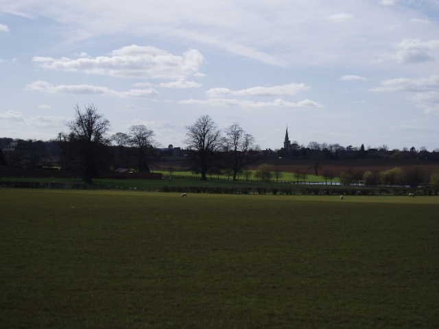
[8]View towards Ridgmont
This was a very pleasant walk on the first day that has really felt like Spring – it was sunny all afternoon, with just a few puffy white clouds in the blue sky, and warm enough for me to roll my sleeves up a couple of times. I carried my coat in my rucksack but never needed it. I knew I’d enjoy the walk as I’d done most of it once before and had really enjoyed the route from Woburn to Eversholt – I certainly didn’t mind walking the same route again. As with my last walk, this one was nicely varied – the Deer Park, fields, woods and some very good bridleways. With buzzards, Fallow deer and Muntjac Deer, as well as all the deer in the park, it was a good day for seeing wildlife, too.
Total Distance: 13.5 miles each way (approximately)