Pete's Walks - Greensand Ridge Walk
If you are considering walking this route yourself, please see my disclaimer. You may also like to see these notes about the maps and GPX files.
Day 3 15/04/06 M1 to Ampthill (about 5 miles each way)
Parked in Bedford Street in Ampthill, a few hundred yards from where the Greensand Ridge Walk crosses it.
I walked this section in the opposite direction to usual, starting in Ampthill and walking back to the M1 before turning around, as Ampthill was the easiest place to park on the walk. I’ll concentrate my description on the walk back however, so it goes in the same West-East direction as the rest of this journal. This was the second half of the 10-mile second section of the Greensand Ridge Walk, which I’ve split into two walks of five-miles each way (OK, because I’m a wimp!). (Update: I did eventually go back and walk the 10-mile section from Woburn to Ampthill each way, on 2nd April 2009 - see here for details.)
I quite enjoyed the drive to Ampthill, as I hadn’t been through places such as Flitwick and Ampthill since I was a child thirty years ago (or more!). I remembered passing through them on an epic bike ride to Bedford and back with my school friend Dave Fowler when we were about thirteen. Ampthill seemed a very nice town with narrow streets and lots of old houses – many looked Georgian, but as so often I suspect many were much older with a Georgian façade built on.
The weather was quite different to yesterday, completely overcast with fairly dark grey clouds and a bit murky, which was a shame as it restricted what would probably have been very good views from the Greensand Ridge over the lower and flatter land around Bedford to the north, particularly from Ampthill Park.
The walk got off to a bad start, as I managed to go the wrong way at the very first junction I came to! The Greensand Ridge Walk had been so well signposted so far, that I foolishly assumed that I could just follow the waymarks and signposts without bothering to check on the map. Where the Greensand Ridge Walk left the road where I parked, there was a fingerpost pointing the way through Ampthill Park. After about a hundred yards there was a path turning off to the left, but as there were no waymarks or signs at all I just carried on ahead through the woodland. It was only when the path emerged from the wood and there were no waymarks at the next junction that I checked the map and realised I was not where I wanted to be. So I had to retrace my steps about quarter of a mile, and take the turning now on my right. Annoyingly, there was a way mark a few hundred yards along the path where it was quite unnecessary, rather than one at the junction where it would have been useful. Fortunately I managed to find my way to the M1 without getting lost again.
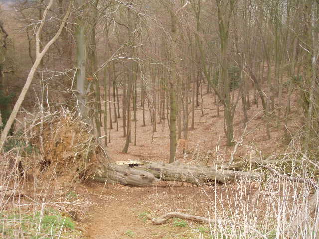
[1]Wooded slope near Jackdaw Hill
From the footbridge over the M1 where I finished yesterday’s walk, I followed a wide grass headland between fields and then a left-hand hedge row. In the corner of a field, an impressive new footbridge carried the Greensand Ridge Walk across a stream to the left. The path then went alongside what seemed a scrap yard to emerge on a rather busy road. A couple of hundred yards to the right, I crossed the road and took a clear cross-field path which led to a narrow lane. Across this, the path followed a thin plantation uphill, then across a ploughed field to a minor road. A hundred yards or so to the left, a Greensand Ridge Walk fingerpost pointed the way along a farm drive, past an equestrian centre and through some small paddocks (I saw three Green Woodpeckers here on my way out and another on my way back). The track continued, becoming the drive to Jackdaw Hill House (where I was pleased to see some Jackdaws). Through a gate at the side of the property, the path continued as a wide track.
The whole of the next section to Millbrook was very pleasant, despite the grey weather. The greensand ridge really was quite obvious here, with a steep wooded slope on the left [1] and a gentler slope on the right towards some coniferous woods. The wide track carried on through the trees for half a mile or so, before turning right around the back of a pond to reach a crossroads of paths. Here the Greensand Ridge Walk turned left, and for about a mile it continued with a golf course on the right and the Millbrook Proving Ground (a test area for cars) on the left.
At one point, there was a bit of a picnic area to the left with some benches – this was at a point where there would normally be good views over the Ouse Valley and Bedford, but today I couldn’t see much at all in the grey and murky conditions. There was also a plaque on a tree stump – this turned out to be a verse, one of seven positioned along the Greensand Ridge Walk to commemorate the Queen’s Golden Jubilee in 2002. I recalled seeing one on a large piece of sandstone where I turned off Nun’s Lane on the first leg of this walk, but hadn’t realised what it was for. I came across another one, attached to another large sandstone boulder, when I was about to enter Ampthill Park later on – I’ll have to keep my eyes open for the other four as I continue on my journey.
A bit later on, the path descended a very steep bank, before turning left – a couple of hundred yards or so on, there was a 1-in-1 slope for cars on the test ground going up the same bank! I would guess the slope where the path descended was 1-in-3 or 1-in-4. The Greensand Ridge Walk continued between the Proving Ground and the golf course, gradually descending from the ridge to reach a road on the outskirts of Millbrook.
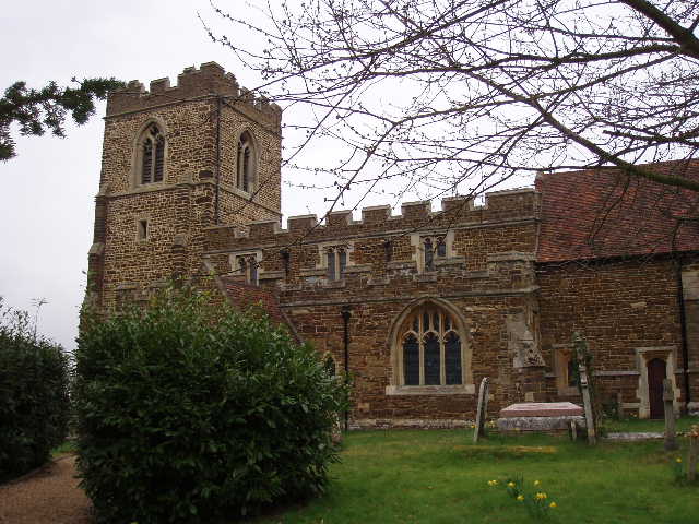
[2]Millbrook church
I followed the road to the right and then turned right at a road junction. I passed a playing field on the right and a pub on the left. After a quarter of a mile, a steep tarmac footpath on the left took me up to Millbrook church [2], in a prominent position on the edge of the ridge. A good track, usable by cars as there was one at the church, continued ahead, with a view downhill to a farm on the left. The track soon reached a farm, where the Greensand Ridge Walk continued as a fenced path, passing some paddocks where there were some Lamas and/or Alpacas (I think there was a small herd of Alpacas and possibly two Lamas in a separate paddock). The path continued through a small belt of trees (planted over the roof of a railway tunnel) and then across a pasture to reach Ampthill Park [3].
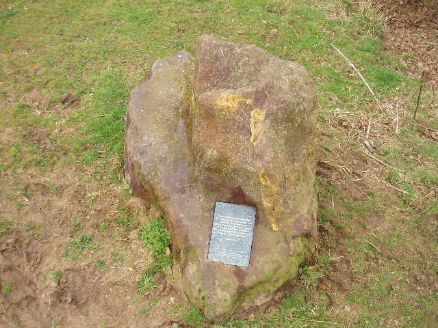
[3]Stone and poem on a plaque, just before Ampthill Park - one of seven such poems and artworks along the Greensand Ridge Walk
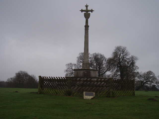
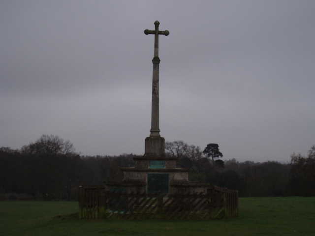
[4]Katherine's Cross in Ampthill Park
Ampthill Park was originally the Deer Park (a reminder of Woburn Abbey yesterday!) surrounding Ampthill Castle. Katherine of Aragon was imprisoned in the castle during her trial and divorce from Henry VIII, and Katherine’s Cross [4] in her memory now stands on the site of the castle (it was demolished later in the sixteenth century). Rather confusingly there is a similar cross nearby [5], which commemorates a military training camp created by the then Duke of Bedford during the First World War. I followed the waymarked path through the park – near the crosses there should have been good views northwards, but in the grey murk I could just about see the chimneys of Stewartby brickworks [6] (brick making is quite an industry around Bedford). The last part of the path through the park took me through the wood, where I went wrong when I set off this morning.
[5]Cross in Ampthill Park commemorating a World War I training camp
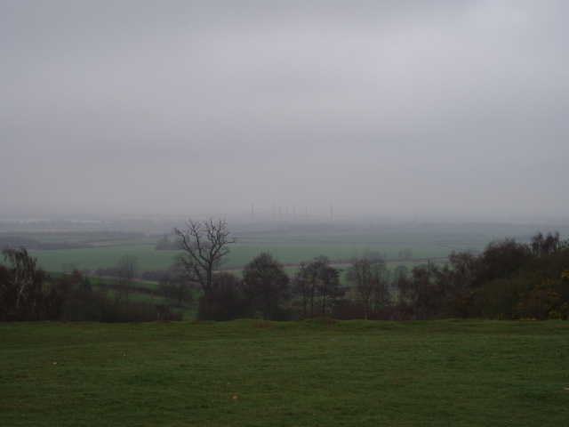
[6]Very restricted view from Ampthill Park - if you click on the photo to enlarge it, you might just be able to see the tall chimneys of Stewartby brickworks peering out of the gloom (see Day 3 of my John Bunyan Trail walk to see how good the view can be on a sunny day)
As with yesterday’s walk, this one took about three hours for the ten miles, an hour and a half each way. I started walking about 9.30 and got back to my car about 12:50 (I lost almost quarter of an hour because of going wrong at the start of the walk). I was surprised how up and down the route was, although there were no really tough hills to climb or descend. It was a very good walk, it was just a shame that the murky conditions meant that I couldn’t enjoy what would otherwise have been far-reaching views. I feel that I have ‘cheated’ by doing two shorter walks of only 10 miles instead of my normal 15 miles – but I think I could easily get used to doing these half-day walks! Anyway, it will be back to normal with my next walk as that will be about 17 miles.
Total Distance: 18.5 miles each way (approximately)