Pete's Walks - Greensand Ridge Walk
If you are considering walking this route yourself, please see my disclaimer. You may also like to see these notes about the maps and GPX files.
Day 4 17/04/06 Ampthill to Haynes (about 8.5 miles each way)
Parked in Bedford Street in Ampthill, a few hundred yards from where the Greensand Ridge Walk crosses it.
I parked in more or less the same spot as on Saturday, and started off about the same time – 9.30am, or a few minutes later. I walked back to where the Greensand Ridge Walk emerged from Ampthill Park, then continued up the road for about another hundred yards, before crossing the road and taking the concrete drive towards Houghton House. I walked along a concrete path beside the drive for a few hundred yards, with a high hedge obscuring the view on my left but with pleasant views over the gentler southern side of the greensand ridge to my right. The hedge ended at a small car park (for visitors to Houghton House) by some houses, and now I could see both the ruins of Houghton House and the extensive view northwards over the flat land around Bedford [1,2]. The weather today was quite different to my walk two days ago, with just a few small puffy clouds in the bright blue sky, so I could really enjoy the views. I took a few photos, and then took a detour down the track to the ruined house, which was unfortunately partially clad in scaffolding and plastic sheeting.
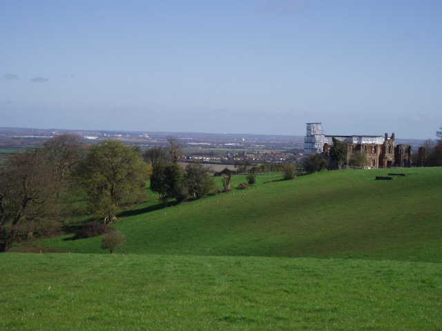
[1]View from the greensand ridge near Houghton House, looking north towards Bedford and the Ouse valley
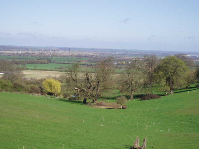
[2]View from the greensand ridge near Houghton House, looking north towards Bedford and the Ouse valley
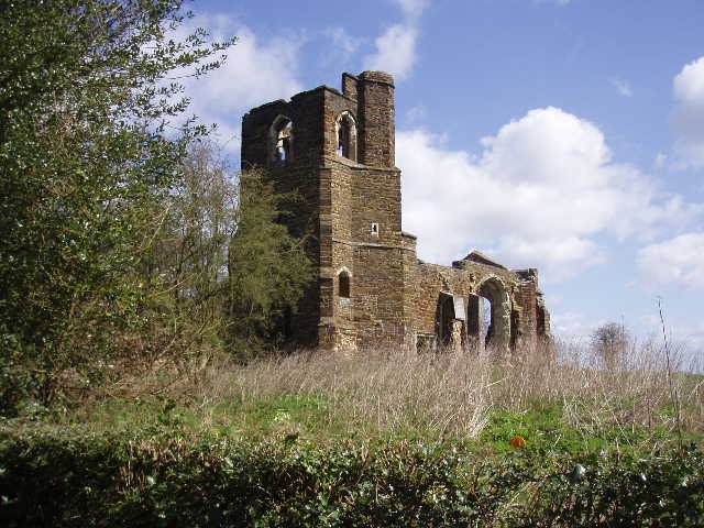
I remember seeing the ruins of Houghton House [3] when I was a child. It was built in the Jacobean style in 1615 for the Countess of Pembroke, with Inigo Jones possibly being responsible for some of the design. At one time it was owned by the Dukes of Bedford. It is thought to have been the model for ‘House Beautiful’ in John Bunyan’s Pilgrims Progress.
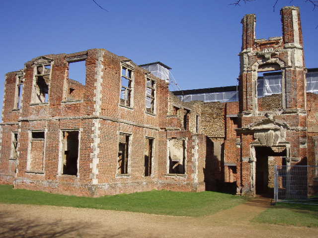
[3]Ruins of Houghton House
I retraced my steps and took a track through a farmyard, which became a long drive to an isolated cottage. The good views northwards over the steep side of the greensand ridge continued, while to the south the ridge descended more gently, to the clay lands around Barton-le-Clay with the northernmost part of the Chiltern Hills beyond. A kissing gate at the cottage gave access to a paddock, which took me to a corner of King’s Wood (a notice board gave information about the wide variety of trees and plants in this nature reserve).
The Greensand Ridge Walk turned right here, to travel southwards over the more gentle slopes of the ridge towards the clay vale. The path followed a field boundary downhill, and then along a hedged track to almost reach a farmyard – a signed path led through grass fields round the edge of the farm (where I met a large group of ramblers coming the other way) and out onto a road on the edge of Maulden. A footpath opposite led across some waste ground and between houses to reach another road in the village, where I turned left and followed the road round a corner to the right. A paved footpath on the left then took me uphill to Maulden church [4,5,6], where there were three wooden crosses, the central one complete with a crown of thorns and a sign saying ‘King of the Jews’ (today was Easter Monday).
[4]Looking back from Maulden church
[5]Part of the churchyard at Maulden
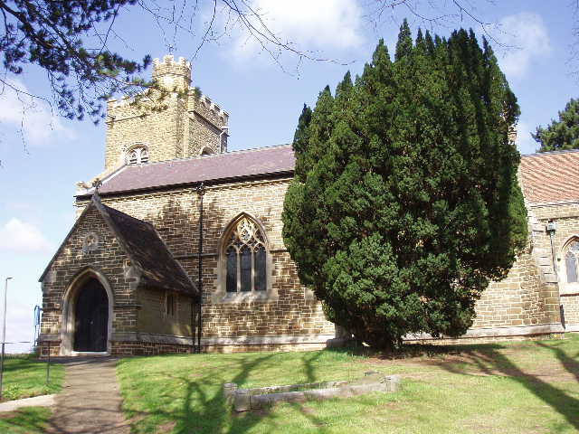
[6]Maulden church
The Greensand Ridge Walk passed through the church car park, and went through a kissing gate into Church Meadow, designated an SSSI (Site of Special Scientific Interest) as it is one of the few remaining unimproved grasslands on the Greensand Ridge. Beyond the meadow, a wide path took me round the southern edge of the Forestry Commission’s Maulden Wood [7], another SSSI – the wood is split between glacial boulder clay and greensand, so has a wide diversity of flora and fauna (as usual, I have got this info from the leaflets for the Greensand Ridge Walk produced by Beds County Council). There was another plaque on a block of sandstone at the entrance to the wood, so I’ve seen four of the seven so far, all of which commemorate the Queen’s Golden Jubilee. The walk along the edge of the wood was very good, with the wood to the left and grassland then heath on my right – I could see past the heath [8] and a plantation of conifers to the distant Chilterns. Partway along the path there was a notice board about the Greensand Ridge Walk and about the plants and animals living in this section by Maulden Wood.
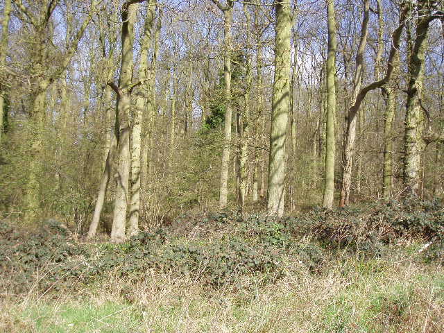
[7]Maulden Wood
[8]Heathland near Maulden Wood
Eventually the path took me past a Forestry Commission house and down a track to the A6 dual carriageway. Having carefully crossed this, I took the pavement downhill to my right, until a Greensand Ridge Walk finger post pointed up the steep embankment through a belt of mainly pine trees. Up this, the path continued around the edge of a couple of fields, with woodland to my right, and then passed round two sides of an old sand pit to reach a road in the village of Clophill. I followed the road to the left past a pub (that was doing a good trade when I came back later) and turned left down a lane between cottages and bungalows. The Greensand Ridge Walk branched off to the right, passing through a small jumble of tiny paddocks, stables and a barn, and across a grassy field to a farm. Here I turned right, the track soon becoming a lane. After a couple of junctions, a footpath on the left led me between fields to the ruins of the 15th Century St Mary’s Church, Clophill [9]. Shamefully, vandals had defaced the church walls with spray-painted graffiti – incredible how ignorant and inadequate some people must be.
[9]Ruined church near Clophill
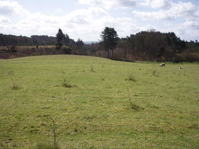
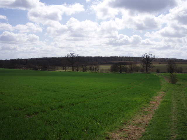
The very pleasant path continued on through grassy meadows (a Kestrel was hovering here each time I passed, and I saw my first Swallows of the year here on my way back) and then followed a hedgerow round a field of some sort of brassica. There was a notice board showing where some permissive paths had been granted by the landowners. A rather bouncy plank bridge across a ditch took me to a good path to the right, a wide bridleway that went on for a mile following the northern edge of Pedley and Chicksand Woods, one of the largest areas of ancient woodland in Bedfordshire. Oak timbers from here were used in the building of Ely Cathedral, and the woods have over 4 miles of woodbanks, marking the divisons of ownership (I’d seen another such bank on the edge of Maulden Wood). The walk along the bridleway was very enjoyable, with the woods on my right and a variety of fields on my left. After a while the view ahead opened up, and I could see the rest of my route to Haynes.
[10]Looking back towards Chicksands Wood from the bridleway leading into Haynes
The bridleway reached a corner of the woods at a road (the John Bunyan Trail went off to the right here, according to the map). I followed the road to the left for about a quarter of a mile, before taking a bridleway between grassy fields on the right [10] – this took me gently uphill to go past a farm and reach the main road running through the village of Haynes. I turned left, and walked about a hundred yards to a fingerpost indicating where the Greensand Ridge Walk left the village. Section 3 of the Greensand Ridge Walk (i.e. the bit covered by the third leaflet) actually goes on another third of a mile to Deadman’s Cross, but I chose to end my walk here, as I would be parking here at the start of my next walk. I turned round and headed back to Ampthill.
I saw a Buzzard as I passed Chicksands Wood, and soon after I overtook a group of four walkers. They passed me a bit later though, as I sat eating my lunch by the ruined church near Clophill. While sitting there, I saw the Kestrel I’d seen earlier and a Green Woodpecker, plus another bird I couldn’t identify – annoyingly, I’d forgotten my binoculars again. Up to this point, I’d been feeling really good, but after lunch my legs felt really tired for some reason. I was really feeling them for the last two hours of my walk, far more than usual, and my knees were really bad on even quite gentle descents. Strange, I don’t know why this should have occurred – the first leg of this walk a week ago was about the same length, and I was still feeling Ok at the end of it. Fortunately the forecast showers didn’t materialise in the afternoon, although I felt just a few spots of rain as I reached the corner of King’s Wood. The skies were certainly much cloudier and greyer by this time, and so the views from near Houghton House were not quite so good now.
Total Distance: 27 miles each way