Pete's Walks - Milton Keynes Boundary Walk
If you are considering walking this route yourself, please see my disclaimer. You may also like to see these notes about the maps and GPX files.
Day 1 16/07/07 Stony Stratford to New Farm, Hanslope (7.8 miles each way)
Parked in car park in Calverton Road, Stony Stratford.
The Milton Keynes Boundary Walk starts on the river Great Ouse near the town of Stony Stratford, which has been described as ‘the jewel in Milton Keynes’. It certainly seemed a very attractive old town as I drove through it this morning, and it has a long and distinguished history, being situated where the Roman Watling Street crosses the Great Ouse. The Saxon king Edward the Elder fought the Danes here, and King John and several other monarchs held court here. Edward I raised one of his Eleanor’s crosses here, marking a resting point of his wife’s funeral cortege on its way to London. It was from a house still standing on the high street that the soon-to-be Richard III secured the young Edward V, soon to meet his fate as one of the ‘Princes in the tower’. During the Civil War, the parliamentarian army was billeted here before the battle of Naseby in 1645. During the 18th century, Stony Stratford became one of the most important coaching towns in the country, being on the London-Holyhead route. Several coaching inns remain – one of which is the source of the phrase ‘Cock and Bull story’. (There’s loads more interesting stuff on the history of Stony Stratford where this lot came from - http://www.stonystratford.co.uk/history.html )
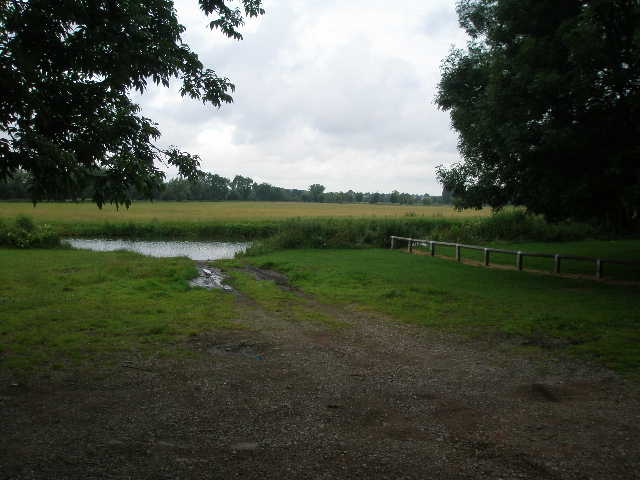
[1]The car park off Calverton Road by the river Great Ouse, the start and finish point of the Milton Keynes Boundary Walk
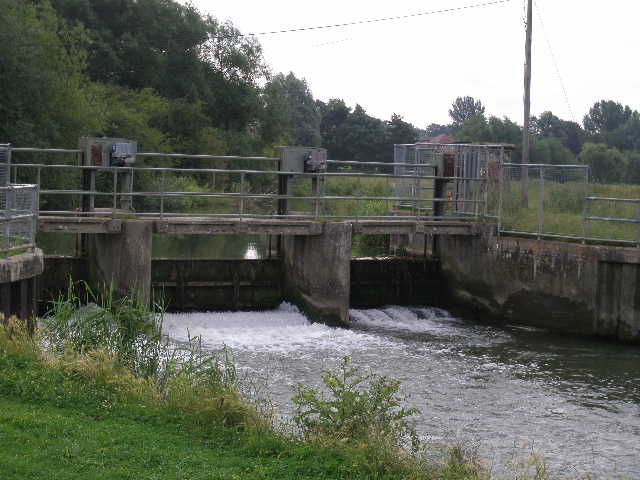
[2] Sluice on the river Great Ouse, Stony Stratford

[3] Path by the river Great Ouse, just beyond the sluice
It had rained slightly as I’d driven to Stony Stratford, and the skies were still very grey as I started walking about 9.55am. It was also very humid, as it would remain all day. From the car park and picnic site on Calverton Road [1], I followed the riverside path northwards with the river on my left. The path was hard-surfaced, as it would be for much of the way, and I worried that I might get sore shins as I sometimes do – this didn’t happen, but my feet were a little sore by the end of the walk. There was generally a line of trees and bushes between the path and the river, so I only got glimpses of it now and again. To my right was a small strip of grass, then garden fences.
After a few hundred yards I crossed a footbridge over a Mill Race, with a sluice on my left [2]. The path now followed a large curve in the Great Ouse, heading eventually towards some refurbished mill buildings, while the Mill Race took the direct route there. Between the river path and the Mill Race was a large area of long grass, with a few paths across it and a small play area for children. I saw some pollarded willows on the far bank of the river [3], where there were some empty water meadows. Close to the old mill, I went through a gate and continued on the path beside the river. I passed through a couple of empty pastures, which clearly had recently had cows and sheep in them, judging by the state of the hard-surfaced path. I then entered a much larger open pasture, between the river and the old Watling Street to my right. There were many sheep grazing here, and a few small brown bullocks lying down, chewing the cud. The path followed the river as it turned from north to east. The river passed under the Old Stratford Bridge [4], while I went through a gate a hundred yards or so to the right to reach the road.
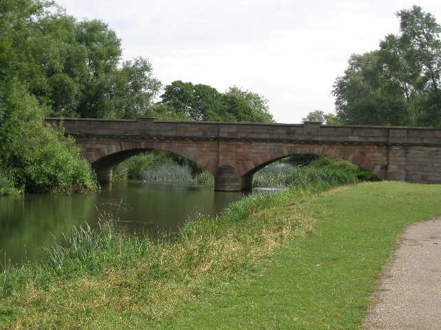
[4] Old Stratford Bridge, on the river Great Ouse
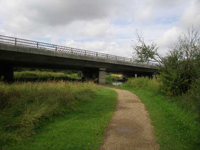
[5] The A5 bridge over the river Great Ouse, Stony Stratford
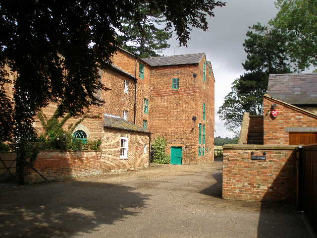
[6] Wolverton Mill
Looking to my right I could see the dead-straight Roman road passing through Stony Stratford (they had lots of bunting flags criss-crossing the road – kind of them to celebrate my departure on the Milton Keynes Boundary Walk!). To my left I could see towards Old Stratford – despite its name, a more recent habitation than its bigger neighbour. As well as also being close to the important river crossing, it also marked where a road branched off from Watling Street to Northampton and another went west along the Ouse valley towards Buckingham. I had, of course, come across the Great Ouse before, when I went through Buckingham on the Bernwood Jubilee Way and then further east in Bedford and its surrounding villages on the John Bunyan Trail.
Across the road, I continued along the path beside the river – I was now in the Ouse Valley Park Wildlife Conservation Area. This was a very pleasant riverside walk, and I took several photos of wildflowers here – as well as some Large Bindweed and Great Willowherb, I was very pleased to see my first Marsh Woundwort and Purple Loosestrife, the latter a particularly attractive flower. Eventually I passed under a long concrete bridge carrying the A5 [5] (the A5 follows the route of the old Watling Street for most of its course, but hereabouts a new dual carriageway has been created). I saw some rather faded Meadow Cranesbill here, and on the other side of the bridge I got a nice close-up photo of a Gatekeeper butterfly. I continued along the riverside path, now heading east, soon coming to a green empty pasture (there were a herd of bullocks here when I came back, obviously used to the walkers, joggers and cyclists on the path).
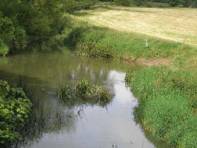
[7] Looking back along the Great Ouse, from the footbridge at Wolverton Mill
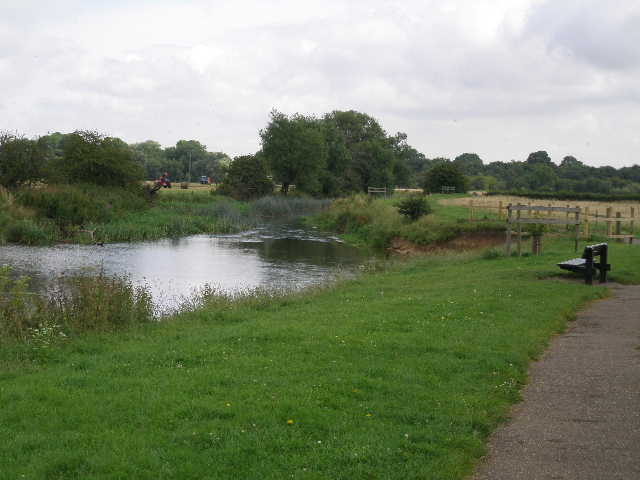
[8] River Great Ouse, near Wolverton
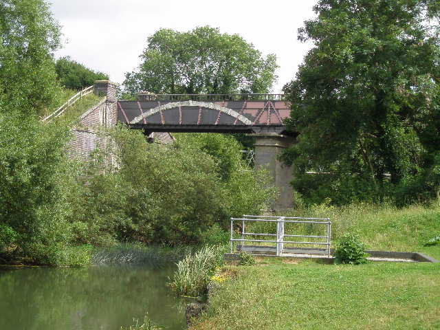
[9] The Iron Trunk Aqueduct, carrying the Grand Union Canal over the river Great Ouse
I then reached a minor road, with Wolverton Mill [6] on my left – the Milton Keynes Boundary Walk continued on the other side but I took a quick detour, as recommended in the guide, passing the converted mill buildings to a footbridge over the river where I took a couple more photos – there was a heron on the far bank of the river here [7]. I then continued on my way, at first between hedges with a field of cows to my right, then across a small meadow and into a large open area of tall grass. Here I got some of my best views of the river [8], as there were seldom any trees or vegetation between the path and the river. I heard and saw a Common Tern over the river at this point.
I could soon see the Iron Trunk Aqueduct ahead [9], carrying the Grand Union Canal over the river Great Ouse. Originally it was planned that two locks would be used to carry the canal over the Ouse valley, but a masonry aqueduct was built instead. This was opened in August 1805, but part of the supporting embankment collapsed the following January and the entire structure gave way on 18th February 1808. A temporary wooden trunk was installed a few months later, which was replaced in 1811 by a cast-iron trunk, built by Reynolds and Company in their Ketley Iron Works in the West Midlands.
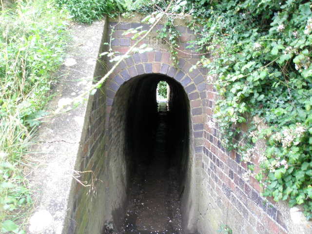
[10] The foot tunnel under the Grand Union Canal
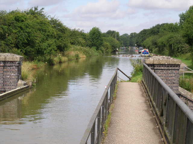
[11] Looking along the canal, over the Iron Trunk Aqueduct towards Cosgrove
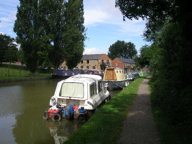
[12] Grand Union Canal at Cosgrove
When I reached the Iron Trunk Aqueduct, I had to go through a narrow brick-lined tunnel [10] under the canal (it wasn’t designed for someone 6ft 3in tall like me, and it was a bit painful for my bad back as I stooped all the way through – blatant ‘heightism’, I should sue somebody! J ). On the far side, I turned right and took a short path up the embankment to the canal. I had been here once before – this is where the North Bucks Way ends. I turned right along the towpath, taking a couple of photos as I crossed the Iron Trunk Aqueduct [11].
I had now entered Northamptonshire, the first time I’d walked in that county (I think I just stepped into it at the end of my North Bucks Way walk). I soon passed a number of narrow-boats moored to this side of the canal. After about a third of a mile I came to a lock. Immediately beyond it was a junction in the canal, where the Old Stratford Cut went off to my left. I continued along the towpath, passing more moored narrow-boats and one or two cottages on my right. Across the canal and over the fields on my left I could see the tower of Cosgrove church. Pretty soon I reached Cosgrove [12], where I crossed over the ornate yellow-stone bridge [13] and continued along the towpath, now to the left of the canal as it headed north.
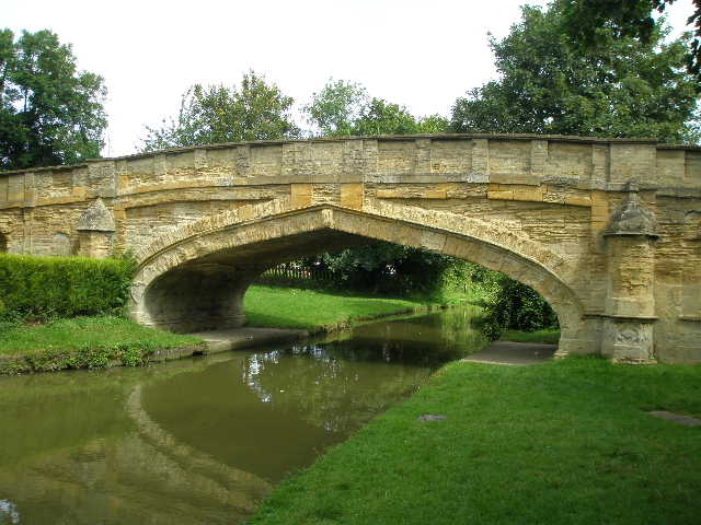
[13] Cosgrove Bridge
[14] View across the canal
[15] Approaching the second road bridge
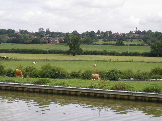
The entire walk so far had been on a hard-surface, and I was glad that this had now come to an end – I was concerned about how sore my feet might be at the end of the day. The path was still occasionally gravel, just a very narrow strip through the grass. There was more Bindweed here, and I saw some White Bryony here when I came back in the afternoon. There were some cows in one of the fields on the other bank of the canal [14], and beyond them I could see towards the far-off village of Hanslope, identified by the tall spire of its church (I could see a smaller church with a tower further right, but haven’t been able to identify it from the map). I saw another heron on the far bank on my way back, and got a photo of it and its reflection. This morning I finally succumbed and took a couple of ‘Aaah!’ photos of some tiny ducklings on the canal. I also tried to photograph the large blue-green damsel flies with dark marks on their wings that I saw along here, but they always flew off before I could get my camera close enough (just after lunch I finally found one that was very co-operative and waited patiently as I edged closer until I could capture it with the SuperMacro facility on my camera – I later found out that they were Banded Demoiselles).
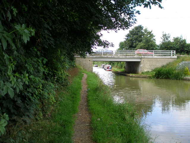
At the next bridge [15], another road crossing, the towpath returned to the right side of the canal. I carried on along the towpath, occasionally passing moored narrow-boats and meeting one or two narrow-boats coming the other way [16]. I passed under a few bridges, generally brick built and far less ornate than the one at Cosgrove. I saw more Purple Loosestrife and Marsh Woundwort as I walked along. The fields either side of the canal were now generally corn or other cereal crops. Although it remained very humid, the grey skies had cleared and it was now quite bright, although there was still quite a lot of cloud about. I passed the wharf at Yardley Gobion, where there was a large mooring area and a dry dock [17]. Further on, I started to see the tower of Grafton Regis church, ahead and to the right of me across the corn fields. I saw some Hedge Woundwort along here.
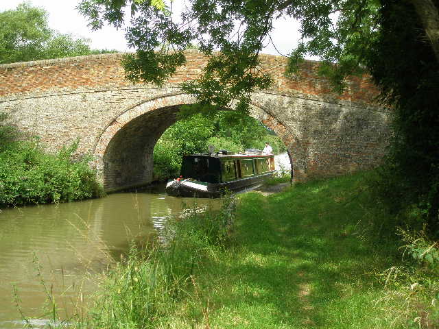
[16] Bridge and narrowboat on the Grand Union Canal
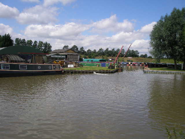
[17] Yardley Gobion wharf
[18] Path leading away from the canal
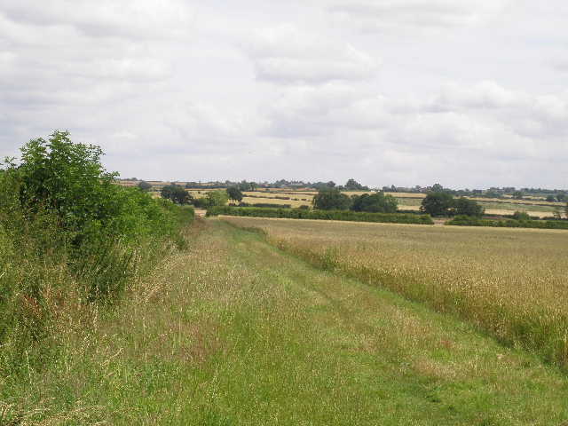
Having followed the canal for over four miles, I finally reached Bridge 58, where I turned right to leave the canal. I followed a broad grass strip beside a left-hand hedge through a large corn field [18]. I heard a Buzzard somewhere to my right as I walked along. The land was fairly flat here, but I could see it rising gently ahead of me. Again I could see the spire of Hanslope church ahead and to the left. Over a stile in the corner of the field, I continued along a narrow path through the tall grass of a meadow with lots of different types of clover and other flowers [19]. I then re-entered Buckinghamshire, by crossing a footbridge over the river Tove [20], flowing south to join the Great Ouse near Wolverton. I crossed a small area of land that was obviously ‘set aside’, with just some weeds and some type of Willowherb growing amongst the remnants of last years corn. The path then went over a small footbridge over a stream, and turned half-right, following a broad bare strip across a corner of a corn field.
I then crossed another small footbridge and over a broken stile into a field of bullocks. These followed me as I turned and walked beside the left-hand hedge, but they soon tired of this and wandered towards the middle of the field. I went over another stile in the corner, and continued through the next field – there were large cylindrical bundles wrapped in black plastic here, where the crop had already been harvested. I went through a gap in the far hedge, and turned left along a broad track beside the hedge, with another large corn field to my right. The track took me to a small meadow, which I crossed half-right to the diagonally opposite corner, with a bungalow to my right. I followed the drive from the bungalow a few yards to a lane, where I turned left. I passed New Farm on my left, and within a few yards came to a footpath sign on my right, which was as far as I was going today [21].
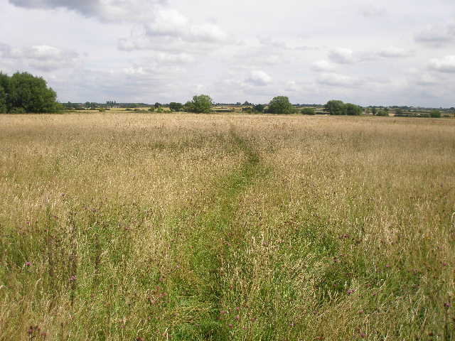
[19] Path through meadow
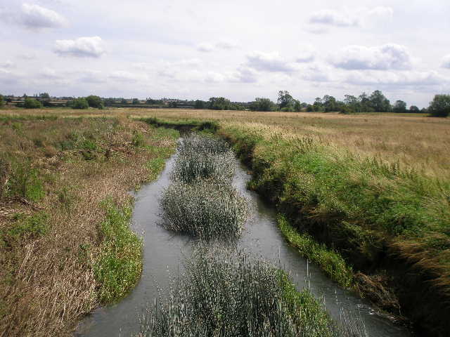
[20] The river Tove, looking south from the footbridge
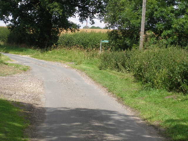
[21] The lane by New Farm, Hanslope, where I turned round
It was about 12.45pm as I turned and started my return to Stony Stratford. I stopped for lunch in the shade of some small trees when I got back to the canal bridge. The walk back along the canal and then the river was quite pleasant in the afternoon, though the skies darkened again and were quite threatening about the time I got back to the Iron Trunk Aqueduct. I got back to my car about 3.30pm.
I enjoyed this walk more than I’d expected to. I’m not a great fan of canal walks, and most of this walk was along a river and then a canal. In fact, this was definitely one of the flattest walks I’ve done. But the flatness in a way made a change, a contrast to the up and down of the Chiltern Way, my previous long-distance path. It was good day for wildflowers and butterflies, and I took over 150 photographs
Total Distance: 7.8 miles each way (approximately)