Pete's Walks - Milton Keynes Boundary Walk
If you are considering walking this route yourself, please see my disclaimer. You may also like to see these notes about the maps and GPX files.
Day 2 19/07/07 New Farm, Hanslope to Weston Underwood (7.5 miles each way)
Parked in Long Street.
There wasn’t really anywhere to park in the narrow lane at New Farm so I parked in Long Street (a large hamlet within the parish of Hanslope) and started the day by walking the mile or so along the route of the Milton Keynes Boundary Walk back to New Farm. I started walking about 9.55am – it was a very warm day, with a forecast of 22-25C, and I was soon applying some sun cream. This was only the second time this summer that I have worn shorts.
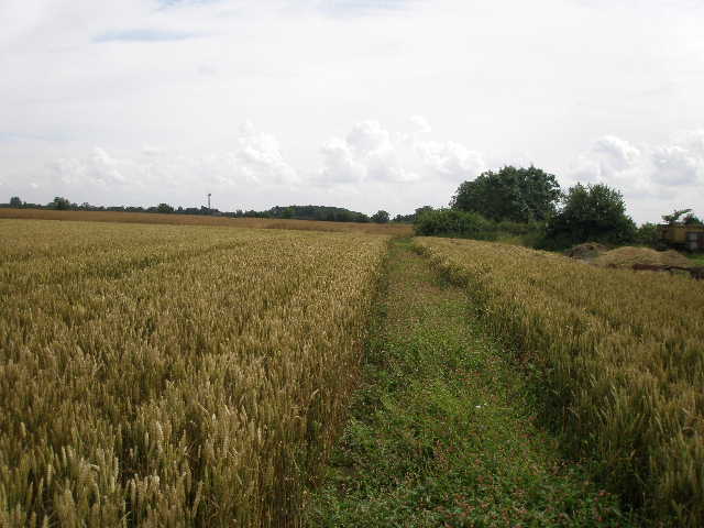
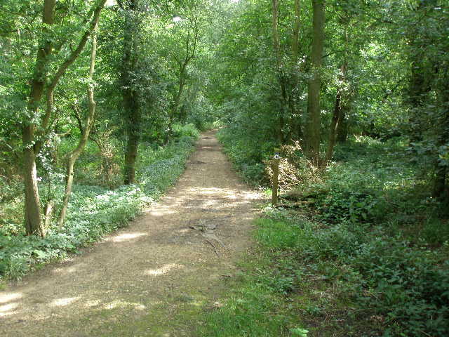
From the lane near New Farm, Hanslope, I climbed over a metal field gate (it was padlocked and there was no stile) and followed a clear path through the middle of a very long and narrow field of grass – currently empty, but obviously a cattle pasture [1]. At the far end, I went through a brick tunnel under a railway embankment [2] and through an open gate into another cattle pasture. I followed a left-hand hedge a short distance to the field corner, and climbed over a stile with difficulty, as it was partly covered by recently fallen branches. I continued alongside the hedge in the next pasture, where I could see some bullocks away to my right at the top of a slight slope. Across a couple more stiles, I crossed the middle of another pasture, heading towards a tree in the hedgeline in front of me. There was a fence to my right, with an open gate, and I could still see the same bullocks beyond it.
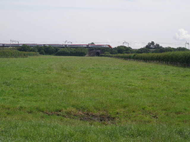
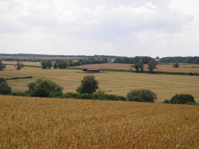
[1] The long narrow pasture at the start of the walk
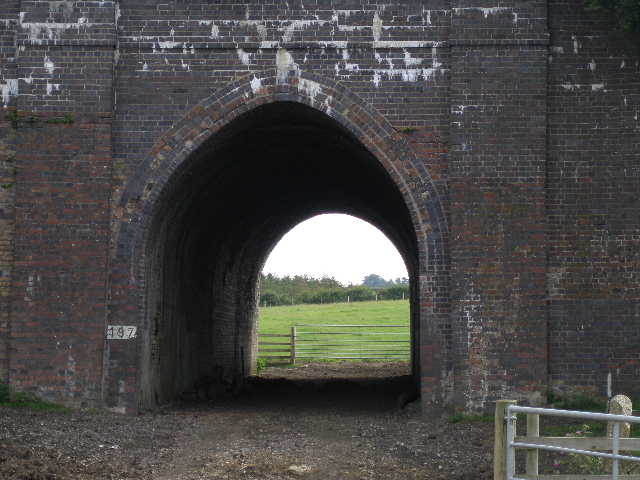
[2] The brick railway tunnel
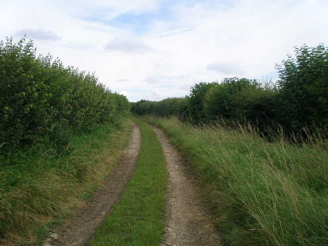
[3] Bridleway leading to Long Street
Across a stile on the far side of this last pasture, I turned left along a bridleway on a wide track. This was soon running between hedges on either side, and a horse rider overtook me here [3]. The left-hand hedge ended as I reached a large field of oil-seed rape, and the bridleway turned to the right [4]. Beyond this field the bridleway ran between hedges again – the surface was grassy but muddy in places and quite uneven. I saw some Great Willowherb growing here. After a few hundred yards I reached a road, with Long Street (and my car) a short distance to my right.
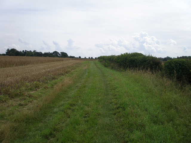
I turned left along the road for about a hundred yards, then turned right on a footpath along a good track between arable fields. I passed Roselane Farm, and continued on a cleared path through a corn field – the path was covered with Redshank (a common weed but this was the first time I’d identified it) [5]. The path then followed a right-hand hedge through two more arable fields [6] to reach another minor road. I turned left here, and soon saw my first Evening Primrose on the left-hand verge. The road went over the M1 motorway – on the far side of the bridge was a good example of Great Mullein.
[4] Bridleway leading to Long Street
[5] Path from Roselane Farm
[6] Field path leading to the road and motorway bridge
I turned right on a path between a wooden fence and a high hedge on my right - beyond the fence were a number of paddocks. Where the hedge ended at a large corn field, I turned left, still with the fence and paddocks on my left. I soon reached a house with some stables, where a woman was exercising a horse in one of the paddocks. Beyond a large farm shed I soon reached a farm drive. The map showed the path continuing across the drive, crossing a field diagonally to the far corner where there was a crossroads of paths, then turning right along the far side of the field to reach the farm drive again. The instructions I’d printed out for the Milton Keynes Boundary Walk said this path was closed and I should just follow the farm drive – however, there was a waymark showing the true route of the path and a sign saying ‘Please keep to the path’, so I ignored the instructions and followed the path through the field (it contained four horses and a much larger number of sheep – the latter were sweltering in the heat when I came back, as they had not yet been sheared). I will contact the people behind the Milton Keynes Boundary Walk to have the instructions changed (there are a few other minor amendments I’ll tell them about, where obstructions to the path have now been cleared).
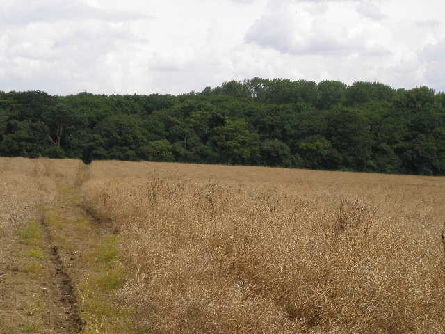
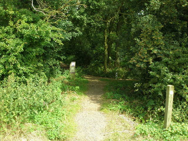
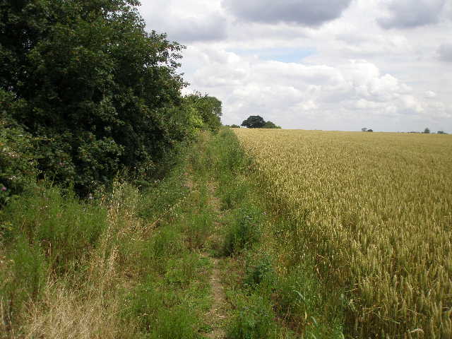
When I returned to the farm drive I turned left and almost immediately passed the farm on my left. The Milton Keynes Boundary Walk then turns right alongside a hedge on the left for a couple of hundred yards, before turning left and crossing a footbridge through the hedge and over a ditch. I then continued on a path cleared through a large cornfield to reach the edge of Salcey Forest [7], the remains of a mediaeval hunting forest now managed by the Forestry Commission. A sign warned that parts of the paths had been washed away by the recent rains [8]. I entered the forest and immediately turned right along a bridleway. This was surfaced with fragments of the local yellow stone, but in places this had indeed been washed away exposing the black matting underneath [9]. The bridleway ran through the trees, mainly oak at first then some beech, for just over a quarter of a mile, the only woodland walking on today’s route [10].
[7] Path approaching Salcey Forest
[8] Entrance to Salcey Forest
[9] Path through Salcey Forest
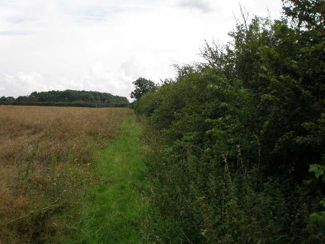
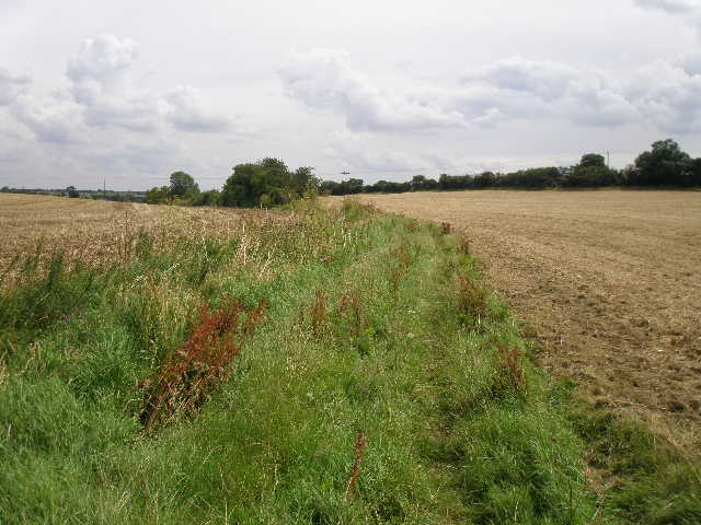
On the far side of the forest, I continued on the bridleway, now running beside a left-hand hedge between fields [11]. I saw some Meadow Cranesbill here. After a few hundred yards I turned right by a waymark, and headed slightly uphill across a field of stubble to a hedge. Through a slightly overgrown gap in the hedge, I continued beside a right-hand hedge with a field of corn on my left. The path continued through the corn when the hedge turned a way to the right. I then crossed a stile, and turned left, following a wire fence between the corn field and a cattle pasture. The pasture was empty, but as I got within a hundred yards or so of the corner, a herd of bullocks came through an open gateway ahead of me (they were hidden from view by the hedge on the far side of the corn field to my left). They were more startled to see me than I was to see them, but they started milling around me as I continued by the fence. I went over a stile into another pasture, and the daft bullocks went through two empty gates to pass through another field into the pasture I had now entered. They followed me a short way, before deciding I wasn’t interested in them.
On the far side of this pasture was a smart wooden fence with a large and attractive house beyond. I went through a gate, noticing there was no footpath sign or waymark, and followed the drive from the house for about a hundred yards, until I reached a gate in the right-hand hedge. The gate was padlocked, there were stinging nettles the other side and there was no sign of a path in the badly overgrown meadow the over side. I tried climbing the gate, but as there was some metal mesh attached to the other side I couldn’t get a footing on the other side and only got stung by the nettles for my troubles. I shall be reporting this problem. From the previous pasture where I left the bullocks, another footpath follows a hedgerow and then goes left between wooden fences (with a paddock on the right and a large number of show-jumping fences in the field on the left) to reach the overgrown meadow. It then follows a wire fence to a metal gate by a road, which is where the correct but blocked path also ends.
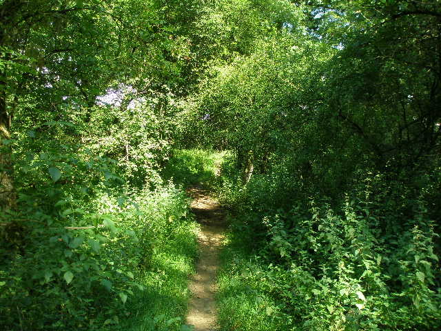
[10] Path through Salcey Forest
[11] Path just beyond Salcey Forest
[12] Looking back towards Salcey Forest
I followed the road to the left, then took a farm track on the right that almost doubled back, parallel to the road. It turned to the left, passing a cottage, and then I turned right through some green gates into a farm yard. In fact, there was no real evidence of farm activity here, just a number of builders at work on converting the outbuildings into residences. The Milton Keynes Boundary Walk then went left through a gate, and followed an electric fence half-left through an overgrown meadow to a stile. A horse in the paddock the other side of the fence ran towards me but then stopped. Over the stile I continued through another paddock (the horse here completely ignored me). I crossed another stile, and then went through a kissing gate the other side of a track. I headed slightly downhill through a meadow of tall grass, to reach another kissing gate in the left-hand fence.
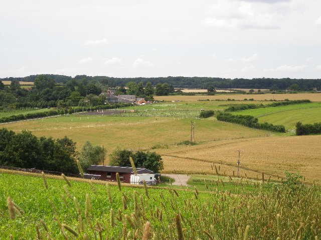
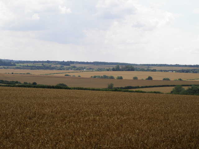
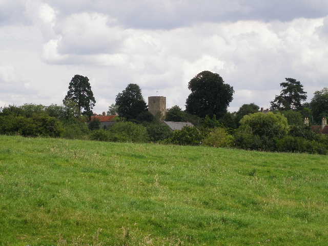
I then followed a cleared path across a corner of another corn field, where I saw another woman exercising a horse on an area of grass to my right. I had to then make my own way over a strip of young maze (where I also saw some Borage), and then followed a line of telegraph poles uphill between corn fields. At the top of the hill there were nice views, looking back west towards Salcey Forest [12] and south towards the distant Greensand Ridge around the Brickhills (where I’ll be walking later on this route). I went through a couple of hedge gaps, and continued onwards alongside the right-hand hedge of another corn field. I followed the hedge for several hundred yards, with nice views over corn fields towads Stoke Goldington on my right [13]. I then went over a stile that took me into a small pasture. Here I went slightly left across the pasture towards the end of a barn at Parkfield Farm [14]. Two small dark brown bullocks came out of a pen beside the barn as I approached, and watched me curiously.
[13] View towards Stoke Goldington
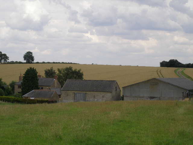
[14] Parkfield Farm
[15] View south from near Parkfield Farm
I went through a gate and crossed the farm yard. The farm drive led slightly uphill between corn fields. Near the top of the rise I went right, following a path through the corn and passing the end of a belt of trees to go through a small gap in a hedge. Again there were nice views over Milton Keynes towards the Brickhills [15]. The path now went half-left across a corner of a large corn field [16]. On the far side I turned right, alongside the hedge, and followed a grass strip several hundred yards to the next field corner. The next field was an empty pasture, which I crossed half-right to reach a gate. Here I could see the tower of Ravenstone church to my right [17]. In the next empty pasture, I turned left and walked close to the left-hand hedge before making my way across to a waymark in the far hedge. Here I went through a gap, to reach a children’s play area and a road in the village of Ravenstone [18].
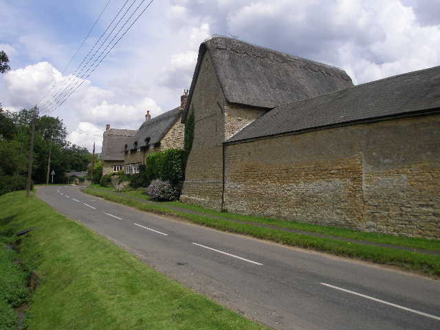
I turned right along the road. Ravenstone is a very attractive village, most of the houses being built of the local honey-coloured oolitic limestone. Many cottages are thatched, and apparently there is still a thatcher in the village. I struggled to get a decent picture of the village, though, as the road was criss-crossed with telephone and power lines. I turned left on a short path between fences and entered another pasture. I followed the left-hand hedge uphill to a corner, where I continued alongside the hedge as it turned left. There was another herd of bullocks at the top of the hill here, and they followed me as I walked along the hedge to a stile. I crossed a smaller empty pasture to a gate and a road (I could have got here by just turning left when I reached the road in Ravenstone).
[16] Path across corner of a corn field, near Parkfield Farm
[17] Looking towards Ravenstone church
[18] Ravenstone
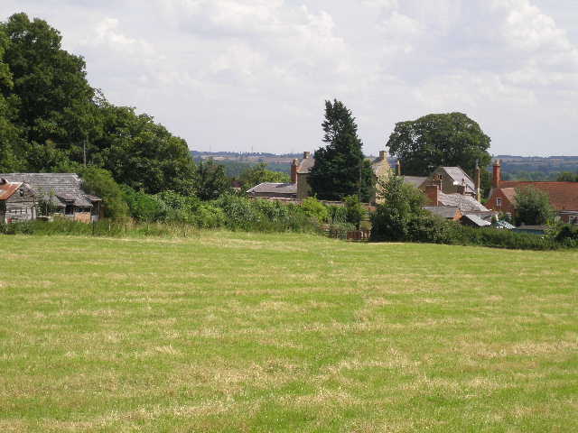
I crossed the road, and took a footpath opposite along a drive by some more modern brick-built houses on the edge of Ravenstone. The path crossed the middle of one corn field, then went through a hedge gap and continued alongside a left-hand hedge in another corn field [19]. After about 200 yards the path went half-right across the field. The path continued on through two more corn fields, then reached a small meadow of tall grass, where I saw several butterflies including a Ringlet. About half way down the meadow, I went over a stile in the left-hand hedge, and crossed a hay meadow that had recently been cut [20]. On the far side I reached a lane, with the main road through Weston Underwood just a few yards to my right. Again, this is pretty village built of the same yellow limestone.
[19] Field path between Ravenstone and Weston Underwood
[20] Weston Underwood, from the last hay meadow
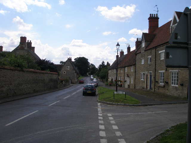
[21] Weston Underwood
I took a quick photo [21], then headed back. I stopped for lunch straight away at the stile on the far side of the hay meadow. It was now 1.25pm and I was worried about how long it had taken me to get this far, even allowing for the time I spent walking from Long Street back to New Farm. As it happened, my return journey was a bit quicker (no navigation, much fewer photo stops) and I got back to my car just before 4pm. Even so, that meant the walk was at least 30 minutes longer than usual for a walk of this distance – this was probably because this was the first walk where I’d taken a large number of photos and also had to navigate. The Chiltern Way required next to no navigation as I’d walked it before, and the first walk on the Milton Keynes Boundary Walk needed little navigation as it followed a river and then a canal for much of its course.
This wasn’t a bad walk, but nothing special. The countryside was pleasant, more undulating rather than the hills and valleys of the Chilterns, though there were one or two small valleys. The relative flatness of the land tended to restrict the views, although there were occasionally good views south towards the Greensand Ridge around the villages of Great, Little and Bow Brickhill. I was annoyed at the path being blocked, and will be reporting this to the appropriate council (the instructions mentioned one or two problems with blocked paths, but these seem to have been sorted out).
Total Distance: 15.3 miles each way (approximately)