Pete's Walks - Bernwood Jubilee Way
If you are considering walking this route yourself, please see my disclaimer. You may also like to see these notes about the maps and GPX files.
Day 2 5/2/07 Marsh Gibbon to Tingewick (8.6 miles each way)
Parked at village hall in Marsh Gibbon.
I started walking about 10.10am. It was a grey day, with a slight mist restricting the views. From the car park at the village hall in Marsh Gibbon, I followed the lane into the centre of the village to the main road [1], turned right for a few yards then left towards the church [2]. This was an ancient building, but largely restored in the late 19th century. It had obviously had bits added to it at many points over the centuries, and consequently looked rather awkward and ungainly to me. Passing the church on my left, I continued a little further along the road, then turned half-left along a narrow lane called The College, passing some very small and charming thatched cottages (I’m sorely tempted to use the word ‘bijou’ here, but real men don’t use words like that!) [3]. The lane gets its name from the fact that a lot of property and land here was owned by the Ewelme College Trust (I went through Ewelme in Oxfordshire on the Chiltern Way).
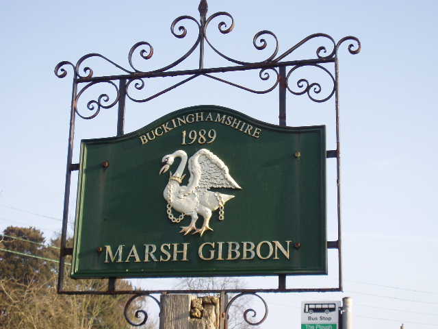
[1] Marsh Gibbon village sign
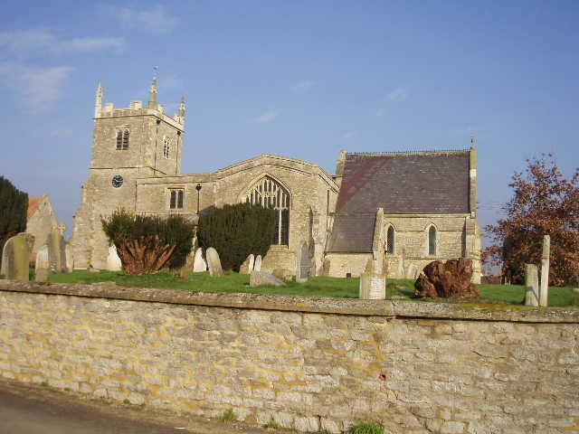
[2] Marsh Gibbon church
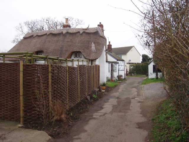
[3]The College, Marsh Gibbon
Where The College almost double backed on itself, I continued ahead along a very short track to a stile and entered a very large empty sheep pasture (the guide book says it has evidence of Ridge and Furrow, but I didn’t notice any). I crossed the field diagonally half-left passing a ‘stump well’ [4], which according to the guide book is a ‘post mediaeval stone well house covering a mineral spring’. In the corner of the field I went through a gateway and turned immediately right through another field entrance. I was now on the route of the Cross Bucks Way, which I would be following for a couple of miles to the other side of Poundon (perhaps it would be more accurate to say that the Cross Bucks Way follows the route of the Bernwood Jubilee Way as it is only the latter path that is signposted along this stretch). I could remember seeing the Stump Well and Marsh Gibbon as I passed this point on Day 1 of my Cross Bucks Way walk.
[4] The 'Stump well' near Marsh Gibbon
I followed a left-hand hedge through the next empty pasture and crossed a stile into the next one – there was quite a bit of ice on the ground here, and surprisingly some still remained when I returned here in the afternoon. I crossed this next very wet pasture half right to a stile in the next hedge (there were indentations in the field as a result of some form of quarrying, apparently). The next field was arable, with the path across it only just discernable. It reached the next hedge just left of a bungalow, where a large Alsatian barked loudly as I passed. I was pleased to see the path continue ahead in the next field, as when I walked the Cross Bucks Way this time last year the path had not been re-instated after ploughing and I’d had to walk round the edge of the field. On the far side of this arable field, I went round the right edge of some scrubby bushes to steps that took me down to a railway crossing. On the other side, I entered another huge sheep pasture stretching over the top of Beacon Hill. Although not very high, I remembered that there were surprisingly good views from here, but today they were not in evidence due to the misty conditions.
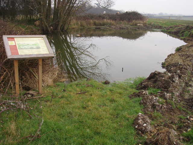
[5] Field pond with information board, near Poundon
I crossed a stile on the far side, then followed a right-hand hedge a short distance to a field pond, with an information board [5]. I continued onwards across a couple more pastures, with the impressive Poundon House (built 1908) in view to my left [6]. In the next field, I crossed a stile in the left-hand hedge, and crossed a couple of small pastures to enter the village of Poundon by way of a stile leading into a back garden.
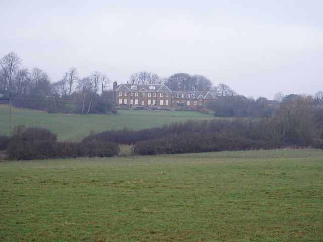
[6] Poundon House
I turned right along the road, soon coming to a T-junction. Almost opposite, a stile took me into another sheep pasture, where I followed the right-hand hedge some distance to another stile. Across this, I turned left and followed the hedge, going right at the next field corner to reach another stile (strictly speaking, I think the path cuts across the corner of this field but there was no evidence of a path on the ground). The next field was a huge paddock where the ground was very soft underfoot – on the way back I noticed a good area of Ridge and Furrow here. Having crossed the paddock diagonally half right, a very overgrown stile led me to a long tarmac farm drive. I turned left along this drive, finally departing from the Cross Bucks Way, and followed it for about half a mile to a farm and stable complex.
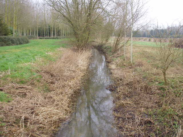
[7] Stream or ditch in woodland, between Poundon and Chetwode
I turned left here at a crossroads of bridleways (two tiny and very friendly white terriers, one only a puppy, appeared here on my way back, and for a while I was worried that they were going to follow me back to Marsh Gibbon). I passed through a farm or stable yard, then continued on a good track with a paddock on my left and a hedge on the right. The bridleway continued through arable fields, soon switching to the other side of the hedge and the hard surface giving way to grass (or mud!). There was a short, narrow and very muddy section between fences, then it continued alongside a left-hand hedge between two large arable fields to reach a farm (with some holiday cottages to let) where I followed the drive to a road. A few yards to the right, a gravel track on the left continued northwards, soon passing through a plantation of conifers and crossing two wooden bridges over clear and fast-flowing streams [7]. The track then went half-right for several hundred yards alongside the right-hand hedge of another arable field. At the next field the track turned right, still with the hedge to the right, then went left at the next corner. Near a small copse, the track went half right across another arable field and then crossed a large brick-built bridge over a disused railway line – having peered over the edge of the bridge, I checked the map, as the water at the bottom made it look more like a disused canal than a railway. The steep embankments either side were overgrown and wooded, and at least part of this area was now a nature reserve. A few yards further on the gravel track reached a minor road. The route so far had been very flat, like the previous walk, but now I could clearly see some gentle undulations in the landscape ahead of me.
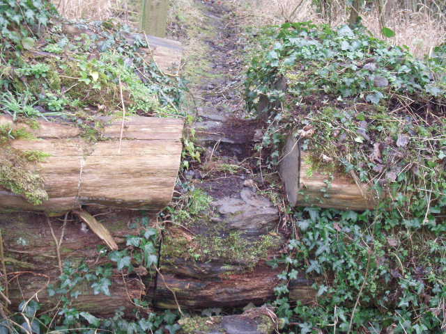
[8] Pathway cut through fallen tree trunk, near Chetwode
I turned right and after a short distance turned left down another minor road, with wide green verges on either side. As I walked down here, I could see what looked like a really old church someway over to the left. Looking on the map. I could see the house there was named Priory House so I guessed, as I was now in the parish of Chetwode, that the building I was looking at would be called Chetwode Priory (I have since looked this up on the internet – it was an Augustinian Priory founded by Sir Ralph de Norwich in 1244, and dissolved due to lack of funds in 1460 when it was annexed by the nearby Abbey of Nutley in Long Crendon). Where the road turned sharply left, I continued ahead on a track past a few cottages, then turned left over a footbridge into an L-shaped pasture. I crossed this to the far left corner, where a stile led into a copse. A narrow path led through the copse (the only bit of woodland walking so far on the Bernwood Jubilee Way) – at one point the path was blocked by the large trunk of a fallen tree, and steps had been cut into the trunk to allow onward progression [8]. Beyond the copse, a muddy path led half-left through a field of root vegetables, then the Bernwood Jubilee Way turned very sharply left to follow the hedge of the field to a corner. It then continued on across another couple of fields of root vegetables [9]. My boots were caked in mud yet again when I finally emerged on a road, now in the parish of Barton Hartshorn.
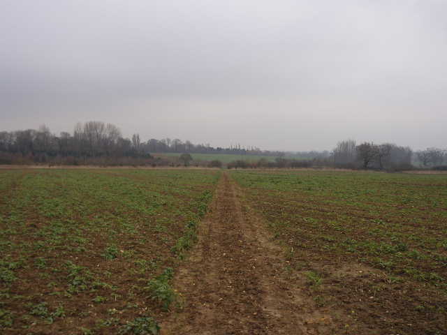
[9] Looking back along a muddy field path near Barton Hartshorn
I took another footpath on the other side of the road, turning half-right to pass through a small area of newly planted trees and then crossed a large empty pasture to a gate and another road. A hundred yards or so to the left, I took another path on the right which followed a left-hand hedge through a couple of very muddy grass fields. There were two horses and some sheep in the first, and both fields had clear evidence of Ridge and Furrow. The hedge in the second, larger field, was rather intermittent, and through one of the gaps I saw a fox walking along the hedge row at the bottom of the adjacent field. It didn’t spot me until I’d gone a fair way further on down the hedgerow, when it turned and fled. At the bottom of the field I crossed a double stile (where I’d stop for lunch on my way back), and then entered a large area of rough grass, once part of the military airfield at Tingewick. I went slightly wrong here as I headed for a post I could see with a footpath waymark on it. When I reached it, I realised I’d gone too far to the right, and should have gone to another post and waymark about a hundred yards to my left (it wasn’t visible from the stile, I checked when I went back). I walked to the other post and a few yards further on, before following a grass headland between two more fields containing some root crop. The path then led across a large concreted area, again some part of the old airfield, then turned half-right to cross another area of rough grass and then a large sheep pasture. It then crossed a runway, which is still used by a company flying microlights (I’d seen one earlier in the day).
Beyond the runway, the Bernwood Jubilee Way turned right on a gravel track at the top of the embankment of the A421 road (a dual carriageway at this point). Having headed north so far, the Bernwood Jubilee Way would now be heading eastwards as far as Buckingham. There were some Long-tailed Tits in the hedge between the track and the main road. The track continued parallel to the A421, crossing a minor road, then turned left to cross a bridge over the main road (a Bernwood Jubilee Way signpost had been twisted to point in the wrong direction here). Beyond the bridge, the track ran between hedges a short distance to reach a street in the village of Tingewick. I turned right, passing a row of charming thatched cottages, and then followed a street downhill to the left to reach the main road through the village. This was where I finally turned round – it was now 1.05pm, and I’d been walking almost three hours.
Half an hour later I stopped for lunch on a stile near where I saw the fox. The walk back was quite pleasant but uneventful. I had been walking for almost six hours when I got back to my car, about an hour more than usual, and I was feeling quite tired at the end. There was just a slight drizzle as I was getting back towards Poundon and it remained very grey – the views from Beacon Hill were again disappointingly limited by the grey and still slightly misty conditions.
This was a slightly more varied walk than the previous one, although it was again very flat. At least there were a few arable fields to walk through, to break up the monotony of endless sheep pastures! Again it was really muddy (why did I bother cleaning my gaiters and boots!), but that is hardly surprising at this time of year. It would obviously have been nicer on a drier and sunnier day.
Total distance: 17miles each way