Pete's Walks - Bernwood Jubilee Way
If you are considering walking this route yourself, please see my disclaimer. You may also like to see these notes about the maps and GPX files.
Day 3 7/2/07 Tingewick to King’s Bridge (8.6 miles each way)
Parked on the main street in Tingewick.
This was a very cold morning with a hard frost – the temperature was -4C as I drove through Dunstable. I went a completely different route today, driving north to Milton Keynes then west to Buckingham – the previous two walks I’d gone west or northwest through Aylesbury. North of Dunstable it was fairly foggy and there was a bit of a hoar frost (not as spectacular as when I walked through Bedford on the John Bunyan Trail before Christmas). By the time I reached Milton Keynes the fog had gone, and it was a bright and beautiful morning.
I had to turn round soon after driving off from home as I realised I’d forgotten my camera! Map, camera – what will I forget next! I actually have an acronym to help me to remember what to take – CHAMPS. It stands for Camera, Hat, Aqua (i.e. water – I knew spending three years to fail Latin O level would come in handy one day!), Maps, Provisions (i.e. lunch and Alpen snack bars). Unfortunately this acronym doesn’t help at all if I forget to recite it before I set off.
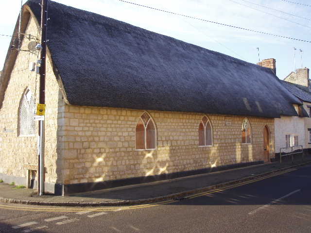
[1] Old Sunday School, Tingewick
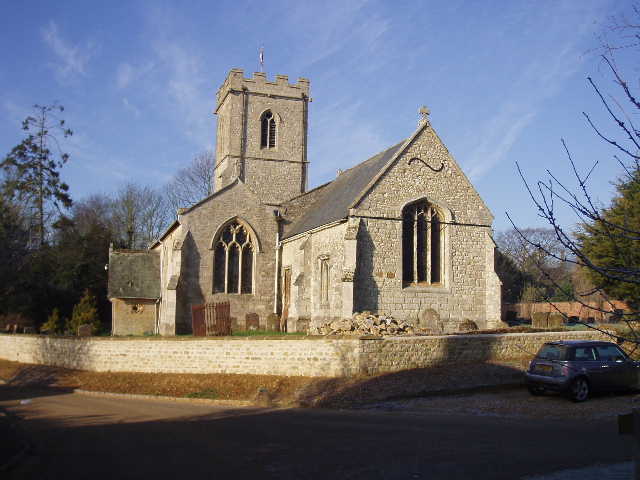
[2] Tingewick Church
I started walking about 10.10am, wearing my maximum protection from the cold – the hood of my coat pulled up over my thermal hat, and my waterproof gloves over my fingerless mittens. From the main street in Tingewick [1], I turned up Church Lane. Shortly after passing the church [2], I took a footpath on the right crossing a large paddock. The ground was white with frost and hard underfoot – much nicer than walking through mud. The path went through a gap in a wooden fence into a much larger open grass field. This contained the largest and most impressive section of Ridge and Furrow that I have yet come across [3] – almost the whole field was like a sheet of corrugated iron. Even if I hadn’t recently read about the mediaeval Open Field and strip system of farming, I’m sure I couldn’t have helped noticing something odd about this field as I constantly rose and fell slightly as I crossed the long succession of ridges and furrows. The next field contained some sort of root crop, with a clear strip through it showing the route of the footpath. Across a stile in the next hedgerow, a less clear set of tyre tracks showed the way half-left across the next ploughed field. It was very pleasant walking in the bright clear air, with nice views over the undulating countryside – I was pleased to have left the dead flat region behind.
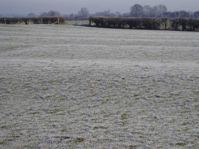
[3] Ridge and Furrow in frosty field near Tingewick
Across another stile, I followed a left-hand hedge and then a fence, through a small field of long grass with a farm and a barn conversion to my left. I then turned right down the farm drive. Where this curved left to meet the road, the Bernwood Jubilee Way continued ahead on a rather overgrown path. I had to fight my way round or over several fallen trees – one completely blocked the stile at the end of the path, and I had to clamber awkwardly over a mesh wire and wood fence. Steep steps then took me down an embankment to the A421 (here a single carriageway road). I had now warmed up and took off my gloves and pulled down my hood. I turned right and followed the road for a few hundred yards to a slight bend, where I took a footpath on the left across a golf course. There was no sign at all of where the path went across the golf course, so I tried to make my way using the contours on the map and the distance from the club house as a guide. Eventually on the second fairway I crossed I asked some golfers whether I was on the line of the footpath or not, and they pointed out the way the path left the course (I wasn’t too far wrong). Beyond the golf course, the Bernwood Jubilee Way crossed a small grass field near a house to reach a minor road [4].
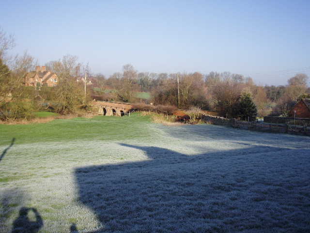
[4] View from the road beyond the golf course
A short way to the left I took another footpath on the right. This led along a farm track and then alongside a right-hand fence, curving to the right as it rose round the hillside. Where the fence turned right, I continued ahead beside intermittent bushes that were obviously once part of a hedge. I was in a very large green pasture spreading all round the hill, with a railway line over to my left. Where the bushes ended, a long bank or earthwork continued downhill showing where the hedge used to go (or possibly a wall, as there were several chunks of limestone in this part of the field). At the bottom of the slope, I followed the field boundary to the right. Over a stile, I continued on alongside the left-hand boundary of the next large grass field a short distance, before going through a kissing gate into a path running to the right of an industrial estate. The path soon brought me out on a road on the edge of Buckingham.
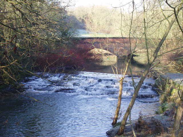
[5] River Great Ouse in Buckingham
Buckingham is situated on a bend of the river Great Ouse. It is a largely Georgian town, as much of it had to be rebuilt after a disastrous fire in 1725. It was the county town (of Buckinghamshire, obviously!) from the ninth century until Henry VIII gave that status to Aylesbury. Amongst its interesting buildings are a castle-like building built by Lord Cobham in 1748 as a gaol, and a tiny 15th century chapel that was once a school. (Incredibly, the Bernwood Jubilee Way guide book has absolutely nothing to say about Buckingham, so the above information was gleaned from the Aylesburyvale.net web pages.)
I followed the road to the left, then turned right down a side street where a Bernwood Jubilee Way signpost indicated the way. Unfortunately this was the last one I’d see for a while, and so I have no idea whether or not I took the correct route through Buckingham. The guide book only shows the route of the Bernwood Jubilee Way as a very thick black line on a scaled-down extract of a 1:25000 map. The scale is so small and the black line so thick, it is impossible to see exactly where it goes in a built-up area like Buckingham. I’d hoped there’d be a clear series of waymarks or signs, but this wasn’t to be, so I may have strayed from the official route. Anyway, this road led under a railway arch to a T-junction where I went left. This road soon turned sharp right, and shortly after the turn I turned right along another road. Part of the way along here I followed a parallel path on the left, between the road and the river Great Ouse [5]. The road turned sharply left, and went slightly downhill to a rather complex junction. Fortunately here I could see another footpath signpost with a Bernwood Jubilee Way waymark at the entrance to a park.
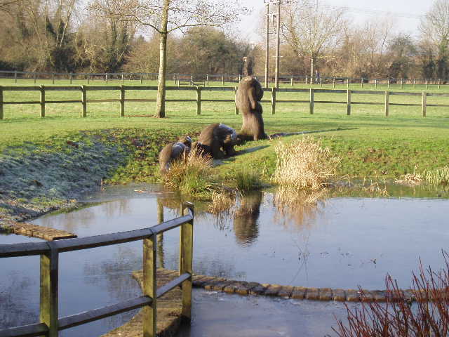
[6] Otter sculptures in park in Buckingham
The next mile or so was very pleasant, as I walked through the park as it followed a long curve of the river (I’d also accompanied the Great Ouse a bit on my last long-distance path, the John Bunyan Trail). There were several paths through the park and no more waymarks for some time, so again I may have strayed from the official route. At some point I had to cross from the right bank of the river to the left, I’m not sure if I used the correct bridge or should have used the previous one. At least on that side of the bridge I found another waymark for the Bernwood Jubilee Way. I passed an information point about a riverside walk, close to some large wooden sculptures of a family of otters [6]. Eventually the path re-crossed the river, leaving the park as it reached a road.
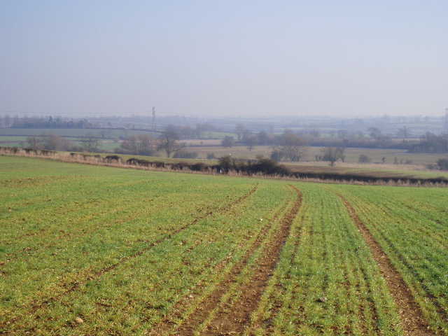
[7] View from arable field just south of Buckingham
Here I turned left and soon crossed over another road at a roundabout. I then turned right on a footpath through a small sheep pasture (the sheep ran to a nearby trough, obviously expecting me to feed them). I then crossed the A421 by another roundabout and took a footpath on the other side – having travelled east for a few miles, the Bernwood Jubilee Way was now heading south. I followed a muddy track through an empty field (it had long since warmed up sufficiently for me to have removed my hat and mittens, and the previously frozen ground was now wet and slippery). I went slightly wrong across the next arable field [7] as there was no sign of a path. The map showed that in the next field I would be walking beside a hedge, so I headed for the only hedge I could see – when I got there, there was no entrance into the next field, and I realised I’d gone too far left. I followed the hedge of the field I’d just crossed to my right to a gateway, where the path was now clear across the next arable field – the hedgerow shown on the map had obviously long since gone. In the next field, however, I did follow a right-hand hedge, soon reaching a road. There had been nice views along this section of the walk over the undulating countryside south of Buckingham.
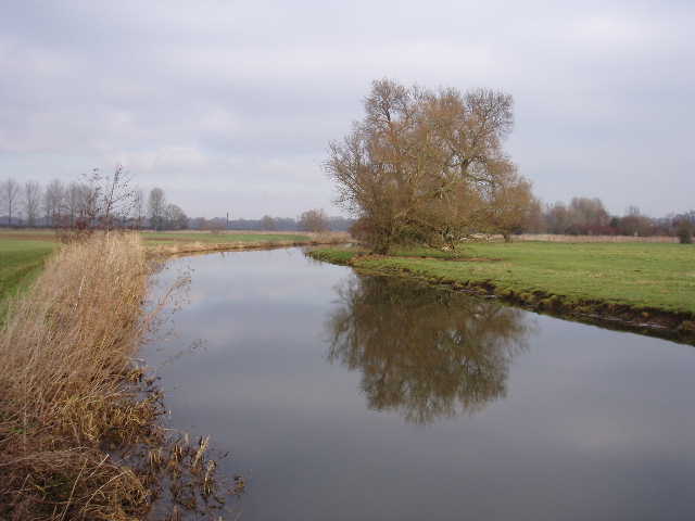
[8] Looking back along Padbury Brook
On the other side of the road, I had another pathless arable field to cross. Fortunately I could make out where the next stile should be – I had to leap a small ditch to get to it though. Over that stile, I immediately turned right over another one, then turned left, veering slightly away from the left hand hedge as I crossed a grass field that had recently been spread with muck (lovely!). Across another stile, I turned left on what was obviously the track of an old railway line. I saw more Ridge and Furrow in a field to the left of me here. Just past a farmyard I came to a minor road, where I turned left, then soon turned right at a junction. I had to walk down this road for about two thirds of a mile, between arable fields lined by hedges. On the first field on the left, I saw a mixed flock of Redwings and Fieldfares when I came back this way. The road had a reasonable verge that I used when infrequent vehicles passed me. When the road reached a narrow hump-backed bridge I turned right onto a footpath which crossed another arable field half-right to the opposite corner. The path then turned sharp left along the field edge (the road and the path had thus just made a ‘Z’ shape) alongside a row of poplar trees. One of these had fallen, and I had to detour round it.
The last mile or so of the walk was the most enjoyable, as it followed the bank of the meandering Padbury Brook. Although only called a brook, it was about 20 feet across and so about the same size as the river Great Ouse had been in Buckingham. When I’d looked on the map, I’d worried about how good the path would be here. In fact there was a wide grass strip next to the brook most of the way, as it slowly twisted its way through a succession of arable fields [8]. There were occasional willow trees along the bank, and I passed a pair of Mute Swans. In the last field I went through, I followed a barbed wire fence that went in and out but actually still flattened out some of the meanders of the brook.
Finally I went over a stile to reach King’s Bridge [9], a modern cement bridge with railings carrying a bridleway across Padbury Brook – I had crossed it very early on the second day of my Cross Bucks Way walk a year ago. I had then just started from the small village of Hillesden, where Hillesden House had been destroyed by Cromwell’s troops in the Civil War – the guide book for this walk says that the Roundheads had been camped at Steeple Claydon, the next village I will come to on this walk, before making that attack. Also, I’ve just found on the internet that Hillesden House was then owned by relatives of John Hampden (him again!), who took the opposite (Royalist) side to him in the conflict. Unfortunately I can’t find anything to tell me why this bridge in the middle of nowhere is called King’s Bridge. Padbury Brook is a wide stream with few crossing places, so I assume there has been some form of bridge there for many centuries before the modern bridge was built. Incidentally, I chose to end a walk here as there was no other named place or feature on a very long stretch of riverside walking, and it was a reasonable distance from Tingewick. I will start my next walk by walking back to the bridge from Steeple Claydon.
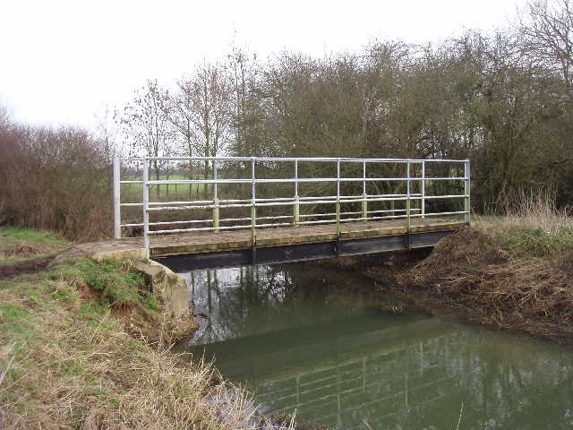
[9] The modern footbridge called King's Bridge, between Padbury and Steeple Claydon
I turned round here at about 1.05pm. I had my second Alpen bar of the day to keep me going as I new there wasn’t anywhere convenient to stop for lunch for a long time. In fact it was almost 2.30 when I stopped at a picnic site at the entrance to the park in Buckingham, the latest lunch I’ve ever had on one of these walks. The walk back was equally enjoyable – it had clouded over slightly around the time I reached King’s Bridge, but this soon passed and the afternoon was quite sunny. This was another walk that took almost six hours, and my legs were feeling a bit tired by the time I got back to Tingewick.
This was definitely the best of the three walks I have done so far on the Bernwood Jubilee Way. It was quite varied, with a golf course, some town walking, a very pleasant and lengthy stretch in the riverside park, as well as the usual arable fields and sheep pastures. The final stretch along the quiet and peaceful Padbury Brook was certainly the most enjoyable part of the walk. Apart from the sections along the river and brook, the walk was much more undulating than the previous two walks, although there were no real hills.
Total distance: 25.6 miles each way