Pete's Walks - Bernwood Jubilee Way
If you are considering walking this route yourself, please see my disclaimer. You may also like to see these notes about the maps and GPX files.
Day 4 13/2/07 King’s Bridge to Quainton (8.6 miles each way)
Parked on side street in Steeple Claydon.
I should say straight away that I didn’t quite make it to Quainton, turning round about 200 yards short of the first house in that village. When I measured the route out on the map, this walk was slightly longer than any of the others. As the walks so far have taken close to six hours to walk, I was concerned how long this one would take. So I decided to make it as near to Quainton as I could before turning round – in the event, I got closer than I’d expected.
It was almost a week since my last walk because of the inclement weather – we had two days of snow followed by three rainy days. It was quite sunny when I started walking, although it clouded over around lunchtime before brightening up again in the afternoon. I parked in Steeple Claydon, and started by walking the mile or so back to King’s Bridge where I finished the last walk. I started walking just after 10am.
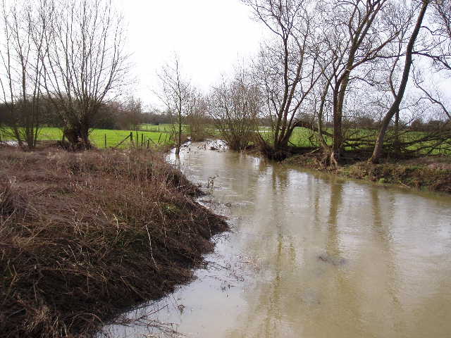
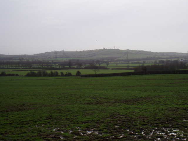
[1] Padbury Brook from King's Bridge
Having crossed King’s Bridge over the Padbury Brook [1], I followed a bridleway between hedges for about 100 yards, before taking a footpath on the right across a green pasture. The path then went half-left across a second green pasture close to a farm. Two fields of cabbages or similar crop followed, the path through them being being very clear. Two more much larger green pastures followed, one of them showing clear evidence of Ridge and Furrow [2]. The path followed a right hand hedge through these muddy pastures, the mud being particularly bad around the entrance and exit to the second pasture – I just had to wade through as quick as I could before my boots sunk in too far and got stuck.
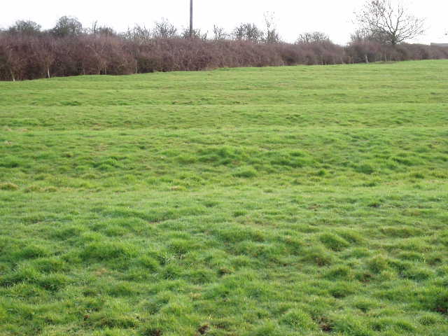
[2] Evidence of Ridge and Furrow, near Steeple Claydon
Beyond the second pasture I reached a road where I turned left, very quickly coming to a T-junction where I turned right and walked slightly uphill into Steeple Claydon. The village is well named as, although it sits on only a slightly elevated position, the church steeple is a noticeable landmark for several miles in all directions – I remember seeing it on my Cross Bucks Way walk. The village is thought to have been founded by the Saxons around 660 AD, and indeed it was the location of a moot (court of administrative assembly) in the Saxon hundred of Lamua. Henry I gave the manor to Sir Robert D’Oyley as part of the marriage portion of his wife Edith, who had been the King’s mistress (that’s the third time I’ve come across the name D’Oyley recently). Documents refer to vineyards here in 1297.
I turned left at a junction in the village centre, walking down Queen Catherine’s Road to the church which is at the eastern end of the village. Here, a footpath ran alongside the church yard before passing through it and then going through an avenue of trees (presumably along a former drive to where the Manor house once stood). The path then crossed a large arable field, the route marked out by tracks through the winter wheat (or whatever). The going was quite squelchy in places along here, but there were nice views northwards over the Vale of Aylesbury [3]. The path descended gradually towards Rookery farm (well named, there were many Rooks here on my way back). Through a hedge, the path continued eastwards through two more very wet arable fields to reach a railway line. Over this I went half right across a grass field to Rectory farm. I walked through the farmyard, then turned left along a hedgerow in front of the farm house (there were six or seven Guinea Fowl here when I came back). Through a thin belt of trees, the path went half-right across another smaller soggy arable field, then across a belt of park land (where some sheep were grazing) [4] to reach a road at the entrance to Claydon House [5]. I saw some Buzzards near this strip of parkland, both now and on my way back. I turned left to walk through the small village of Middle Claydon.
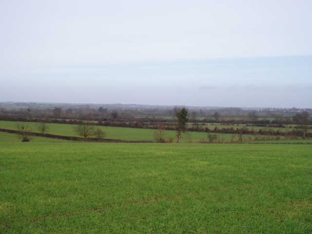
[3] View from field just after Steeple Claydon church
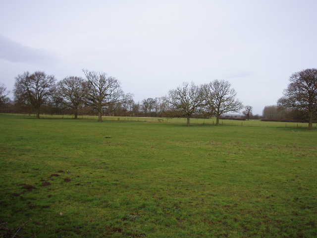
[4] Park land near Claydon House, Middle Claydon
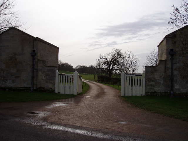
[5] Entrance to grounds of Claydon House
I could see Claydon House in the distance, with the village church next to it. When the second Earl Verney had the house built in 1768, he relocated the village to where it is now, with just the church remaining at the old site. The Verneys had held the land since the 1400’s. The house is now managed by the National Trust, and is filled with mementoes of the Verney family’s history, ranging from Civil War exploits to visits from their relative Florence Nightingale. As large local landowners, the Verneys had much to do with the Forest of Bernwood. When the legal status of the Forest was finally abolished in 1632, Sir Edmund Verney bought land at Brill and Oakley. Sir Edmund was later standard-bearer to Charles I and was killed at the battle of Edgehill in 1642.
I followed the road as it curved through Middle Claydon, then took a footpath on the right that passed through a small cemetery and then joined a gravel farm track. This continued eastwards alongside a hedge, rising very gently uphill beside a large field of cabbages or something similar. Again there were nice views over the surrounding agricultural land. When the hedge turned right, the Bernwood Jubilee Way continued slightly left on a clear track across another cabbage field. The going here was again very wet and slippery. Through a gate, the path continued through two grass fields to reach East Claydon (in the second field there were several large mounds in the field, indicating former house platforms where the village had shrunk over the years – there had been something similar in a field as I entered Middle Claydon).
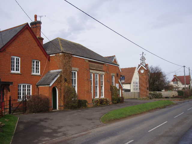
[6] Library, Village Hall, Clock Tower and School in East Claydon
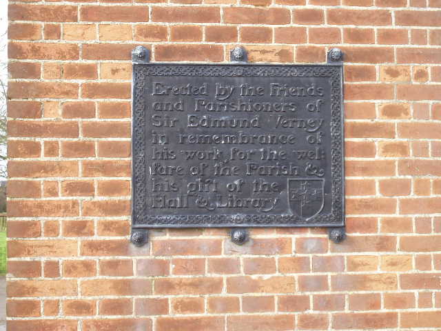
[7] Memorial Plaque on Clock Tower, East Claydon
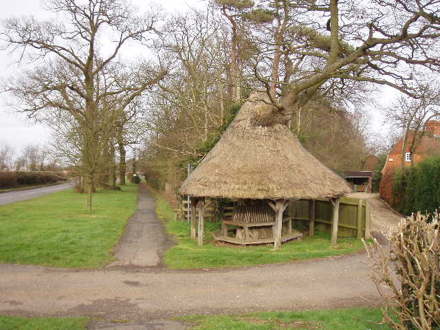
[8] The Mushroom Seat, East Claydon
I turned right along a road through East Claydon, following the route of the North Bucks Way for a couple of hundred yards before I took the first turning on the right. I was now heading southwards again. On the map it looked as if I’d have about half a mile of road walking – in fact for most of the way a pavement ran along a wide grass strip with a hedge separating it from the road, so it was perfectly pleasant and safe walking. The road took me into the adjacent settlement of Botolph Claydon. Where a sign indicated that I was crossing from East Claydon to Botolph Claydon, I passed a school, a village hall and a library, all shared by both villages [6,7]. Just before this, I had passed a curious thatched shelter built around the trunk of a tree, called the Mushroom Seat [8]. There were several attractive old cottages in Botolph Claydon, some thatched, some whitewashed, some built of bricks and timber. Where the road turned sharply right as another road came in from the left, I continued ahead on a narrow lane, passing some cottages and a duck pond (where some geese cackled noisily at me) to reach Bernwood Farm (I think that’s the first time I’ve come across the name Bernwood so far on this walk).
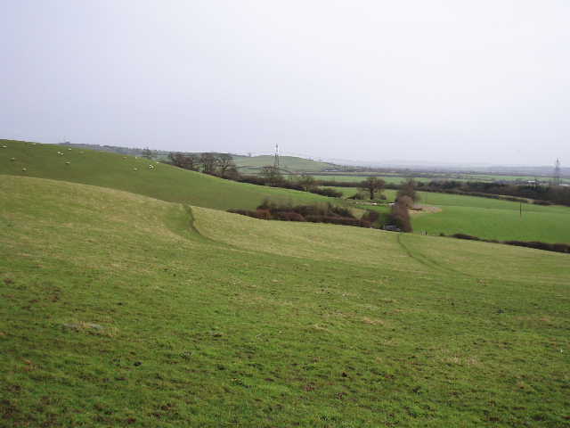
The Bernwood Jubilee Way continued across another couple of soggy pastures, then followed a right hand hedge on a broad strip of grass beside more cabbage fields. There were good views here, with Quainton Hill about a mile or so away to the left rising steeply out of the Vale of Aylesbury [9]. After following the hedge for about a third of a mile I reached a junction with a crossing bridleway, with Runts Wood immediately in front of me. I turned right, then almost immediately left at another bridleway junction. The Bernwood Jubilee Way now followed the edge of Runts Wood for almost half a mile on a good track – a notice board near the start of the bridleway gave information about the wood, about the forest of Bernwood and about the Bernwood Jubilee Way. At the far end of the wood, the good track turned slightly left between hedgerows – I saw another pair of
[9] Distant view of Quainton Hill
The track ended at a T-junction of bridleways, where I turned left. After a couple of hundred yards I went through the hedge on my right – here I was at the top of Finemere Hill, with extensive views over the lower ground in front of me towards Waddesdon Manor on its hill and, slightly further away, Brill. The top of this hill was a large sheep pasture, which I crossed diagonally, descending towards a gate near the ruins of Kitehill farm (just brick and concrete rubble) [10]. The path continued descending slightly through two smaller fields and then across a pasture of rough grass to a corner of Finemere wood, where I saw a Muntjac deer. The Bernwood Jubilee Way then crossed an empty sheep pasture, to a small wooden footbridge over the river Ray (so small that I thought it was a ditch until I looked on the map later). I then crossed a very large pasture containing both sheep and more evidence of Ridge and Furrow (it seems to be everywhere in this part of Buckinghamshire).
[10] The path descending Finemere Hill
The path then went through a small enclosure near to Middle farm, passing a small pond, and then went through a new plantation of small trees, before joining the farm drive and following it to a road. A very short distance to the right, a footpath on the other side of the road took me into another large and empty pasture. I went slightly uphill across this to reach a corner of a hedge, which I followed to another footbridge by a field corner. Across the bridge there was an information board about Grange Farm, a hundred yards to the north, originally the site of a manor house belonging to the Abbots of Thame. Visible earthworks were the site of mediaeval fish ponds [11].
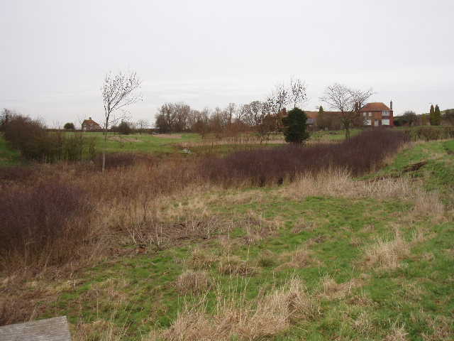
[11] Site of mediaeval fish ponds, near Grange Farm
A path had been cleared across the next field. It didn’t look too muddy, but the soil just clung to my boots – within a few paces, I felt like I was wearing those lead boots old-fashioned divers had to use. It was really hard work getting across the field, but I eventually reached a stile and a road junction. I walked about a hundred yards down the road towards Quainton, when I realised it was now 1.20 and I needed to turn round if I was to get home at a reasonable time. I’d always known that I’d be really hard-pressed to get to Quainton (the muddy conditions at this time of year are really slowing me down), and I’d actually got further than I’d expected to. So I had to struggle back across that field with the cloying mud, and make my way back to Steeple Claydon [12].
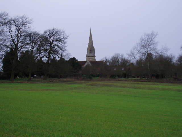
[12] Steeple Claydon church
I had another Alpen Snack bar as I turned round, and it wasn’t until almost 2.30 that I stopped for lunch on a fallen tree at the far side of Runts Wood. The walk back was very pleasant, despite the muddy conditions. I got back to my car at 4pm (so, with hindsight, I would have had time to go on another quarter of a mile or so into Quainton).
I enjoyed this walk, despite the fact that almost every path I went down was very muddy. I walked past a wood even if I didn’t really enter one, and the agricultural sections of the walk were reasonably varied. It was gently up and down in places, with one reasonable hill (Finemere Hill). There were nice views in many places, especially towards Quainton Hill. The villages on route all had something of historic interest in them. The Guinea Fowl, Buzzards and Muntjac Deer all added to the pleasures of the walk. On a nice summer’s day with the ground dry underfoot, this would make a very pleasant walk.
Total distance: 34.2 miles each way