Pete's Walks - Bernwood Jubilee Way
If you are considering walking this route yourself, please see my disclaimer. You may also like to see these notes about the maps and GPX files.
Day 5 15/2/07 Quainton to Nether Winchendon (7.4 miles each way)
Parked by The Green in Quainton.
Looking at the map the night before, I saw that this walk divided neatly into three roughly equal sections. The first third, from Quainton to Waddesdon, I’d walked once before on the North Bucks Way – I wasn’t especially keen to walk it again, as I remembered it as a long sequence of very flat cow pastures, which I correctly predicted would be very muddy. The next third, from Waddesdon to the river Thame I’d walked twice before (on the North Bucks Way and the Aylesbury Ring) and I very much looked forward to walking it again – it’s a nice up and down route with some great views over the Vale of Aylesbury and the Thame Valley, with very good chances of seeing both Red Kites and Buzzards. The final third of the walk, alongside the river Thame to Nether Winchendon would be the only section that I hadn’t walked before.
I made sure that I took my binoculars with me today, as I knew it would be a good walk for bird watching. In fact, I actually saw a Red Kite as I drove past Ivinghoe Beacon on my way to Quainton, the second or third nearest sighting of a kite to Kensworth that I’ve had (it was about the same distance away as the one I saw at Steps Hill last August). They are definitely spreading this way along the Chilterns.
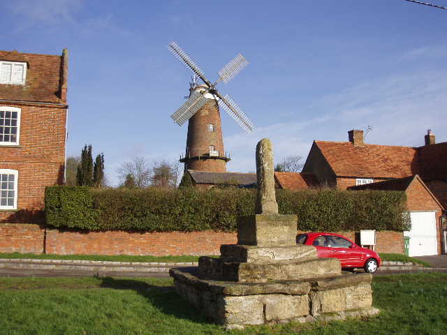
[1] The 15th century cross and the windmill, Quainton
[2] Village Green, Quainton
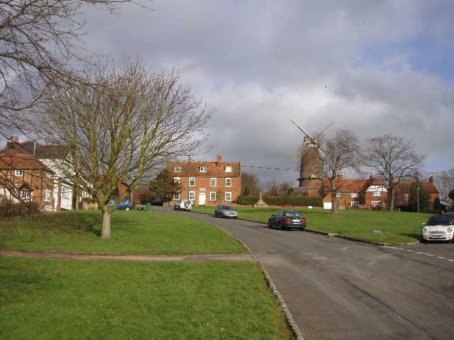
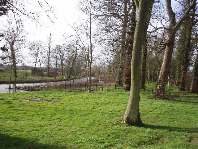
I parked beside the village green in Quainton, and started walking at 10am. I first had to walk back to the point on the road just outside the village which I reached on my last walk, which only took about 10 minutes. From there, I retraced my steps back along the road into the village, bearing left at a junction to reach the top of The Green close to the windmill and the 15th Century cross, believed to be associated with the dedication of the village church to St Mary and the Holy Cross [1]. The windmill was built in the 19th century, and at 65 feet high is the tallest tower mill in the county. After taking a few photographs, I walked down the roughly triangular green [2], and turned left at the bottom. After a few yards I then went right down a narrow path between garden fences, crossed a minor residential street and continued on a short gravel path to a stile.
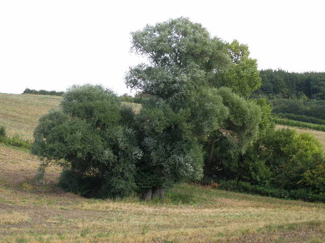
This was the start of the long sequence of large and flat cow pastures that I remembered from my North Bucks Way walk. I walked through four of them, all with gates open so that cattle could wander freely between these and the adjoining pastures. It was very muddy making it slow going and rather laborious plodding my way along. There was some evidence of Ridge and Furrow (yet again!), the furrows obviously being much wetter than the slightly higher ridges. I didn’t think there would be any cattle about as the fields were so muddy, but in the fourth large pasture there was a largish group of what looked like mainly bullocks in a huddle by the left-hand hedge. As I crossed the middle of the field, there were a slightly unnerving few moments as they suddenly started running along to the left of me, as if they were trying to cut me off from the stile I was walking to, but then they stopped and started running away in the opposite direction. Across the stile, I followed the right-hand hedge of a small grass field and then crossed over a railway line (the Buckinghamshire Railway Centre was a few hundred yards to my right) to reach another very large and empty pasture. Again this was very muddy.
On the far side I followed a hard-surfaced farm track for about a hundred yards, before taking a path on the left that led through an even muddier pasture to another farm track. Across this, the Bernwood Jubilee Way went half-right across a smaller pasture, then followed a left-hand hedge through a smaller grass field (now on the route of the Aylesbury Ring as well as the North Bucks Way) – I remembered this field as having a strangely uneven surface when the ground was hard, making me concerned about twisting my ankle, but that was not a problem in these very soft and muddy conditions. I then stepped over an electric wire fence (protected by a bit of black tubing) and a stile. On my way back, I was bemused to see a Spaniel lie down in the middle of the next field and refuse to follow its lady owner into the field I was now leaving – when I asked her about this very odd behaviour, she said it was because the dog always got an electric shock trying to go under the wire! Beyond this next field, a short alleyway led me into the village of Waddesdon [3].
[3] Waddesdon
I walked down a short street and crossed over the main road, then almost immediately turned left down a footpath to some allotments. I therefore didn’t really see very much of the village at all. Waddesdon was largely re-designed and re-built by Baron Ferdinand de Rothschild when he bought the Waddesdon Estate in 1874. He had the top of the nearby Lodge Hill flattened to accommodate the building of his fine new residence, Waddesdon Manor, an extravagant mock French Chateau which is now one of the National Trust’s most popular attractions. At the time of the Domesday Book, the current parish was divided into a number of smaller parishes, some of which are now represented by the earthworks of deserted mediaeval villages (the whole Vale of Aylesbury is dotted with such DMVs). A number of prehistoric and Roman finds have been found in the parish, and the Akeman Street Roman road passed through the village.
On the far side of the somewhat overgrown allotments, I turned left alongside the wire fence of the large and modern school, following the wire when it turned right at the corner of the school grounds. I was expecting to see Red Kites on the next section of the walk, and in fact saw some straight away, two flying over the school buildings and three more much further off, only visible through the binoculars. Partway along the fence I took a path going left across an arable field to reach a small section of wood – here the ground was very wet and I had to take a slight diversion round a very large puddle. On the other side of the trees I reached the hamlet of Wormstone, where I took a path running between the edge of a farm yard and a garden fence. The path then crossed a small area of rough grass to a farm track. Across this, I went through a small belt of trees and over a stile, where there was an information board, one of several I have come across on the Bernwood Jubilee Way. This one I remembered from my two previous walks here, in fact it was this board which first made me aware of the Bernwood Jubilee Way.
The information board was mainly about Black Poplars, Britain’s rarest and most endangered native tree – it is also our largest native tree, growing to 100 feet in height and up to 60 feet wide. About two thirds of the 6000 such trees in the country are to be found within 10 miles of Aylesbury (I saw some on another stretch of the Aylesbury Ring, near Astrope). Apparently, Black Poplars are ‘dioecious’, meaning that their red male and green female catkins grow on separate trees, and so male and female trees need to be close to one another for pollination to take place. Most of the Black Poplars in Buckinghamshire have grown from cuttings planted 200-300 years ago. Unfortunately, the female trees produce an unsightly mass of down-like seed, so most of the trees that were planted were males. There are thought to be only around 100 female Black Poplars in all the UK. There are also a wide variety of hybrid Poplars (there were several by the information board) and it really takes an expert to identify a true Black Poplar. There are a number on the Waddesdon Estate, however, and I am fairly confident I saw some a little later on this walk. (N.B. Some of this data is from the information board, but mostly from the Bernwood Jubilee Way Guide Book – it can be really interesting and informative, such a shame it doesn’t describe the whole route!).
[4] The path from the notice board leading towards Waddesdon Stud
[5] Poplar trees, possibly Black Poplar, from path to Waddesdon Stud
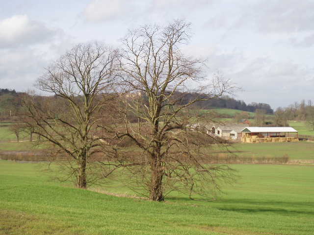
[6] Looking towards Waddesdon Manor from Waddesdon Stud
From the information board, I followed a right-hand hedge uphill to a small copse [4,5]. The path then crossed a small belt of grass and passed through a second copse to a large paddock, with Waddesdon Stud to the left. As I crossed the paddock I saw more Red Kites, and there were very good views - northwards back to Quainton, north-east over the Vale of Aylesbury and west to Waddesdon Manor set amongst trees on top of Lodge Hill [6] (actually, I described this field as a paddock - on the reasonable grounds that it was surrounded by a wooden fence and it was next to the Stud - but when I came back it was full of sheep which ran to me and followed me across the field, obviously expecting some food). Across a stile, I turned left through trees and then walked down the drive of the Stud to the road. The stables at Waddesdon Stud [7] always look remarkably clean and tidy, much neater than many houses I can think of. I crossed the road and took the lane opposite, rising slightly upwards past a couple of cottages – I jumped when a large hairy Alsatian barked at me from the garden on the left, though as it has done it before I should have been expecting it. At the top of the hill were a small clump of Corsican Pines (thanks again to the guide book for identifying them), near where another long-distance path called the Mid-Shires Way took a path on the left (it generally shared the route I’d been walking from Quainton all the way to the river Thame, just varying slightly between here and Waddesdon).
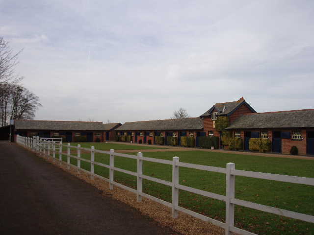
[7]Waddesdon Stud
[8] View of Thame Valley, from North Lodge
[9] Poplar tree, probably Black Poplar, in Eythrope Park estate (photo taken 11/9/07 while walking here on Swan's Way - the tree in the photo I originally put here turned out to be a Horse Chestnut!)
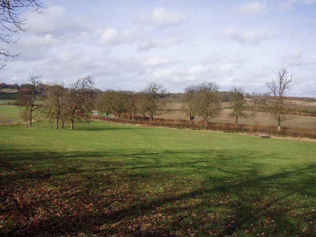
The road then went downhill slightly, with views over the well-trimmed hedge on my left towards Aylesbury, to reach an isolated house called North Lodge (presumably a lodge for the Eythrope Estate that I was about to enter). I took the bridleway to the right of the house, but immediately stopped to watch two more Red Kites, one very close by, and to take some more photographs of the very charming countryside here [8]. The bridleway followed a right-hand hedge beside a large ploughed field which contained a few large trees which I’m fairly sure must be Black Poplars [9]. The path then passed a small wood on the right, before running gently down hill to reach a tarmac drive. This was all part of Eythrope Park – this estate was bought by Miss Alice de Rothschild, the sister of the builder of Waddesdon Manor, and the estates were combined on his death. I followed the drive a few yards to the left, then took a path on the right that rose gently uphill across what the guide book described as a hay meadow [10]. I saw a couple of Buzzards here, not a surprise as I’ve seen them here before. The path next went through a copse at the top of the hill. On the other side, there was a splendid view south-westwards of the Thame Valley. I was a little concerned that there was a lot of water in some of the fields along the valley, but then spotted a line through some of the arable fields which was obviously the path I’d be walking, well clear of all the water.
[10] Looking back along path through Eythrope Park estate
The Bernwood Jubilee Way then followed a hedgerow downhill, with the open park land of the Eythrope Estate to my left. Amongst the trees over to my left I glimpsed The Pavilion, built by Miss Alice de Rothschild as a daytime retreat from her brother’s house. The path took me to a corner of another drive, close to a cottage and to a mixed clump of mature trees that included Black Poplar, Horse Chestnut, Oak and Scots Pine. I continued ahead along the drive for a few hundred yards, until it turned sharply left shortly before crossing a bridge over the river Thame [11]. A wooden post here had waymarks for all six of the long-distance paths that pass this point (apart from the three I’ve walked or am currently walking, the others are the Thame Valley Walk, Swan’s Way and the previously mentioned Midshires Way) [12]. I now left the route of the Aylesbury Ring and North Bucks Way by turning right to follow the route of the Thame Valley Walk alongside the river in its pleasant green valley [13].
By the way, I do mean the river Thame as opposed to the larger and rather better known Thames. The Thame (pronounced Tame) is formed by a confluence of streams near Aylesbury and flows roughly south-westwards, passing the small town that shares its name (and pronunciation), finally flowing into the Thames near Dorchester-on-Thames in Oxfordshire. It is about 40 miles long. Like its near-namesake, the Thame has its own long-distance path, the Thame Valley Walk, but as far as I’m aware there is no Thame Valley Police Force.
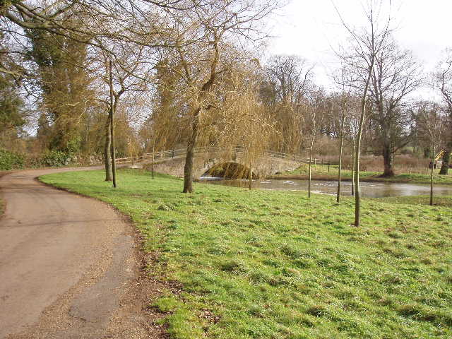
[11] The bridge over the river Thame in Eythrope Park
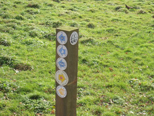
[12]A surfeit of waymarks, near the bridge over the river Thame in Eythrope Park
[13]The river Thame in Eythrope Park
As I had seen earlier, the path crossed a couple of arable fields on a broad strip of brown earth (fortunately not the cloggy stuff that stuck to my boots in the last field before Quainton on my last walk – if it had been, I might well have given up, as I certainly wouldn’t fancy ploughing through that stuff for several miles!). These were quite large fields, where the winter wheat had grown higher than anywhere else I’d seen it. The river here was a short distance to my left, meandering its way through its wide flat valley floor, its course marked by occasional pollarded willows. Low hills rose either side, covered by mainly arable fields and dotted with occasional farms.
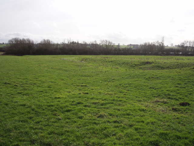
After the two arable fields, the Bernwood Jubilee Way crossed an empty pasture. Well, empty of farm animals at least – there was a large flock of starlings feeding here, and I spotted one or two redwings amongst them. The map showed that there was a moat in this field, and it was very clear and well preserved although dry in even these wet conditions [14]. Unfortunately this section of the Bernwood Jubilee Way isn’t covered by the guide book, and I couldn’t find out anything about the moat on the internet, so I don’t know what sort of building was here or anything of it’s history (there were also some mediaeval fish ponds shown on the map a few fields further on, but I didn’t see them as they were some way from the path and partially screened by a row of trees).
[14] Remains of a moated site in the Thame Valley
[15] Flooded fields in the Thame valley
[16] Path through partially flooded field, Thame valley
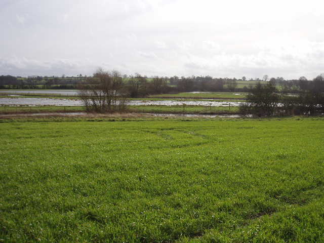
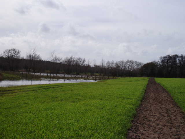
The next field was another arable one, with the path again a long narrow strip of brown earth. Again I was glad that it wasn’t the stuff that clung to my boots in great clumps, doubling their weight. Looking across the river, many of the fields there had large sheets of standing water [15], and in the far left corner of this field a small section (that had been set aside and planted with trees) was also under water [16]. There were two benches here, and I sat on one when I had my lunch on the way back. The next few fields were more pastures, some empty but some containing sheep. The ground here was wet underfoot but not too muddy, nowhere near as bad as the pastures between Quainton and Waddesdon. Meanwhile the river Thame continued meandering onwards, sometimes only a few yards from my path, other times a couple of hundred yards away. I saw a heron take flight several times, one time seeing it ‘mobbed’ by a small bird.
After a succession of pastures, there was a very muddy section of 200-300 yards, where the path ran between a left-hand hedge and a fence. There was then a long thin pasture, near the end of which was what appeared to be the platform of a long vanished building. I then went through a gate into the yard of the Old Mill at Nether Winchendon, and followed the drive and then a short lane into the village (the map shows the name of the village as Lower or Nether Winchendon, but a notice in the porch of the church stated that in 1998 the parish council had voted for the parish name to be changed to Nether Winchendon). I saw a Red Admiral as I entered the village, my first butterfly of the year. I found Nether Winchendon to be a very attractive place, with several large cottages and houses from different historic periods. It is in a very nice setting in this quiet and charming valley. It also has Red Kites! I saw one near the Old Mill, then presumably the same one flew over the church [17,18]. The church was interesting, with a short tower seeming out of proportion to the large nave. Apparently it’s included in Simon Jenkins’ book England’s Thousand best churches. Nether Winchendon House is open to the public. It has a 12th century Great Hall and a 16th century Dining Room, but was largely remodelled in the late 18th century in the ‘Strawberry Hill Gothick’ style (I have heard of that, it was mentioned on one of Griff Rhys Jones’ Restoration programmes, but I don’t pretend to understand what it is!).
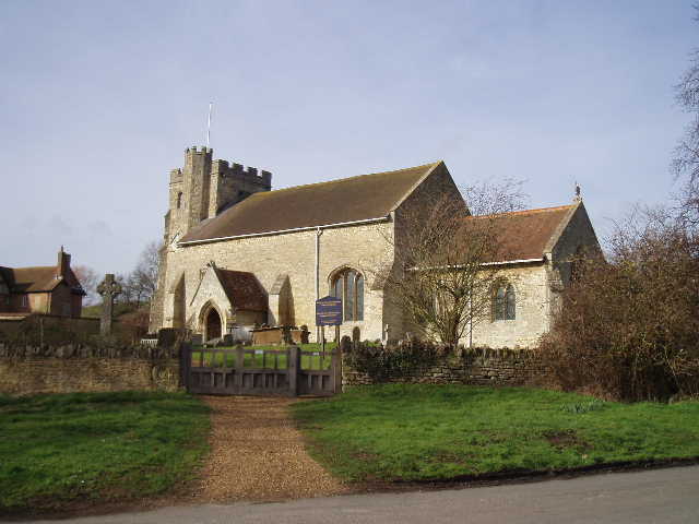
[17] Nether Winchendon church
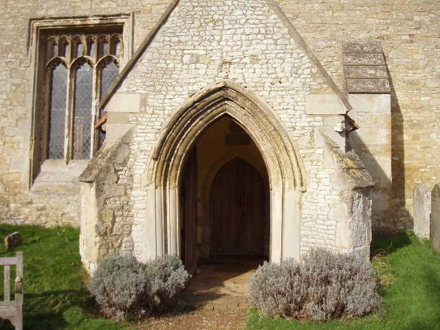
[18] Porch, Nether Winchendon church
It was now about 1.15pm and I turned round and headed back to Quainton. There were more sightings of Buzzards and Red Kites, including one kite nearby when I stopped for lunch. The weather remained pleasant all day, although I was walking into a quite a stiff breeze early on. It was warm enough for me to take my coat off just before I reached Nether Winchendon. It was generally quite sunny, although there was always a fair amount of high clouds about. The last section back across the muddy cattle pastures was a slight drag at the end of the day, but didn’t spoil what was altogether a very enjoyable walk indeed.
Total distance: 41.6 miles each way