Pete's Walks - Bernwood Jubilee Way
If you are considering walking this route yourself, please see my disclaimer. You may also like to see these notes about the maps and GPX files.
Day 6 19/2/07 Nether Winchendon to Shabbington (7 miles each way)
Parked by the church in Nether Winchendon.
This was a very grey day, with only an occasional glimpse of blue sky and the odd feeble attempt by the sun to pierce the grey clouds. The Thame valley was a much duller and gloomier place than on my previous walk. I was disappointed with the conditions today. I’d decided not to walk two days ago on Saturday, but instead to wait and let the ground dry out as there were several dry days forecast. So when I woke this morning to find it rather misty and with the ground very wet again, I was not too happy. I’ve been getting a bit fed up with the muddy conditions recently – I realise now how fortunate I was last winter when it was exceptionally dry.
Before setting off, I had a very quick look inside Nether Winchendon church. Unfortunately I didn’t have time to do it justice, and I’ll have to go back another time (perhaps combining it with a visit to Nether Winchendon House). The church dates from the 13th Century, although the rough stones at the base of the west tower are thought to be possibly from an earlier Saxon building. For many years, the church and parish were administered by the monks of nearby Notley Abbey (I’d be passing its remains later on this walk). The church has a three-decker pulpit dating from 1613, and a wooden gallery across the west end of the nave (I had to duck to get my 6’ 3” frame beneath it to reach the tower). As it is the only public building in this small community of 57 households, it is still used for parish meetings, as it would have been in the middle ages. According to a web site I found, it has twice been used as a location in Midsomer Murders, the popular detective series (entertaining, but not a patch on Morse, Cracker or A touch of Frost). Much of this information came from the web site for Nether Winchendon House, which is at http://www.netherwinchendonhouse.com/index.html.
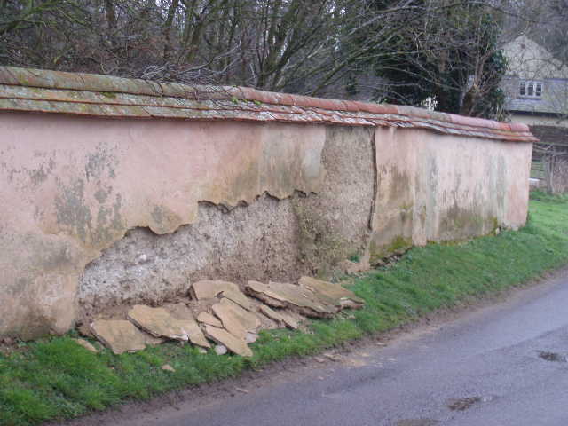
[1] 'Witchert' wall in Nether Winchendon
I started walking about 10.10am, setting off along the main lane through the village, still heading west along the Thame valley. Again I was very impressed with Nether Winchendon – there are many old and large detached houses and cottages, some half-timbered some brick-and-timber. Manor farm looked impressive, and so did the ancient barn at its entrance. Over to my left, and slightly behind me, was Nether Winchendon House, which I glimpsed on my way back. Again I saw a Red Kite flying nearby, which was a nice start to the walk. I think that Nether Winchendon is one of the nicest places I have passed through on any of the walks I have done – remarkably, it isn’t mentioned at all in the guide book! The guide book does mention that the next village, Chearsley, is a good place to see ‘witchert’ (more commonly called ‘cob’ in other parts of the country), a type of walling made from local soils and straw. There was a good example of a witchert wall on my right just before I left the Nether Winchendon – it looked as if it was in a state of disrepair, but the core of the wall was fine, just some of the coating of lime plaster had fallen off [1].
I took a footpath going left alongside a left-hand hedge. At the field corner I turned right, the path now being a cleared brown strip continuing alongside the hedge. Where the hedge veered left, the strip continued ahead across the cabbage field to reach a road. As usual, the brown earth soon clogged my boots, but not quite as badly as in some fields I have walked through. Here I did a remarkably stupid thing, and automatically carried on along a similar brown and muddy path through the field across the road. It was only when I had slogged my way through the mud to the next hedgerow that I checked the map and realised that I should have turned left along the road. I turned round and went through the mud again back to the road – there was a signpost here with fingers pointing the way for both the Bernwood Jubilee Way and the Thame Valley Walk, so I must have been in a real dream to have gone straight past it. I was not a happy bunny at this point, it is so annoying to go wrong so early in a walk, and I was already fed up with the muddy footpaths. Fortunately, as it turned out, these were the only fields on the entire walk where the mud was bad, apart from a couple of soggy sections around stiles or gates.
I followed the road a couple of hundred yards to a junction, where I went right for a few yards and then went over a stile on the left. This took me into a corner of a huge pasture of rough grass, with a few sheep grazing in the far corner. A note by the stile said to head towards Chearsley church, which was just about visible in the distance over the far hedge. I headed in that direction, crossing this huge expanse of rough grass diagonally – I was a bit confused here, as a curving hedgerow shown on the map has obviously since been grubbed out. The next field was another one containing cabbages or similar, but the path followed the left hand hedge and was grassy and not too muddy at all. I saw a small flock of Lapwings here on my return journey. I continued through a small sheep pasture, then continued down a drive shared by a farm and some cottages to reach Chearsley church.
[2] Spring in Chearsley
[3] Looking back at Chearsley church
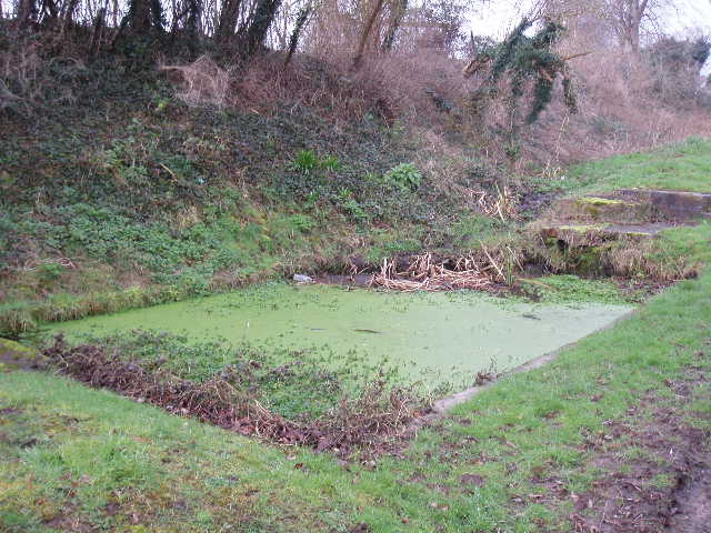
I followed the lane past the church (13th or 14th century, according to the guide book) and passed a small spring [2], then took a path off to the left, to continue my journey along the Thame valley. I crossed a small grass field, with a nice view back to the church [3], and then followed a wire fence on my right through the next much larger field. This brought me to a railway line, which I crossed carefully (I saw a very small train pass here on my way back). On the other side, I went through a small area where some small trees had been planted fairly recently, and then through a small belt of woodland. On the far side, I went slightly left – there was a redundant stile in this grass field, obviously left behind when a fence or hedge was removed, and as usual I couldn’t resist the temptation to climb over it [4]. The Bernwood Jubilee Way then climbed gently uphill, with Lenton’s Pond on the other side of the fence to my left. This is thought to be named after some tenants at the nearby Notley Abbey House in the 1600’s. The guide book describes it as a bit of a wildlife haven with lilies and bulrushes, but it looked to me as if it has recently been completely cleaned out with no vegetation visible at all. If I hadn’t read the guide book, I’d have thought that it was a new pond [5].
[4] Redundant stile, just before Lenton's Pond
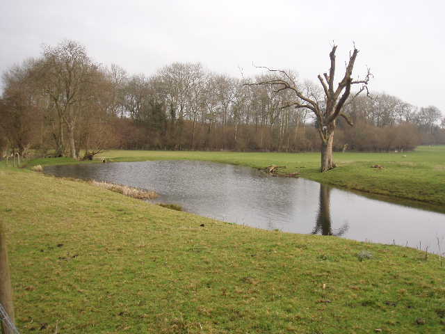
[5] Lenton's Pond
Just past the pond was a large square dovecote with a tiled roof [6], thought to have been built from stones from the nearby Abbey in the 16th or 17th century. Between the pond and the dovecote was a notice board about Notley Abbey, which I somehow completely missed and only saw on my way back. Notley was an Augustinian abbey founded between 1154 and 1164 by Walter Giffard, Earl of Buckingham, and his wife Ermangard (charming name!). Over time, many neighbouring lords added to its lands and it became one of the wealthiest monasteries in the country, with a church twice the length of the current Oxford Cathedral. King John granted it a charter allowing it to use two carts to carry firewood from Bernwood Forest during several months of the year.
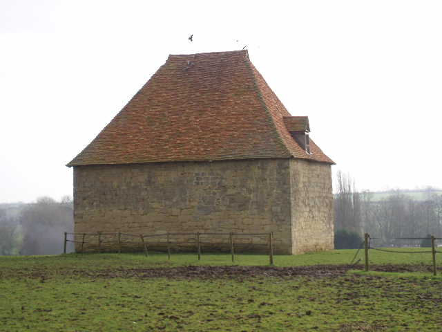
[6] Dovecote near Notley Abbey farm
Just beyond the dovecote, I went through Notley farm. I thought about taking the short detour to the left to see the remains of the abbey, but decided to wait and see if I had time when I came back in the afternoon. So far today the Bernwood Jubilee Way had been following the same route as the Thame Valley Walk, but here the latter turned left to the abbey ruins and a path close to the river, while I continued ahead on a good farm track, passing some outbuildings and then a small wood on my right. There were pleasant views ahead of the Thame valley, although it was still grey and mirky. I saw a couple of buzzards here, and on the way back there were several Red Kites here. The track ended by some sheep pens, where I climbed over a stile and then followed the right-hand fence of a large sheep pasture. The path followed the fence steadily downhill to reach a stile in the corner, where the Thame Valley Walk rejoined my route. The path then followed the right-hand hedge of the next field as it turned slightly right. At the next field corner, I turned left along another side of the same field, while the Thame Valley Walk continued ahead to reach Long Crendon, whose church I could see at the top of a hill [7].
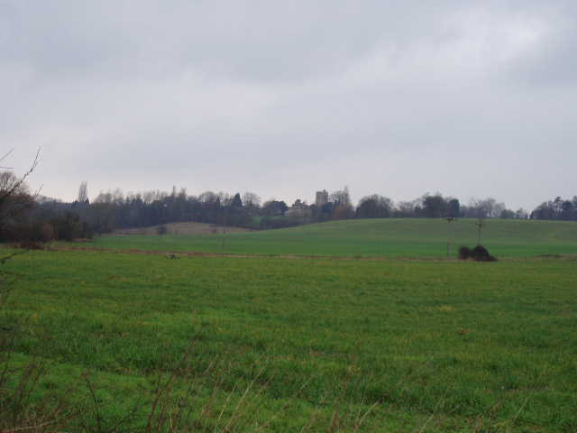
[7] View towards Long Crendon
At the next field corner, the Bernwood Jubilee Way switched to the right of the hedge line, passing another pond and soon reaching an industrial estate. At first the path through the estate was easy to follow as it was paved with red bricks, but these ended at a road junction, with no sign of where the footpath continued. In the end, I went slightly left before continuing on the other side of the road, with a number of parked vehicles between me and the industrial units. This was the only part of today’s walk that wasn’t clear – ironically, halfway along the bit of old roadway I followed here was a sign proclaiming that it was called ‘Hikers Way’. The old bit of roadway then turned back to the units, and I saw a waymark on a drainpipe attached to the last unit. Beyond this, I passed a collection of about twenty old car washes to reach a stile marking my escape route from the industrial estate.
[8] Looking back along the path from the road near Thame
[9] Looking across the bypass to Thame
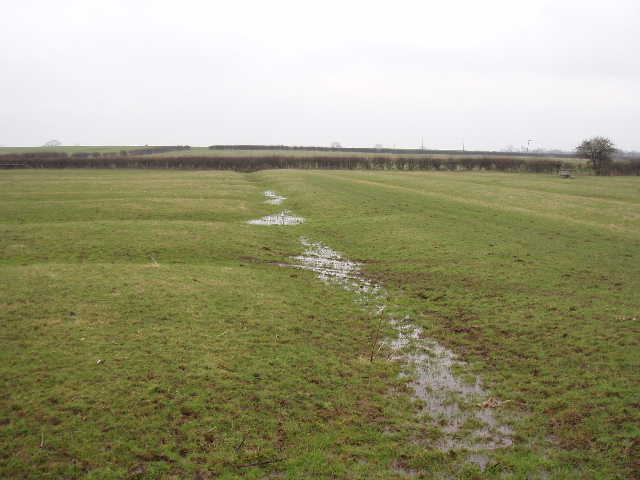
I crossed a couple of small empty pastures to a point just twenty or so yards from the river, the nearest I would approach the river on this walk. The Bernwood Jubilee Way then followed a right-hand hedge through two larger pastures, the second rising slightly, to reach a road [8]. Here I turned left for a few hundred yards. Where the road curved to the left, I continued ahead on what was obviously the old road before the coming of the Thame bypass. Straight ahead of me was the noisy Thame bypass, beyond which was the tower of Thame church, something I’d been able to see for some time [9]. Having passed a farm on my right, I turned off onto a path on my right a short distance before reaching the bypass. I followed the right hand hedge through a long empty pasture, with the bypass beyond the hedge over to my left. The road noise was a bit of a distraction in this and the next field, both of which had some evidence of yet more Ridge and Furrow. After another couple of pastures, the second one complete with sheep, I crossed a couple of cabbage fields (fortunately on fairly solid ground) and then followed a left hand hedge through two more large empty pastures – the second one had the best Ridge and Furrow so far on today’s walk.
The Bernwood Jubilee Way then turned left along a minor road. Here I had the very pleasant company of a Red Kite that flew about 20 feet over my head, then flew at a lower level along the hedge to the left as I followed it down the road. I didn’t have my binoculars with me, but didn’t need them because it was so close. You’ve probably already noticed, but I absolutely adore these birds. I love everything about them – their striking colours, their elegant shape and forked tails, their plaintive calls. Best of all I love the way they are so unfazed by my presence. This one was well aware of my presence but not bothered in the slightest. It eventually soared off over the field to the left.
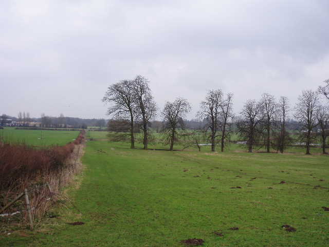
[10] Ridge and Furrow in field near Shabbington
After a few hundred yards the road turned right. Almost immediately I took a path on the left. This next large and irregularly shaped pasture was the best one yet for Ridge and Furrow. I had to cross part of it in a southwesterly direction, with the clear ridges and furrows running south-north. Then as I got about three-quarters of the way across, the pattern changed and the ridges and furrows ran east-west [10]. Between the two sets was a very large furrow and a larger ridge, presumably what was called a ‘headland’, formed by the action of turning ploughs at the end of a strip over hundreds of years. Another Red Kite flew nearby as I crossed the field – Ridge and Furrow and a Red Kite, what more could I want! Actually, I could have done without the fierce barking of a dog somewhere in the farm over to my right, or the barking of another dog that ran towards me before being called back by its owner (it was wagging its tail, so it was either friendly or delighted at the thought of having a whole hiker to devour by itself).
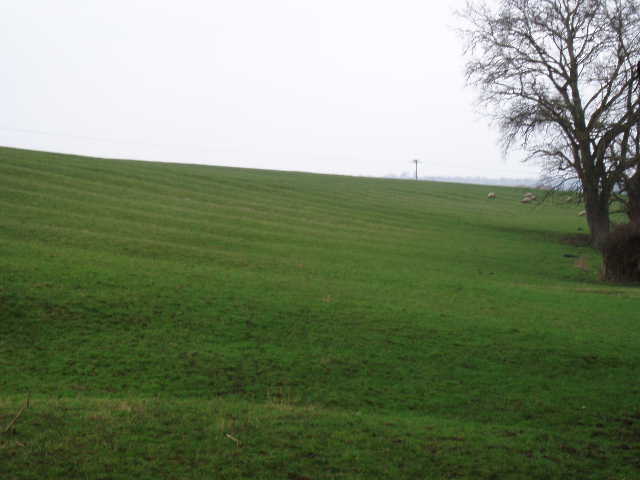
[11] Ridge and Furrow in sloping field just before Shabbington
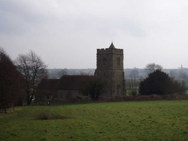
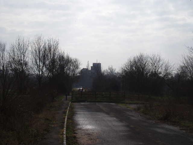
Across a stile, I turned right and walked almost parallel to the right-hand hedge through the next empty pasture. In the next pasture, I followed a fence on my left as it curved slightly left, with the field rising uphill to my right – here again was very clear Ridge and Furrow, the first I have seen on a slope all the rest being in fairly flat fields [11]. The sheep in this field obviously thought I’d come to feed them as they ran up and followed me as I walked across. Across yet another stile, I found myself in a very muddy paddock inhabited by two horses, one of which came up to me and allowed me to stroke it as I somehow ploughed my way across. Another Red Kite flew above here, both now and a few minutes later when I came back. Over another stile, I had to cross a large paddock subdivided by electric fences, where I had to use handles to unhook sections of the fence to get across. Beyond this, I reached a lane in Shabbington opposite the church [12], my destination for the day.
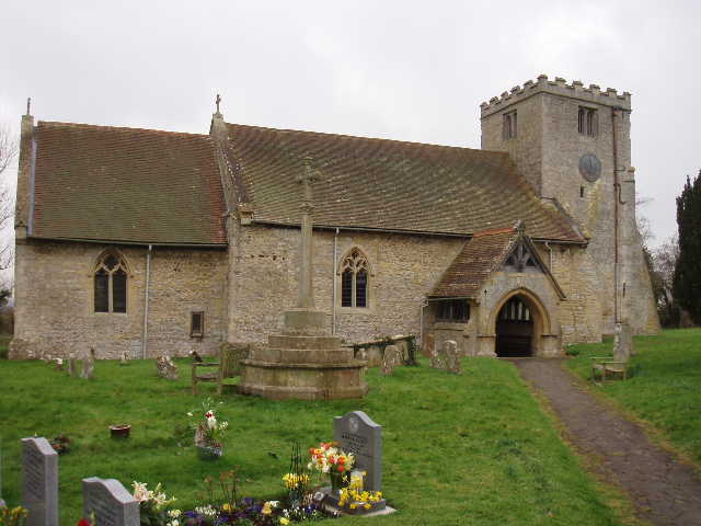
[12] Shabbington church
After taking a photo of the church, I turned round and headed back, the time now being about 12.50. I had my lunch seated on the last stile before I reached the old section of road near Thame. It was a bit of a struggle to get going after lunch for some reason, but this was just psychological not anything physical – for some reason my ‘get and up and go’ seemed to have got up and gone. But this soon passed, and by the time I got back to Notley farm I was quite enthusiastic about taking the slight detour to see the abbey ruins. In fact all there was to see was the large private house, Notley Abbey House, created from the Abbott’s lodging and part of the west range of the cloisters. It certainly looked old and impressive from the footpath that ran alongside the edge of its garden.
As I drew near the railway line near Chearsley, I had another pleasant encounter with a Red Kite, one flying low overhead and circling round, following me across the railway and into the field beyond. Again there was no need for binoculars as I had such close views – I could even see tags on the wings (the birds were re-introduced into the Chilterns a few years ago, and the released birds and their fledglings have been tagged and monitored).
This was a fairly flat walk along the Thame valley, with just a few gentle ups and downs. It was a grey and gloomy day, though it remained dry – on a nice summer’s day with firm ground underfoot I am sure it would have been more enjoyable. As always I really enjoyed seeing the Red Kites and Buzzards, and there was a reasonable amount of historic interest on the route including some very good examples of Ridge and Furrow. I’d certainly like to go back to Nether Winchendon sometime, I think its one of the nicest and most interesting places I’ve been to on these walks.
Total distance: 48.6 miles each way