Pete's Walks - Bernwood Jubilee Way
If you are considering walking this route yourself, please see my disclaimer. You may also like to see these notes about the maps and GPX files.
Day 7 8/3/07 Shabbington to Oakley (5.5 miles each way)
Parked on road in Shabbington.
There had been a gap of 2½ weeks since my last walk on the Bernwood Jubilee Way, largely because of the wet weather and subsequent very muddy conditions. In the meanwhile I managed just one walk, walking the Aylesbury Arm of the Grand Union Canal both ways (a total distance of 12½ miles) – I knew that at least some of the towpath would be surfaced, and so this would be less muddy than crossing footpaths and I wouldn’t have to worry about damaging wet pastures with my boot prints. As a result of that walk, I have added a very minor update to my journal for Day 4 of my Aylesbury Ring walk, as I found out exactly where that path had been re-routed near Buckland.
It was a glorious sunny morning as I drove to Shabbington, with hardly a cloud in the sky. Water levels had obviously risen since my last walk, and as I drove near Thame I could see that part of the route I followed last time was now under water. Fortunately I didn’t have any problems with flood water today, although this was destined to be the muddiest walk I have done since starting these journals.
I started walking about 10am, passing through the churchyard to leave Shabbington. There was a notice board about Red Kites by the stile on the far side of the churchyard, and the guide book also said this was good area to see these magnificent birds. Ironically, I didn’t see any today (apart from when I was driving home) whereas I’d seen plenty on the last two sections of this walk where the guide book hadn’t mentioned them. The Bernwood Jubilee Way went right to cross an empty pasture, which was very wet underfoot, to a stile in front of a bungalow by a farmyard. Here I went through a paddock to the right of the bungalow, where a horse was drinking at a trough. I then went through another empty paddock, and then followed a right-hand hedge through another very sodden pasture. The countryside looked very green in the bright sunshine, but this was a ‘low energy’ day for me and I wasn’t feeling too enthusiastic for some reason. Strange, as the day before I’d been really keen to get on with this long-distance path again.
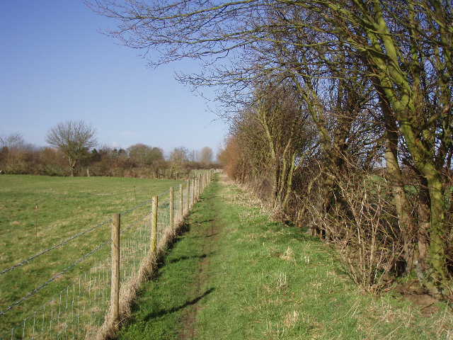
[1] Path between Shabbington and Ickford
After the next stile, I crossed a farm track and then crossed a field of recently planted grass where a flock of sheep grazed. The next narrow pasture contained five large reddish-brown bullocks that stared at me nonchalantly as I crossed to a gate. The next field was another damp pasture, where I could see my boot prints in the grass when I looked back. The Bernwood Jubilee Way then continued between a wire fence and a right-hand hedgerow [1,5]. There were horses in the paddocks to my left, where there was also clear evidence of Ridge and Furrow, although this was more obvious in the empty grass field to my right. Several rabbits scurried about as I walked this path – on my way back I saw a black rabbit here, either an escaped pet or the descendant of one. (Note: I don’t usually mention rabbits and squirrels, simply because they are so commonplace – it’s unusual if I don’t see them on a walk). Across another stile, I entered the field that had been on my right – the regular pattern of humps and hollows was still very clear here [2], as I continued ahead to a stile in the far left corner of the field.
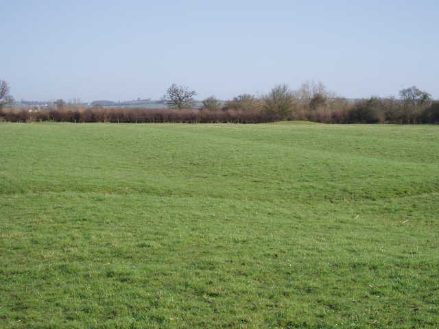
[2] Ridge and Furrow in a field near Ickford
Across the stile I reached a road at a sharp corner as it entered the village of Ickford. There was a large duck pond here [3], and a hand-made sign warning ‘Mind our ducks!’. I continued ahead along the village street, passing the infants school where the children where enjoying their mid-morning break from lessons. I followed the road as it turned sharply right, soon passing the village pub which was closed while undergoing some form of building works – I hope it’s only a temporary closure, as so many villages are losing their pubs. The road left the village, and soon came to a T-junction.
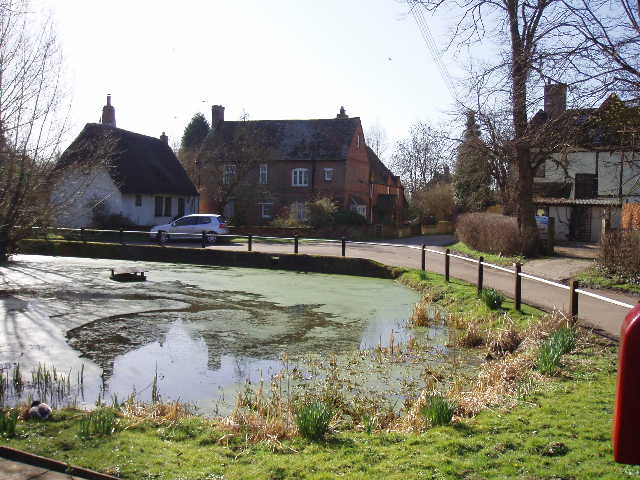
[3] Duck pond, Ickford
Across the junction, I took a bridleway running between hedges, initially on a gravel surface. After a few hundred yards, the hard surface ended as the bridleway entered a long and narrow grass field [4]. As I crossed this, a Buzzard soared overhead. At the far end of this long field, the bridleway turned right for about a hundred yards between two wire fences. This stretch was pretty muddy, forcing me to keep very close to the right-hand fence. Next the bridleway turned sharp left beside a hedge, with a wire fence still on the left. This section too was pretty muddy. Soon the bridleway was running between two hedges, and the mud got wetter and deeper. The next half mile or so was the muddiest section I have encountered on any of my walks so far. Almost at the start of this section, a deep and wide puddle made the path almost impassable. At first I thought I could wade through, but after a couple of steps I quickly went back – the mud and water was clearly going to go over the tops of my boots. Eventually I managed to get by, almost pressing myself into the left hand hedge and advancing slowly step by step. After that initial problem, the rest of the way was easier, but I was looking where I could safely put my feet all the time, deciding where there was relatively solid ground and where there was deep and soft mud.
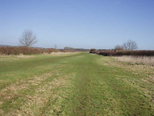
[4] Long narrow field north of Ickford
After about half a mile, the bridleway emerged into a small grass field, where it continued ahead alongside a left-hand hedge. The ground was now solid again, much to my relief. Partway along the hedge was a sawn up tree, where I stopped for my lunch on the way back. At the end of the field I came to a crossroads of bridleways, where I turned left along a broad strip of grass between hedges. This was wet and muddy, but nowhere near as muddy as the section I’d just been through. After two or three hundred yards, I went through a gate into a large sheep pasture. There was no sign of the bridleway on the ground, but I tried to follow the route shown on the map as best I could. Instead of going straight across the pasture, the bridleway went half right up a slight rise (only one contour line on the map) and then half left to reach the opposite hedge. Its rather odd course actually formed a roughly square shape with the hedge to my left, so I imagine it was following the lines of two old hedges that had been grubbed up – in fact, after going half-left it passed a few old trees that presumably had once been part of a hedge.
The bridleway then continued again for some way on a grass strip between hedges, muddy in places but not too bad. I heard and then saw another three Buzzards soar fairly low overhead. Further on I was surprised to see my second butterfly of the year, a bright yellow Brimstone. The bridleway eventually ended at a sharp corner of a minor road. I continued ahead for about a hundred yards, then turned right onto a footpath which crossed a couple of fields planted with a root crop. The Bernwood Jubilee Way then continued across a very large grass field towards a farmhouse. Over a stile, I went through a small new plantation of young trees and across the farm drive. I went through a small gate into a paddock, containing four or five horses. It was yet another field showing clear evidence of Ridge and Furrow. As I started across it, three large black Labradors and a smaller white dog ran out of the farm and started barking aggressively at me – fortunately they didn’t come into the paddock after me, although they could easily have got through or under the metal rail fence.
Across another stile, the Bernwood Jubilee Way then continued across two very large stubble fields. The path was well marked, a clear brown strip running through the first field and a grassy line marking the route in the second. There was some Common Field Speedwell in both these field, the first wildflower I’ve noticed this year (not surprising, as it flowers all year round except after severe frosts). I then followed the right-hand hedge of a small pasture to reach a road in the village of Oakley (curiously I passed through another village of the same name not too long ago, on Day 6 of my John Bunyan Trail walk). I crossed over the road to a Bernwood Jubilee Way signpost at the start of a side road. It was about 12.10pm as I turned and started back.
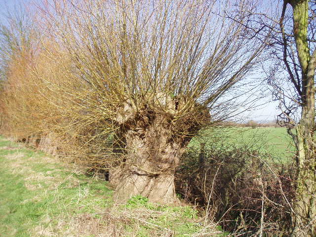
[5] A pollarded willow, a common sight in the Thame Valley - this one was near Ickford
Fortunately the aggressive dogs were nowhere to be seen or heard as I made my way back. I had lunch about 1pm, seated on the sawn up chunks of tree near the end of the very muddy section. It was nice just sitting there eating my sandwiches, looking at the fields and trees, watching a few clouds in the sky, and listening to a skylark. I ploughed my way back through the very muddy section, and continued onwards, getting back to Shabbington about 2.25pm.
This was a very flat and very muddy walk, with nothing of too much interest on the route. At least I saw some Buzzards, and the Brimstone butterfly came as a pleasant surprise. It was nice to see yet more Ridge and Furrow too – it never ceases to amaze me how this has survived so well over the centuries. As I mentioned, it was a day when I was feeling low on energy and enthusiasm, so it was probably just as well it was a shorter walk than normal. I think I’m just getting fed up of ploughing my way through mud – this walk took me about 45 minutes longer than normal for a walk of this distance, just because of the muddy conditions. At one point on the way back, one foot got stuck in the mud and I nearly fell – fortunately I regained my balance, otherwise, with one foot stuck I could have easily injured myself if I’d fallen. I’d had a similar experience near Marsh Gibbon on my second day on the Bernwood Jubilee Way.
Total distance: 54.1 miles each way