Pete's Walks - The Chiltern Chain Walk, Walk 12
If you are considering walking this route yourself, please see my disclaimer. You may also like to see these notes about the maps and GPX files.
Google map of the walkDownload GPX file of the walk
Walk 12 24/05/08 – Coombe Hill and the Hampdens (12.5 miles approximately)
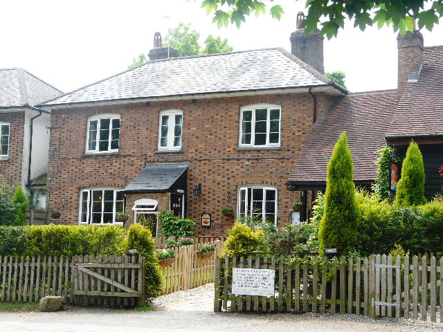
Parked in car park at Coombe Hill.
If you are interested in walking this route yourself, click here to see the route description (but only if you have already read my disclaimer and notes regarding route descriptions).
I could possibly have done this walk yesterday, Friday, but it was drizzling steadily as I had breakfast and it looked like it was going to be grey and overcast. Having done this walk (or slight variations on it) several times before, I really wanted to do it on a nice day so that I could get some reasonable photos. So I put the walk off until today, even though that meant walking on the Saturday of a Bank Holiday Weekend, when there would be more people about. As I didn’t have to worry about rush hour traffic, I just had the one cup of coffee at breakfast, and set out from Kensworth almost half an hour earlier than usual. Consequently I managed to start the walk at about 9.05am.
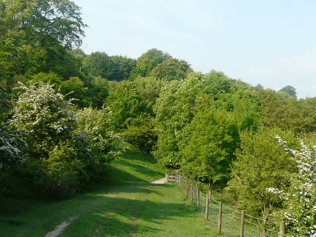
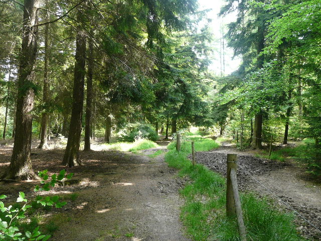
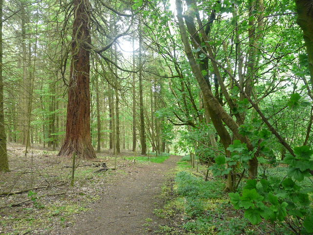
[1] The start of the walk, Coombe Hill
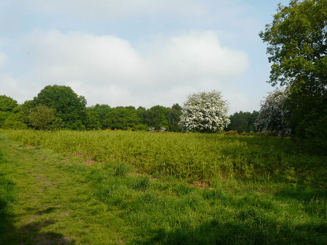
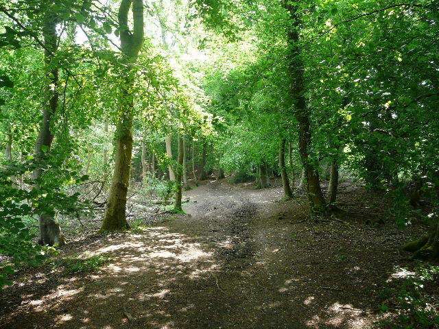
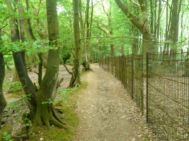
I went through the gate from the car park into the National Trust land on top of Coombe Hill. Three paths go off in different directions from the gate – the middle path is the most widely used one, going straight to the monument on top of the hill, but that would be my return route. I took the path going left, fairly close to some gardens on my left, with an open area of gorse and other bushes to my right [1]. After a few hundred yards I came to a metal kissing-gate in the fence on my left. I went through it into a beech wood – I was now on the route of the Ridgeway, which I’d be following for a few miles as far as Whiteleaf Hill, and also on the route of the South Bucks Way which starts (or ends) at Coombe Hill.
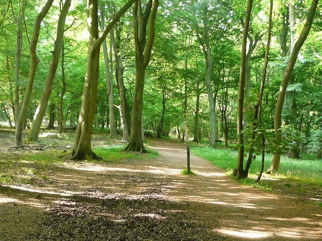
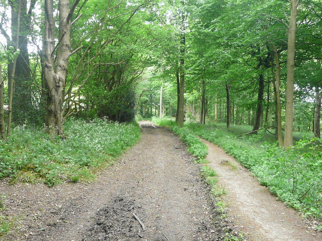
[2] The Ridgeway path through the beech wood
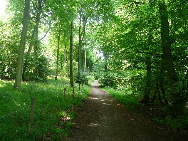
The path weaved its way between the beech trees – I noticed some Yellow Archangel, Garlic Mustard and Woodruff growing here. I soon came to a road (the car park where I’d started was along it to my left) where I turned right and went downhill for a hundred yards or so. I went a few yards along a track on the left, before going over a stile and entering another beech wood. The path was initially close to a field on my left, but then went over another stile in a wooden fence on the right, and then moved further into the wood. Every hundred yards or so there were signposts [2] with the white acorn sign depicting the Ridgeway National Trail – the path was reasonably clear today, but when the ground is covered in autumn leaves, the frequent signposts here are invaluable. As always it was a pleasure to walk through a beech wood like this. After half a mile or so, the Ridgeway came to a wide track, where it turned right, heading fairly steeply downhill.
[3] Approaching the drive to Chequers
Towards the bottom of the hill there was a bridleway crossing (here the South Bucks Way went left towards Little Hampden, where I’d cross its route again later today). Going straight on, I was now in a thin belt of trees with fields either side. I heard some voices here, and discovered two horse riders in the field on the right who were obviously lost – I told them about the bridleway I’d just crossed, and they eventually made their way towards it. The tree belt ended by a farm and some cottages on a bend in a road. I crossed over and continued along a path on the other side [3] – there was a security camera at the start of the path, as Chequers was now a short distance away to my right (the last time I walked round here, I met a policemen armed with a sub-machine gun – there must be some pretty unsavoury characters living round here! J).
There has been a house at Chequers since the 12th century. The name possibly comes from the Chequers (or Wild Service) tree that grows in the grounds, or from the fact that the original owner Elias Ostiarius was an Usher at the Court of Exchequer and so included a chequer board on his coat of arms. The current house is 16th century, and was restored and enlarged by John Hawtrey in 1565. Soon after, he was given the responsibility of keeping a royal prisoner – Lady Mary Grey, sister of the unfortunate Lady Jane Grey. A later owner married a grandson of Oliver Cromwell, and the house still has a collection of Cromwell memorabilia. During World War I the house served as a hospital and then a convalescent home for officers. In 1918, the owners Lord and Lady Lee of Fareham presented the house to the nation for use as a country residence by the Prime Minister.
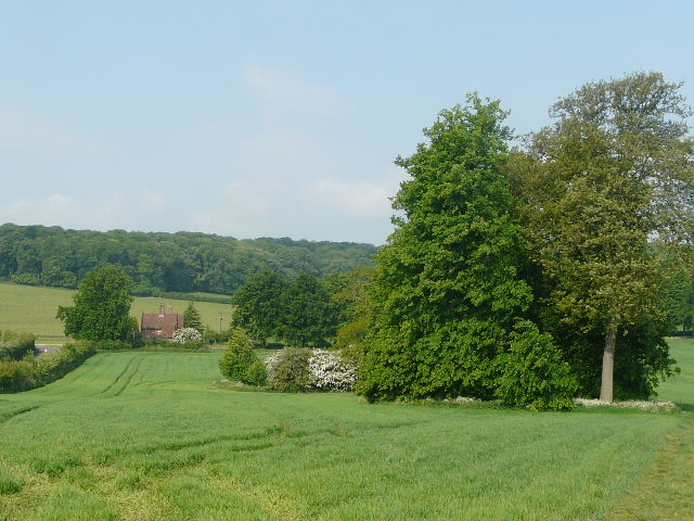
[4] Chequers, with Coombe Hill behind
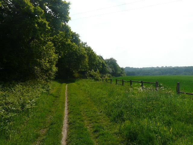
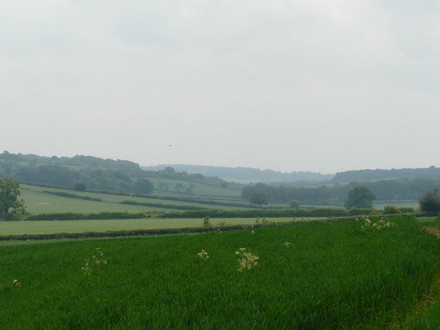
The path followed a wire fence on my right through a small arable field dotted with a few trees and bushes, then went through wooden kissing-gates either side of the tree-lined drive to Chequers – the Lodges at the end of the drive were just a few yards to my left. The path continue alongside another fence, with large meadows either side. Ahead I could see an attractive brick-built farm, with a backdrop of a wooded hillside. At the end of the meadows, I turned right onto a path running alongside a wood on my left. To my right, I could see across the meadows to Chequers, with Coombe Hill beyond surmounted by its tall monument [4]. Ahead of me I could see the distinctive outline of Beacon Hill. After some distance I reached a gate, and carried on across a large pasture containing cows and calves. As I crossed it, views started to open out ahead of me over the Vale of Aylesbury. This path is marked ‘Cradle Footpath’ on the map, but I have not been able to discover the origin of the name. The path continued into another pasture – this was empty of cattle today, and unlike the previous one had numerous trees and bushes dotted about [5]. I spotted some Common Rock-rose growing here. Again there were good views down the hillside and across the Vale of Aylesbury – I took a short detour to the top of a small hillock called Chequer’s Knap for a wider view [6].
[5] A pasture along the 'Cradle Footpath'
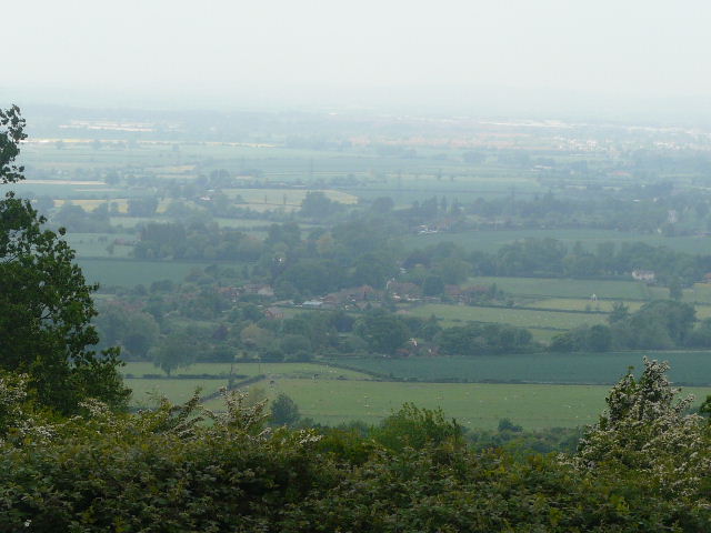
[6]View from Chequers Knap, over Ellesborough and the Vale of Aylesbury
[7] The Ridgeway north of Pulpit Hill, heading towards Whiteleaf Hill with Bledlow Cop on the horizon
My route then went through a kissing gate by a huge old beech tree, and turned right down a broad track. After just a few yards I came to another junction, where I turned left (the North Bucks Way starts here, continuing straight on, a fingerpost indicating that it went 35 miles to Wolverton). There was some yellow Welsh Poppies growing here. The path now contoured through an area of short grassland studded with bushes, with the wooded slopes of Pulpit Hill to my left and some paddocks over to the right [7]. There were still views out to the Vale of Aylesbury, and a nice view ahead to the wooded slopes of Whiteleaf Hill, with Bledlow Copse beyond it on the horizon. Although sunny, it was very hazy so the views were not as far reaching as they can be on clear days.
[8] The Ridgeway heading towards Whiteleaf Hill
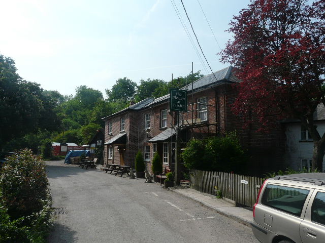
[9] The pub at Lower Cadsden
I crossed over a chalky track [8], where I spotted Silverweed and Germander Speedwell, and continued gently downhill through a nature reserve – more chalky grassland and bushes. There seem to be two alternative routes for the Ridgeway here – the map shows a different route, but there were still the white acorn signs along this path. Beyond the reserve, the path continued beside the long fence of a house to my right – a distant dog just looked at me and decided to ignore me today, sometimes it runs along the fence barking. At the end of the path I turned left along a road, soon forking right to reach The Plough pub at Cadsden [9]. I turned right, behind the pub, but soon forked left, starting the long and quite steep climb up through the trees to Whiteleaf Hill. There was a lot of attractive blue spikes of Bugle growing beside the chalky path [10]. I stopped at one point to look out through a gap to my left, over a wooded valley (called The Hanging on the map). I took the climb very slowly, and wasn’t too out of breath when I emerged from the trees onto the grass at the top of Whiteleaf Hill.
[10] The path up Whiteleaf Hill
[11] Neolithic burial mound on Whiteleaf Hill
Whiteleaf Hill sits in a prominent position on the Chiltern escarpment overlooking Monks and Princes Risborough. At its top sits a Neolithic Barrow, dating back to about 3500BC. There are also possible round barrows, a bronze-age dyke and WWI practice trenches here. The hill is cloaked in ancient woodland and flower rich chalk grassland. Carved on its steep chalk slope is Whiteleaf Cross, whose origins are unknown although a phallic symbol on the hillside here is recorded in a document of 903. The first reference to a cross was in 1742, and it is known that the shape of the cross and the symbol below it have been changed since then. Whiteleaf Cross is mentioned in the song 'Louisa on a horse' by the legendary John Otway.
[12] View from Whiteleaf Hill, over Monks Risborough and the Vale of Aylesbury
[13] The path through the beech wood near The Hangings
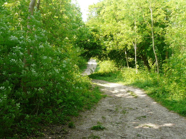
I photographed the Neolithic Barrow [11] and admired the views over Princes Risborough and the Vale of Aylesbury [12], but didn’t bother today to wander the few yards down the slope to see the chalk cross carved into the hillside. I continued southwards on a new gravel track, but only for a short distance before turning left onto a bridleway (thus finally parting company with the Ridgeway). The bridleway ran just inside the edge of another beech wood, with a large corn field a few feet to my right. Initially the trees on my left were on a steep slope descending into the wooded valley I’d seen earlier [13]. I passed another walker and a couple of Horse Riders coming the other way. Where the field eventually ended, I turned right, the path through the trees again staying close to the field on my right. I soon came to a junction of paths on the edge of the wood, and turned left, on a bridleway between the wood on my left and another large arable field on my right [14]. Again, at the end of the field I turned right, on another woodland path following the edge of the field. I saw Yellow Archangel, Herb Robert and Woodruff amongst the flowers growing here, and near the end of the path managed to photograph a Speckled Wood butterfly.
[14] Path beside the wood on the way to Parslow's Hillock
[15] Path through the wood approaching Parslow's Hillock
The path ended along the drive to a house, beyond which I turned left along a minor road (this section of the route was very much ‘left, right, left, right’). Where the field to the right of the road ended, I again went right, with another section of wood on my left. The path soon turned left and ran through the trees, with the main escarpment of the Chilterns dropping away to my right [15] – there were one or two openings in the trees giving views out to the Vale of Aylesbury. I passed a woman walking her three dogs – she commented on the smell of some wildflowers she’d just been past. This was a very pleasant section of walking, on a clear level path through the woods. At the end I went through a gate and turned left along a drive for a few yards to reach a road in the hamlet of Parslow’s Hillock. I went right for a short distance, then turned left beside the Pink and Lily pub [16].
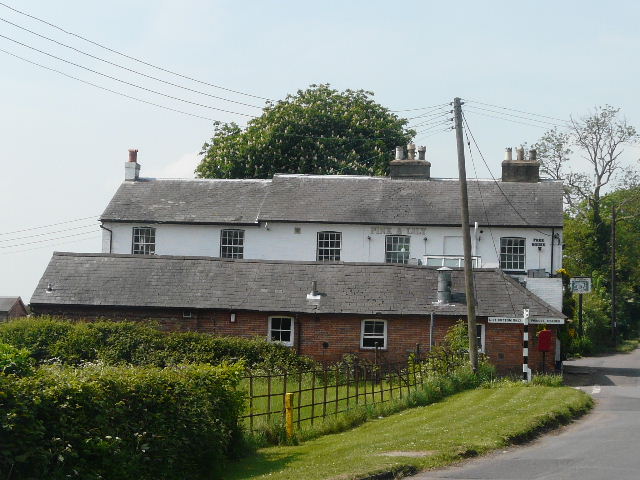
[16] The Pink and Lily pub, Parslow's Hillock
The Pink and Lily pub is associated with the poet Rupert Brooke, who discovered it on one of his walks in the Chilterns and became quite a regular visitor in the years immediately before World War I. His most famous poem is possibly The Soldier with its opening lines
“If I should die, think only this of me:
that there’s some corner of a foreign field
that is for ever England”.
Brooke died of blood poisoning in 1915 while on the way to Gallipoli.
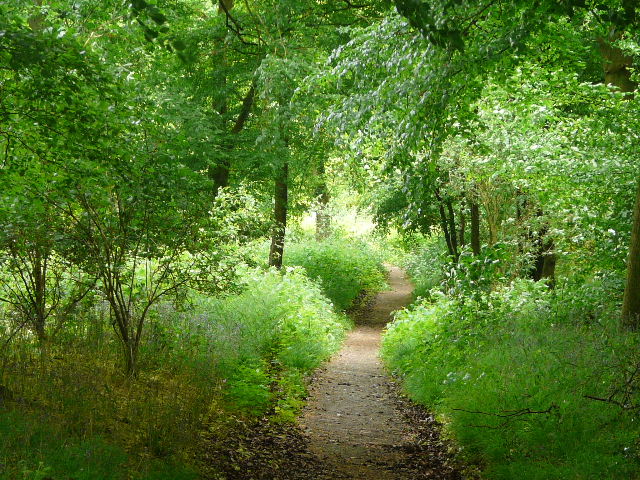
I followed the lane (which would eventually become just a track through the valley of Lily Bottom) for about quarter of a mile – I have twice before seen Muntjac Deer here, but not today. I turned left onto a bridleway, briefly on the route of the Chiltern Way again but leaving it almost immediately by turning onto a path starting behind the cottage garden on my right. This path ran along through another beech wood, with gardens and then fields nearby on my right. Again it was very pleasant following the slightly meandering path between beech trees and holly bushes. Eventually I came to a wooden fence, where I turned left, keeping to the left of the fence – the path on this side is for walkers, the path on the other side is for horses. The wood now changed to being a mixture of deciduous and coniferous trees [17].
[17] Path through wood on way to Hampden Common
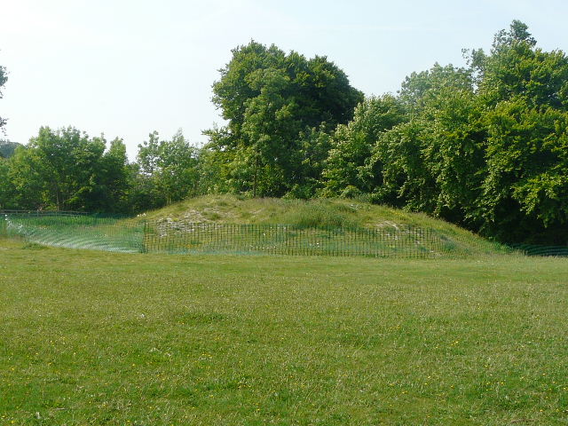
The path ended at a crossroads, which I crossed diagonally and took the leftmost of two paths going back into the woods. I was only amongst the trees for a short while, soon emerging on the edge of a cricket pitch at Hampden Common. I followed the edge of the pitch to a lane, where I went left a few yards to where it ended at a minor road. A drive continued on the other side to a few houses – where it soon turned sharply left, a footpath continued ahead. This ran between a small wood on my left (where I heard a Chiffchaff) and a meadow. It then crossed a field of oil-seed rape [18] – here there was a long line of beautiful Field Pansies on the right edge of the path. Beyond this field, there was a small mound set amongst trees on my right – the map indicates that it’s of historic interest, but gives no clue as to what it was for. There seemed to be the remains of a small moat around it, but it seemed too small to serve any defensive purpose. I wondered if it was the site of a windmill, as it seemed similar to a couple of such sites that I’ve come across on other walks.
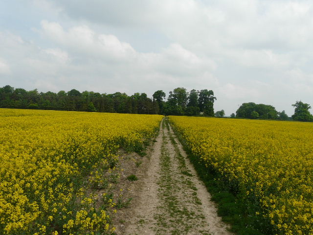
[18] Path through oil-seed rape field on way to Great Hampden
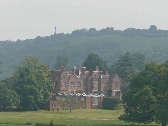
The path continued alongside a fence between some grassy meadows to reach the church at Great Hampden [19]. I immediately twigged a wedding was about to be celebrated, as the door was decorated with a garland and there were a couple of smartly dressed women standing outside. I followed the path through the churchyard, going left of the church, and turned left along a drive – there were signs here for the ‘Wedding Car Park’ and I saw more smartly attired people turning up for the big occasion. I soon turned right onto a footpath (joining the Chiltern Way again). This crossed another meadow, with a ha-ha (a wall or, as in this case, a fence, sunk in a deep ditch so that it doesn’t spoil the view) with Hampden House beyond [20]. The house was presumably being used for the wedding reception, as the car park was in its grounds and there were more smartly dressed guests in the garden.
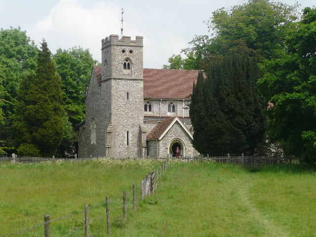
[19] Great Hampden Church
Hampden House in Great Hampden is named after the Hampden family (later Earls of Buckingham), who owned the site from before the Norman Conquest until 1938. The present house dates in part to the 14th century, though most of the house is 17th century. The north and west ranges were remodelled by the architect Thomas Iremonger in 1750, clearly in the style known as Strawberry Hill Gothic although this style wasn’t ’ invented’ until almost 20 years later by Horace Walpole! This architectural style made the house a favourite setting for Hammer horror films. Visitors to the house are thought to include Edward III, the Black Prince and Elizabeth I. The most famous resident was John Hampden, the leading Parliamentarian in the years leading up to the Civil War, who died from wounds received at the Battle of Chalgrove in 1643. He had earlier earned fame through his refusal to pay the hated tax called Ship Money to Charles I.
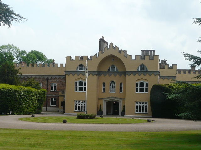
[20] Hampden House
The path then entered Lady Hampden’s Wood – I soon passed a family coming the other way, and a bit further on passed some sort of huge Redwood tree [21]. There was some more Bugle and some Wood Speedwell here. Beyond the wood I followed a path heading diagonally downhill to a distant corner of a huge corn field. I was now crossing the large valley of Hampden Bottom [22]. As I neared the field corner, I met a couple of walkers coming the other way – this being a Bank Holiday Saturday there were far more people about than on my usual mid-week walks. I crossed the road running through the valley bottom, and continued on a path opposite, which ran through a thin belt of trees curiously named Coach Hedgerow [23] – the path here was certainly a lot clearer than when I first came here on the Chiltern Way three years ago. There was a wide variety of wildflowers growing here – Bluebells (as everywhere else, fading away badly now), Wood Avens, Herb Robert, Greater Stitchwort, Yellow Archangel, Germander Speedwell. Where a farm track crossed the tree belt, I turned right and followed a path across the corner of a corn field and then across a narrow meadow.
[21] Redwood tree beside the path through Lady Hampden's Wood
[22] View east along Hampden Bottom from beyond Lady Hampden's Wood
[23] Path through Coach Hedgerow
I stopped to eat my lunch on an impressive wooden seat, with a nice view back across Hampden Bottom [24]. I saw a pair of Orange Tip butterflies while I munched away. It had been bright and sunny for most of the morning, but now I noticed that it had clouded over. I continued on my way, passing through a small belt of trees where I found some Sanicle, the first I’ve come across. My route then turned right on a permissive path which followed the edge of a corn field, where I saw some Common Field Speedwell, and then entered another wood, where I soon turned left at a path junction. After a short distance the path left the wood and continued between hedgerows for a couple of hundred yards to reach a track or drive which led to the lane into Little Hampden. Briefly repeating part of my previous walk, I followed the lane left as far as the Rising Sun pub [25] (Update 22/10/18: sadly this has now closed) – whereas last time I turned right onto a footpath here, today I went half-right on a bridleway.
[24] View back across Hampden Bottom from the wooden seat
[25] The Rising Sun pub, Little Hampden (Update 22/10/18: sadly this has now closed)
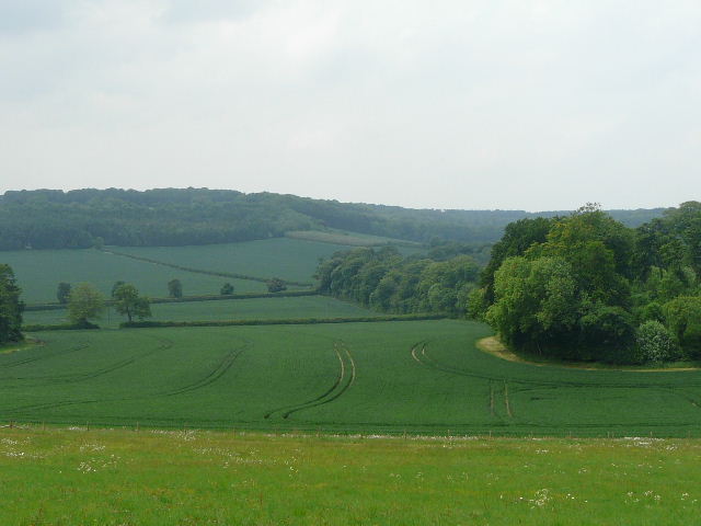
The bridleway descended almost imperceptibly through yet another wood for several hundred yards [26] (I passed some Wood Avens and Yellow Pimpernel here) before dropping quite steeply to a valley bottom. I continued on it as it turned slightly right and gradually rose up the opposite side, still in the trees. There was again a wide variety of wildflowers beside the path, including Herb Robert, Bugle, Germander Speedwell, Wood Speedwell, Wood Spurge and some more Sanicle. At the top of the hill I reached a bridleway junction, where I turned left. At first I was on a track along the edge of the wood, but soon passed a house and garden and the track became more of a lane, running between hedges and fields either side. Through gaps in the right-hand hedge I could see across a wide valley to Boddington Hill and Wendover Woods, where I’d started Walk 5. I could also see some quite threatening grey clouds, so I hurried on my way along the lane. I soon reached the attractive hamlet of Dunsmore, passing the small chapel on my right [27] and coming to a crossroads of lanes by a pond on my left.
[26] The bridleway from Little Hampden
Dunsmore is a hamlet in the parish of Ellesborough and, like nearby Little Hampden, is one of the most remote places in Buckinghamshire. It is accessible only by two narrow and steep lanes, and is occasionally cut off in winter. It retains its small community atmosphere, although both its pubs have closed in recent years. The name dates back to Anglo-Saxon times.
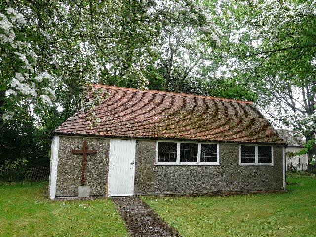
[27] Tiny chapel in Dunsmore
I stopped and signed a petition here against increased flight noise from Luton airport, then carried on along the dead-end lane opposite. This passed several old houses and cottages then became a bridleway. At a bridleway fork I went left, back into the woods once more. There were initially fences either side of the bridleway. Over the fence on the right I soon saw a spectacular yellow and pink fungus [28] – I later had it identified on a website as a ‘Chicken of the Woods’ (I was amazed – that and Fly Agaric are the only fungi names I know!). Further on, the bridleway ran for a good distance beside an old rusting iron fence [29]. After walking through the wood for over half a mile, the bridleway turned half-right just after the iron fence petered out, but I went on ahead, following a path through the trees that was marked by painted yellow arrows. I crossed a broad track (the car park was along it to the left) and went through a kissing-gate into an area of grass and bushes. Initially walking parallel to the wood on my left, the path soon became clear and led through the bushes to the open grass area surrounding the monument on Combe Hill.
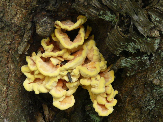
[28]Chicken Of The Woods fungus, near Dunsmore
[29]The path from Dunsmore to Coombe Hill
Coombe Hilllies just south of Wendover, Buckinghamshire. At 853 feet above sea level, it is one of the highest points in the Chilterns, and there are panoramic views over the Vale of Aylesbury. It is surmounted by a tall column, a memorial to the men of Buckinghamshire who died in the Boer war – the column has twice needed repairing after suffering severe damage from lightning strikes. In 1918 Coombe Hill was given to the National Trust by Lord Lee of Fareham, who also donated the nearby Chequers to the nation for use as the Prime Minister’s country retreat.
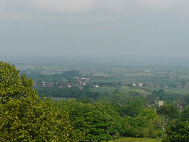
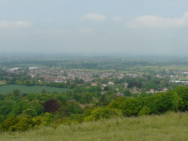
[30] View over the Vale of Aylesbury from Coombe Hill
It had seemed to brighten up briefly as I’d been walking through the wood from Dunsmore, but it was now very grey again, the views over the Vale of Aylesbury were therefore disappointing [30], nowhere near as extensive as they are on a clear day. I could still see for several miles, however. There were a lot of people about as it was a Bank Holiday Saturday (I remember having the monument briefly to myself on my Berks-Essex Walk) so I quickly moved on, following a broad grass strip with gorse bushes either side. At the end, a clear path went through some trees and then continued through an open area of grass and gorse back to the car park where I’d started.
It’s immodest of me to say so (as I designed the route!) but I think this is an excellent walk. I’ve done it (or variations of it) several times now and I’m sure I’ll walk it many times again. It’s certainly one of my favourite walks in the Chilterns - there’s hardly a dull footstep throughout the whole twelve and a half miles. There are some really good views, especially from the edge of the escarpment at places like Coombe Hill and Whiteleaf Hill, a lot of enjoyable stretches through woodland interspersed with occasional field paths, several places of historic interest, and plenty of ups and downs. My plodding prose and poor photos really don’t do it justice. The only slight disappointment today was that it clouded over and was quite grey at the end of the walk, so the views at Coombe Hill were not as good as they might have been. But that was just a very minor irritation – the photos I took of a Speckled Wood butterfly, a beautiful Field Pansy and, most of all, the Chicken Of The Woods fungus, were a real bonus.
Total distance: 145.7 miles
(To see this walk repeated IN THE OPPOSITE DIRECTION on 4/5/13, CLICK HERE)