Pete's Walks - The Hertfordshire Way
If you are considering walking this route yourself, please see my disclaimer. You may also like to see these notes about the maps and GPX files.
Day 16 16/11/05 Goff’s Oak to Broxbourne (8.0 miles each way)
Parked in service road in Goff’s Oak.
This was a great walk on a cold but beautiful day. I’d been looking forward to this section of the Hertfordshire Way because the guide book informed me that much of the way was through ancient woodland, and the walk certainly lived up to my expectations. It was probably the best walk I’ve done on the Hertfordshire Way so far.
From the centre of Goff’s Oak I went down Newgatestreet Road, passing an oak tree planted in 1950 to replace the one that had given the village its name, which had been blown down in that year. A lane then led me to a large field of rough grass where some horses were grazing. Beyond this another grass field went down hill, and then more of the same led up the opposite slope. A path between hedges (where, much to my surprise, I came across two large but friendly goats on my way back) led on to a road. Across this came a short section of lane walking, before I joined a bridleway at a sharp right hand corner. The bridleway joined a farm drive, which I soon left, turning right and going downhill alongside a hedge in a grassy field. A gate gave access to a thin belt of trees alongside a stream at the bottom of the valley. I turned left for a few yards, and then turned right as I entered the first section of woodland for the day.
Broxbourne Woods National Nature Reserve (the only one in Hertfordshire) consists of four woods, mainly sessile oak and hornbeam (it’s one of the most northerly sites for hornbeam). The Hertfordshire Way goes through three of the four woods, including Wormley wood which is mentioned in documents as far back as the 6th century but is thought to have existed since the end of the last ice age.

[1] The Coal Post
Much of the first half of the four mile section through the woods was just inside the edge of the woods, with fields often visible to my right. Quite early on I passed a Coal Post [1]. These were first erected around London in 1851, marking where duty could be levied on imported coal and wine leaving the city – the tax went back to 1667, when it was created to help fund the rebuilding required after the Great Fire the previous year. The posts were moved in 1861 when the Metropolitan Police District came into being, and became redundant when the tax was repealed in 1892.
[2] Path through Danemead Wood Nature Reserve
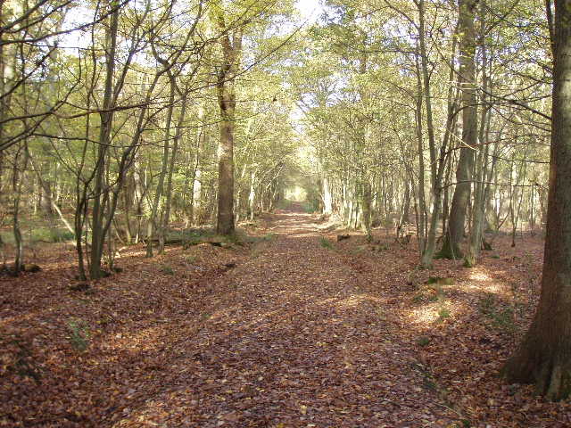
The walk through the woods was very pleasant indeed [5] – despite the odd muddy bits, it is always a delight to walk through a wood in autumn. The paths were obviously well-used, but I only came across two or three dog walkers during the whole day. About halfway through the woodland section, I came across a lane that I followed for about a hundred yards to a T-junction. Across that, a kissing gate led into a series of paddocks and then the Hertfordshire Way passed between a house and its stables. Across another lane, a sequence of kissing gates and more horse paddocks led back into the woods. Shortly after came a section of coniferous wood, for a change, and a bit later the Hertfordshire Way went through the Danemead Wood Nature Reserve [2], following a path beside a stream. Not far beyond this, I passed the site of a moated house (nothing left to see but a slight mound and an overgrown ditch) [3].
[3]Track in Hoddesdon Park Wood
Eventually, after about four miles, the Hertfordshire Way emerged from the woodland. I followed a drive to a house, and then crossed two grassy fields to reach the embankment of the A10 dual carriageway. I followed this to a lane, where a bridge crossed the A10, and then I turned right on a footpath that went close to a new housing estate and then through an older residential area. Having crossed a road, I followed a bridleway [4] that went parallel to the A10 for a while, before turning left away from it. A path through trees and then between a school playing field and some tennis courts led to a road, where I turned round once I reached a bridge over the New River.
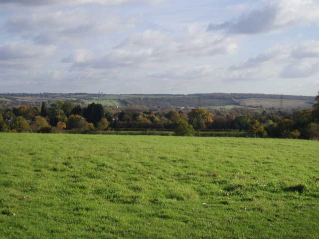
[4] Looking across the Lea Valley, near Broxbourne
I ate lunch on a bench shortly after turning round as it was 1pm, although this left me a long walk in the afternoon. I really enjoyed the walk back, and got to my car about 3.30pm. Unfortunately the journey home was a bit of a nightmare – the M1 (North) junction of the M25 was closed due to an accident. I had to take the next exit instead – this turned out to be the A41 to Hemel Hempstead. I thought this would be fine, as it was dual carriageway and once I reached Hemel I was only about 8 miles from home. But the traffic was virtually at a standstill on the dual carriageway, and it took ages to get to Hemel. Typical, I thought – this was the one time I’ve had a bad journey on the way home from a walk, and it was on the one day I was in a bit of a hurry to get back (as I was going to my nephew’s 10th birthday celebrations).
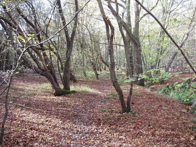
[5] Looking out from the edge of Bencroft Wood
Total Distance: 122.1 miles each way